
Manor houses · South East England
Howfield Manor
In or near Stuppington.
Howfield Manor — Grade II listed building-listed manor in england-south-east, United Kingdom.

Nick Smith — CC BY-SA 2.0 via Wikimedia Commons licence

Plan your visit
- Typical visit
- 1 h–2 h
- Nearest railway station
- Chartham · 1.4 km
- Limited wheelchair access
Getting there & planning your visit
To visit Howfield Manor, the nearest railway station is Chartham, located 1.4 km away. The postcode for sat-nav is CT4 7HQ. Accessibility is limited for wheelchair users.
About
Howfield Manor is a Grade II listed building-listed manor in england-south-east, United Kingdom, registered on the National Heritage List for England (NHLE entry 1100327). Listed status protects buildings and structures of special architectural or historic interest. See the linked Wikipedia article for further details.
Photo gallery
Heritage listing
Details 1. 5273 TR 15 NW 8/242 29.9.52 CHARTHAM HOWFIELLD LANE Howfield Manor (formerly listed as Howfield Farmhouse) II 2. An L-shaped building. The back or east wing is C13 and is known as the Chapel. Built of flint, partly coated with cement. Tiled roof. One narrow lancet window. The front or main wing facing west is mid C17. Two storeys and attic in gable, built of red brick. Tiled roof. C17 chimney stack. Five casement windows. At the south end is a large triangular tile-hung gable containing an attic window. To the north of this is a projecting porch with a room over and a small shaped Dutch gable containing an oval recess. To the north again are three small shaped Dutch gables, the centre one topped by a curved pediment, the others by triangular pediments. Behind, in the angle of the L, is a small rectangular projection, with a tile-hung gable, probably containing the staircase. Listing NGR: TR1174856085 Legacy The contents of this record have been generated from a legacy data system. Legacy System number: 171079 Legacy System: LBS
From the Historic England List Entry under OGL v3.
Protected designations
- Area of Outstanding Natural Beauty: Kent Downs
Designations sourced from Natural England open data under OGL v3.
Place summary
Howfield Manor is a Grade II listed manor located in South-East England. This designation highlights its architectural and historical significance within the region. The building reflects the characteristics of its era, contributing to the area's heritage.
AI-generated from the structured facts on this page (operator, designation, listing, era). Not a substitute for visiting.
- Coordinates
- 51.2646, 1.0337
- County
- Kent
- District
- Canterbury
- Parish
- Chartham
- Postcode
- CT4 7HQ
- Parliamentary constituency
- Canterbury
- Nearest railway station
- Chartham — 1.4 km
- Official site
- www.howfieldcanterbury.co.uk
Sources
- wikidata: Q26392447 (CC0)
Other places nearby

Chapel Of St John The Baptist, Milton
Chapels · 0.5 km

Stonework Ruins at Toniford Manor
Manor houses · 1.1 km
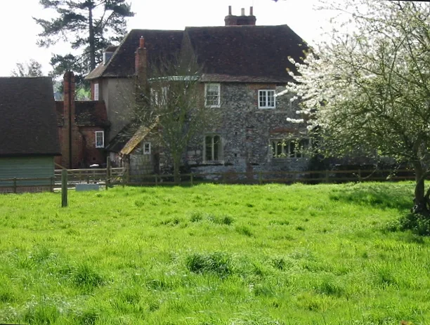
Tonford Manor
Stately homes · 1.2 km

Dovecote at Burnt House Farm
Farms (open to visitors) · 1.3 km

Chartham
Villages · 1.4 km

Larkey Valley Wood
Forests & woodlands · 1.5 km
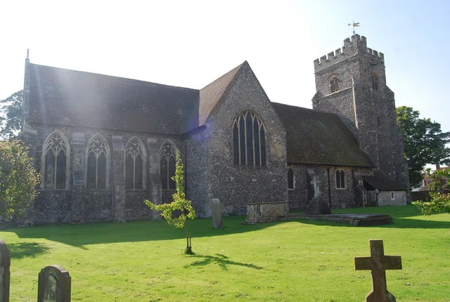
Church of St Mary, Chartham
Historic churches · 1.5 km

Chartham War Memorial
Memorials & monuments · 1.5 km

Bigbury Camp
Vineyards · 1.5 km

Thannington
Villages · 1.5 km

Bigbury Camp
Archaeological sites · 1.6 km

Poldhurst Manor
Manor houses · 2.1 km
Nearby
📷 5Chapels · South East England
Chapel Of St John The Baptist, Milton
Chapel Of St John The Baptist, Milton — chapel in Thanington, Kent, England, UK.
📷 5Manor houses · South East England
Stonework Ruins at Toniford Manor
Stonework Ruins at Toniford Manor — a manor in england-south-east, United Kingdom.
Flagship📷 5Stately homes · South East England
Tonford Manor
Tonford Manor — manor house in Thanington, Kent, England, UK.
📷 5Farms (open to visitors) · South East England
Dovecote at Burnt House Farm
Dovecote at Burnt House Farm — a Grade II-listed farm in england-south-east, United Kingdom.
📷 5📷 5Forests & woodlands · South East England
Larkey Valley Wood
Larkey Valley Wood is a forest or woodland in the United Kingdom.
Where to eat & stay near Howfield Manor
Places to stay
 📷 7
📷 7Hotels · South East England
Castle House Hotel
Castle House Hotel — a hotel in england south east.
 📷 7
📷 7B&Bs · South East England
House of Agnes
House of Agnes — a bed-and-breakfast in england south east.
 📷 5
📷 5Hotels · South East England
Falstaff Hotel
Falstaff Hotel — a hotel in england south east.
 📷 5
📷 5Hotels · South East England
Hampton by Hilton Canterbury
Hampton by Hilton Canterbury — a hotel in england south east. 3-star. Brand: Hampton.
 📷 5
📷 5Caravan parks · South East England
Sunnyside Farm Caravan Park
Sunnyside Farm Caravan Park — a caravan park in england south east.
 📷 5
📷 5Hotels · South East England
The Pilgrims Hotel
The Pilgrims Hotel — a hotel in england south east.
Places to eat & drink
 📷 5
📷 5Historic pubs · South East England
The Maiden's Head Inn
The Maiden's Head Inn in England South East, United Kingdom.
 📷 5
📷 5Restaurants · South East England
Pinocchio's
Pinocchio's — a restaurant in england south east.
 📷 7
📷 7Cafés · South East England
The Coffee Corner
The Coffee Corner — a café in england south east.
 📷 6
📷 6 📷 5
📷 5Restaurants · South East England
Dubai Shawarma
Dubai Shawarma — a restaurant in england south east.
 📷 5
📷 5Restaurants · South East England
Marlowe's
Marlowe's — a restaurant in england south east.
More places in this region
 📷 5
📷 5Manor houses · South East England
Albury Manor
Albury Manor — a manor in england-london, United Kingdom.
 📷 5
📷 5Manor houses · South East England
Weardale Manor
Weardale Manor — a manor in england-london, United Kingdom.
 📷 5
📷 5Manor houses · South East England
Rowbarns Manor
Rowbarns Manor — a manor in england-london, United Kingdom.
 📷 5
📷 5Manor houses · South East England
Sutton Place
Sutton Place — a manor in england-london, United Kingdom.
Frequently asked questions
- Where is Howfield Manor?
- Howfield Manor is in Kent, South-East England, United Kingdom (postcode CT4 7HQ), in the parish of Chartham.
- What is Howfield Manor?
- Howfield Manor — Grade II listed building-listed manor in england-south-east, United Kingdom.
- How do I get to Howfield Manor?
- The nearest railway station is Chartham, about 1.4 km away. The nearest town is Stuppington. Drivers can use postcode CT4 7HQ.
- Is Howfield Manor a listed building?
- Howfield Manor is officially recognised as Grade II listed building listed.
- Is Howfield Manor a protected site?
- Yes — Howfield Manor is part of the Kent Downs National Landscape (AONB).
- How do I get to Howfield Manor?
- The nearest railway station is Chartham, about 1.4 km away. Drivers can navigate to postcode CT4 7HQ.