
Campsites · East of England
Homefields Camping
In or near Cantley.
Homefields Camping — a campsite in england east.

Eirian Evans — CC BY-SA 2.0 via Wikimedia Commons licence

Plan your visit
- Typical visit
- 1 h–2 h
- Nearest railway station
- Cantley · 1.5 km
About
Homefields Camping is a campsite located in england east. Campsite listed with verified location and OSM metadata. Pitch availability, facilities (toilets, showers, electric hookup) and seasonal opening vary — confirm directly.
Photo gallery
Protected designations
- Site of Special Scientific Interest: Cantley Marshes SSSI
- National Nature Reserve: MID-YARE
- Ramsar wetland: Broadland
Designations sourced from Natural England open data under OGL v3.
Place summary
Homefields Camping is a campsite located in the East of England. It offers a natural setting for visitors seeking outdoor accommodation. Facilities typically include basic amenities suitable for tents and caravans. The site is designed for those looking to enjoy a camping experience in a rural environment.
AI-generated from the structured facts on this page (operator, designation, listing, era). Not a substitute for visiting.
- Coordinates
- 52.5920, 1.5117
- County
- Norfolk
- District
- Broadland
- Parish
- Cantley, Limpenhoe and Southwood
- Postcode
- NR13 3JG
- Parliamentary constituency
- Broadland and Fakenham
- Nearest railway station
- Cantley — 1.5 km
Sources
- osm: w624536979 (ODbL)
Other places nearby

Cantley VIllage Sign
Public art & sculpture · 0.7 km

Saint Edmund
Archaeological sites · 1.2 km
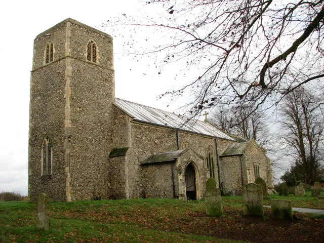
Cantley
Towns & cities · 1.6 km

The Reedcutter Caravan and Motorhome Club
Caravan parks · 1.7 km

Limpenhoe War Memorial
Memorials & monuments · 1.9 km

Limpenhoe Village Sign
Public art & sculpture · 2.1 km
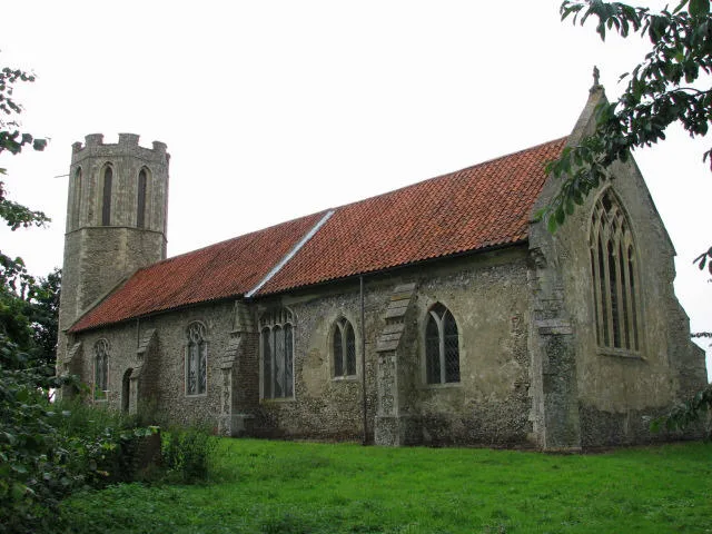
St Nicholas' Church, Buckenham
Historic churches · 2.5 km

Buckenham War Memorial
Memorials & monuments · 2.5 km

Wherryman's Way
Military museums · 2.5 km

Beighton Village Sign
Public art & sculpture · 2.6 km

Buckenham Ferry Drainage Mill
Windmills · 2.7 km

Moulton War Memorial Cross
Memorials & monuments · 2.7 km
Nearby
📷 3Public art & sculpture · East of England
Cantley VIllage Sign
Cantley VIllage Sign — a public art in england-east, United Kingdom.
📷 5Flagship📷 3📷 5Caravan parks · East of England
The Reedcutter Caravan and Motorhome Club
The Reedcutter Caravan and Motorhome Club — a caravan park in england east.
📷 3Memorials & monuments · East of England
Limpenhoe War Memorial
Limpenhoe War Memorial — Grade II listed building-listed memorial in england-east, United Kingdom.
📷 3Public art & sculpture · East of England
Limpenhoe Village Sign
Limpenhoe Village Sign — a public art in england-east, United Kingdom.
Where to eat & stay near Homefields Camping
Places to stay
📷 5Caravan parks · East of England
The Reedcutter Caravan and Motorhome Club
The Reedcutter Caravan and Motorhome Club — a caravan park in england east.
 📷 5
📷 5Campsites · East of England
Strumpshaw Steam Museum
Strumpshaw Steam Museum — a campsite in england east.
 📷 5
📷 5Caravan parks · East of England
Reedham Ferry Touring Park
Reedham Ferry Touring Park — a caravan park in england east.
 📷 5
📷 5 📷 5
📷 5 📷 5
📷 5Caravan parks · East of England
Tingdene Caldecott Hall Country Park
Tingdene Caldecott Hall Country Park — a caravan park in england east.
Places to eat & drink
 📷 5
📷 5Historic pubs · East of England
The Top House Public House, Including Boundary Wall To Yard
The Top House Public House, Including Boundary Wall To Yard in England East, United Kingdom.
 📷 5
📷 5 📷 5
📷 5 📷 5
📷 5Restaurants · East of England
The Town House
The Town House — a restaurant in england east. Brand: Stonehouse Pizza and Carvery.
 📷 5
📷 5 📷 5
📷 5Historic pubs · East of England
St Johns Head Public House
St Johns Head Public House in England East, United Kingdom.
More places in this region
 📷 5
📷 5Campsites · East of England
Sacrewell Farm
Sacrewell Farm — a campsite in england london.
 📷 5
📷 5Campsites · East of England
Jordans Close Scout Activity Centre
Jordans Close Scout Activity Centre — a campsite in england london.
 📷 5
📷 5 📷 5
📷 5Campsites · East of England
Ashwell House
Ashwell House — a campsite in england london.
Frequently asked questions
- Where is Homefields Camping?
- Homefields Camping is in Norfolk, East of England, United Kingdom (postcode NR13 3JG), in the parish of Cantley, Limpenhoe and Southwood.
- What is Homefields Camping?
- Homefields Camping — a campsite in england east.
- How do I get to Homefields Camping?
- The nearest railway station is Cantley, about 1.5 km away. Drivers can use postcode NR13 3JG.
- Is Homefields Camping a protected site?
- Yes — Homefields Camping is part of the Cantley Marshes SSSI Site of Special Scientific Interest and the MID-YARE National Nature Reserve.
- How do I get to Homefields Camping?
- The nearest railway station is Cantley, about 1.5 km away. Drivers can navigate to postcode NR13 3JG.