Castles · North West England
Holmrook
In or near Ravenglass.
Holmrook is a linear village in the English county of Cumbria. It lies along the A595 road on the west banks of the River Irt. The B5344 road connects it to Drigg, with its railway station less than

Espresso Addict — CC BY-SA 2.0 via Wikimedia Commons licence
Plan your visit
- Typical visit
- 1.5 h–3 h
- Nearest railway station
- Drigg · 1.7 km
- Family-friendly
- Limited wheelchair access
About
Holmrook is a linear village in the English county of Cumbria. It lies along the A595 road on the west banks of the River Irt. The B5344 road connects it to Drigg, with its railway station less than two miles to the west. Two miles north-east along the Irt valley is Irton Hall, a large mostly 19th-century house which incorporates a 14th-century pele tower.
Photo gallery
See it from the streetimagery from 2022
Imagery © Mapillary contributors, CC BY-SA 4.0
Protected designations
- Site of Special Scientific Interest: Drigg Coast SSSI
Designations sourced from Natural England open data under OGL v3.
From the Wikipedia article
Holmrook is a linear village in the English county of Cumbria. It lies along the A595 road on the west banks of the River Irt. The B5344 road connects it to Drigg, with its railway station less than two miles to the west.
Two miles north-east along the Irt valley is Irton Hall, a large mostly 19th-century house which incorporates a 14th-century pele tower.
Excerpt from Wikipedia under CC BY-SA 4.0. See the source article linked in Sources below.
- Coordinates
- 54.3830, -3.4200
- District
- Cumberland
- Parish
- Drigg and Carleton
- Postcode
- CA19 1YE
- Parliamentary constituency
- Whitehaven and Workington
- Nearest railway station
- Drigg — 1.7 km
Sources
- wikipedia: Holmrook (CC BY-SA 4.0)
Other places nearby

Holmbrook Hall Bridge
Historic bridges · 0.7 km

The Irton Cross
Memorials & monuments · 1.6 km

The Irton Cross
Archaeological sites · 1.6 km

Drigg
Villages · 1.6 km

Shepherd's View
Campsites · 2.3 km
Shepherds View Holidays
Caravan parks · 2.4 km

Irton Hall
B&Bs · 2.8 km

Medieval Tower Incorporated Into Irton Hall
Memorials & monuments · 2.8 km

Ravenglass Railway Museum
Museums · 3.1 km

Muncaster War Memorial And Area Wall
Memorials & monuments · 3.1 km

Ravenglass railway station
Museums · 3.1 km

Ravenglass Camping & Caravanning
Campsites · 3.2 km
Nearby
📷 3Historic bridges · North West England
Holmbrook Hall Bridge
Holmbrook Hall Bridge — Grade II listed building-listed bridge in england-north-west, United Kingdom.
📷 3Memorials & monuments · North West England
The Irton Cross
The Irton Cross — a memorial in england-north-west, United Kingdom.
📷 5Archaeological sites · North West England
The Irton Cross
The Irton Cross — archaeological in england north west.
📷 5📷 5📷 5Caravan parks · North West England
Shepherds View Holidays
Shepherds View Holidays — a caravan park in england north west.
Where to eat & stay near Holmrook
Places to stay
📷 5📷 5Caravan parks · North West England
Shepherds View Holidays
Shepherds View Holidays — a caravan park in england north west.
📷 5B&Bs · North West England
Irton Hall
Irton Hall — a bed-and-breakfast in england north west.
📷 5Campsites · North West England
Ravenglass Camping & Caravanning
Ravenglass Camping & Caravanning — a campsite in england north west.
 📷 7
📷 7Hotels · North West England
Pennington Hotel
Pennington Hotel — a hotel in england north west.
 📷 5
📷 5Campsites · North West England
Parkgate Farm
Parkgate Farm — a campsite in england north west.
Places to eat & drink
 📷 5
📷 5Historic pubs · North West England
Blacksmiths Arms
Blacksmiths Arms in England North West, United Kingdom.
 📷 7
📷 7Historic pubs · North West England
Church House Public House
Church House Public House in England North West, United Kingdom.
 📷 5
📷 5Historic pubs · North West England
Fox and Grapes
Fox and Grapes in England North West, United Kingdom.
 📷 5
📷 5Restaurants · North West England
The Terrace Coffee House and Restaurant
The Terrace Coffee House and Restaurant — a restaurant in england north west. Cuisine: sandwich;lunch.
 📷 7
📷 7Cafés · North West England
Grange Bridge Cottage
Grange Bridge Cottage — a café in england north east.
More castles in this region
 📷 3
📷 3Castles · North West England
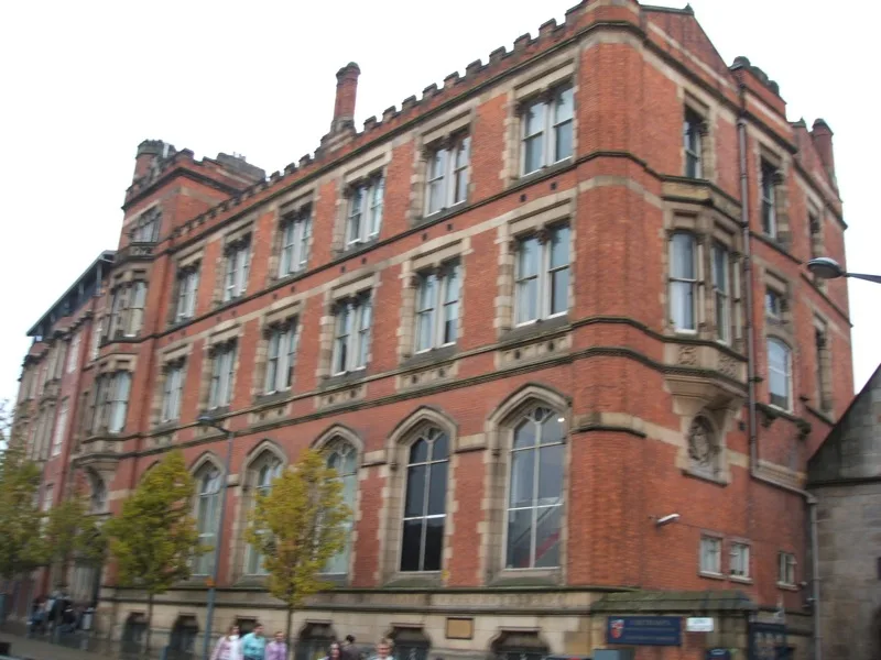
Manchester Castle
Manchester Castle — medieval fortified manor house in England.
 📷 5
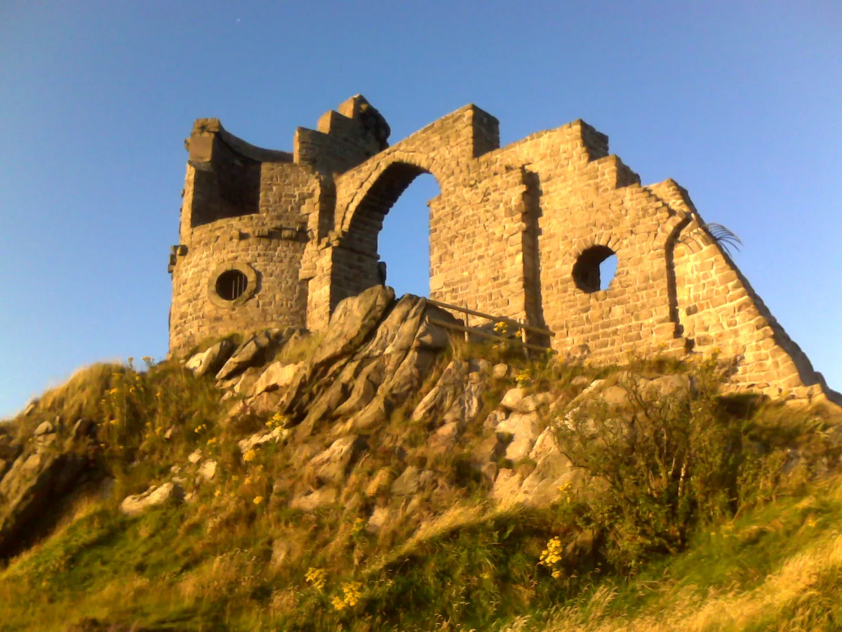
📷 5Castles · North West England
Mow Cop Castle
Mow Cop Castle — folly on the Cheshire and Staffordshire border, England, UK.
 📷 3
📷 3 📷 3
📷 3Castles · North West England
Ullerwood Castle
Ullerwood Castle — castle in Greater Manchester, England.
Frequently asked questions
- Where is Holmrook?
- Holmrook is in North-West England, United Kingdom (postcode CA19 1YE), in the parish of Drigg and Carleton.
- What is Holmrook?
- Holmrook is a linear village in the English county of Cumbria. It lies along the A595 road on the west banks of the River Irt. The B5344 road connects it to Drigg, with its railway station less than
- How do I get to Holmrook?
- The nearest railway station is Drigg, about 1.7 km away. Drivers can use postcode CA19 1YE.
- Is Holmrook a protected site?
- Yes — Holmrook is part of the Drigg Coast SSSI Site of Special Scientific Interest.
- Does Holmrook charge admission?
- Holmrook typically charges admission. Check the official site for current ticket prices and opening hours.
- How do I get to Holmrook?
- The nearest railway station is Drigg, about 1.7 km away. Drivers can navigate to postcode CA19 1YE.