Museums · East Midlands
Holme Pierrepont
In or near Burton Joyce.
Holme Pierrepont is a hamlet and civil parish located 5 miles (8 km) south-east of the city of Nottingham in Nottinghamshire, England. It is in the Gamston ward of the Rushcliffe local authority in th

Mat Fascione — CC BY-SA 2.0 via Wikimedia Commons licence
Plan your visit
- Typical visit
- 1.5 h–3 h
- Best time of year
- Year-round
- Nearest railway station
- Netherfield · 1.9 km
- Free entry
- Family-friendly
- Limited wheelchair access
Getting there & planning your visit
To visit Holme Pierrepont, the nearest railway station is Netherfield, which is 1.9 km away. The postcode for sat-nav is NG12 2LD. Accessibility is limited for wheelchair users.
About
Holme Pierrepont is a hamlet and civil parish located 5 miles (8 km) south-east of the city of Nottingham in Nottinghamshire, England. It is in the Gamston ward of the Rushcliffe local authority in the East Midlands region. The population of the civil parish (which envelops Adbolton, Bassingfield and a fringe portion of Lady Bay) as at the 2011 census was 528, and this reported 568 residents at the 2021 census. The word Holme comes from the Old English and Old Norse words for a small island or low-lying land by a river. Pierrepont is northern French for "Stone Bridge" and is the surname of an Anglo-Norman family that once held the manor. Henry Perpount, of Holme by Nottingham, appears as a defendant in a Common Pleas record of 1433.
Photo gallery
360° viewimagery from 2026
Imagery © Mapillary contributors, CC BY-SA 4.0
Official information
Holme Pierrepont is an English civil parish located in Nottinghamshire, situated along the southern bank of the River Trent. The area has historical significance, having been a settlement point for the Anglo-Saxons and a former dividing line between kingdoms.
From the Wikipedia article
Holme Pierrepont is a hamlet and civil parish located 5 miles (8 km) south-east of the city of Nottingham in Nottinghamshire, England. It is in the Gamston ward of the Rushcliffe local authority in the East Midlands region. The population of the civil parish (which envelops Adbolton, Bassingfield and a fringe portion of Lady Bay) as at the 2011 census was 528, and this reported 568 residents at the 2021 census. The word Holme comes from the Old English and Old Norse words for a small island or low-lying land by a river. Pierrepont is northern French for "Stone Bridge" and is the surname of an Anglo-Norman family that once held the manor. Henry Perpount, of Holme by Nottingham, appears as a defendant in a Common Pleas record of 1433.
Excerpt from Wikipedia under CC BY-SA 4.0. See the source article linked in Sources below.
Background
History
There is evidence that Holme Pierrepont was settled by farming communities at least as long ago as the Neolithic era. Archaeological remains from the Bronze Age, Iron Age and Roman period have been found in the parish. The main historic features of Holme Pierrepont are the Church of St Edmund and Holme Pierrepont Hall.
Sourced from Wikipedia under CC BY-SA 4.0.
- Coordinates
- 52.9460, -1.0660
- County
- Nottinghamshire
- District
- Rushcliffe
- Parish
- Holme Pierrepont
- Postcode
- NG12 2LD
- Parliamentary constituency
- Rushcliffe
- Nearest railway station
- Netherfield — 1.9 km
- Official site
- www.holmepierrepontandgamstonpc.org.uk
Sources
- wikipedia: Holme Pierrepont (CC BY-SA 4.0)
Other places nearby
Holme Pierrepont Hall
Stately homes · 0.2 km
St. Edmund's Church, Holme Pierrepont
Historic churches · 0.3 km

Martin Brandon-Bravo O.B.E.
Memorials & monuments · 0.9 km
.jpg?width=1200)
Rectory Junction Viaduct
Historic bridges · 1.1 km

Mountain Bike Route
Mountain bike trails · 1.1 km

Colwick
Villages · 1.5 km

Colwick Fish Pass
Public art & sculpture · 1.5 km
St. Mary's Church, Radcliffe on Trent
Historic churches · 1.6 km

Manvers Arms Public House
Historic pubs · 1.6 km

War Memorial
Memorials & monuments · 1.6 km

Canping & Caravan Club Nottingham Site
Campsites · 1.7 km

Radcliffe on Trent
Villages · 1.9 km
Nearby
📷 3Stately homes · East Midlands
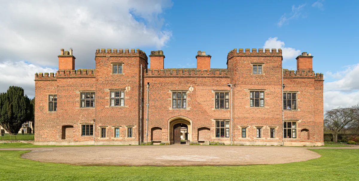
Holme Pierrepont Hall
Holme Pierrepont Hall — Grade I listed country house in Nottinghamshire, England, UK.
📷 3Historic churches · East Midlands
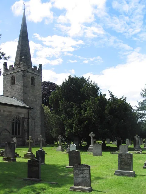
St. Edmund's Church, Holme Pierrepont
St. Edmund's Church, Holme Pierrepont — Grade I listed church in Holme Pierrepont, Rushcliffe, Nottinghamshire, England, UK.
📷 3Memorials & monuments · East Midlands
Martin Brandon-Bravo O.B.E.
Martin Brandon-Bravo O.B.E. — a memorial in england-east-midlands, United Kingdom.
📷 3Historic bridges · East Midlands
Rectory Junction Viaduct
Rectory Junction Viaduct is a historic bridge in the United Kingdom.
📷 5Mountain bike trails · East Midlands
Mountain Bike Route
Mountain Bike Route — a mtb trail in england east midlands.
📷 5Where to eat & stay near Holme Pierrepont
Places to stay
📷 5Campsites · East Midlands
Canping & Caravan Club Nottingham Site
Canping & Caravan Club Nottingham Site — a campsite in england east midlands.
 📷 5
📷 5Campsites · East Midlands
Bell Tent Village Parks
Bell Tent Village Parks — a campsite in england east midlands.
 📷 5
📷 5Campsites · East Midlands
Holme Pierrepont Country Park
Holme Pierrepont Country Park — a campsite in england east midlands.
 📷 5
📷 5Hotels · East Midlands
Colwick Hall
Colwick Hall — a hotel in england east midlands.
 📷 5
📷 5Campsites · East Midlands
Hollygate Scout Camp
Hollygate Scout Camp — a campsite in england east midlands.
 📷 5
📷 5B&Bs · East Midlands
Primrose House B&B
Primrose House B&B — a bed-and-breakfast in england east midlands.
Places to eat & drink
📷 5Historic pubs · East Midlands
Manvers Arms Public House
Manvers Arms Public House in England East Midlands, United Kingdom.
 📷 7
📷 7Historic pubs · East Midlands
Test Match Hotel
Test Match Hotel in England East Midlands, United Kingdom.
 📷 7
📷 7Historic pubs · East Midlands
Trent Bridge Inn
Trent Bridge Inn in England East Midlands, United Kingdom.
 📷 7
📷 7Historic pubs · East Midlands
Bath Inn Public House
Bath Inn Public House in England East Midlands, United Kingdom.
 📷 5
📷 5Restaurants · East Midlands
Pizza Pilgrims
Pizza Pilgrims — a restaurant in england east midlands. Cuisine: pizza. Brand: Pizza Pilgrims.
 📷 3
📷 3Historic pubs · East Midlands
Pitcher & Piano
Pitcher & Piano — Historic pub — listed building or notable heritage status.
More museums in this region
 📷 5
📷 5Museums · East Midlands
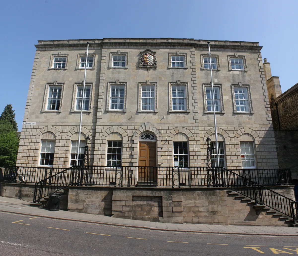
Stamford Town Hall
Stamford Town Hall — building in Stamford, Lincolnshire, England, UK.
 📷 5
📷 5Museums · East Midlands
Thorney Museum
Thorney Museum — a museum in england-london, United Kingdom.
 📷 5
📷 5Museums · East Midlands
Octavia Hill Birthplace Museum
Octavia Hill Birthplace Museum — a museum in england-london, United Kingdom.
 📷 5
📷 5Museums · East Midlands
Museum of Technology
Museum of Technology — a museum in england-london, United Kingdom.
Frequently asked questions
- Where is Holme Pierrepont?
- Holme Pierrepont is in Nottinghamshire, the East Midlands, United Kingdom (postcode NG12 2LD), in the parish of Holme Pierrepont.
- What is Holme Pierrepont?
- Holme Pierrepont is a hamlet and civil parish located 5 miles (8 km) south-east of the city of Nottingham in Nottinghamshire, England. It is in the Gamston ward of the Rushcliffe local authority in th
- How do I get to Holme Pierrepont?
- The nearest railway station is Netherfield, about 1.9 km away. Drivers can use postcode NG12 2LD.
- How do I get to Holme Pierrepont?
- The nearest railway station is Netherfield, about 1.9 km away. Drivers can navigate to postcode NG12 2LD.