
Other places · Scottish Islands
HMS E49
In or near Baltasound.
HMS E49 in Orkney + Shetland, United Kingdom.

Adam Kerr — CC BY-SA 2.0 via Wikimedia Commons licence

Plan your visit
- Typical visit
- 1 h–2 h
About
HMS E49 is a place of interest in Orkney + Shetland, United Kingdom — drawn from open-data sources for visitor reference. See the linked Wikipedia article for the full description.
Photo gallery
From the Wikipedia article
HMS E49 was an E-class submarine built by Swan Hunter, Wallsend for the Royal Navy. She was laid down on 15 February 1915 and was commissioned on 14 December 1916. E49 was mined off the Shetland Islands on 12 March 1917. The minefield was laid by the German U-boat UC-76 on 10 March 1917. There were no survivors. E49 lies 96 ft (29 m) down with her bow blown off.
Excerpt from Wikipedia under CC BY-SA 4.0. See the source article linked in Sources below.
Background
Architecture
Like all post-E8 British E-class submarines, E49 had a displacement of 662 LT at the surface and 807 LT while submerged. She had a total length of 180 ft and a beam of 22 ft. She was powered by two 800 hp Vickers eight-cylinder two-stroke diesel engines and two 420 hp electric motors. The submarine had a maximum surface speed of 16 kn and a submerged speed of 10 kn. British E-class submarines had fuel capacities of 50 LT of diesel and ranges of 3255 mi when travelling at 10 kn. E49 was capable of operating submerged for five hours when travelling at 5 kn. E49 was armed with a 12-pounder 76 mm QF gun mounted forward of the conning tower. She had five 18 inch (450 mm) torpedo tubes, two in…
Sourced from Wikipedia under CC BY-SA 4.0.
- Coordinates
- 60.7369, -0.7987
Sources
Other places nearby
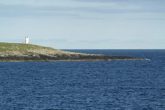
Balta Sound Lighthouse
Lighthouses · 0.5 km

Huney
Islands · 0.7 km

fish curing yard
Archaeological sites · 1.5 km
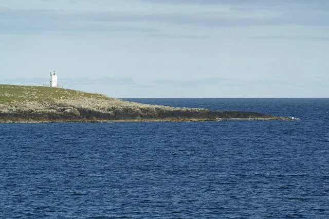
Balta
Islands · 1.5 km

St Sunniva's Chapel remains
Archaeological sites · 1.5 km

Upswall Broch
Archaeological sites · 1.9 km

Geo of the Brough Broch
Archaeological sites · 2.4 km

Geo of the Brough Broch
Archaeological sites · 2.4 km

Hamar Viking Longhouse
Archaeological sites · 3.0 km

Hamar
Vineyards · 3.0 km

Balta Sound
Islands · 3.0 km

Unst Airport
Islands · 3.2 km
Nearby
📷 3Lighthouses · Scottish Islands
Balta Sound Lighthouse
Balta Sound Lighthouse — lighthouse on the south tip of Balta, Shetland Islands, Scotland, UK.
📷 5📷 3Archaeological sites · Scottish Islands
fish curing yard
fish curing yard — a archaeological in scotland-islands, United Kingdom.
📷 5Islands · Scottish Islands
Balta
Balta — island of the Shetland Islands, Scotland, UK, east of Unst.
📷 3Archaeological sites · Scottish Islands
St Sunniva's Chapel remains
St Sunniva's Chapel remains — a archaeological in scotland-islands, United Kingdom.
📷 3Archaeological sites · Scottish Islands
Upswall Broch
Upswall Broch — a archaeological in scotland-islands, United Kingdom.
Where to eat & stay near HMS E49
Places to stay
 📷 5
📷 5Hostels · Scottish Islands
Saxa Vord resort
Saxa Vord resort — a hostel in scotland islands.
 📷 5
📷 5 📷 5
📷 5Campsites · Scottish Islands
Gardiesfauld Campsite
Gardiesfauld Campsite — a campsite in scotland islands.
 📷 5
📷 5Caravan parks · Scottish Islands
Gardiesfauld Caravan Park
Gardiesfauld Caravan Park — a caravan park in scotland islands.
 📷 5
📷 5Hostels · Scottish Islands
Aithbank Camping Böd
Aithbank Camping Böd — a hostel in scotland islands.
 📷 5
📷 5More places in this region
 📷 3
📷 3Other places · Scottish Islands
Mosaic Mackerel
Mosaic Mackerel — Public artwork (sculpture) by Rosalind Waites.
 📷 3
📷 3Other places · Scottish Islands
TEF-20 Ferguson Sculpture
TEF-20 Ferguson Sculpture — Public artwork (sculpture).
 📷 3
📷 3Other places · Scottish Islands
Time and Tide Bell
Time and Tide Bell — Public artwork (sculpture) by Marcus Vergette.
 📷 3
📷 3Frequently asked questions
- Where is HMS E49?
- HMS E49 is in the Scottish Islands, United Kingdom.
- What is HMS E49?
- HMS E49 in Orkney + Shetland, United Kingdom.
- How do I get to HMS E49?
- Its coordinates are 60.7369°, -0.7987°.