Mountains & hills · Scottish Highlands
Hill of Mackalea
Hill of Mackalea — mountain in scotland highlands. Elevation: 466 m.

Alan Hodgson — CC BY-SA 2.0 via Wikimedia Commons licence
Plan your visit
- Typical visit
- 3 h–8 h
- Best time of year
- Late spring – early autumn (May–Oct)
About
Hill of Mackalea is a mountain located in scotland highlands. Elevation: 466 m. A named British peak recorded in OpenStreetMap. Peaks are typically named on Ordnance Survey 1:50k mapping.
Photo gallery
Place summary
Hill of Mackalea is a mountain located in the Scottish Highlands. It is characterised by its rugged terrain and scenic views typical of the region. The area is popular for outdoor activities such as hiking and nature observation, attracting those interested in the natural landscape of Scotland. The surrounding highland scenery offers a diverse habitat for wildlife.
AI-generated from the structured facts on this page (operator, designation, listing, era). Not a substitute for visiting.
- Coordinates
- 57.4292, -3.0527
Sources
- osm: n2442929754 (ODbL)
Other places nearby
Loading nearby places…
Nearby
 📷 5
📷 5Villages · Scottish Highlands
Auchindoun
Auchindoun — a village in scotland highlands.
 📷 5
📷 5Mountains & hills · Scottish Highlands
The Scalp
The Scalp — mountain in scotland highlands. Elevation: 487 m.
📷 5Mountains & hills · Scottish Highlands
The Scalp
The Scalp — a hill or mountain in scotland highlands.
 📷 4
📷 4Castles · Scottish Highlands
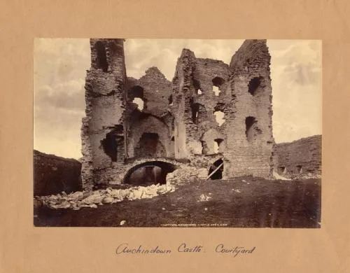
Auchindoun Castle
Auchindoun Castle — 15th-century tower castle in Scotland.
 📷 5
📷 5Watermills · Scottish Highlands
Auchindoun Mill
Auchindoun Mill — category B listed building-listed watermill in scotland-highlands, United Kingdom.
 📷 5
📷 5Archaeological sites · Scottish Highlands
Auchindown Castle
Auchindown Castle — a archaeological site in scotland highlands.
Where to eat & stay near Hill of Mackalea
Places to stay
 📷 3
📷 3Campsites · Scottish Highlands
Aberlour Gardens Camping Park
Aberlour Gardens Camping Park — a campsite in scotland highlands.
 📷 5
📷 5Hotels · Scottish Highlands
Craigellachie Hotel
Craigellachie Hotel — a hotel in scotland highlands.
 📷 5
📷 5Campsites · Scottish Highlands
Speyside by Craigellachie
Speyside by Craigellachie — a campsite in scotland highlands.
 📷 5
📷 5Caravan parks · Scottish Highlands
Huntly Castle Caravan Park
Huntly Castle Caravan Park — a caravan park in scotland highlands.
 📷 5
📷 5Caravan parks · Scottish Highlands
Burnside Caravan Park
Burnside Caravan Park — a caravan park in scotland highlands.
 📷 5
📷 5Campsites · Scottish Highlands
Camping
Camping — a campsite in scotland highlands.
Places to eat & drink
 📷 5
📷 5Historic pubs · Scottish Highlands
Seafield Arms Hotel, 84, 86 Mid Street, Keith
Seafield Arms Hotel, 84, 86 Mid Street, Keith in Scotland Highlands, United Kingdom.
 📷 5
📷 5Historic pubs · Scottish Highlands
Forbes Arms Hotel, Milltown of Rothiemay
Forbes Arms Hotel, Milltown of Rothiemay in Scotland Highlands, United Kingdom.
More mountains in this region
 📷 3
📷 3Mountains & hills · Scottish Highlands
A' Bhuidheanach Bheag
A' Bhuidheanach Bheag — Named summit at 936 m.
 📷 3
📷 3Mountains & hills · Scottish Highlands
A' Chailleach
A' Chailleach — Named summit at 997 m.
 📷 3
📷 3Mountains & hills · Scottish Highlands
A' Chailleach
A' Chailleach — Named summit at 930 m.
 📷 3
📷 3Mountains & hills · Scottish Highlands
A' Chaoirnich
A' Chaoirnich — Named summit at 875 m.
Frequently asked questions
- Where is Hill of Mackalea?
- Hill of Mackalea is in the Scottish Highlands, United Kingdom.
- What is Hill of Mackalea?
- Hill of Mackalea — mountain in scotland highlands. Elevation: 466 m.
- How do I get to Hill of Mackalea?
- Its coordinates are 57.4292°, -3.0527°.