Historic houses · South West England
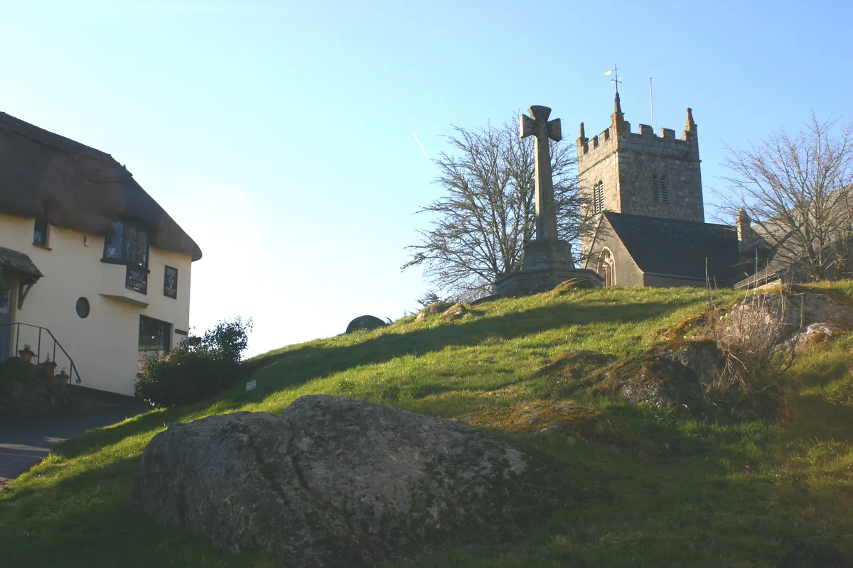
Higher Combe cross: a wayside cross in a field 250m east of Higher Combe
In or near Christow.
Higher Combe cross: a wayside cross in a field 250m east of Higher Combe — a Grade II*-listed historic house in england-south-west, United Kingdom.

Derek Harper — CC BY-SA 2.0 via Wikimedia Commons licence
Plan your visit
- Typical visit
- 1 h–2 h
- Nearest railway station
- Riverside Station · 9.2 km
- Family-friendly
- Limited wheelchair access
About
Higher Combe cross: a wayside cross in a field 250m east of Higher Combe is a Grade II*-listed building in england-south-west, United Kingdom. Grade II* status is conferred by Historic England (or Cadw, Historic Environment Scotland or NIEA equivalents) on buildings of exceptional national interest. See the linked Wikipedia article for full historical and architectural details.
Photo gallery
Protected designations
- Site of Special Scientific Interest: Bovey Valley Woodlands SSSI
Designations sourced from Natural England open data under OGL v3.
Place summary
Higher Combe cross is a wayside cross located in a field 250 metres east of Higher Combe in Moretonhampstead, Devon, South-West England. This historic structure is designated as Grade II*, indicating its particular importance and special interest.
AI-generated from the structured facts on this page (operator, designation, listing, era). Not a substitute for visiting.
- Coordinates
- 50.6297, -3.7296
- County
- Devon
- District
- Teignbridge
- Parish
- Moretonhampstead
- Postcode
- TQ13 9SN
- Parliamentary constituency
- Central Devon
- Nearest railway station
- Riverside Station — 9.2 km
Sources
- wikidata: Q17648445 (CC0)
Other places nearby

Plain Mummeries Tor
Mountains & hills · 0.7 km

Great Wood Tor
Mountains & hills · 0.8 km

Elsford Rock
Mountains & hills · 1.0 km

Uphill, The Great Hall, And Oaknuve
Historic houses · 1.0 km

Wray Valley Camping
Campsites · 1.4 km
.jpg?width=1200)
May Day Rock
Memorials & monuments · 1.4 km

Lustleigh War Memorial
Memorials & monuments · 1.4 km

Sanduck Cross: a wayside cross on the north side of a minor road 45m south west of Sanduck Farm
Farms (open to visitors) · 1.4 km
Church of St John the Baptist
Abbeys & priories · 1.5 km

Church of St John the Baptist
Cathedrals · 1.5 km

Lustleigh
Museums · 1.5 km

Hunter's Tor
Mountains & hills · 1.5 km
Nearby
📷 5Mountains & hills · South West England
Plain Mummeries Tor
Plain Mummeries Tor — mountain in england south west. Elevation: 215 m.
📷 5Mountains & hills · South West England
Great Wood Tor
Great Wood Tor — mountain in england south west. Elevation: 175 m.
📷 5Mountains & hills · South West England
Elsford Rock
Elsford Rock — mountain in england south west. Elevation: 290 m.
📷 3Historic houses · South West England
Uphill, The Great Hall, And Oaknuve
Uphill, The Great Hall, And Oaknuve — a Grade I-listed historic house in england-south-west, United Kingdom.
📷 5Campsites · South West England
Wray Valley Camping
Wray Valley Camping — a campsite in england south west.
📷 5Memorials & monuments · South West England
May Day Rock
May Day Rock is a memorial in the United Kingdom.
Where to eat & stay near Higher Combe cross: a wayside cross in a field 250m east of Higher Combe
Places to stay
📷 5Campsites · South West England
Wray Valley Camping
Wray Valley Camping — a campsite in england south west.
 📷 5
📷 5 📷 5
📷 5 📷 7
📷 7Hotels · South West England
The White Hart Hotel
The White Hart Hotel — a hotel in england south west.
 📷 5
📷 5Hostels · South West England
Sparrowhawk Backpackers
Sparrowhawk Backpackers — a hostel in england south west.
 📷 5
📷 5Hotels · South West England
Bovey Castle
Bovey Castle — a hotel in england south west.
Places to eat & drink
 📷 5
📷 5Historic pubs · South West England
The Artichoke Inn
The Artichoke Inn in England South West, United Kingdom.
 📷 5
📷 5Cafés · South West England
Staple Hill Servery
Staple Hill Servery — a café in england south west.
 📷 5
📷 5 📷 7
📷 7Historic pubs · South West England
The Bishop Lacy Public House
The Bishop Lacy Public House in England South West, United Kingdom.
 📷 7
📷 7Historic pubs · South West England
Warren House Inn
Warren House Inn in England South West, United Kingdom.
 📷 5
📷 5Historic pubs · South West England
Kings Arms Inn
Kings Arms Inn in England South West, United Kingdom.
More historic houses in this region
 📷 5
📷 5Historic houses · South West England
1 South Parade
1 South Parade — Grade I listed house in Bath, Somerset, England, UK.
_(geograph_6440799).jpg?width=1200) 📷 5
📷 5Historic houses · South West England
1-4 Lansdowne Grove, Morris Lane
1-4 Lansdowne Grove, Morris Lane — houses in Devizes, Wiltshire, England, UK.
 📷 5
📷 5Historic houses · South West England
2 North Parade
2 North Parade — building in Bath, UK; part of Abbey Hotel.
 📷 5
📷 5Historic houses · South West England
2, South Place, Lacock Road
2, South Place, Lacock Road — house in Corsham, Wiltshire, England, UK.
Frequently asked questions
- Where is Higher Combe cross: a wayside cross in a field 250m east of Higher Combe?
- Higher Combe cross: a wayside cross in a field 250m east of Higher Combe is in Devon, South-West England, United Kingdom (postcode TQ13 9SN), in the parish of Moretonhampstead.
- What is Higher Combe cross: a wayside cross in a field 250m east of Higher Combe?
- Higher Combe cross: a wayside cross in a field 250m east of Higher Combe — a Grade II*-listed historic house in england-south-west, United Kingdom.
- How do I get to Higher Combe cross: a wayside cross in a field 250m east of Higher Combe?
- The nearest railway station is Riverside Station, about 9.2 km away. Drivers can use postcode TQ13 9SN.
- Is Higher Combe cross: a wayside cross in a field 250m east of Higher Combe a listed building?
- Higher Combe cross: a wayside cross in a field 250m east of Higher Combe is officially recognised as Grade II* listed.
- Is Higher Combe cross: a wayside cross in a field 250m east of Higher Combe a protected site?
- Yes — Higher Combe cross: a wayside cross in a field 250m east of Higher Combe is part of the Bovey Valley Woodlands SSSI Site of Special Scientific Interest.
- How do I get to Higher Combe cross: a wayside cross in a field 250m east of Higher Combe?
- Drivers can navigate to postcode TQ13 9SN. It sits within the Central Devon parliamentary constituency.