Mountains & hills · North East England
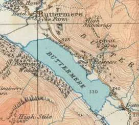
High Snockrigg
High Snockrigg — mountain in england north east. Elevation: 526 m.

Tim Glover — CC BY-SA 2.0 via Wikimedia Commons licence
Plan your visit
- Typical visit
- 3 h–8 h
- Best time of year
- Late spring – early autumn (May–Oct)
About
High Snockrigg is a mountain located in england north east. Elevation: 526 m. A named British peak recorded in OpenStreetMap. Peaks are typically named on Ordnance Survey 1:50k mapping.
Photo gallery
Place summary
High Snockrigg is a mountain located in North-East England. It is part of the Lake District National Park and offers panoramic views of the surrounding landscape. The area is popular for hiking and provides various trails suitable for different skill levels. Visitors can expect a rugged terrain typical of the region, with opportunities for outdoor activities.
AI-generated from the structured facts on this page (operator, designation, listing, era). Not a substitute for visiting.
- Coordinates
- 54.5408, -3.2582
Sources
- osm: n4871717491 (ODbL)
Other places nearby
Loading nearby places…
Nearby
📷 5Mountains & hills · North East England
High Snockrigg
High Snockrigg — a hill or mountain in england north east.
 📷 5
📷 5Waterfalls · North East England
Moss Force
Moss Force — waterfall in england north east.
 📷 4
📷 4Memorials & monuments · North West England
Moss Force
Moss Force is a waterfall situated within the Lake District National Park in the English county of Cumbria. It is located 10 km SW of the town of Keswick at Newlands Hause, the pass between the Newlan
 📷 5
📷 5Campsites · North East England
Dalegarth Guest House Camp Site
Dalegarth Guest House Camp Site — a campsite in england north east.
 📷 3
📷 3Natural landmarks · North East England
Buttermere
Buttermere — lake in the United Kingdom.
 📷 3
📷 3Towns & cities · North East England
Buttermere
Buttermere — village and civil parish in Cumbria, England, UK.
Where to eat & stay near High Snockrigg
Places to stay
📷 5Campsites · North East England
Dalegarth Guest House Camp Site
Dalegarth Guest House Camp Site — a campsite in england north east.
 📷 5
📷 5Campsites · North East England
Syke Farm Campsite
Syke Farm Campsite — a campsite in england north east.
 📷 5
📷 5Hostels · North East England
YHA Black Sail
YHA Black Sail — a hostel in england north east.
 📷 5
📷 5Hostels · North East England
Honister Pass YHA
Honister Pass YHA — a hostel in england north east.
 📷 5
📷 5Hostels · North East England
Ennerdale
Ennerdale — a hostel in england north east.
 📷 5
📷 5Campsites · North East England
Hollows Farm Campsite
Hollows Farm Campsite — a campsite in england north east.
Places to eat & drink
 📷 5
📷 5Cafés · North East England
Grange Bridge Cottage
Grange Bridge Cottage — a café in england north east.
 📷 5
📷 5Cafés · Scottish Lowlands
YHA Cafe
YHA Cafe — a café in scotland lowlands.
 📷 5
📷 5Historic pubs · Scottish Lowlands
The Pheasant Inn
The Pheasant Inn in Scotland Lowlands, United Kingdom.
 📷 5
📷 5Historic pubs · North West England
The Travellers Rest
The Travellers Rest in England North West, United Kingdom.
 📷 5
📷 5Historic pubs · North West England
Fox and Grapes
Fox and Grapes in England North West, United Kingdom.
 📷 5
📷 5Historic pubs · North West England
Golden Rule Hotel
Golden Rule Hotel in England North West, United Kingdom.
More mountains in this region
 📷 3
📷 3Mountains & hills · North East England
Angletarn Pikes
Angletarn Pikes — Named summit at 566 m.
 📷 3
📷 3Mountains & hills · North East England
Angletarn Pikes South Top
Angletarn Pikes South Top — Named summit at 563.6 m.
 📷 3
📷 3Mountains & hills · North East England
Ard Crags
Ard Crags — Named summit at 581 m.
 📷 3
📷 3Mountains & hills · North East England
Arnison Crag
Arnison Crag — Named summit at 433 m.
Frequently asked questions
- Where is High Snockrigg?
- High Snockrigg is in North-East England, United Kingdom.
- What is High Snockrigg?
- High Snockrigg — mountain in england north east. Elevation: 526 m.
- How do I get to High Snockrigg?
- Its coordinates are 54.5408°, -3.2582°.