Mountains & hills · South West England
High Peak
High Peak — Named summit at 157 m.

Wikimedia Commons contributors — see linked file page for photographer and licence licence
Plan your visit
- Typical visit
- 3 h–8 h
- Best time of year
- Late spring – early autumn (May–Oct)
- Free entry
- Dog-friendly
About
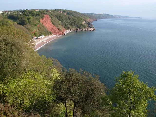
High Peak is a named summit in the United Kingdom. Wikidata describes it as: "Named summit at 157 m.". Coordinates: 50.6662°, -3.2700°.
Photo gallery
Protected designations
- Site of Special Scientific Interest: Ladram Bay to Sidmouth SSSI
- National Nature Reserve: PEBBLEBED HEATHS
- Area of Outstanding Natural Beauty: East Devon
Designations sourced from Natural England open data under OGL v3.
From the Wikipedia article
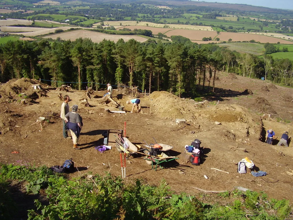
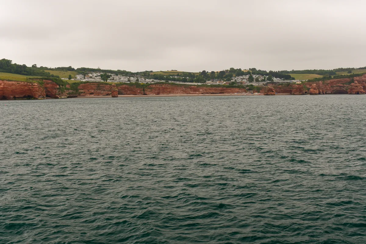
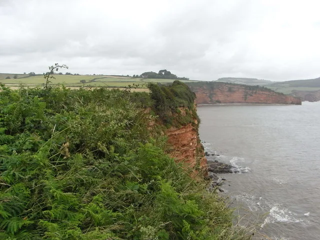
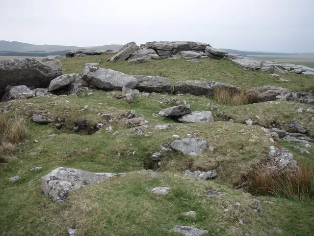
High Peak (also known as Peak Hill) is a hill which is partially eroded, resulting in a cliff face, on the English Channel coast to the southwest of Sidmouth, Devon, southern England. Its highest point is about 157 metres (515 ft) above sea-level. It features a partially eroded Iron Age hill fort, with pre-Roman and post Roman pottery found there.
Excerpt from Wikipedia under CC BY-SA 4.0. See the source article linked in Sources below.
Background
History
On the edge of the cliff there are the remains of significant earthworks, which have been variously shown as having Iron Age, Roman and Dark Age occupation. Geological study, and the lines of the earthworks, suggest that the site once extended several tens of metres into what is now eroded away. General interpretation suggests that it was an Iron Age defensive site which saw re-use in the Dark Age period, perhaps as a coastal trading station.
Sourced from Wikipedia under CC BY-SA 4.0.
- Coordinates
- 50.6662, -3.2700
- County
- Devon
- District
- East Devon
- Parish
- Otterton
- Postcode
- EX9 7BU
- Parliamentary constituency
- Exmouth and Exeter East
Sources
- osm: n1334298921 (ODbL)
- wikipedia: High Peak, Devon (CC BY-SA 4.0)
- commons: View from Peak Hill, near Sidmouth - geograph.org.uk - 1372146.jpg (CC BY-SA 4.0)
Other places nearby
Loading nearby places…
Nearby
 📷 5
📷 5Archaeological sites · South West England
High Peak camp, Sidmouth
High Peak camp, Sidmouth — human settlement in Otterton, East Devon, England, UK.
 📷 3
📷 3Archaeological sites · South West England
High Peak Camp
High Peak Camp — a archaeological in england-south-west, United Kingdom.
Caravan parks · South West England
Ladram Bay Holiday Park
Ladram Bay Holiday Park — a caravan park in england south west.
 📷 5
📷 5Mountains & hills · South West England
Ladram Bay
Ladram Bay — bay in the United Kingdom.
 📷 5
📷 5Beaches · South West England
Jacobs Ladder Beach
Jacobs Ladder Beach is a beach in the United Kingdom.
 📷 5
📷 5Mountains & hills · South West England
Chiselbury Bay
Chiselbury Bay — bay in the United Kingdom.
More mountains in this region
 📷 5
📷 5Mountains & hills · South West England
Alex Tor
Alex Tor — Named summit at 291 m.
 📷 5
📷 5Mountains & hills · South West England
Ash Hole Cavern
Ash Hole Cavern — cave in Brixham, Devon, England, UK.
 📷 5
📷 5Mountains & hills · South West England
Babbacombe Bay
Babbacombe Bay — bay in Devon, England.
 📷 5
📷 5Mountains & hills · South West England
Barley Bay
Barley Bay — bay in the United Kingdom.
Frequently asked questions
- Where is High Peak?
- High Peak is in Devon, South-West England, United Kingdom (postcode EX9 7BU), in the parish of Otterton.
- Is High Peak a protected site?
- Yes — High Peak is part of the Ladram Bay to Sidmouth SSSI Site of Special Scientific Interest and the PEBBLEBED HEATHS National Nature Reserve.
- Is High Peak free to visit?
- Yes, High Peak is free to enter.
- How do I get to High Peak?
- Drivers can navigate to postcode EX9 7BU. It sits within the Exmouth and Exeter East parliamentary constituency.