
Historic bridges · West Midlands
High Bridge (Bridge No.39) Shropshire Union Canal Main Line
In or near Offleyhay.
High Bridge (Bridge No.39) Shropshire Union Canal Main Line — Grade II listed building-listed bridge in england-west-midlands, United Kingdom.

Jo Turner — CC BY-SA 2.0 via Wikimedia Commons licence

Plan your visit
- Typical visit
- 15 min–30 min
- Free entry
- Dog-friendly
About
High Bridge (Bridge No.39) Shropshire Union Canal Main Line is a Grade II listed building-listed bridge in england-west-midlands, United Kingdom, registered on the National Heritage List for England (NHLE entry 1406777). Listed status protects buildings and structures of special architectural or historic interest. See the linked Wikipedia article for further details.
Photo gallery
See it from the streetimagery from 2022
Imagery © Mapillary contributors, CC BY-SA 4.0
Heritage listing
Details A canal bridge and wing walls, built 1832-3, for the Birmingham and Liverpool Junction Canal Company, by Thomas Telford, principal engineer; William Provis, consulting engineer and contractor; and Alexander Easton, resident engineer. A strainer arch was inserted into the bridge in the mid-C19 onto which a telegraph pole was placed in 1861 by the United Kingdom Telegraph Company. In the late C20 the bridge was partly cement rendered and the parapet rebuilt. MATERIALS: The bridge is constructed from brick, now partly cement rendered, with a rebuilt parapet of blue engineering brick and stone coping. The revetment wing walls are of rock-faced rusticated sandstone. DESCRIPTION: A single-span canal bridge carrying the A519 Newcastle-under-Lyme to Newport road over the Shropshire Union Canal Main Line. It consists of a semi-circular, horseshoe arch of around 12.2m in height, built on a slight skew. The north and south faces of the bridge have a stone band at road level from below which the spandrel walls are cement rendered, each face with exaggerated keystone and voussoir mouldings. A brick strainer arch with a segmental-arched top and bottom spans the principal arch at its half-way point and has a wooden telegraph pole affixed to its upper section. Attached to the tow path (west) side of the bridge are two iron rope fenders. The shallow road-side parapet has chamfered coping stones and terminates in square piers with chamfered stone caps. On the north and south sides of the bridge there are opposing revetment wing walls. A service pipe (not of special interest) runs across the south side of the bridge.
From the Historic England List Entry under OGL v3.
Protected designations
- Site of Special Scientific Interest: Loynton Moss SSSI
Designations sourced from Natural England open data under OGL v3.
Place summary
High Bridge (Bridge No.39) is a Grade II listed bridge located on the Shropshire Union Canal Main Line in Norbury, Staffordshire, within the West Midlands. This structure is notable for its historical significance and architectural merit, contributing to the canal's heritage.
AI-generated from the structured facts on this page (operator, designation, listing, era). Not a substitute for visiting.
- Coordinates
- 52.8150, -2.3134
- County
- Staffordshire
- District
- Stafford
- Parish
- Norbury
- Postcode
- ST20 0NX
- Parliamentary constituency
- Stafford
Sources
- wikidata: Q26675893 (CC0)
Other places nearby

Loynton Moss
Wildlife reserves · 0.4 km
Loynton Moss
Forests & woodlands · 0.6 km
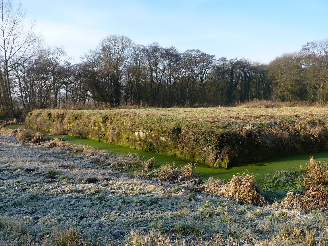
Norbury Manor moated site, 8 fishponds and connecting channels
Archaeological sites · 1.1 km

Shropshire Union Canal Bridge Number 41 At Sj 782 252
Historic bridges · 1.3 km

Shropshire Union Canal Junction Bridge (Number 38) Norbury Junction At Sj 792 228
Historic bridges · 1.4 km

Hob Hill
Mountains & hills · 1.4 km

Norbury
Villages · 1.7 km

Bridge Number 42 At Sj 775 256
Historic bridges · 2.1 km

High Offley
Villages · 2.1 km

Weston Jones Motte
Literary houses · 2.2 km

Weston Jones
Castles · 2.2 km

Shropshire Union Canal Bridge Number 43 At Sj 772 259
Historic bridges · 2.4 km
Nearby
📷 3Wildlife reserves · West Midlands
Loynton Moss
Loynton Moss — nature reserve in Staffordshire, UK.
📷 3Forests & woodlands · West Midlands
Loynton Moss
Loynton Moss is a forest or woodland in the United Kingdom.
📷 3Archaeological sites · West Midlands
Norbury Manor moated site, 8 fishponds and connecting channels
Norbury Manor moated site, 8 fishponds and connecting channels — archaeological site in Norbury, Stafford, England, UK.
📷 3Historic bridges · West Midlands
Shropshire Union Canal Bridge Number 41 At Sj 782 252
Shropshire Union Canal Bridge Number 41 At Sj 782 252 — Grade II listed building-listed bridge in england-west-midlands, United Kingdom.
📷 3Historic bridges · West Midlands
Shropshire Union Canal Junction Bridge (Number 38) Norbury Junction At Sj 792 228
Shropshire Union Canal Junction Bridge (Number 38) Norbury Junction At Sj 792 228 — Grade II listed building-listed bridge in england-west-midlands, United Kingdom.
📷 5Where to eat & stay near High Bridge (Bridge No.39) Shropshire Union Canal Main Line
Places to stay
 📷 5
📷 5Caravan parks · West Midlands
Red Lion Farm Caravan Park
Red Lion Farm Caravan Park — a caravan park in england west midlands.
 📷 5
📷 5 📷 5
📷 5 📷 5
📷 5Caravan parks · West Midlands
Boothstone Park homes
Boothstone Park homes — a caravan park in england west midlands.
 📷 5
📷 5Campsites · West Midlands
Ted's Caravan and Camp Site
Ted's Caravan and Camp Site — a campsite in england west midlands.
 📷 5
📷 5Caravan parks · West Midlands
White Caravan Park
White Caravan Park — a caravan park in england west midlands.
Places to eat & drink
 📷 5
📷 5Historic pubs · West Midlands
Eagle Inn Public House
Eagle Inn Public House in England West Midlands, United Kingdom.
 📷 5
📷 5Historic pubs · West Midlands
The Chains Public House
The Chains Public House in England West Midlands, United Kingdom.
 📷 5
📷 5 📷 5
📷 5Historic pubs · West Midlands
Shrewsbury Arms
Shrewsbury Arms in England West Midlands, United Kingdom.
 📷 7
📷 7 📷 7
📷 7Historic pubs · West Midlands
The Littleton Arms
The Littleton Arms in England West Midlands, United Kingdom.
More bridges in this region
 📷 3
📷 3Historic bridges · West Midlands
Wolseley Bridge
Wolseley Bridge is a historic bridge in the United Kingdom.
 📷 3
📷 3Historic bridges · West Midlands
Bridge, Gatepiers, Walls And Ha Ha South Of Blithfield Hall
Bridge, Gatepiers, Walls And Ha Ha South Of Blithfield Hall — Grade II listed building-listed bridge in england-east-midlands, United Kingdom.
 📷 3
📷 3Historic bridges · West Midlands
Bridge Over River Swarbourn At West End Of Town Hill
Bridge Over River Swarbourn At West End Of Town Hill — Grade II listed building-listed bridge in england-east-midlands, United Kingdom.
 📷 3
📷 3Historic bridges · West Midlands
Viaduct over Trent and Mersey Canal at SK 0485 1780
Viaduct over Trent and Mersey Canal at SK 0485 1780 — Grade II listed building-listed bridge in england-east-midlands, United Kingdom.
Frequently asked questions
- Where is High Bridge (Bridge No.39) Shropshire Union Canal Main Line?
- High Bridge (Bridge No.39) Shropshire Union Canal Main Line is in Staffordshire, the West Midlands, United Kingdom (postcode ST20 0NX), in the parish of Norbury.
- What is High Bridge (Bridge No.39) Shropshire Union Canal Main Line?
- High Bridge (Bridge No.39) Shropshire Union Canal Main Line — Grade II listed building-listed bridge in england-west-midlands, United Kingdom.
- How do I get to High Bridge (Bridge No.39) Shropshire Union Canal Main Line?
- Drivers can use postcode ST20 0NX.
- Is High Bridge (Bridge No.39) Shropshire Union Canal Main Line a listed building?
- High Bridge (Bridge No.39) Shropshire Union Canal Main Line is officially recognised as Grade II listed building listed.
- Is High Bridge (Bridge No.39) Shropshire Union Canal Main Line a protected site?
- Yes — High Bridge (Bridge No.39) Shropshire Union Canal Main Line is part of the Loynton Moss SSSI Site of Special Scientific Interest.
- Is High Bridge (Bridge No.39) Shropshire Union Canal Main Line free to visit?
- Yes, High Bridge (Bridge No.39) Shropshire Union Canal Main Line is free to enter.
- How do I get to High Bridge (Bridge No.39) Shropshire Union Canal Main Line?
- Drivers can navigate to postcode ST20 0NX. It sits within the Stafford parliamentary constituency.