
Viewpoints · South Wales
Hide
In or near St Fagans.
Hide is a viewpoint in the United Kingdom.

Gareth James — CC BY-SA 2.0 via Wikimedia Commons licence

Plan your visit
- Typical visit
- 20 min–45 min
- Best time of year
- Clear days year-round
- Nearest railway station
- Radyr · 0.4 km
- Free entry
- Dog-friendly
About
Hide is a named viewpoint in the United Kingdom. Coordinates: 51.5195°, -3.2447°. This entry is part of The Great Britain Guide, a free, ad-free, open-data tourist directory.
Photo gallery
Place summary
Hide is a viewpoint located in Whitchurch, South Wales. It offers panoramic views of the surrounding landscape, making it a notable spot for observation in the area.
AI-generated from the structured facts on this page (operator, designation, listing, era). Not a substitute for visiting.
- Coordinates
- 51.5195, -3.2447
- District
- Cardiff
- Parish
- Whitchurch
- Postcode
- CF14 7XZ
- Parliamentary constituency
- Cardiff North
- Nearest railway station
- Radyr — 0.4 km
Sources
- osm: n4904848122 (ODbL)
Other places nearby

Glamorgan Canal / Long Wood
Wildlife reserves · 0.2 km
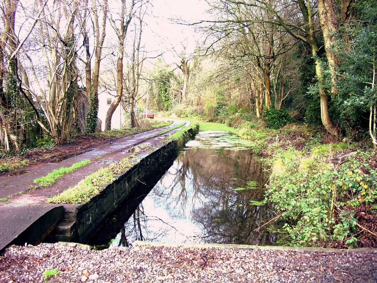
Glamorganshire Canal
Canals · 0.3 km

Towpath Bridge of Glamorganshire Canal about 50m north of junction with Forest Farm Road
Historic bridges · 0.7 km

Radyr Allegory
Memorials & monuments · 0.7 km

Radyr War Memorial
Memorials & monuments · 0.7 km

Church of Christ Church
Historic churches · 0.8 km

Whitchurch Hospital
Historic churches · 0.8 km

Radyr
Villages · 0.9 km

Former Towpath Bridge to Glamorganshire Canal
Historic bridges · 1.0 km

Afon Taff Viaduct
Historic bridges · 1.0 km

Melingriffith Tin Plate Works
Hill forts · 1.0 km

Gelynis Farm Guest House
B&Bs · 1.1 km
Nearby
📷 3Wildlife reserves · South Wales
Glamorgan Canal / Long Wood
Glamorgan Canal / Long Wood — Nature reserve in Cardiff, Wales.
📷 5Canals · South Wales
Glamorganshire Canal
Glamorganshire Canal — Site of Special Scientific Interest in Wales.
📷 5Historic bridges · South Wales
Towpath Bridge of Glamorganshire Canal about 50m north of junction with Forest Farm Road
Towpath Bridge of Glamorganshire Canal about 50m north of junction with Forest Farm Road — Grade II listed building-listed bridge in wales-south, United Kingdom.
📷 3Memorials & monuments · South Wales
Radyr Allegory
Radyr Allegory is a memorial in the United Kingdom.
📷 5Memorials & monuments · South Wales
Radyr War Memorial
Radyr War Memorial — Grade II listed building-listed memorial in wales-south, United Kingdom.
📷 5Historic churches · South Wales
Church of Christ Church
Church of Christ Church — Grade II listed building-listed church in wales-south, United Kingdom.
Where to eat & stay near Hide
Places to stay
📷 5B&Bs · South Wales
Gelynis Farm Guest House
Gelynis Farm Guest House — a bed-and-breakfast in wales south.
 📷 5
 📷 5
 📷 5
Caravan parks · South Wales
Cardiff Caravan & Camping Park
Cardiff Caravan & Camping Park — a caravan park in wales south.
 📷 7
 📷 7
Hotels · South Wales
The Angel Hotel
The Angel Hotel — a hotel in wales south.
Places to eat & drink
 📷 5
Restaurants · South Wales
Fino Lounge
Fino Lounge — a restaurant in wales south.
 📷 3
Historic pubs · South Wales
The Plymouth Arms
The Plymouth Arms — Historic pub — listed building or notable heritage status.
 📷 5
 📷 5
 📷 5
Restaurants · South Wales
Juno Lounge
Juno Lounge — a restaurant in wales south.
 📷 5
More viewpoints in this region
 📷 4
 📷 3
 📷 5
 📷 5
Frequently asked questions
- Where is Hide?
- Hide is in South Wales, United Kingdom (postcode CF14 7XZ), in the parish of Whitchurch.
- What is Hide?
- Hide is a viewpoint in the United Kingdom.
- How do I get to Hide?
- The nearest railway station is Radyr, about 0.4 km away. The nearest town is St Fagans. Drivers can use postcode CF14 7XZ.
- Is Hide free to visit?
- Yes, Hide is free to enter.
- How do I get to Hide?
- The nearest railway station is Radyr, about 0.4 km away. Drivers can navigate to postcode CF14 7XZ.