Forests & woodlands · London
Hexton Chalk Pits
Hexton Chalk Pits is a forest or woodland in the United Kingdom.

Wikimedia Commons licence
Plan your visit
- Typical visit
- 1 h–3 h
- Nearest railway station
- Harlington · 7.2 km
- Free entry
- Family-friendly
- Dog-friendly
About
Hexton Chalk Pits is a named forest, woodland or nature reserve in the United Kingdom. Coordinates: 51.9568°, -0.3905°. This entry is part of The Great Britain Guide, a free, ad-free, open-data tourist directory.
Photo gallery
Protected designations
- Area of Outstanding Natural Beauty: Chilterns
Designations sourced from Natural England open data under OGL v3.
From the Wikipedia article
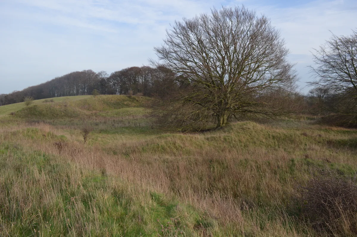
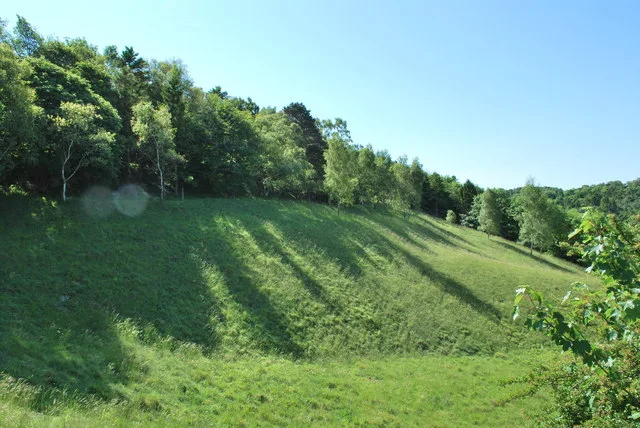
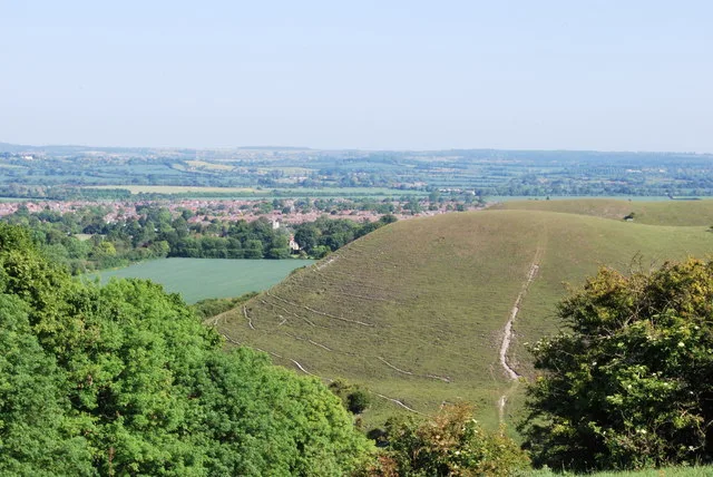
Hexton Chalk Pit is a 1.9-hectare (4.7-acre) nature reserve in Hexton in North Hertfordshire, managed by the Herts and Middlesex Wildlife Trust. It is grassland with steep slopes and many chalk-loving plants such as horseshoe vetch, yellow-wort, milkwort and rockrose. There are five species of orchid and a large colony of chalkhill blue butterflies. The site has extensive views over the countryside. The reserve is on the left of the road signposted "Lilley" from Hexton. There is also access by a footpath, signposted "circular walk", from Barton Hill Road, close to the Icknield Way Path.
Excerpt from Wikipedia under CC BY-SA 4.0. See the source article linked in Sources below.
- Coordinates
- 51.9568, -0.3905
- County
- Hertfordshire
- District
- North Hertfordshire
- Parish
- Hexton
- Postcode
- SG5 3JP
- Parliamentary constituency
- Hitchin
- Nearest railway station
- Harlington — 7.2 km
Sources
- osm: w10365892 (ODbL)
- wikipedia: Hexton Chalk Pit (CC BY-SA 4.0)
Other places nearby
Loading nearby places…
Nearby
 📷 5
📷 5Wildlife reserves · London
Barton Gravel Pit
Barton Gravel Pit — nature reserve in the United Kingdom.
 📷 3
📷 3Castles · London
Ravensburgh Castle
Ravensburgh Castle — hillfort in Hertfordshire, England, UK.
 📷 5
📷 5Towns & cities · London
Pegsdon
Pegsdon — village in Bedfordshire, England, UK.
 📷 5
📷 5Forests & woodlands · London
Pegsdon Hills
Pegsdon Hills is a forest or woodland in the United Kingdom.
📷 5Wildlife reserves · London
Pegsdon Hills
Pegsdon Hills — nature reserve in Bedfordshire, England, UK.
 📷 5
📷 5Wildlife reserves · London
Barton Hills, Bedfordshire
Barton Hills, Bedfordshire — nature reserve and Site of Special Scientific Interest near Barton-le-Clay, Bedfordshire.
More forests in this region
 📷 5
📷 5Forests & woodlands · London
Ackroyd Drive Green Link
Ackroyd Drive Green Link is a forest or woodland in the United Kingdom.
 📷 5
📷 5Forests & woodlands · London
Adams Road Bird Sanctuary
Adams Road Bird Sanctuary is a forest or woodland in the United Kingdom.
 📷 5
📷 5Forests & woodlands · London
Adelaide Nature Reserve
Adelaide Nature Reserve is a forest or woodland in the United Kingdom.
 📷 5
📷 5Forests & woodlands · London
Angel's Wings
Angel's Wings — Public artwork by Thomas Heatherwick.
Frequently asked questions
- Where is Hexton Chalk Pits?
- Hexton Chalk Pits is in Hertfordshire, London, United Kingdom (postcode SG5 3JP), in the parish of Hexton.
- Is Hexton Chalk Pits a protected site?
- Yes — Hexton Chalk Pits is part of the Chilterns National Landscape (AONB).
- Is Hexton Chalk Pits free to visit?
- Yes, Hexton Chalk Pits is free to enter.
- How do I get to Hexton Chalk Pits?
- The nearest railway station is Harlington, about 7.2 km away. Drivers can navigate to postcode SG5 3JP.