
Archaeological sites · Mid Wales
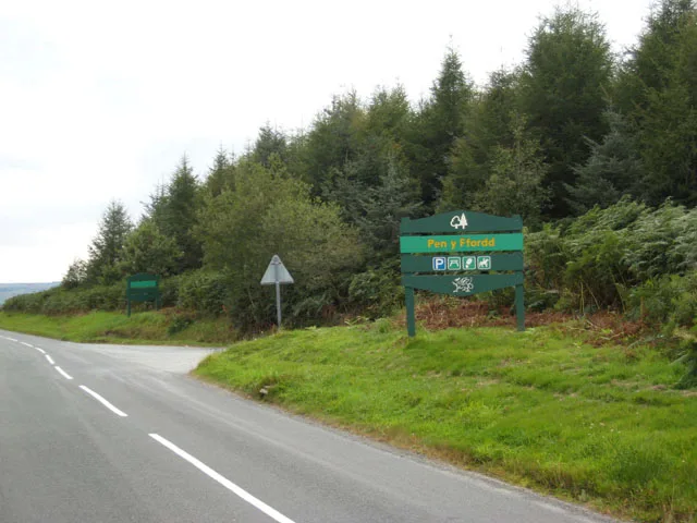
Hen Gaer, Bow Street
In or near Borth.
Hen Gaer, Bow Street in Wales Mid, United Kingdom.

Marion Phillips — CC BY-SA 2.0 via Wikimedia Commons licence

Plan your visit
- Typical visit
- 45 min–1.5 h
- Nearest railway station
- Bow Street · 1.2 km
- Free entry
- Dog-friendly
About
Hen Gaer, Bow Street is a place of interest in Wales Mid, United Kingdom — drawn from open-data sources for visitor reference. See the linked Wikipedia article for the full description.
Photo gallery
From the Wikipedia article
Hen Gaer is an Iron Age hillfort, on a hill adjacent to and east of Bow Street, Ceredigion, Wales. Other names of the hillfort are Broncastellan and Caer Shon.
Excerpt from Wikipedia under CC BY-SA 4.0. See the source article linked in Sources below.
Background
Description
Hen Gaer ("Old Castle") is smaller than a typical tribal fortification. It is strongly defended; the single rampart is about 12 m wide and 3 – above the interior, with a rock-cut external ditch. On the north-east side, carefully laid stone blocks of the original rampart wall can be seen. The main entrance is on the west side. There is a circular mound outside the entrance: it is not an earlier barrow, but may be a defensive feature. The enclosed area includes some of the southern hillslope; it is thought this may have been to make the fortification visible from the narrow valley below, at the confluence of Afon Stewi and Nant Seilo forming Afon Clarach.
Sourced from Wikipedia under CC BY-SA 4.0.
- Coordinates
- 52.4403, -4.0127
- District
- Ceredigion
- Parish
- Trefeurig
- Postcode
- SY23 3EE
- Parliamentary constituency
- Ceredigion Preseli
- Nearest railway station
- Bow Street — 1.2 km
Sources
Other places nearby
Hen Gaer
Archaeological sites · 0.0 km

Hen Gaer
Mountains & hills · 0.1 km

Gogerddan Picnic Site
Natural landmarks · 0.6 km

Gogerddan Mansion
Historic houses · 0.8 km

Bridge at Plas Gogerddan
Historic bridges · 0.8 km

Penrhyn-coch War Memorial
Memorials & monuments · 1.0 km

Carreg Llwyd
Archaeological sites · 1.1 km

Bow Street
Other places · 1.1 km

Bow Street railway station
Heritage railway stations · 1.2 km

Penrhyncoch F.C.
Stadiums · 1.2 km
Penrhyn-coch
Other places · 1.3 km

Bow Street F.C.
Stadiums · 1.5 km
Nearby
📷 3Archaeological sites · Mid Wales
Hen Gaer
Hen Gaer — a archaeological in wales-mid, United Kingdom.
📷 5📷 3Natural landmarks · Mid Wales
Gogerddan Picnic Site
Gogerddan Picnic Site — a other in wales-mid, United Kingdom.
📷 4📷 5Historic bridges · Mid Wales
Bridge at Plas Gogerddan
Bridge at Plas Gogerddan — Grade II listed building-listed bridge in wales-mid, United Kingdom.
📷 3Memorials & monuments · Mid Wales
Penrhyn-coch War Memorial
Penrhyn-coch War Memorial is a memorial in the United Kingdom.
Where to eat & stay near Hen Gaer, Bow Street
Places to stay
 📷 5
📷 5 📷 5📷 5
 📷 5
📷 5Campsites · Mid Wales
Riverside Caravan And Camping Park
Riverside Caravan And Camping Park — a campsite in wales mid.
 📷 5
📷 5Caravan parks · Mid Wales
Clarach Bay Caravan Park
Clarach Bay Caravan Park — a caravan park in wales mid.
 📷 5
📷 5Places to eat & drink
 📷 5
📷 5 📷 7
📷 7 📷 5
📷 5Cafés · Mid Wales
Llywernog Silver Lead Mine
Llywernog Silver Lead Mine — a café in wales mid.
 📷 5
📷 5Restaurants · Mid Wales
The White Lion Hotel
The White Lion Hotel — a restaurant in wales mid.
 📷 4
📷 4More archaeological sites in this region
 📷 5
📷 5 📷 3
📷 3Archaeological sites · Mid Wales
Quaker settlement Dolgellau
Quaker settlement Dolgellau — a archaeological in wales-north, United Kingdom.
 📷 3
📷 3Archaeological sites · Mid Wales
Centenary Viewpoint
Centenary Viewpoint — a archaeological in wales-north, United Kingdom.
 📷 3
📷 3Archaeological sites · Mid Wales
Gwanas-Fawr Roman Marching Camp
Gwanas-Fawr Roman Marching Camp — a archaeological in wales-north, United Kingdom.
Frequently asked questions
- Where is Hen Gaer, Bow Street?
- Hen Gaer, Bow Street is in Mid Wales, United Kingdom (postcode SY23 3EE), in the parish of Trefeurig.
- What is Hen Gaer, Bow Street?
- Hen Gaer, Bow Street in Wales Mid, United Kingdom.
- How do I get to Hen Gaer, Bow Street?
- The nearest railway station is Bow Street, about 1.2 km away. Drivers can use postcode SY23 3EE.
- Is Hen Gaer, Bow Street free to visit?
- Yes, Hen Gaer, Bow Street is free to enter.
- How do I get to Hen Gaer, Bow Street?
- The nearest railway station is Bow Street, about 1.2 km away. Drivers can navigate to postcode SY23 3EE.