
Mountain bike trails · South East England
Helter Skelter
In or near Coursehorn.
Helter Skelter — a mtb trail in england south east.

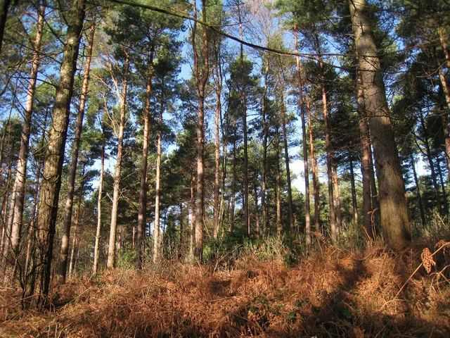
Oast House Archive — CC BY-SA 2.0 via Wikimedia Commons licence

Plan your visit
- Typical visit
- 1 h–2 h
- Nearest railway station
- Etchingham · 6.6 km
About
Helter Skelter is a mtb trail located in england south east, mapped by OpenStreetMap contributors. Detailed amenities and visitor information may vary; check the OSM page for the latest tagged metadata.
Photo gallery
Protected designations
- Area of Outstanding Natural Beauty: High Weald
- Area of Outstanding Natural Beauty: Kent Downs
Designations sourced from Natural England open data under OGL v3.
Place summary
Helter Skelter is a mountain biking trail located in South-East England. This trail offers a series of twists and turns, catering to a range of skill levels. Riders can expect a mix of terrain, which includes both challenging sections and easier paths suitable for less experienced cyclists. The natural setting provides a refreshing outdoor experience, ideal for those looking to engage in mountain biking amidst the English landscape.
AI-generated from the structured facts on this page (operator, designation, listing, era). Not a substitute for visiting.
- Coordinates
- 51.0666, 0.4724
- County
- Kent
- District
- Tunbridge Wells
- Parish
- Hawkhurst
- Postcode
- TN18 5HA
- Parliamentary constituency
- Tunbridge Wells
- Nearest railway station
- Etchingham — 6.6 km
Sources
- osm: w164535327 (ODbL)
Other places nearby

Cardiac
Mountain bike trails · 0.2 km
Cardiac
Mountain bike trails · 0.3 km

Singletrack Mountain Bike Trail
Mountain bike trails · 0.5 km
Bedgebury Forest
Archaeological sites · 0.7 km
Fibreglass Trees
Mountain bike trails · 0.7 km

Deliverance
Mountain bike trails · 0.9 km

Family Cycle Route
Mountain bike trails · 0.9 km

Starvegoose
Mountain bike trails · 1.1 km
Starvegoose
Mountain bike trails · 1.1 km
Magic Carpet
Mountain bike trails · 1.1 km

Wanda's
Mountain bike trails · 1.1 km
Show of Hands
Mountain bike trails · 1.2 km
Nearby
📷 5📷 5📷 5Mountain bike trails · South East England
Singletrack Mountain Bike Trail
Singletrack Mountain Bike Trail — a mtb trail in england south east.
📷 5Archaeological sites · South East England
Bedgebury Forest
Bedgebury Forest — forest in Kent, England.
📷 5Mountain bike trails · South East England
Fibreglass Trees
Fibreglass Trees — a mtb trail in england south east.
📷 5Mountain bike trails · South East England
Deliverance
Deliverance — a mtb trail in england south east.
Where to eat & stay near Helter Skelter
Places to stay
 📷 5
Campsites · South East England
Glassenbury Camping
Glassenbury Camping — a campsite in england south east.
 📷 5
Campsites · South East England
Star Field camping and glamping
Star Field camping and glamping — a campsite in england south east.
 📷 5
Campsites · South East England
Cedar Gables Campsite
Cedar Gables Campsite — a campsite in england south east.
 📷 5
Campsites · South East England
Bedgebury Camping
Bedgebury Camping — a campsite in england south east.
 📷 5
 📷 5
Campsites · South East England
Caird's Camping and Caravan Site
Caird's Camping and Caravan Site — a campsite in england south east.
Places to eat & drink
 📷 5
Historic pubs · South East England
The Cherry Tree Public House
The Cherry Tree Public House in England South East, United Kingdom.
 📷 7
Historic pubs · South East England
The Old Bull Inn
The Old Bull Inn in England South East, United Kingdom.
 📷 7
Restaurants · South East England
The Royal George
The Royal George — a restaurant in england south east.
 📷 7
 📷 5
Historic pubs · South East England
Elephants Head Public House
Elephants Head Public House in England South East, United Kingdom.
 📷 5
Historic pubs · South East England
The Salehurst Halt Public House
The Salehurst Halt Public House in England South East, United Kingdom.
More places in this region
 📷 5
 📷 5
 📷 5
 📷 5
Frequently asked questions
- Where is Helter Skelter?
- Helter Skelter is in Kent, South-East England, United Kingdom (postcode TN18 5HA), in the parish of Hawkhurst.
- What is Helter Skelter?
- Helter Skelter — a mtb trail in england south east.
- How do I get to Helter Skelter?
- The nearest railway station is Etchingham, about 6.6 km away. The nearest town is Coursehorn. Drivers can use postcode TN18 5HA.
- Is Helter Skelter a protected site?
- Yes — Helter Skelter is part of the High Weald National Landscape (AONB) and the Kent Downs National Landscape (AONB).
- How do I get to Helter Skelter?
- The nearest railway station is Etchingham, about 6.6 km away. Drivers can navigate to postcode TN18 5HA.