
Mountains & hills · West Midlands
Haughmond Hill
In or near Wroxeter.
Haughmond Hill — Named summit at 153 m.

Wikimedia Commons contributors — see linked file page for photographer and licence licence

Plan your visit
- Typical visit
- 3 h–8 h
- Best time of year
- Late spring – early autumn (May–Oct)
- Nearest railway station
- Shrewsbury · 4.8 km
- Free entry
- Dog-friendly
Getting there & planning your visit
Haughmond Hill is located in Shropshire, with the nearest railway station being Shrewsbury, approximately 4.8 km away. Entry to the site is free.
About
Haughmond Hill is a named summit in the United Kingdom. Wikidata describes it as: "Named summit at 153 m.". Coordinates: 52.7167°, -2.6780°.
Photo gallery
From the Wikipedia article
Haughmond Hill is a small, shallow hill in the English county of Shropshire. It is covered by woodland for the most part, although there is an open cast quarry (for stone aggregates) in use. Its proximity to the town of Shrewsbury has meant that it has become something of a forest park, with guided paths, car parking and picnic areas maintained in places. The rocky summit overlooks countryside and Shrewsbury itself. Haughmond Hill is made up of ancient turbidite sediments from the late Precambrian era which once cascaded off the edge of a continent into the ocean that surrounded it. The villages of Uffington and Upton Magna lie below and the B5062, Shrewsbury to Newport, road runs through the northern half of the woodland. Deer can be found in the woods, which are mixed deciduous/coniferous and are to some extent used for forestry to this day. The hill has several dubious connections with the Battle of Shrewsbury in 1403. Queen Eleanor's Bower is a small enclosure on the hill from which the wife of Henry IV of England supposedly watched the battle's progress (although neither of his wives were named Eleanor). Finally, the "bosky hill" mentioned in Act V Scene i of Shakespeare's Henry IV part 1 is almost certainly Haughmond, which looms to the east of the battlefield: Also nearby is Haughmond Abbey, now a ruin, and Ebury Hill, a prehistoric fort. The summit has the ruins of Haughmond Castle, a folly originally built about 1780 that collapsed in 1931.
Excerpt from Wikipedia under CC BY-SA 4.0. See the source article linked in Sources below.
- Coordinates
- 52.7167, -2.6780
- District
- Shropshire
- Parish
- Upton Magna
- Postcode
- SY4 4PL
- Parliamentary constituency
- Shrewsbury
- Nearest railway station
- Shrewsbury — 4.8 km
Sources
- osm: n370164846 (ODbL)
- wikipedia: Haughmond Hill (CC BY-SA 4.0)
- commons: Haughmond Hill.jpg (CC BY-SA 4.0)
Other places nearby

Queen Eleanors Bower
Castles · 0.6 km
Queen Eleanor's Bower: a ringwork, 710m north east of Bridge Farm
Literary houses · 0.7 km

Haughmond Hill Camp
Vineyards · 0.7 km

Quarry View
Viewpoints · 0.8 km

Upton Magna
Villages · 1.5 km

Berwick Tunnel Picnic Area
Natural landmarks · 1.8 km
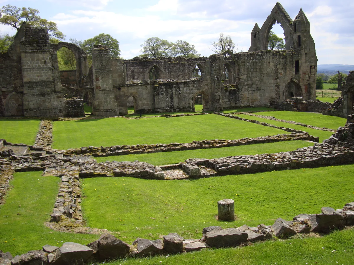
Haughmond Abbey
Abbeys & priories · 1.8 km

Haughmond Abbey
Cathedrals · 1.8 km

Shropshire Union Canal, Shrewsbury Branch Canal Bridge Approximately 20 Metres To West Of Numbers 1 And 2, Canal Cottages
Historic bridges · 2.2 km

Sundorne Castle
Castles · 2.3 km

Longner Hall
Historic houses · 2.8 km

Ebury Camp
Archaeological sites · 3.0 km
Nearby
📷 5📷 5Literary houses · West Midlands
Queen Eleanor's Bower: a ringwork, 710m north east of Bridge Farm
Queen Eleanor's Bower: a ringwork, 710m north east of Bridge Farm — a literary house museum in wales north.
📷 5Vineyards · West Midlands
Haughmond Hill Camp
Haughmond Hill Camp — a UK vineyard in wales north, producing English or Welsh wine from cool-climate grape varieties.
📷 5Viewpoints · West Midlands
Quarry View
Quarry View is a viewpoint in the United Kingdom.
📷 5📷 3Natural landmarks · West Midlands
Berwick Tunnel Picnic Area
Berwick Tunnel Picnic Area — a place in West Midlands, United Kingdom.
Where to eat & stay near Haughmond Hill
Places to stay
📷 5Campsites · West Midlands
Ebury Hill Camping And Caravanning Club Site
Ebury Hill Camping And Caravanning Club Site — a campsite in wales north.
 📷 5
📷 5 📷 6
📷 6Hotels · West Midlands
Lion & Pheasant
Lion & Pheasant — a hotel in wales north.
 📷 7
📷 7 📷 5
📷 5Hotels · West Midlands
Abbots Mead Hotel
Abbots Mead Hotel — a hotel in wales north.
 📷 5
📷 5Places to eat & drink
 📷 5
📷 5Historic pubs · West Midlands
The Dun And Cow Public House
The Dun And Cow Public House in Wales North, United Kingdom.
 📷 7
📷 7Historic pubs · West Midlands
Canal Tavern Public House And Attached Outbuilding Range
Canal Tavern Public House And Attached Outbuilding Range in Wales North, United Kingdom.
 📷 7
📷 7Historic pubs · West Midlands
The Castle Vaults Public House
The Castle Vaults Public House in Wales North, United Kingdom.
 📷 7
📷 7Historic pubs · West Midlands
Yorkshire House Public House
Yorkshire House Public House in Wales North, United Kingdom.
 📷 7
📷 7Restaurants · West Midlands
The Golden Cross
The Golden Cross — a restaurant in wales north.
 📷 7
📷 7More mountains in this region
 📷 5
📷 5Mountains & hills · West Midlands
Stile Cop
Stile Cop — mountain in england east midlands. Elevation: 219 m.
 📷 5
📷 5Mountains & hills · West Midlands
Rawnsley Hill
Rawnsley Hill — mountain in england east midlands. Elevation: 237 m.
 📷 5
📷 5Mountains & hills · West Midlands
Hound Hill
Hound Hill — mountain in england east midlands. Elevation: 98 m.
 📷 5
📷 5Frequently asked questions
- Where is Haughmond Hill?
- Haughmond Hill is in the West Midlands, United Kingdom (postcode SY4 4PL), in the parish of Upton Magna.
- What is Haughmond Hill?
- Haughmond Hill — Named summit at 153 m.
- How do I get to Haughmond Hill?
- The nearest railway station is Shrewsbury, about 4.8 km away. The nearest town is Wroxeter. Drivers can use postcode SY4 4PL.
- Is Haughmond Hill free to visit?
- Yes, Haughmond Hill is free to enter.
- How do I get to Haughmond Hill?
- The nearest railway station is Shrewsbury, about 4.8 km away. Drivers can navigate to postcode SY4 4PL.