
Historic houses · London
Hatch End Cricket Club
In or near South Oxhey.
Hatch End Cricket Club — a historic house in england-london, United Kingdom.

John Salmon — CC BY-SA 2.0 via Wikimedia Commons licence

Plan your visit
- Typical visit
- 1 h–2 h
- Nearest railway station
- Hatch End · 0.6 km
- Family-friendly
- Limited wheelchair access
About
Hatch End Cricket Club is a historic house located in england-london, United Kingdom. Sourced from OpenStreetMap (ODbL licence); see local listings for visitor information, opening hours and admission details.
Photo gallery
Protected designations
- Area of Outstanding Natural Beauty: Chilterns
Designations sourced from Natural England open data under OGL v3.
Place summary
Hatch End Cricket Club is a historic cricket venue located in London. It is known for its longstanding tradition in the sport and has served as a hub for local cricket activities. The club's facilities and history reflect the evolution of cricket in the area.
AI-generated from the structured facts on this page (operator, designation, listing, era). Not a substitute for visiting.
- Coordinates
- 51.6101, -0.3781
- District
- Harrow
- Parish
- Harrow, unparished area
- Postcode
- HA5 4PW
- Parliamentary constituency
- Ruislip, Northwood and Pinner
- Nearest railway station
- Hatch End — 0.6 km
Sources
- osm: way/970901100 (ODbL)
Other places nearby

Kol Chai Reform Synagogue
Historic churches · 0.3 km

Hatch End
Villages · 0.4 km

Hatch End railway station
Heritage railway stations · 0.7 km

Coal tax obelisk
Memorials & monuments · 0.9 km
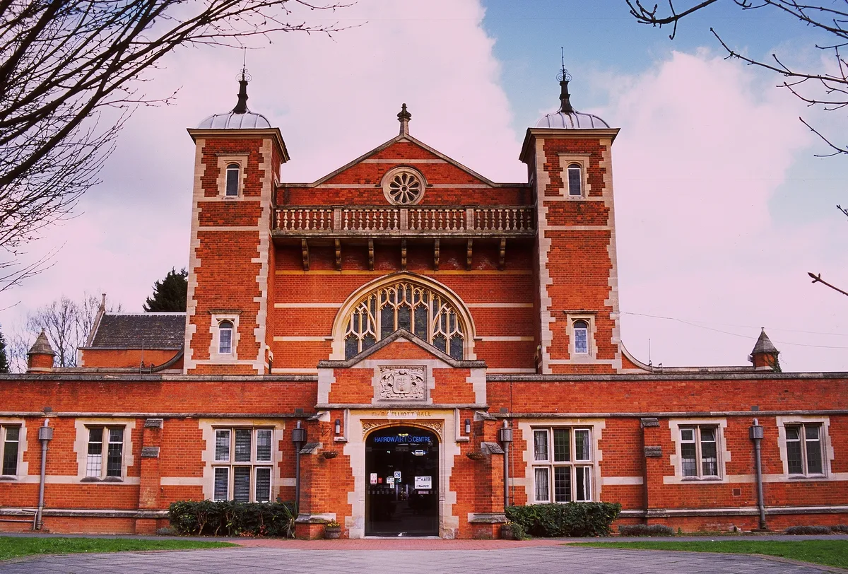
Harrow Arts Centre
Theatres · 1.0 km

Hatch End
Chapels · 1.0 km

Prestwick Road Meadows
Forests & woodlands · 1.1 km

W. Heath Robinson
Memorials & monuments · 1.2 km

Headstone
Chapels · 1.4 km

South Oxhey
Towns & cities · 1.4 km

Carpenders Park Lawn Cemetery
Cemeteries · 1.6 km

Grim's Ditch
Archaeological sites · 1.6 km
Nearby
📷 5Historic churches · London
Kol Chai Reform Synagogue
Kol Chai Reform Synagogue — a church in england-london, United Kingdom.
📷 5📷 5Heritage railway stations · London
Hatch End railway station
Hatch End railway station — a Grade II*-listed railway station in england-london, United Kingdom.
📷 5Memorials & monuments · London
Coal tax obelisk
Coal tax obelisk — a memorial in england-london, United Kingdom.
📷 5Theatres · London
Harrow Arts Centre
Harrow Arts Centre is a theatre in the United Kingdom.
📷 5Chapels · London
Hatch End
Hatch End — a methodist chapel in england-london, United Kingdom.
Where to eat & stay near Hatch End Cricket Club
Places to stay
 📷 5
📷 5 📷 5
📷 5 📷 5
📷 5 📷 5
📷 5 📷 5
📷 5Caravan parks · London
Watling Farm Caravan Site
Watling Farm Caravan Site — a caravan park in england london.
 📷 7
📷 7Places to eat & drink
 📷 5
📷 5Historic pubs · London
The Hand In Hand Public House
The Hand In Hand Public House in England London, United Kingdom.
 📷 5
📷 5 📷 5
📷 5 📷 5
📷 5 📷 5
📷 5 📷 5
📷 5More historic houses in this region
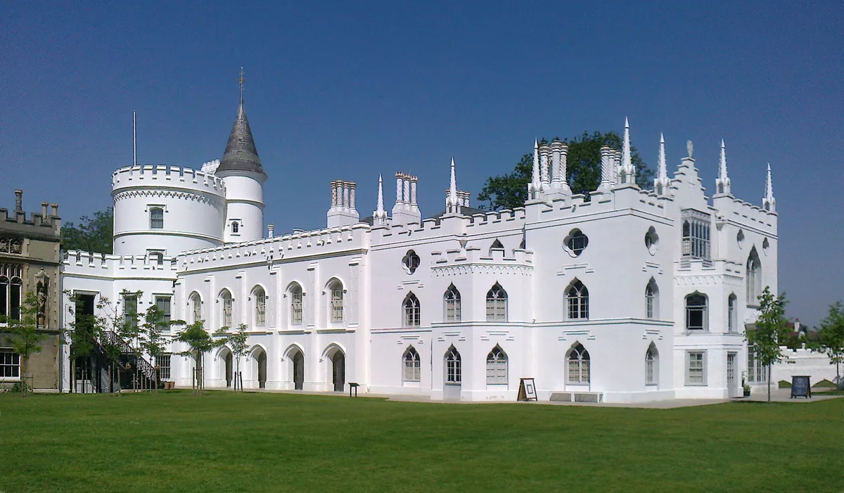 Flagship📷 10
Historic houses · London
Strawberry Hill House
Strawberry Hill House — villa and house museum in Twickenham, London, United Kingdom.
 📷 5
📷 5Historic houses · London
1 Old Palace Terrace
1 Old Palace Terrace — house in Richmond upon Thames, London, United Kingdom.
 📷 5
📷 5Historic houses · London
1 Palace Green
1 Palace Green — house on Palace Green, Kensington, London.
 📷 5
📷 5Historic houses · London
1–2 Orme Square
1–2 Orme Square — pair of houses in Orme Square, Bayswater, London.
Frequently asked questions
- Where is Hatch End Cricket Club?
- Hatch End Cricket Club is in London, United Kingdom (postcode HA5 4PW), in the parish of Harrow, unparished area.
- What is Hatch End Cricket Club?
- Hatch End Cricket Club — a historic house in england-london, United Kingdom.
- How do I get to Hatch End Cricket Club?
- The nearest railway station is Hatch End, about 0.6 km away. Drivers can use postcode HA5 4PW.
- Is Hatch End Cricket Club a protected site?
- Yes — Hatch End Cricket Club is part of the Chilterns National Landscape (AONB).
- How do I get to Hatch End Cricket Club?
- The nearest railway station is Hatch End, about 0.6 km away. Drivers can navigate to postcode HA5 4PW.