
Archaeological sites · North East England
Harwood Forest
In or near Elsdon.
Harwood Forest — forest in Northumberland, England.

Wikimedia Commons licence
Plan your visit
- Typical visit
- 45 min–1.5 h
- Free entry
- Dog-friendly
About
Harwood Forest is an archaeological site in the United Kingdom. It covers approximately 3,527 km². Wikidata describes it as: "forest in Northumberland, England". Coordinates: 55.2426°, -2.0063°.
Photo gallery
Protected designations
- Site of Special Scientific Interest: Northumberland Shore SSSI
Designations sourced from Natural England open data under OGL v3.
From the Wikipedia article
Harwood Forest is a 3,527-hectare (8,720-acre) conifer plantation located to the south of Rothbury in North Northumberland, England, and managed by Forestry England. The forest occupies moorland north of the east-west Morpeth to Elsdon road, west of the B6342, extending north to the Simonside Hills; it measures some eleven kilometres (6.8 mi) north-to-south and at its widest is seven kilometres (4.3 mi) east-to-west. The initial impetus for its establishment was an offer made in 1929 by Sir Charles Trevelyan, 3rd Baronet to sell Harwood Farm to the commission at less than market rate. Trevelyan had inherited Wallington Hall and estate on the death of his father, the 2nd Baronet, in August 1928, and wished to see the estate forested; and although he determined on large-scale planting on other, retained, parts of the estate, he determined that it was reasonable to make arrangements with the commission to expedite his plan by transferring 1,536 acres (622 ha) to it. The farm forms the trapezoid southernmost section of the forest. The next major acquisition was in 1950, when the Cragside estate of William Watson-Armstrong, 2nd Baron Armstrong, leased 525 acres (212 ha) to the commission, followed in 1951 by another 867 acres (351 ha), to form the Simonside section of the forest. This section is enclosed by the Simonside Hills, Simonside and Tosson Hill constraining the forest to a narrow neck-section, with additional forest to the north of Simonside. In the same year, 1951, the County Borough of Tyneside leased Chartners, a 1,755-acre (710 ha) farm to the south of the Simonside section, which covered the high watershed of Fontburn Reservoir, to the commission. Subsequent additions to the forest include Redpath farm, which joined the previously isolated Harwood farm area to Chartners and the Simonside section.
Excerpt from Wikipedia under CC BY-SA 4.0. See the source article linked in Sources below.
- Coordinates
- 55.2426, -2.0063
- District
- Northumberland
- Parish
- Hepple
- Postcode
- NE61 4LJ
- Parliamentary constituency
- North Northumberland
Sources
- wikidata: Q62394102 (CC0)
- wikipedia: Harwood Forest (CC BY-SA 4.0)
Other places nearby

Hemmel Hill
Mountains & hills · 0.4 km

Tod Knowe
Mountains & hills · 1.3 km

Lough Hill
Mountains & hills · 1.9 km

Darden Rigg
Mountains & hills · 2.4 km

Darden Rigg
Mountains & hills · 2.4 km
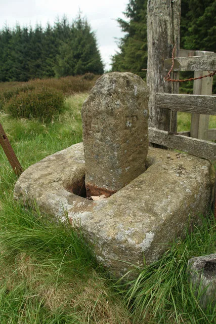
Manside defended settlement and medieval cross
Archaeological sites · 2.5 km

Dough Crag
Mountains & hills · 2.6 km

Darden Pike
Mountains & hills · 3.2 km

Whitefield Hill
Mountains & hills · 3.3 km

Fallowlees Flush
Wildlife reserves · 3.5 km

Weather Head
Mountains & hills · 3.8 km
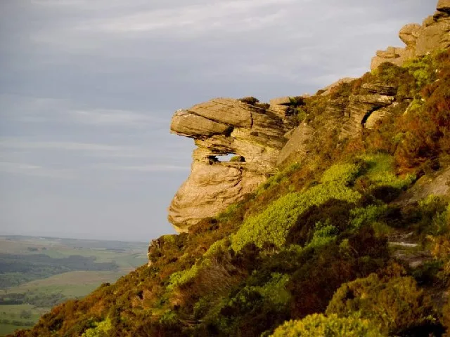
Tosson Hill
Mountains & hills · 4.1 km
Nearby
📷 5Mountains & hills · North East England
Hemmel Hill
Hemmel Hill — mountain in scotland lowlands. Elevation: 333 m.
📷 5Mountains & hills · North East England
Tod Knowe
Tod Knowe — mountain in scotland lowlands. Elevation: 336 m.
📷 5Mountains & hills · North East England
Lough Hill
Lough Hill — mountain in scotland lowlands. Elevation: 305 m.
📷 5Mountains & hills · North East England
Darden Rigg
Darden Rigg — a hill or mountain in scotland lowlands.
📷 5Mountains & hills · North East England
Darden Rigg
Darden Rigg — mountain in scotland lowlands. Elevation: 407 m.
📷 3Archaeological sites · North East England
Manside defended settlement and medieval cross
Manside defended settlement and medieval cross — archaeological site in Hollinghill, Northumberland, England, UK.
Where to eat & stay near Harwood Forest
Places to stay
 📷 5
📷 5 📷 3
📷 3Campsites · North East England
Nunnykirk Scout Campsite
Nunnykirk Scout Campsite — a campsite in scotland lowlands.
 📷 5
📷 5Caravan parks · North East England
Whitton Glebe Caravan Park
Whitton Glebe Caravan Park — a caravan park in scotland lowlands.
 📷 5
📷 5Caravan parks · North East England
Elf Hills CL Site
Elf Hills CL Site — a caravan park in scotland lowlands.
 📷 5
📷 5Caravan parks · North East England
Coquetdale Holiday Park
Coquetdale Holiday Park — a caravan park in scotland lowlands.
 📷 7
📷 7Hotels · North East England
Newcastle House Hotel
Newcastle House Hotel — a hotel in scotland lowlands.
Places to eat & drink
 📷 7
📷 7 📷 5
📷 5Historic pubs · North East England
The Anglers Arms
The Anglers Arms in Scotland Lowlands, United Kingdom.
 📷 5
📷 5Historic pubs · North East England
The Redesdale Arms
The Redesdale Arms in Scotland Lowlands, United Kingdom.
 📷 5
📷 5Historic pubs · North East England
Northumberland Arms
Northumberland Arms in Scotland Lowlands, United Kingdom.
 📷 7
📷 7Historic pubs · North East England
Bridge Of Aln Hotel
Bridge Of Aln Hotel in Scotland Lowlands, United Kingdom.
 📷 5
📷 5More archaeological sites in this region
 📷 5
📷 5Archaeological sites · North East England
Medieval Manorial Site of Low Dinsdale
Medieval Manorial Site of Low Dinsdale — archaeological in england yorkshire.
 📷 3
📷 3Archaeological sites · North East England
Old Smelting Mill
Old Smelting Mill — an archaeological site in North East England, United Kingdom.
 📷 5
📷 5Archaeological sites · North East England
Roper Castle or Round Table (Roman Signal Station)
Roper Castle or Round Table (Roman Signal Station) — archaeological in england north west.
 📷 5
📷 5Archaeological sites · North East England
Nine Standards Rigg
Nine Standards Rigg — archaeological in england north west. Elevation: 662 m.
Frequently asked questions
- Where is Harwood Forest?
- Harwood Forest is in North-East England, United Kingdom (postcode NE61 4LJ), in the parish of Hepple.
- What is Harwood Forest?
- Harwood Forest — forest in Northumberland, England.
- How do I get to Harwood Forest?
- The nearest town is Elsdon. Drivers can use postcode NE61 4LJ.
- Is Harwood Forest a protected site?
- Yes — Harwood Forest is part of the Northumberland Shore SSSI Site of Special Scientific Interest.
- Is Harwood Forest free to visit?
- Yes, Harwood Forest is free to enter.
- How do I get to Harwood Forest?
- Drivers can navigate to postcode NE61 4LJ. It sits within the North Northumberland parliamentary constituency.