Other places · South East England
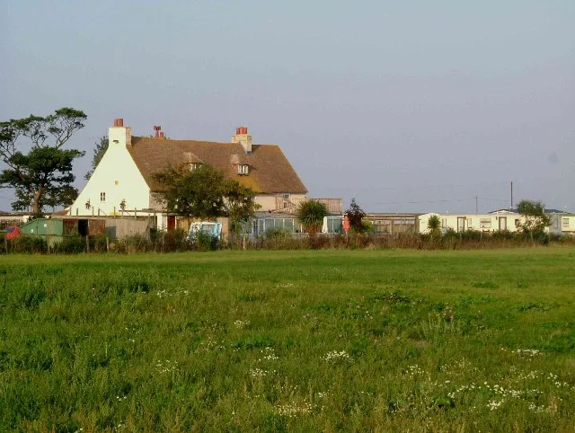
Harty, Kent
In or near Warden.
Harty, Kent — a other in england-south-east, United Kingdom.

David Anstiss — CC BY-SA 2.0 via Wikimedia Commons licence
Plan your visit
- Typical visit
- 1 h–2 h
- Nearest railway station
- Faversham · 5.8 km
About
Harty, Kent is a other in england-south-east, United Kingdom, listed in the Wikipedia register of British heritage and tourism sites. See the linked Wikipedia article for full details.
Photo gallery
Protected designations
- Site of Special Scientific Interest: The Swale SSSI
- Area of Outstanding Natural Beauty: Kent Downs
- Ramsar wetland: The Swale
Designations sourced from Natural England open data under OGL v3.
Place summary
Harty is a village located in Kent, South-East England. It is primarily known for its rural character and proximity to the Swale estuary. Harty is not a major tourist destination but offers a glimpse into the quieter aspects of English village life.
AI-generated from the structured facts on this page (operator, designation, listing, era). Not a substitute for visiting.
Background
History
The earliest recorded evidence of human occupation comes from a late Bronze Age hoard of axes, gouged bronze founder's appliances and metal. The find has wider importance from the information it gives into methods used for casting in the late Bronze Age. Evidence of Roman occupation also exists; finds of tesserae, roof and flue tiles may indicate the site of a Roman villa. During the Middle Ages there were extensive salt workings. Remains today consist of groups of salt mounds which are the waste left over from the process. Park Farmhouse is a dating from the 16 century. In 1798 Edward Hasted recorded that an earlier form of the name was 'Harteigh' which he presumes came from the Saxon…
Sourced from Wikipedia under CC BY-SA 4.0.
- Coordinates
- 51.3640, 0.8910
- County
- Kent
- District
- Swale
- Parish
- Leysdown
- Postcode
- ME12 4BQ
- Parliamentary constituency
- Sittingbourne and Sheppey
- Nearest railway station
- Faversham — 5.8 km
Sources
- wikipedia: Harty, Kent (CC BY-SA 4.0)
Other places nearby

Ferry House Inn
Historic pubs · 0.8 km

Oare Marshes
Parks · 2.0 km

Cold War anti-aircraft battery
Historic houses · 3.0 km

Cold War anti-aircraft battery
Archaeological sites · 3.0 km

Faversham explosives industry
Museums · 3.5 km

Oare
Villages · 3.8 km
Muswell Manor
Stately homes · 4.0 km

South Shellness Beach
Beaches · 4.0 km

Harts Holiday Park
Caravan parks · 4.0 km

Muswell Manor Holiday Park
Caravan parks · 4.0 km

Vanity Village Park
Caravan parks · 4.0 km

Park Avenue Holiday Village
Caravan parks · 4.0 km
Nearby
📷 5Historic pubs · South East England
Ferry House Inn
Ferry House Inn — Historic pub — listed building or notable heritage status.
📷 5📷 5Historic houses · South East England
Cold War anti-aircraft battery
Cold War anti-aircraft battery — a historic house in england-south-east, United Kingdom.
📷 5Archaeological sites · South East England
Cold War anti-aircraft battery
Cold War anti-aircraft battery — archaeological in england south east.
📷 5Museums · South East England
Faversham explosives industry
Faversham, in Kent, England, has claims to be the cradle of the UK's explosives industry: it was also to become one of its main centres. The first gunpowder plant in the UK was established in the 16th
📷 5Where to eat & stay near Harty, Kent
Places to stay
📷 5Caravan parks · South East England
Harts Holiday Park
Harts Holiday Park — a caravan park in england south east.
📷 5Caravan parks · South East England
Muswell Manor Holiday Park
Muswell Manor Holiday Park — a caravan park in england south east.
📷 5Caravan parks · South East England
Vanity Village Park
Vanity Village Park — a caravan park in england south east.
📷 5Caravan parks · South East England
Park Avenue Holiday Village
Park Avenue Holiday Village — a caravan park in england south east.
 📷 5
📷 5Caravan parks · South East England
Happy Valley Chalet Park
Happy Valley Chalet Park — a caravan park in england south east.
📷 5Caravan parks · South East England
Priory Hill Chalet Park
Priory Hill Chalet Park — a caravan park in england south east.
Places to eat & drink
📷 5Historic pubs · South East England
Ferry House Inn
Ferry House Inn — Historic pub — listed building or notable heritage status.
 📷 5
📷 5Historic pubs · South East England
34, Abbey Street
34, Abbey Street in England South East, United Kingdom.
 📷 5
📷 5Historic pubs · South East England
Mechanics Arms
Mechanics Arms in England South East, United Kingdom.
 📷 5
📷 5 📷 5
📷 5 📷 5
📷 5Historic pubs · South East England
Maison Dieu
Maison Dieu in England South East, United Kingdom.
More places in this region
 📷 5
📷 5Other places · South East England
Vigo Village
Vigo Village — a other in england-london, United Kingdom.
 📷 5
📷 5Other places · South East England
Royal Earlswood Hospital
Royal Earlswood Hospital — a other in england-london, United Kingdom.
 📷 5
📷 5Other places · South East England
The Open Market
The Open Market is a place of interest in the United Kingdom.
 📷 5
📷 5Other places · South East England
Upper Gardner Street Saturday Market
Upper Gardner Street Saturday Market is a place of interest in the United Kingdom.
Frequently asked questions
- Where is Harty, Kent?
- Harty, Kent is in Kent, South-East England, United Kingdom (postcode ME12 4BQ), in the parish of Leysdown.
- What is Harty, Kent?
- Harty, Kent — a other in england-south-east, United Kingdom.
- How do I get to Harty, Kent?
- The nearest railway station is Faversham, about 5.8 km away. Drivers can use postcode ME12 4BQ.
- Is Harty, Kent a protected site?
- Yes — Harty, Kent is part of the The Swale SSSI Site of Special Scientific Interest and the Kent Downs National Landscape (AONB).
- How do I get to Harty, Kent?
- The nearest railway station is Faversham, about 5.8 km away. Drivers can navigate to postcode ME12 4BQ.