Viewpoints · Scottish Lowlands
Hartside Top
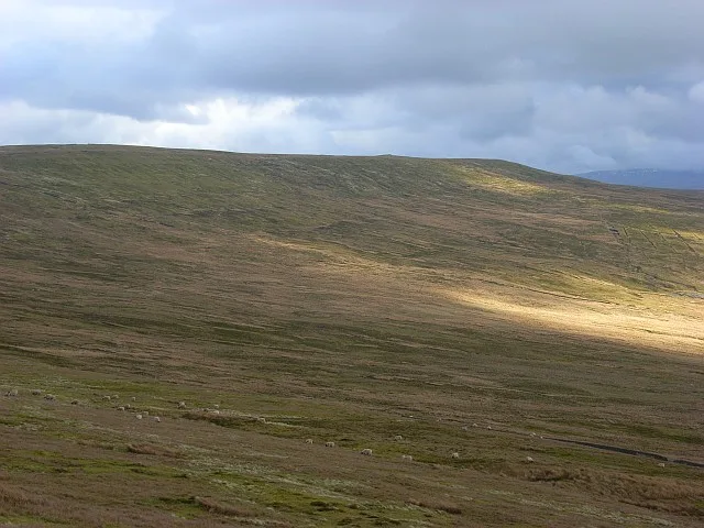
Hartside Top is a viewpoint in the United Kingdom.

Oliver Dixon — CC BY-SA 2.0 via Wikimedia Commons licence
Plan your visit
- Typical visit
- 20 min–45 min
- Best time of year
- Clear days year-round
- Nearest railway station
- Alston · 8.6 km
- Free entry
- Dog-friendly
- Wheelchair accessible
About
Hartside Top is a named viewpoint in the Scottish Lowlands, marked on Ordnance Survey maps for its outlook. The site is within the North Pennines National Landscape (AONB), and is a designated Site of Special Scientific Interest. It sits within the Penrith and Solway parliamentary constituency. The nearest railway station is Alston, about 8.6 km away. Postcode area CA9.
Photo gallery
Protected designations
- Site of Special Scientific Interest: River Eden and Tributaries SSSI
- Site of Special Scientific Interest: Moorhouse and Cross Fell SSSI
- Area of Outstanding Natural Beauty: North Pennines
Designations sourced from Natural England open data under OGL v3.
Place summary
Hartside Top is a viewpoint located in the Scottish Lowlands, within the parish of Kirkoswald, postcode CA9. It is designated as a Site of Special Scientific Interest (SSSI) for both the River Eden and Tributaries, and Moorhouse and Cross Fell, as well as being part of the North Pennines Area of Outstanding Natural Beauty (AONB).
AI-generated from the structured facts on this page (operator, designation, listing, era). Not a substitute for visiting.
- Coordinates
- 54.7700, -2.5517
- District
- Westmorland and Furness
- Parish
- Kirkoswald
- Postcode
- CA9 3BW
- Parliamentary constituency
- Penrith and Solway
- Nearest railway station
- Alston — 8.6 km
Sources
- osm: n1381679200 (ODbL)
Other places nearby
Loading nearby places…
Nearby
 📷 5
📷 5Mountains & hills · Scottish Lowlands
Hartside Height
Hartside Height — mountain in scotland lowlands. Elevation: 620 m.
 📷 5
📷 5Mountains & hills · Scottish Lowlands
Twotop Hill
Twotop Hill — mountain in scotland lowlands. Elevation: 549 m.
 📷 5
📷 5Mountains & hills · Scottish Lowlands
Fiends Fell
Fiends Fell — mountain in scotland lowlands. Elevation: 634.6 m.
 📷 5
📷 5Mountains & hills · Scottish Lowlands
Daffenside Beacon
Daffenside Beacon — mountain in scotland lowlands. Elevation: 661 m.
 📷 3
📷 3Natural landmarks · Scottish Lowlands
Black Fell
Black Fell — mountain in the North Pennines, England.
 📷 5
📷 5Mountains & hills · Scottish Lowlands
Little Knapside Hill
Little Knapside Hill — mountain in scotland lowlands. Elevation: 657 m.
Where to eat & stay near Hartside Top
Places to stay
 📷 5
📷 5Caravan parks · Scottish Lowlands
Melmerby Holiday Park
Melmerby Holiday Park — a caravan park in scotland lowlands.
 📷 5
📷 5Caravan parks · Scottish Lowlands
Melmerby Mill Holiday Caravan Park
Melmerby Mill Holiday Caravan Park — a caravan park in scotland lowlands.
 📷 5
📷 5Caravan parks · Scottish Lowlands
Crossfell Caravan Park
Crossfell Caravan Park — a caravan park in scotland lowlands.
 📷 5
📷 5Hostels · Scottish Lowlands
YHA Alston
YHA Alston — a hostel in scotland lowlands.
📷 5Hostels · Scottish Lowlands
YHA Alston
YHA Alston — a hostel in scotland lowlands.
 📷 5
📷 5Campsites · Scottish Lowlands
Tyne Willows
Tyne Willows — a campsite in scotland lowlands.
Places to eat & drink
 📷 3
📷 3Historic pubs · North East England
Langwathby
Langwathby in England North East, United Kingdom.
 📷 5
📷 5Cafés · Scottish Lowlands
Narrowbar Cafe
Narrowbar Cafe — a café in scotland lowlands.
 📷 5
📷 5Historic pubs · Scottish Lowlands
Two Lions public house and integral stables
Two Lions public house and integral stables in Scotland Lowlands, United Kingdom.
 📷 5
📷 5Historic pubs · Scottish Lowlands
Gloucester Arms
Gloucester Arms in Scotland Lowlands, United Kingdom.
 📷 4
📷 4Historic pubs · North East England
Hallbankgate
Hallbankgate in England North East, United Kingdom.
 📷 5
📷 5Historic pubs · Scottish Lowlands
Graham Arms (West Of Gelt Bridge)
Graham Arms (West Of Gelt Bridge) in Scotland Lowlands, United Kingdom.
More viewpoints in this region
 📷 5
📷 5Viewpoints · Scottish Lowlands
Bird hide
Bird hide is a viewpoint in the United Kingdom.
 📷 5
📷 5Viewpoints · Scottish Lowlands
Bird Hide
Bird Hide is a viewpoint in the United Kingdom.
 📷 5
📷 5Viewpoints · Scottish Lowlands
Bird Hide
Bird Hide is a viewpoint in the United Kingdom.
 📷 3
📷 3Viewpoints · Scottish Lowlands
Border Viewpoint
Border Viewpoint is a viewpoint in the United Kingdom.
Frequently asked questions
- Where is Hartside Top?
- Hartside Top is in the Scottish Lowlands, United Kingdom (postcode CA9 3BW), in the parish of Kirkoswald.
- What is Hartside Top?
- Hartside Top is a viewpoint in the United Kingdom.
- How do I get to Hartside Top?
- The nearest railway station is Alston, about 8.6 km away. Drivers can use postcode CA9 3BW.
- Is Hartside Top a protected site?
- Yes — Hartside Top is part of the River Eden and Tributaries SSSI Site of Special Scientific Interest and the Moorhouse and Cross Fell SSSI Site of Special Scientific Interest.
- Is Hartside Top free to visit?
- Yes, Hartside Top is free to enter.
- How do I get to Hartside Top?
- Drivers can navigate to postcode CA9 3BW. It sits within the Penrith and Solway parliamentary constituency.