
Manor houses · South East England
Hartridge Manor
In or near Frittenden.
Hartridge Manor — Grade II listed building-listed manor in england-south-east, United Kingdom.

Oast House Archive — CC BY-SA 2.0 via Wikimedia Commons licence

Plan your visit
- Typical visit
- 1 h–2 h
- Nearest railway station
- Staplehurst · 4.7 km
- Limited wheelchair access
Getting there & planning your visit
To visit Hartridge Manor, the nearest railway station is Staplehurst, located 4.7 km away. The postcode for sat-nav is TN17 2NA. Accessibility is limited for wheelchair users.
About
Hartridge Manor is a Grade II listed building-listed manor in england-south-east, United Kingdom, registered on the National Heritage List for England (NHLE entry 1084836). Listed status protects buildings and structures of special architectural or historic interest. See the linked Wikipedia article for further details.
Photo gallery
Heritage listing
Details CRANBROOK PALEY LANE, (SOUTH TQ 73 NE SIDE) 3/205 9. 6.52 Hartridge Manor - II Farmhouse. C17, clad in C19 and extended in mid and later C19. Timber-framed on wide red brick plinth, tile-hung above. Plain tiled roof, half-hipped with brick ridge stack. 2 storeys. Three windows, regular through the central first floor window is blocked. Tripartite glazing bar sashes. Entrance at rear. L-shaped block with mid C18 2 storey block in angle of L to rear with further wing beyond, (to north-east). Triple-span hipped roofed extension to right (south). Listing NGR: TQ7747039831 Legacy The contents of this record have been generated from a legacy data system. Legacy System number: 169055 Legacy System: LBS
From the Historic England List Entry under OGL v3.
Protected designations
- Area of Outstanding Natural Beauty: High Weald
- Area of Outstanding Natural Beauty: Kent Downs
Designations sourced from Natural England open data under OGL v3.
Place summary
Hartridge Manor is a Grade II listed manor located in South-East England. This designation highlights its architectural and historical significance. The manor's features and design reflect the region's heritage.
AI-generated from the structured facts on this page (operator, designation, listing, era). Not a substitute for visiting.
- Coordinates
- 51.1303, 0.5350
- County
- Kent
- District
- Tunbridge Wells
- Parish
- Cranbrook & Sissinghurst
- Postcode
- TN17 2NA
- Parliamentary constituency
- Weald of Kent
- Nearest railway station
- Staplehurst — 4.7 km
Sources
- wikidata: Q26369368 (CC0)
Other places nearby

Staplehurst Castle Bank
Castles · 1.2 km

Lovehurst Manor
Manor houses · 1.6 km
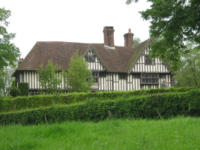
Hush Heath Manor
Stately homes · 2.0 km

Hayselden Manor
Manor houses · 2.1 km

Old Wilsley
Historic houses · 2.9 km

Sissinghurst
Villages · 2.9 km
.jpg?width=1200)
King's Head House
Historic houses · 3.0 km
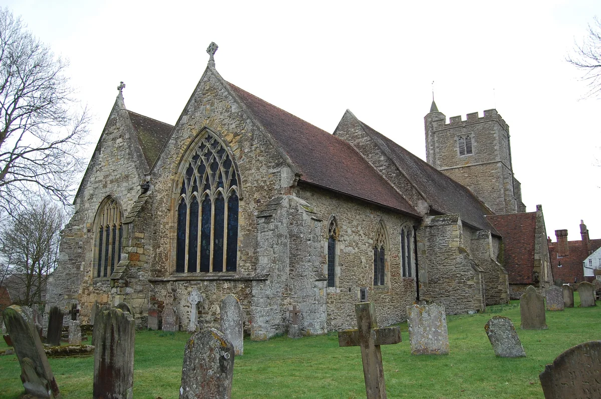
All Saints Church, Staplehurst
Historic churches · 3.3 km
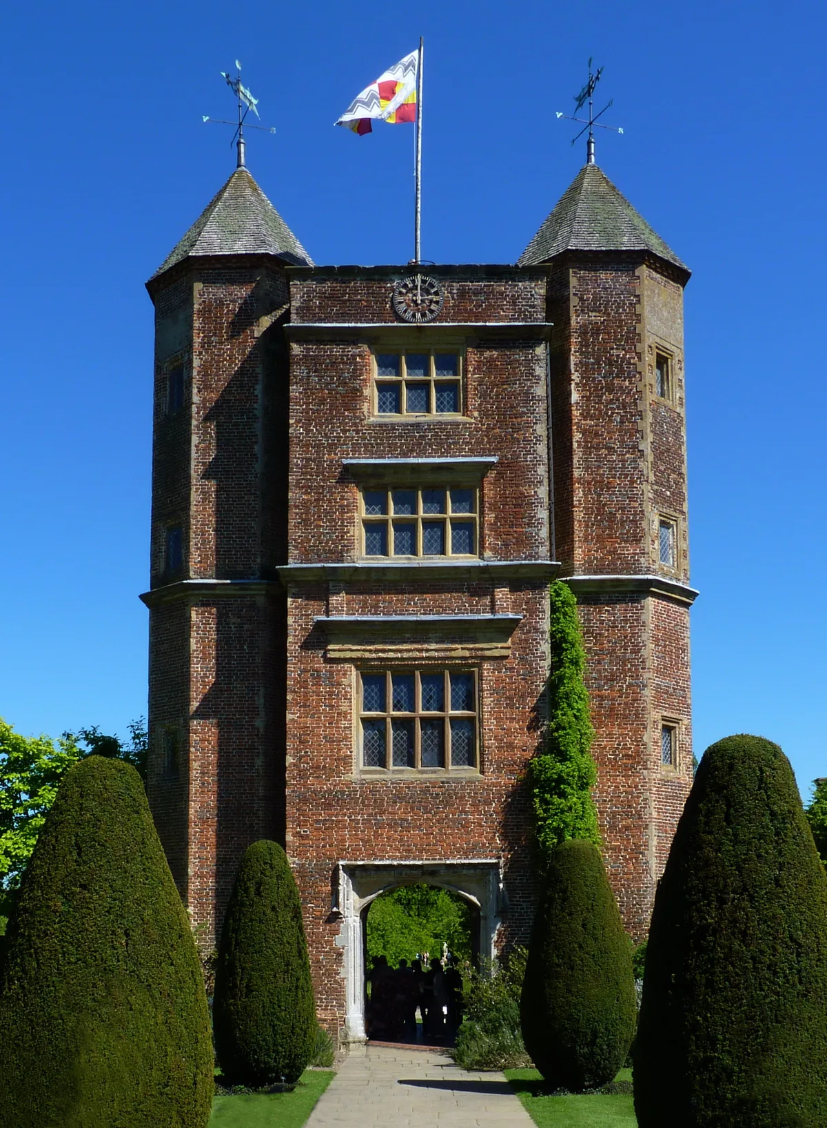
Sissinghurst Castle Garden
Gardens · 3.4 km

Maplehurst Mill
Watermills · 3.4 km

Bly Court Manor
Manor houses · 3.6 km

West Range at Sissinghurst Castle
Castles · 3.6 km
Nearby
📷 5Castles · South East England
Staplehurst Castle Bank
Staplehurst Castle Bank — a castle in england south east.
📷 5Manor houses · South East England
Lovehurst Manor
Lovehurst Manor — Grade II listed building-listed manor in england-south-east, United Kingdom.
Flagship📷 5Stately homes · South East England
Hush Heath Manor
Hush Heath Manor — manor house in Staplehurst, Kent, England, UK.
📷 5Manor houses · South East England
Hayselden Manor
Hayselden Manor — Grade II listed building-listed manor in england-south-east, United Kingdom.
📷 5Historic houses · South East England
Old Wilsley
Old Wilsley — a Grade I-listed historic house in england-south-east, United Kingdom.
📷 5Where to eat & stay near Hartridge Manor
Places to stay
 📷 5
📷 5 📷 5
📷 5Campsites · South East England
Glassenbury Camping
Glassenbury Camping — a campsite in england south east.
 📷 5
📷 5 📷 5
📷 5Campsites · South East England
Star Field camping and glamping
Star Field camping and glamping — a campsite in england south east.
 📷 5
📷 5Caravan parks · South East England
Waterside Oast
Waterside Oast — a caravan park in england south east.
 📷 5
📷 5Campsites · South East England
Bedgebury Camping
Bedgebury Camping — a campsite in england south east.
Places to eat & drink
 📷 7
📷 7Historic pubs · South East England
The Kings Arms Inn And Shop Adjoining To Right
The Kings Arms Inn And Shop Adjoining To Right in England South East, United Kingdom.
 📷 7
📷 7Historic pubs · South East England
The Gun And Spitroast Public House And Rear Courtyard
The Gun And Spitroast Public House And Rear Courtyard in England South East, United Kingdom.
 📷 7
📷 7Restaurants · South East England
West House
West House — a restaurant in england south east.
 📷 5
📷 5Historic pubs · South East England
John Brunt V.C.
John Brunt V.C. in England South East, United Kingdom.
 📷 5
📷 5Historic pubs · South East England
The Harrow Public House
The Harrow Public House in England South East, United Kingdom.
 📷 5
📷 5Historic pubs · South East England
The Cherry Tree Public House
The Cherry Tree Public House in England South East, United Kingdom.
More places in this region
 📷 5
📷 5Manor houses · South East England
Albury Manor
Albury Manor — a manor in england-london, United Kingdom.
 📷 5
📷 5Manor houses · South East England
Weardale Manor
Weardale Manor — a manor in england-london, United Kingdom.
 📷 5
📷 5Manor houses · South East England
Rowbarns Manor
Rowbarns Manor — a manor in england-london, United Kingdom.
 📷 5
📷 5Manor houses · South East England
Sutton Place
Sutton Place — a manor in england-london, United Kingdom.
Frequently asked questions
- Where is Hartridge Manor?
- Hartridge Manor is in Kent, South-East England, United Kingdom (postcode TN17 2NA), in the parish of Cranbrook & Sissinghurst.
- What is Hartridge Manor?
- Hartridge Manor — Grade II listed building-listed manor in england-south-east, United Kingdom.
- How do I get to Hartridge Manor?
- The nearest railway station is Staplehurst, about 4.7 km away. Drivers can use postcode TN17 2NA.
- Is Hartridge Manor a listed building?
- Hartridge Manor is officially recognised as Grade II listed building listed.
- Is Hartridge Manor a protected site?
- Yes — Hartridge Manor is part of the High Weald National Landscape (AONB) and the Kent Downs National Landscape (AONB).
- How do I get to Hartridge Manor?
- The nearest railway station is Staplehurst, about 4.7 km away. Drivers can navigate to postcode TN17 2NA.