
Archaeological sites · South East England
Harting Beacon: a hilltop enclosure, Anglo-Saxon burial mound and telegraph station on Beacon and Pen Hills
In or near Ditcham.
Harting Beacon: a hilltop enclosure, Anglo-Saxon burial mound and telegraph station on Beacon and Pen Hills — hillfort in West Sussex, England, UK.

Wikimedia Commons contributors — see linked file page for photographer and licence licence

Plan your visit
- Typical visit
- 45 min–1.5 h
- Nearest railway station
- Petersfield · 8.2 km
- Free entry
- Dog-friendly
Getting there & planning your visit
Harting Beacon is accessible via the nearest railway station, Petersfield, which is 8.2 km away. The postcode for navigation is GU31 5NG, and entry is free.
About
Harting Beacon: a hilltop enclosure, Anglo-Saxon burial mound and telegraph station on Beacon and Pen Hills is an archaeological site in the United Kingdom. Heritage designation: scheduled monument. Wikidata describes it as: "hillfort in West Sussex, England, UK". Coordinates: 50.9582°, -0.8523°.
Photo gallery
Official information
Harting Beacon is a historical site featuring a hilltop enclosure and an Anglo-Saxon burial mound. Visitors can explore the remnants of a telegraph station and enjoy panoramic views from the Beacon and Pen Hills.
Protected designations
- Site of Special Scientific Interest: Harting Downs SSSI
Designations sourced from Natural England open data under OGL v3.
From the Wikipedia article
Beacon Hill, also known as Harting Beacon, is a hillfort on the South Downs, in the county of West Sussex in southern England. The hillfort is located in the parish of Elsted and Treyford, in Chichester District. It is a Scheduled Ancient Monument with a list entry identification number of 1015915. The hilltop enclosure is dated to the Late Bronze Age, from the 8th to 6th centuries BC. The hillfort defences were renewed during the Late Iron Age. The fort extends approximately 400 metres (1,300 ft) east-west by approximately 500 metres (1,600 ft) north-south, and covers an area of approximately 10 hectares (1,100,000 sq ft). Archaeological investigations of the hillfort took place from 1948 to 1952, and from 1976 to 1977. Cross dykes on neighbouring hills are considered to be outlying defences associated with the fort. As well as the Bronze Age remains, the area of the fort also includes an Anglo-Saxon burial mound, and the foundations of a late 18th-century telegraph station.
Excerpt from Wikipedia under CC BY-SA 4.0. See the source article linked in Sources below.
Background
Description
The hillfort is situated on the top of the hill and is defined by a single rampart and a flat-bottomed ditch, which survives as a low bank up to 6 m wide. The rampart infill was built with a mixture of soil and chalk, Excavations of the west entrance revealed that a large timber gate was built within the entrance causeway, It is possible that there was a second entrance on the northeast side, where a modern track crosses the rampart. These are interpreted as having been raised granaries.
Sourced from Wikipedia under CC BY-SA 4.0.
- Coordinates
- 50.9582, -0.8523
- County
- West Sussex
- District
- Chichester
- Parish
- Harting
- Postcode
- GU31 5NG
- Parliamentary constituency
- Arundel and South Downs
- Nearest railway station
- Petersfield — 8.2 km
- Official site
- ancientmonuments.uk
Sources
- wikidata: Q17675643 (CC0)
- wikipedia: Beacon Hill, West Sussex (CC BY-SA 4.0)
- commons: Beacon Hill trig point, South Harting 01.JPG (CC BY-SA 4.0)
Other places nearby

Harting Beacon Hilltop Enclosure.
Archaeological sites · 0.0 km

Beacon Hill
Mountains & hills · 0.1 km
Beacon Hill
Mountains & hills · 0.1 km

Pen Hill
Mountains & hills · 0.5 km

Harting Down
Mountains & hills · 1.3 km
Harting Downs
Mountains & hills · 1.3 km

East Harting
Villages · 1.6 km

Elsted
Villages · 1.6 km

St Peter. Site of.
Historic houses · 1.7 km

The Church of St Mary, Treyford
Historic houses · 1.8 km
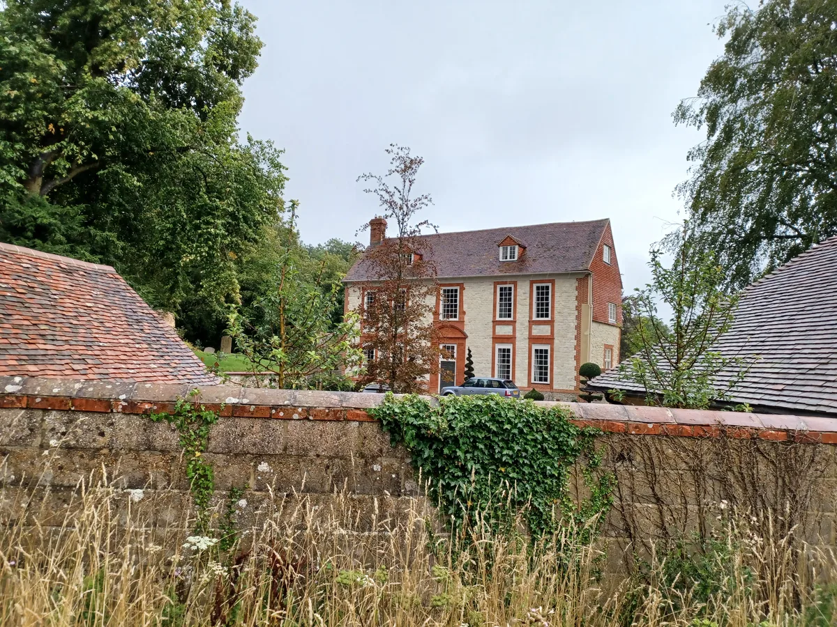
Treyford Manor
Stately homes · 1.8 km

Kent House
Historic houses · 1.8 km
Nearby
📷 5Archaeological sites · South East England
Harting Beacon Hilltop Enclosure.
Harting Beacon Hilltop Enclosure. — an archaeological site in South East England, United Kingdom.
📷 5Mountains & hills · South East England
Beacon Hill
Beacon Hill — a hill or mountain in england south east.
📷 5Mountains & hills · South East England
Beacon Hill
Beacon Hill — mountain in england south east. Elevation: 242 m.
📷 5Mountains & hills · South East England
Pen Hill
Pen Hill — mountain in england south east. Elevation: 215 m.
📷 5Mountains & hills · South East England
Harting Down
Harting Down — mountain in england south east. Elevation: 229 m.
📷 5Mountains & hills · South East England
Harting Downs
Harting Downs — a hill or mountain in england south east.
Where to eat & stay near Harting Beacon: a hilltop enclosure, Anglo-Saxon burial mound and telegraph station on Beacon and Pen Hills
Places to stay
 📷 5
📷 5Campsites · South East England
1st Harting Scout HQ
1st Harting Scout HQ — a campsite in england south east.
 📷 5
📷 5 📷 5
📷 5Campsites · South East England
West Dean Campsite
West Dean Campsite — a campsite in england south east.
 📷 5
📷 5 📷 5
📷 5Hotels · South East England
Spread Eagle Hotel
Spread Eagle Hotel — a hotel in england south east.
 📷 5
📷 5Campsites · South East England
Hazelbank Farm
Hazelbank Farm — a campsite in england south east.
Places to eat & drink
 📷 7
📷 7Historic pubs · South East England
Keepers Arms
Keepers Arms — Historic pub — listed building or notable heritage status.
 📷 7
📷 7Historic pubs · South East England
The Five Bells Public House
The Five Bells Public House in England South East, United Kingdom.
 📷 5
📷 5Historic pubs · South East England
The Red Lion Hotel
The Red Lion Hotel in England South East, United Kingdom.
 📷 7
📷 7Historic pubs · South East England
The Market Inn
The Market Inn in England South East, United Kingdom.
 📷 7
📷 7Historic pubs · South East England
The Good Intent
The Good Intent in England South East, United Kingdom.
 📷 5
📷 5Historic pubs · South East England
The Partridge Inn
The Partridge Inn in England South East, United Kingdom.
More archaeological sites in this region
 📷 5
📷 5Archaeological sites · South East England
Chatham Dockyard, site of South Mast Pond
Chatham Dockyard, site of South Mast Pond — archaeological site in Medway, Kent, England, UK.
 📷 5
📷 5Archaeological sites · South East England
Open areas within Roman, Saxon and medieval town
Open areas within Roman, Saxon and medieval town — archaeological site in Medway, Kent, England, UK.
 📷 5
📷 5Archaeological sites · South East England
Oxmoor Copse
Oxmoor Copse — woodland in Surrey, England.
 📷 5
📷 5Frequently asked questions
- Where is Harting Beacon: a hilltop enclosure, Anglo-Saxon burial mound and telegraph station on Beacon and Pen Hills?
- Harting Beacon: a hilltop enclosure, Anglo-Saxon burial mound and telegraph station on Beacon and Pen Hills is in West Sussex, South-East England, United Kingdom (postcode GU31 5NG), in the parish of Harting.
- What is Harting Beacon: a hilltop enclosure, Anglo-Saxon burial mound and telegraph station on Beacon and Pen Hills?
- Harting Beacon: a hilltop enclosure, Anglo-Saxon burial mound and telegraph station on Beacon and Pen Hills — hillfort in West Sussex, England, UK.
- How do I get to Harting Beacon: a hilltop enclosure, Anglo-Saxon burial mound and telegraph station on Beacon and Pen Hills?
- The nearest railway station is Petersfield, about 8.2 km away. The nearest town is Ditcham. Drivers can use postcode GU31 5NG.
- Is Harting Beacon: a hilltop enclosure, Anglo-Saxon burial mound and telegraph station on Beacon and Pen Hills a listed building?
- Harting Beacon: a hilltop enclosure, Anglo-Saxon burial mound and telegraph station on Beacon and Pen Hills is officially recognised as scheduled monument listed.
- Is Harting Beacon: a hilltop enclosure, Anglo-Saxon burial mound and telegraph station on Beacon and Pen Hills a protected site?
- Yes — Harting Beacon: a hilltop enclosure, Anglo-Saxon burial mound and telegraph station on Beacon and Pen Hills is part of the Harting Downs SSSI Site of Special Scientific Interest.
- Is Harting Beacon: a hilltop enclosure, Anglo-Saxon burial mound and telegraph station on Beacon and Pen Hills free to visit?
- Yes, Harting Beacon: a hilltop enclosure, Anglo-Saxon burial mound and telegraph station on Beacon and Pen Hills is free to enter.
- How do I get to Harting Beacon: a hilltop enclosure, Anglo-Saxon burial mound and telegraph station on Beacon and Pen Hills?
- Drivers can navigate to postcode GU31 5NG. It sits within the Arundel and South Downs parliamentary constituency.