
Memorials & monuments · London
Harrow - Great War
In or near South Oxhey.
Harrow - Great War — War memorial, dating to 1921-10-06.

Des Blenkinsopp — CC BY-SA 2.0 via Wikimedia Commons licence

Plan your visit
- Typical visit
- 15 min–45 min
- Nearest railway station
- Harrow-on-the-Hill · 0.6 km
- Free entry
- Dog-friendly
- Wheelchair accessible
Getting there & planning your visit
To visit the Harrow - Great War memorial, the nearest railway station is Harrow-on-the-Hill, located 0.6 km away. Entry is free, and the site is wheelchair accessible. The postcode for sat-nav is HA1 3HL.
About
Harrow - Great War is a public memorial in London, recording local sacrifice and named in the parish register of war and civic monuments. The site is within the Chilterns National Landscape (AONB). It sits within the Harrow West parliamentary constituency. The nearest railway station is Harrow-on-the-Hill, about 0.6 km away. Postcode area HA1.
Photo gallery
Protected designations
- Area of Outstanding Natural Beauty: Chilterns
Designations sourced from Natural England open data under OGL v3.
From the Wikipedia article
Harrow () is a town in Greater London, England, and serves as the principal settlement of the London Borough of Harrow. Lying about 9.5 miles (15.3 km) north-west of Charing Cross and 5.4 miles (8.7 km) south of Watford. In 2022, the town and localities had an estimated population of 117,651, whereas the wider borough (which also contains Pinner and Stanmore) had a population of 261,185. The original settlement was at Harrow on the Hill, atop the 408 feet (124 m) Harrow Hill. The modern town centre of Harrow developed at the foot of the hill, in an area historically called Greenhill, following the opening of Harrow-on-the-Hill station on the Metropolitan Railway in 1880. Harrow became the unofficial "capital" of the Metroland suburbia in the early 20th century. Harrow & Wealdstone station on the West Coast Main Line had opened in 1837, but was more distant from Harrow, lying 1.5 miles (2.4 km) north of the hill. Workers were drawn to the area by the opening of several factories in Wealdstone; Harrow was the base of the large Kodak factory, used for the manufacture of photographic materials and R&D, which was in operation for more than a century. Historically in the hundred of Gore in the county of Middlesex, Harrow became part of Greater London in 1965. Today, the historic area is distinguished as Harrow on the Hill and is a conservation area with listed buildings of Georgian architecture and home to Harrow School, one of the seven major boys' boarding schools in England as defined by the Public Schools Act 1868. The modern-day town meanwhile is an established commercial centre of outer north-west London and houses a campus of the University of Westminster.
Excerpt from Wikipedia under CC BY-SA 4.0. See the source article linked in Sources below.
- Coordinates
- 51.5734, -0.3368
- District
- Harrow
- Parish
- Harrow, unparished area
- Postcode
- HA1 3HL
- Parliamentary constituency
- Harrow West
- Nearest railway station
- Harrow-on-the-Hill — 0.6 km
Sources
- osm: n322270194 (ODbL)
- wikipedia: Harrow, Greater London (CC BY-SA 4.0)
Other places nearby

Harrow School Chapel
Chapels · 0.0 km
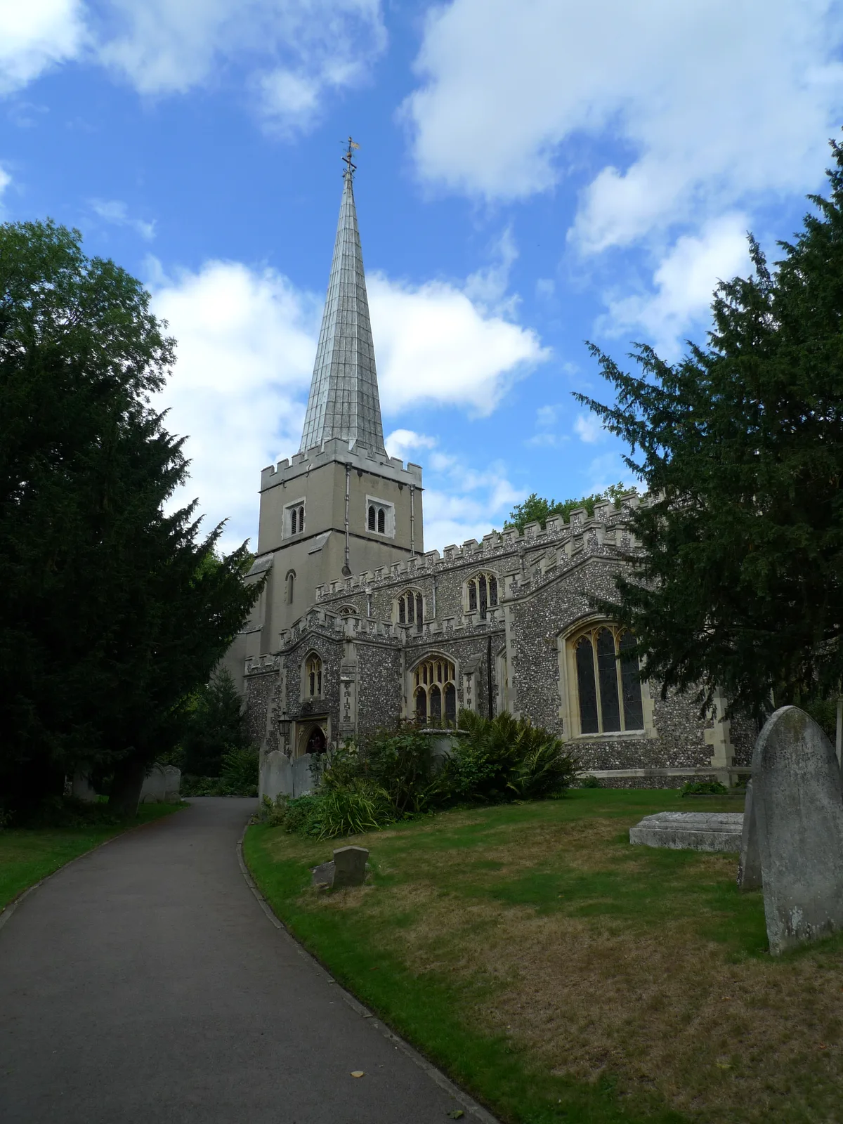
St. Mary's, Harrow on the Hill
Historic churches · 0.1 km

Harrow on the Hill
Mountains & hills · 0.1 km

Museum of Harrow Life
Museums · 0.1 km

'favourite spot' - Lord Byron
Memorials & monuments · 0.1 km
Harrow Hill
Mountains & hills · 0.1 km

The Ryan Theatre
Theatres · 0.2 km

The Castle
Historic pubs · 0.3 km

Uxenden Hall
Stately homes · 0.3 km

Harrow on the Hill War Memorial
Memorials & monuments · 0.4 km
Harrow on the Hill Town Memorial
Memorials & monuments · 0.4 km

Mosaic Reform Synagogue
Historic churches · 0.7 km
Nearby
📷 5Chapels · London
Harrow School Chapel
Harrow School Chapel — chapel in the London Borough of Harrow, England, UK.
📷 5Historic churches · London
St. Mary's, Harrow on the Hill
St. Mary's, Harrow on the Hill — church in Harrow on the Hill, London, England, UK.
📷 5Mountains & hills · London
Harrow on the Hill
Harrow on the Hill — a hill or mountain in england london.
📷 5Museums · London
Museum of Harrow Life
Museum of Harrow Life — a museum in england-london, United Kingdom.
📷 5Memorials & monuments · London
'favourite spot' - Lord Byron
'favourite spot' - Lord Byron — a memorial in england-london, United Kingdom.
📷 5Where to eat & stay near Harrow - Great War
Places to stay
 📷 5
📷 5Hotels · London
Wembley International Hotel
Wembley International Hotel — a hotel in england london.
 📷 5
📷 5 📷 5
📷 5Hotels · London
Novotel London Wembley
Novotel London Wembley — a hotel in england london.
 📷 5
📷 5 📷 5
📷 5 📷 7
📷 7Places to eat & drink
📷 5.jpg?width=1200) 📷 5
📷 5Historic pubs · London
The Windermere
The Windermere — Historic pub — listed building or notable heritage status.
 📷 5
📷 5 📷 5
📷 5Historic pubs · London
The Hand In Hand Public House
The Hand In Hand Public House in England London, United Kingdom.
 📷 5
📷 5 📷 5
📷 5More memorials in this region
.jpg?width=1200) 📷 5
📷 5Memorials & monuments · London
1st Surrey Rifles War Memorial
1st Surrey Rifles War Memorial is a memorial in the United Kingdom.
 📷 5
📷 5Memorials & monuments · London
24th East Surrey Division War Memorial
24th East Surrey Division War Memorial is a memorial in the United Kingdom.
 📷 5
📷 5Memorials & monuments · London
Abney Park Cemetery CWGC Cross
Abney Park Cemetery CWGC Cross is a memorial in the United Kingdom.
 📷 5
📷 5Memorials & monuments · London
Admiral Sir John Franklin
Admiral Sir John Franklin is a memorial in the United Kingdom.
Frequently asked questions
- Where is Harrow - Great War?
- Harrow - Great War is in London, United Kingdom (postcode HA1 3HL), in the parish of Harrow, unparished area.
- What is Harrow - Great War?
- Harrow - Great War — War memorial, dating to 1921-10-06.
- How do I get to Harrow - Great War?
- The nearest railway station is Harrow-on-the-Hill, about 0.6 km away. The nearest town is South Oxhey. Drivers can use postcode HA1 3HL.
- Is Harrow - Great War a protected site?
- Yes — Harrow - Great War is part of the Chilterns National Landscape (AONB).
- Is Harrow - Great War free to visit?
- Yes, Harrow - Great War is free to enter.
- How do I get to Harrow - Great War?
- The nearest railway station is Harrow-on-the-Hill, about 0.6 km away. Drivers can navigate to postcode HA1 3HL.