
Historic bridges · South East England
Halfpenny Bridge
Also known as: Ha'penny Bridge
In or near Coln St. Aldwyns.
Halfpenny Bridge is a historic bridge in the United Kingdom.

Wikimedia Commons contributors — see linked file page for photographer and licence licence

Plan your visit
- Typical visit
- 15 min–30 min
- Free entry
- Dog-friendly
About
Halfpenny Bridge is a named historic bridge in the United Kingdom. Also known as: Ha'penny Bridge. Coordinates: 51.6924°, -1.6927°.
Photo gallery
See it from the streetimagery from 2026
Imagery © Mapillary contributors, CC BY-SA 4.0
Heritage listing
Halfpenny Bridge is a bridge across the River Thames, at Lechlade, Gloucestershire, England. The bridge and its toll house are a Grade II listed building. It marks the start of the navigable Thames, although if the waters are high, the Thames can continue to be travelled by small and unpowered craft as far as Cricklade, over 10 miles (16 km) south-west. The bow-backed bridge was built to a design of James Hollingworth in 1792. It carries the A361 from the south into Lechlade. It was called the Halfpenny bridge because that was the toll charged for pedestrians to cross it, until the toll was done away with in 1839. The A361 is called Thames Street at this point, and the bridge was built when Thames Street was laid out.
From the Historic England List Entry under OGL v3.
Protected designations
- Site of Special Scientific Interest: Cotswold Water Park SSSI
- Area of Outstanding Natural Beauty: Cotswolds
Designations sourced from Natural England open data under OGL v3.
From the Wikipedia article
Halfpenny Bridge is a bridge across the River Thames, at Lechlade, Gloucestershire, England. The bridge and its toll house are a Grade II listed building. It marks the start of the navigable Thames, although if the waters are high, the Thames can continue to be travelled by small and unpowered craft as far as Cricklade, over 10 miles (16 km) south-west. The bow-backed bridge was built to a design of James Hollingworth in 1792. It carries the A361 from the south into Lechlade. It was called the Halfpenny bridge because that was the toll charged for pedestrians to cross it, until the toll was done away with in 1839. The A361 is called Thames Street at this point, and the bridge was built when Thames Street was laid out. The structure is around 20 feet (6 m) wide and the single arch is nearly 26 feet (8 m) high to its apex. On the north bank of the river, a small square toll house is attached to the bridge on the downstream side. It consists of a basement and a room at road level, with a pyramidal asbestos slate roof. Both the bridge and the toll house are grade II listed. It is thought that a local firm of builders called Ralph and Crowdy were responsible for its construction. There is a separate arch in the south causeway, through which the towpath passes, and both parapets carry a central panel with a line on it, to mark the county boundary between Wiltshire and Gloucestershire. In June 2023, a driver crashed into the eastern parapet causing substantial damage to the structure. The bridge is expected to remain closed to traffic for some months. A local micro-brewery based in Lechlade, The Halfpenny Brewery, is named after the bridge.
Excerpt from Wikipedia under CC BY-SA 4.0. See the source article linked in Sources below.
- Coordinates
- 51.6924, -1.6927
- County
- Gloucestershire
- District
- Cotswold
- Parish
- Lechlade
- Postcode
- GL7 3AQ
- Parliamentary constituency
- South Cotswolds
Sources
- osm: w1220674665 (ODbL)
- wikipedia: Halfpenny Bridge (CC BY-SA 4.0)
- commons: Halfpenny Bridge, Lechlade.jpg (CC BY-SA 4.0)
Other places nearby

Thames meander
Long-distance walking trails · 0.0 km

Lechlade
Villages · 0.2 km

Hobbs And Lambert Monument, About 5 Metres South Of Second Aisle Window From East In Churchyard Of Church Of St Lawrence
Memorials & monuments · 0.2 km
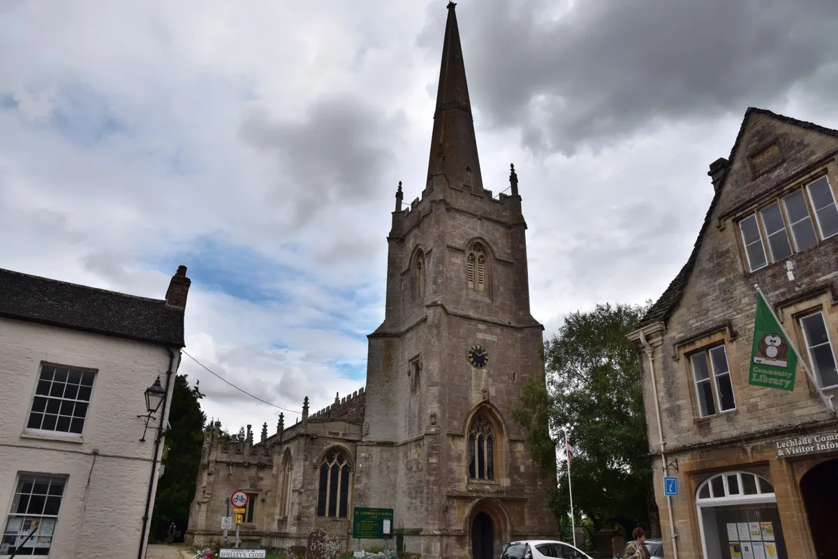
Church of St Lawrence
Historic churches · 0.2 km

Bridge House Campsite
Campsites · 0.2 km

Three Walker Monuments, About 2 Metres North Of Single Walker Monument In Churchyard Of Church Of St Lawrence
Memorials & monuments · 0.3 km
Yeatman Monument, About 21 Metres North Of North Vestry In Churchyard Of Church Of St Lawrence
Memorials & monuments · 0.3 km
Pace Monument, About 1 Metre North Of Matthews Monument In Churchyard Of Church Of St Lawrence
Memorials & monuments · 0.3 km

Giles Monument, About 50 Metres East South East Of Raven Monument In Churchyard Of Church Of St Lawrence
Memorials & monuments · 0.3 km

Lechlade
Museums · 0.7 km

Father Thames
National landscapes (AONB) · 0.9 km
St John's Lock
Canal locks · 0.9 km
Nearby
📷 3Long-distance walking trails · South West England
Thames meander
Thames meander refers to a long-distance journey over all or part of the River Thames in England. Walking the Thames Path is itself a meander, but the term usually applies to journeys using other meth
📷 5📷 3Memorials & monuments · South East England
Hobbs And Lambert Monument, About 5 Metres South Of Second Aisle Window From East In Churchyard Of Church Of St Lawrence
Hobbs And Lambert Monument, About 5 Metres South Of Second Aisle Window From East In Churchyard Of Church Of St Lawrence — Grade II listed building-listed memorial in england-west-midlands, United Kin
📷 5Historic churches · South East England
Church of St Lawrence
Church of St Lawrence — church in Lechlade, Gloucestershire, England, UK.
📷 5Campsites · South East England
Bridge House Campsite
Bridge House Campsite — a campsite in england west midlands.
📷 3Memorials & monuments · South East England
Three Walker Monuments, About 2 Metres North Of Single Walker Monument In Churchyard Of Church Of St Lawrence
Three Walker Monuments, About 2 Metres North Of Single Walker Monument In Churchyard Of Church Of St Lawrence — Grade II listed building-listed memorial in england-west-midlands, United Kingdom.
Where to eat & stay near Halfpenny Bridge
Places to stay
📷 5Campsites · South East England
Bridge House Campsite
Bridge House Campsite — a campsite in england west midlands.
 📷 5
📷 5Caravan parks · South East England
Rough Grounds Farm
Rough Grounds Farm — a caravan park in england west midlands.
 📷 5
📷 5 📷 5
📷 5Campsites · South East England
Kempsford Camping (July Only)
Kempsford Camping (July Only) — a campsite in england west midlands.
 📷 5
📷 5B&Bs · South East England
The Saracen's Head Hotel
The Saracen's Head Hotel — a bed-and-breakfast in england west midlands.
 📷 5
📷 5Caravan parks · South East England
Island CL
Island CL — a caravan park in england west midlands.
Places to eat & drink
 📷 7
📷 7Historic pubs · South East England
Trout Inn
Trout Inn — Historic pub — listed building or notable heritage status.
 📷 7
📷 7Historic pubs · South East England
Plough Cottage The Plough Inn
Plough Cottage The Plough Inn in England South West, United Kingdom.
 📷 7
📷 7Historic pubs · South East England
The Radnor Arms Public House
The Radnor Arms Public House in England South West, United Kingdom.
 📷 6
📷 6Restaurants · South East England
Kushbo Indian Restaurant
Kushbo Indian Restaurant — a restaurant in england west midlands. Cuisine: indian.
 📷 5
📷 5Restaurants · South East England
Kebria Tandoori
Kebria Tandoori — a restaurant in england west midlands.
 📷 7
📷 7Historic pubs · South East England
The Duke Of Wellington Public House
The Duke Of Wellington Public House in England South East, United Kingdom.
More bridges in this region
 📷 5
📷 5Historic bridges · South East England
Briary Hill Bridge east
Briary Hill Bridge east is a historic bridge in the United Kingdom.
 📷 5
📷 5Historic bridges · South East England
Briary Hill Bridge west
Briary Hill Bridge west is a historic bridge in the United Kingdom.
 📷 5
📷 5Historic bridges · South East England
Bridge 157 VIR (Bath Hard Road)
Bridge 157 VIR (Bath Hard Road) is a historic bridge in the United Kingdom.
 📷 5
📷 5Historic bridges · South East England
Dorking Arch Bridge
Dorking Arch Bridge is a historic bridge in the United Kingdom.
Frequently asked questions
- Where is Halfpenny Bridge?
- Halfpenny Bridge is in Gloucestershire, the West Midlands, United Kingdom (postcode GL7 3AQ), in the parish of Lechlade.
- What is Halfpenny Bridge?
- Halfpenny Bridge is a historic bridge in the United Kingdom.
- How do I get to Halfpenny Bridge?
- Drivers can use postcode GL7 3AQ.
- Is Halfpenny Bridge a listed building?
- Halfpenny Bridge is officially recognised as scheduled monument listed.
- Is Halfpenny Bridge a protected site?
- Yes — Halfpenny Bridge is part of the Cotswold Water Park SSSI Site of Special Scientific Interest and the Cotswolds National Landscape (AONB).
- Is Halfpenny Bridge free to visit?
- Yes, Halfpenny Bridge is free to enter.
- How do I get to Halfpenny Bridge?
- Drivers can navigate to postcode GL7 3AQ. It sits within the South Cotswolds parliamentary constituency.