Mountains & hills · North Wales
Gwaun Lydan
Gwaun Lydan — Named summit at 632 m.

Wikimedia Commons contributors — see linked file page for photographer and licence licence
Plan your visit
- Typical visit
- 3 h–8 h
- Best time of year
- Late spring – early autumn (May–Oct)
- Nearest railway station
- Llanuwchllyn · 8.8 km
- Free entry
- Dog-friendly
Getting there & planning your visit
To visit Gwaun Lydan in North Wales, the nearest railway station is Llanuwchllyn, which is 8.8 km away. Entry to the site is free.
About
Gwaun Lydan is a named summit in the United Kingdom. Wikidata describes it as: "Named summit at 632 m.". Coordinates: 52.7768°, -3.6610°.
Photo gallery
From the Wikipedia article
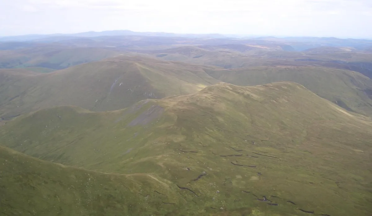
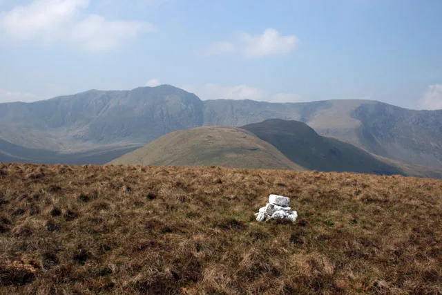
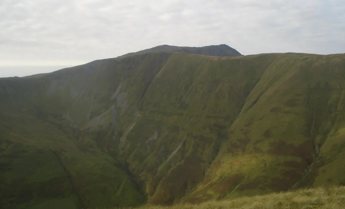
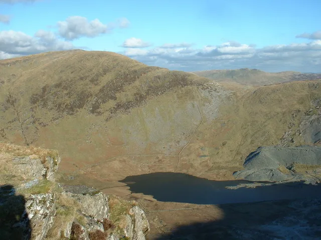
Gwaun Lydan is the top of Aran Fawddwy in the south of the Snowdonia National Park in Gwynedd, Wales. It is located at the end of the south ridge. The summit comprises a small boggy plateau, the highest point being a peat hag marked by a few stones. The summit panorama includes the eastern face of Aran Fawddwy with Creiglyn Dyfi below. To the north is Esgeiriau Gwynion and Llechwedd Du. Heading east, Pen yr Allt Uchaf can be reached.
Excerpt from Wikipedia under CC BY-SA 4.0. See the source article linked in Sources below.
- Coordinates
- 52.7768, -3.6610
- Address
- Gwynedd, Wales
- Nearest railway station
- Llanuwchllyn — 8.8 km
Sources
- osm: n3486933527 (ODbL)
- wikipedia: Gwaun Lydan (CC BY-SA 4.0)
- commons: Gwaun llydan.JPG (CC BY-SA 4.0)
Other places nearby

Drysgol
Mountains & hills · 0.9 km

Waun Goch
Mountains & hills · 1.1 km
Foel Hafod-fynydd
Natural landmarks · 1.5 km

Foel Hafod-fynydd
Mountains & hills · 1.5 km

Pistyll Gwyn
Waterfalls · 1.6 km

Maenaidd
Mountains & hills · 1.7 km

In memory of Mike Aspain
Memorials & monuments · 1.7 km

Foel Clochydd
Mountains & hills · 1.8 km

Llechwedd Du
Natural landmarks · 1.8 km
Llechwedd Du
Mountains & hills · 1.8 km

Pen yr Allt Uchaf
Natural landmarks · 1.8 km
Pen yr Allt Uchaf
Mountains & hills · 1.8 km
Nearby
📷 5📷 5📷 3Natural landmarks · North Wales
Foel Hafod-fynydd
Foel Hafod-fynydd — mountain (689m) in Gwynedd.
📷 3📷 5📷 5Where to eat & stay near Gwaun Lydan
Places to stay
 📷 5
📷 5Caravan parks · Mid Wales
Ty'n Y Pwll Caravan Park
Ty'n Y Pwll Caravan Park — a caravan park in wales north.
 📷 7
📷 7 📷 5📷 5
 📷 5
📷 5Caravan parks · North Wales
Hendre Mawr Caravan Park
Hendre Mawr Caravan Park — a caravan park in wales north.
 📷 7
📷 7Places to eat & drink
 📷 5
📷 5 📷 7
📷 7 📷 7
📷 7 📷 7
📷 7 📷 6
📷 6 📷 7
📷 7Restaurants · North Wales
Palé Hall Hotel Restaurant
Palé Hall Hotel Restaurant — a restaurant in wales north. Cuisine: welsh;british;fine dining. 5-star.
More mountains in this region
 📷 5
📷 5Mountains & hills · North Wales
Cemlyn Bay and lagoon
Cemlyn Bay and lagoon — Site of Special Scientific Interest in Wales.
 📷 3
📷 3Mountains & hills · North Wales
Aberffraw Bay
Aberffraw Bay — bay on the west coast of Anglesey, in Wales, UK.
 📷 3
📷 3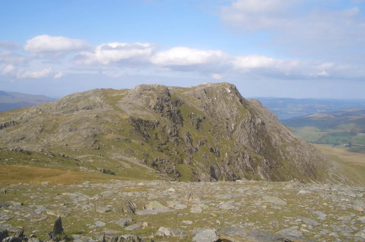 📷 3
📷 3Mountains & hills · North Wales
Aran Benllyn
Aran Benllyn — Named summit at 884 m.
Frequently asked questions
- Where is Gwaun Lydan?
- Gwaun Lydan is in North Wales, United Kingdom.
- What is Gwaun Lydan?
- Gwaun Lydan — Named summit at 632 m.
- How do I get to Gwaun Lydan?
- The nearest railway station is Llanuwchllyn, about 8.8 km away. Its coordinates are 52.7768°, -3.6610°.
- Is Gwaun Lydan free to visit?
- Yes, Gwaun Lydan is free to enter.