
Mountains & hills · Scottish Highlands
Gulvain
Also known as: Gaor Bheinn
Gulvain — Named summit at 987 m.

Wikimedia Commons contributors — see linked file page for photographer and licence licence

Plan your visit
- Typical visit
- 3 h–8 h
- Best time of year
- Late spring – early autumn (May–Oct)
- Nearest railway station
- Locheilside · 8.9 km
- Free entry
- Dog-friendly
Getting there & planning your visit
To visit Gulvain in the Scottish Highlands, the nearest railway station is Locheilside, located 8.9 km away. Entry to the mountain is free.
About
Gulvain is a named summit in the United Kingdom. Also known as: Gaor Bheinn. Wikidata describes it as: "Named summit at 987 m.". Coordinates: 56.9362°, -5.2845°.
Photo gallery
Official information
Gulvain, also known as Gaor Bheinn, is a 'Y' shaped hill located in the Scottish Highlands. It features moderately steep slopes with rocky regions and offers a challenging ascent to its summit at 987 meters, providing stunning views of the surrounding landscape.
From the Wikipedia article
Gaor Bheinn, also known in English as Gulvain (Scottish Gaelic: Gadhail Bheinn), is a mountain in the Northwest Highlands of Scotland. It is in Lochaber, south of Loch Arkaig and north of the road west of Fort William (from which it is usually climbed). It is composed of banded granite and shaped like a letter Y, with two tops connected by a ridge running from northeast to southwest, with the northern top 6 m higher than the one to the south. Crags drop at either end, and steep slopes fall away to either side. The south ridge path is really a stream bed, so in wet conditions an easier if longer ascent from Na Socachan is to walk up Allt a Choire Reidh towards Gualann nan Osna and climb the south top's north-west ridge. According to Ainmean-Àite na h-Alba, the name comes from Gadhail Bheinn, meaning "mountain of the hunting dogs" (gadhar). It has also been suggested the name comes from Gaothail Bheinn or Gaothar Bheinn, "windy mountain".
Excerpt from Wikipedia under CC BY-SA 4.0. See the source article linked in Sources below.
- Coordinates
- 56.9362, -5.2845
- Address
- Highland, Scotland
- Nearest railway station
- Locheilside — 8.9 km
- Official site
- www.munromagic.com
Sources
- osm: n255385279 (ODbL)
- wikipedia: Gaor Bheinn (CC BY-SA 4.0)
- commons: Gulvain from Gleann Fionnlighe - geograph.org.uk - 221315.jpg (CC BY-SA 4.0)
Other places nearby
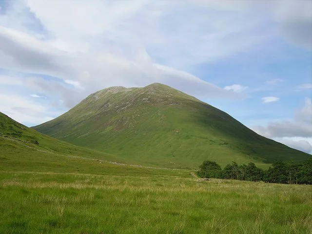
Gaor Bheinn
Natural landmarks · 0.0 km

Gulvain South Top
Mountains & hills · 1.3 km
Gulvain South Top
Mountains & hills · 1.3 km

Gualann nan Osna
Mountains & hills · 1.7 km

Gleann Camgharaidh
Gorges · 1.8 km

Leac na Carnaich
Mountains & hills · 2.8 km
Leac na Carnaich
Mountains & hills · 2.8 km
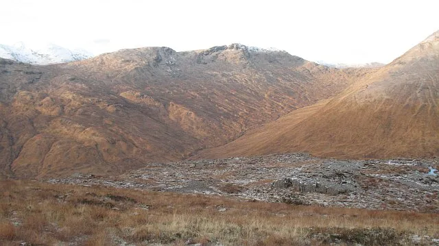
Braigh nan Uamhachan
Mountains & hills · 2.9 km

Sròn Liath
Mountains & hills · 3.4 km

Meall a' Phubuill
Mountains & hills · 3.4 km
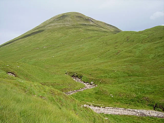
Meall a'Phubuill
Mountains & hills · 3.4 km

Meall Onfhaidh
Mountains & hills · 3.6 km
Nearby
📷 3Natural landmarks · Scottish Highlands
Gaor Bheinn
Gaor Bheinn — 987m high mountain in Highland, Scotland, UK.
📷 5Mountains & hills · Scottish Highlands
Gulvain South Top
Gulvain South Top — a hill or mountain in scotland highlands.
📷 5Mountains & hills · Scottish Highlands
Gulvain South Top
Gulvain South Top — mountain in scotland highlands. Elevation: 961 m.
📷 5Mountains & hills · Scottish Highlands
Gualann nan Osna
Gualann nan Osna — mountain in scotland highlands. Elevation: 534 m.
📷 3📷 5Mountains & hills · Scottish Highlands
Leac na Carnaich
Leac na Carnaich — a hill or mountain in scotland highlands.
Where to eat & stay near Gulvain
Places to stay
 📷 5
📷 5 📷 5
📷 5Campsites · Scottish Highlands
Linnhe Lochside Holiday Park
Linnhe Lochside Holiday Park — a campsite in scotland highlands.
 📷 5
📷 5 📷 5
📷 5Hostels · Scottish Highlands
Chase The Wild Goose
Chase The Wild Goose — a hostel in scotland highlands.
 📷 5
📷 5Caravan parks · Scottish Highlands
Lochy Holiday Park
Lochy Holiday Park — a caravan park in scotland highlands.
 📷 5
📷 5Campsites · Scottish Highlands
Moy Bridge informal campsite
Moy Bridge informal campsite — a campsite in scotland highlands.
More mountains in this region
 📷 3
📷 3Mountains & hills · Scottish Highlands
A' Bhuidheanach Bheag
A' Bhuidheanach Bheag — Named summit at 936 m.
 📷 3
📷 3Mountains & hills · Scottish Highlands
A' Chailleach
A' Chailleach — Named summit at 997 m.
 📷 3
📷 3Mountains & hills · Scottish Highlands
A' Chailleach
A' Chailleach — Named summit at 930 m.
 📷 3
📷 3Frequently asked questions
- Where is Gulvain?
- Gulvain is in the Scottish Highlands, United Kingdom.
- What is Gulvain?
- Gulvain — Named summit at 987 m.
- How do I get to Gulvain?
- The nearest railway station is Locheilside, about 8.9 km away. Its coordinates are 56.9362°, -5.2845°.
- Is Gulvain free to visit?
- Yes, Gulvain is free to enter.