
Windmills · East Midlands
Gringley Windmill
In or near Walkeringham.
Gringley Windmill — Grade II listed building-listed windmill in england-east-midlands, United Kingdom.

Alan Murray-Rust — CC BY-SA 2.0 via Wikimedia Commons licence

Plan your visit
- Typical visit
- 30 min–1 h
- Nearest railway station
- Gainsborough Central · 8.9 km
- Free entry
- Family-friendly
- Dog-friendly
Getting there & planning your visit
Gringley Windmill is located in the East Midlands, with the nearest railway station being Gainsborough Central, approximately 8.9 km away. The postcode for the windmill is DN10 4RA, and entry is free.
About
Gringley Windmill is a Grade II listed building-listed windmill in england-east-midlands, United Kingdom, registered on the National Heritage List for England (NHLE entry 1156678). Listed status protects buildings and structures of special architectural or historic interest. See the linked Wikipedia article for further details.
Photo gallery
Heritage listing
Details SK 79 SW GRINGLEY ON THE HILL MILL HILL (south side) 5/54 Gringley Windmill 21.1.83 G.V. II Windmill, c.1830. Brick with dentillated eaves and curb, remains of timber cap. Battered circular tower, 4 stages. All opening with segmental heads. First stage has doorway to west and 2 iron frame glazing bar casements; upper stages have each two 2 light unglazed timber casements. Interior has remains of fourth stage floor. Listing NGR: SK7302090605 Legacy The contents of this record have been generated from a legacy data system. Legacy System number: 241136 Legacy System: LBS
From the Historic England List Entry under OGL v3.
Protected designations
- Site of Special Scientific Interest: Chesterfield Canal SSSI
Designations sourced from Natural England open data under OGL v3.
Place summary
Gringley Windmill is a Grade II listed windmill located in the East Midlands. It is notable for its historical significance and architectural features, representing the region's milling heritage.
AI-generated from the structured facts on this page (operator, designation, listing, era). Not a substitute for visiting.
- Coordinates
- 53.4072, -0.9031
- County
- Nottinghamshire
- District
- Bassetlaw
- Parish
- Gringley on the Hill
- Postcode
- DN10 4RA
- Parliamentary constituency
- Bassetlaw
- Nearest railway station
- Gainsborough Central — 8.9 km
Sources
- wikidata: Q26450498 (CC0)
Other places nearby
Gringley On The Hill War Memorial
Memorials & monuments · 0.0 km

St Peter & St Paul's Church, Gringley-on-the-Hill
Historic churches · 0.6 km

Gringley on the Hill
Villages · 0.7 km

Beacon Hill
Viewpoints · 1.2 km

Gringley on the Hill
Castles · 1.2 km

Lady's Bridge, Chesterfield Canal
Historic bridges · 1.5 km

Wiseton Top Bridge
Historic bridges · 1.5 km

Wiseton Road
Historic bridges · 2.1 km
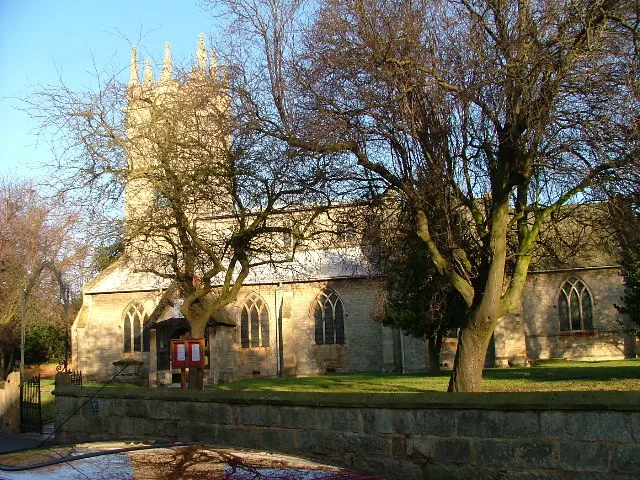
St. Peter's Church, Clayworth
Historic churches · 2.2 km

Clayworth
Villages · 2.4 km

Mattersey Priory
Abbeys & priories · 2.9 km

Mattersey Priory
Archaeological sites · 2.9 km
Nearby
📷 3Memorials & monuments · East Midlands
Gringley On The Hill War Memorial
Gringley On The Hill War Memorial — Grade II listed building-listed memorial in england-east-midlands, United Kingdom.
📷 3Historic churches · East Midlands
St Peter & St Paul's Church, Gringley-on-the-Hill
St Peter & St Paul's Church, Gringley-on-the-Hill — Grade II* listed building-listed church in england-east-midlands, United Kingdom.
📷 5Villages · East Midlands
Gringley on the Hill
Gringley on the Hill — a village in england east midlands.
📷 3📷 5Castles · East Midlands
Gringley on the Hill
Gringley on the Hill — a castle in england east midlands.
📷 3Historic bridges · East Midlands
Lady's Bridge, Chesterfield Canal
Lady's Bridge, Chesterfield Canal — Grade II listed building-listed bridge in england-east-midlands, United Kingdom.
Where to eat & stay near Gringley Windmill
Places to stay
 📷 5
📷 5Campsites · East Midlands
White House Farm Camping and Caravanning
White House Farm Camping and Caravanning — a campsite in england east midlands.
 📷 5
📷 5 📷 5
📷 5Campsites · East Midlands
Waterfront Country Park
Waterfront Country Park — a campsite in england east midlands.
 📷 5
📷 5Campsites · East Midlands
Pilgrim Fathers Camping Site
Pilgrim Fathers Camping Site — a campsite in england east midlands.
 📷 5
📷 5Caravan parks · East Midlands
Marshall's Caravan Park
Marshall's Caravan Park — a caravan park in england east midlands.
 📷 5
📷 5Caravan parks · East Midlands
Plumtree Caravan Park
Plumtree Caravan Park — a caravan park in england east midlands.
Places to eat & drink
 📷 7
📷 7Historic pubs · East Midlands
Black Boy Public House
Black Boy Public House in England Yorkshire, United Kingdom.
 📷 5
📷 5 📷 5
📷 5Historic pubs · East Midlands
Newcastle Arms Public House
Newcastle Arms Public House in England Yorkshire, United Kingdom.
 📷 5
📷 5Historic pubs · East Midlands
New Inn Public House
New Inn Public House in England Yorkshire, United Kingdom.
 📷 5
📷 5Historic pubs · East Midlands
The Red Hart Hotel
The Red Hart Hotel in England Yorkshire, United Kingdom.
 📷 7
📷 7Restaurants · East Midlands
Miller & Carter
Miller & Carter — a restaurant in england east midlands. Cuisine: steak. Brand: Miller & Carter.
More windmills in this region
 📷 5
📷 5 📷 5
📷 5Windmills · East Midlands
Mill House East Of Barnack Windmill
Mill House East Of Barnack Windmill — Grade II listed building-listed windmill in england-london, United Kingdom.
 📷 5
📷 5Windmills · East Midlands
Barnack Windmill
Barnack Windmill — Grade II listed building-listed windmill in england-london, United Kingdom.
 📷 3
📷 3Frequently asked questions
- Where is Gringley Windmill?
- Gringley Windmill is in Nottinghamshire, the East Midlands, United Kingdom (postcode DN10 4RA), in the parish of Gringley on the Hill.
- What is Gringley Windmill?
- Gringley Windmill — Grade II listed building-listed windmill in england-east-midlands, United Kingdom.
- How do I get to Gringley Windmill?
- The nearest railway station is Gainsborough Central, about 8.9 km away. Drivers can use postcode DN10 4RA.
- Is Gringley Windmill a listed building?
- Gringley Windmill is officially recognised as Grade II listed building listed.
- Is Gringley Windmill a protected site?
- Yes — Gringley Windmill is part of the Chesterfield Canal SSSI Site of Special Scientific Interest.
- Is Gringley Windmill free to visit?
- Yes, Gringley Windmill is free to enter.
- How do I get to Gringley Windmill?
- Drivers can navigate to postcode DN10 4RA. It sits within the Bassetlaw parliamentary constituency.