
Mountains & hills · North West England
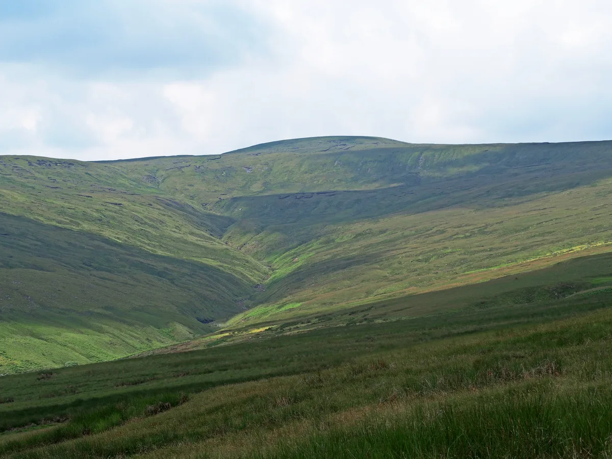
Great Shunner Fell
In or near Satron.
Great Shunner Fell — Named summit at 716 m.

Wikimedia Commons contributors — see linked file page for photographer and licence licence

Plan your visit
- Typical visit
- 3 h–8 h
- Best time of year
- Late spring – early autumn (May–Oct)
- Nearest railway station
- Garsdale · 8.1 km
- Free entry
- Dog-friendly
Getting there & planning your visit
To visit Great Shunner Fell, the nearest railway station is Garsdale, located 8.1 km away. Entry is free. There are no specific accessibility details provided.
About
Great Shunner Fell is a named summit in the United Kingdom. Wikidata describes it as: "Named summit at 716 m.". Coordinates: 54.3709°, -2.2345°.
Photo gallery
Protected designations
- Site of Special Scientific Interest: Mallerstang-Swaledale Head SSSI
Designations sourced from Natural England open data under OGL v3.
From the Wikipedia article
Great Shunner Fell is the third-highest mountain in the Yorkshire Dales, North Yorkshire, England, and the highest point in Wensleydale; at 716 metres above sea level. In clear weather the summit affords views of Wensleydale to the south, Ribblesdale to the southwest and Swaledale to the north, as well as views into Cumbria and County Durham beyond the A66. The Pennine Way passes over its summit, on the way from Hawes to Keld. The popularity of this route had eroded vegetation from a strip 70 m wide across the moor, which has been alleviated since 1996 by the construction of a path made of flagstones. The summit holds a cross-shaped windbreak of which the triangulation pillar has been built into the northern 'arm'. Great Sleddale Beck, which becomes the River Swale after its confluence with Birkdale Beck, has its sources on the northern slopes of Great Shunner Fell, while the southern slopes drain into the River Ure and Wensleydale. The dominating rock type in the area is limestone, but millstone grit outcrops extensively on Great Shunner Fell, and coal seams have also been worked on its slopes. Great Shunner Fell is the most southerly remaining outpost in Great Britain for the yellow marsh saxifrage, Saxifraga hirculus.
Excerpt from Wikipedia under CC BY-SA 4.0. See the source article linked in Sources below.
- Coordinates
- 54.3709, -2.2345
- Address
- North Yorkshire, England
- Nearest railway station
- Garsdale — 8.1 km
Sources
- osm: n477367984 (ODbL)
- wikipedia: Great Shunner Fell (CC BY-SA 4.0)
- commons: Great-Shunner-Fell-NE.jpg (CC BY-SA 4.0)
Other places nearby
Great Shunner Fell
Natural landmarks · 0.1 km

Little Shunner Fell
Mountains & hills · 1.3 km

Round Hill
Mountains & hills · 2.1 km

Cotterdale House
Caves · 2.2 km

Fossdale Beck Cave
Caves · 2.3 km

Ash Force
Waterfalls · 2.4 km

Long Scar East Cave
Caves · 2.6 km

Butter Tubs
Natural landmarks · 2.8 km

Cliff Force
Waterfalls · 2.9 km
Cliffe Force Cave
Caves · 3.0 km

Coal Force
Waterfalls · 3.0 km
Seavy Sike Force
Waterfalls · 3.0 km
Nearby
📷 3Natural landmarks · North West England
Great Shunner Fell
Great Shunner Fell — mountain in United Kingdom.
📷 5Mountains & hills · North West England
Little Shunner Fell
Little Shunner Fell — mountain in england north west. Elevation: 653 m.
📷 5Mountains & hills · North West England
Round Hill
Round Hill — mountain in england north west. Elevation: 591 m.
📷 5📷 5Caves · North West England
Fossdale Beck Cave
Fossdale Beck Cave — a cave broad in england-north-west, United Kingdom.
📷 5Where to eat & stay near Great Shunner Fell
Places to stay
 📷 5
📷 5Campsites · North East England
Hoggarths campsite
Hoggarths campsite — a campsite in england north west.
 📷 5
📷 5Campsites · Yorkshire & the Humber
Usha Gap Campsite
Usha Gap Campsite — a campsite in england north west.
 📷 5
📷 5Campsites · North West England
Shaw Ghyll caravan and camping
Shaw Ghyll caravan and camping — a campsite in england north west.
 📷 5
📷 5Campsites · North East England
Park House Camping & Keld Bunkhouse
Park House Camping & Keld Bunkhouse — a campsite in england north west.
 📷 5
📷 5Campsites · North East England
Rukin's Park Lodge Campsite
Rukin's Park Lodge Campsite — a campsite in england north west.
 📷 5
📷 5Hostels · North West England
Old School Bunkhouse
Old School Bunkhouse — a hostel in england north west.
Places to eat & drink
 📷 5
📷 5Historic pubs · Yorkshire & the Humber
Kings Head Inn
Kings Head Inn in England North West, United Kingdom.
 📷 5
📷 5 📷 7
📷 7Cafés · North West England
The White Hare Cafe
The White Hare Cafe — a café in england north west.
 📷 5
📷 5Cafés · North West England
The Cross Keys Temperance Inn
The Cross Keys Temperance Inn — a café in england north west.
 📷 5
📷 5 📷 5
📷 5Cafés · North West England
Gun Dog Coffee Shop
Gun Dog Coffee Shop — a café in england north west.
More mountains in this region
 📷 5
📷 5Mountains & hills · North West England
Appleton Park
Appleton Park — a hill or mountain in england west midlands.
 📷 5
📷 5Mountains & hills · North West England
High Warren
High Warren — mountain in england west midlands. Elevation: 105 m.
 📷 5
📷 5Mountains & hills · North West England
Alderley Edge
Alderley Edge — mountain in england west midlands. Elevation: 194 m.
 📷 3
📷 3Frequently asked questions
- Where is Great Shunner Fell?
- Great Shunner Fell is in North-West England, United Kingdom.
- What is Great Shunner Fell?
- Great Shunner Fell — Named summit at 716 m.
- How do I get to Great Shunner Fell?
- The nearest railway station is Garsdale, about 8.1 km away. The nearest town is Satron. Its coordinates are 54.3709°, -2.2345°.
- Is Great Shunner Fell a protected site?
- Yes — Great Shunner Fell is part of the Mallerstang-Swaledale Head SSSI Site of Special Scientific Interest.
- Is Great Shunner Fell free to visit?
- Yes, Great Shunner Fell is free to enter.