
Historic churches · East Midlands
Grasby
In or near Barnetby le Wold.
Grasby is a small village and civil parish in the West Lindsey district of Lincolnshire, England. The population of the civil parish (including Clixby) taken at the 2011 census was 480. It is situated

Brian Westlake — CC BY-SA 2.0 via Wikimedia Commons licence

Plan your visit
- Typical visit
- 30 min–1 h
- Nearest railway station
- Barnetby · 6.0 km
- Free entry
Getting there & planning your visit
To visit Grasby church, the nearest railway station is Barnetby, located 6 km away. The postcode for navigation is DN38 6AH, and entry is free.
About
Grasby is a small village and civil parish in the West Lindsey district of Lincolnshire, England. The population of the civil parish (including Clixby) taken at the 2011 census was 480. It is situated 3 miles (5 km) north-west of the town of Caistor and lies in the Lincolnshire Wolds, a designated Area of Outstanding Natural Beauty. Grasby's 13th-century Anglican parish church, dedicated to All Saints, is opposite the village primary school. The church is part of the Caistor group of parishes in the Deanery of West Wold. The 2013 incumbent is The Rev'd Canon Ian Robinson. In earlier times the vicar was Rev Charles Tennyson Turner, brother of the poet Alfred Lord Tennyson. The village school came close to closing at the end of the 20th century but remains open. It is now Grasby All Saints Church of England Primary School, and grant maintained. The school received a Grade 2 (Good) judgement for "Overall effectiveness" in its 2013 Ofsted report. The village hall holds events such as Rock and Roll and Jive classes, runs a Learn Direct programme and is used by the village school for physical education lessons and a yearly Easter ceremony. Grasby has one public house, The Cross Keys, on the Caistor to Brigg road, which for a time housed a village shop. A second public house, The Bluebell, on the corner of Church Hill and Canty Nook, is now closed. Since 1987 Grasby has been twinned with the small French village of Saint-Rémy-de-Sillé in Sarthe, whose main road has been renamed Rue
Photo gallery
Protected designations
- Site of Special Scientific Interest: Humber Estuary - 2000480 SSSI
- Ramsar wetland: Humber Estuary
Designations sourced from Natural England open data under OGL v3.
From the Wikipedia article
Grasby is a small village and civil parish in the West Lindsey district of Lincolnshire, England. The population of the civil parish (including Clixby) taken at the 2011 census was 480. It is situated 3 miles (5 km) north-west of the town of Caistor and lies in the Lincolnshire Wolds, a designated Area of Outstanding Natural Beauty. Grasby's 13th-century Anglican parish church, dedicated to All Saints, is opposite the village primary school. The church is part of the Caistor group of parishes in the Deanery of West Wold. The 2013 incumbent is The Rev'd Canon Ian Robinson. In earlier times the vicar was Rev Charles Tennyson Turner, brother of the poet Alfred Lord Tennyson. The village school came close to closing at the end of the 20th century but remains open. It is now Grasby All Saints Church of England Primary School, and grant maintained. The school received a Grade 2 (Good) judgement for "Overall effectiveness" in its 2013 Ofsted report. The village hall holds events such as Rock and Roll and Jive classes, runs a Learn Direct programme and is used by the village school for physical education lessons and a yearly Easter ceremony. Grasby has one public house, The Cross Keys, on the Caistor to Brigg road, which for a time housed a village shop. A second public house, The Bluebell, on the corner of Church Hill and Canty Nook, is now closed. Since 1987 Grasby has been twinned with the small French village of Saint-Rémy-de-Sillé in Sarthe, whose main road has been renamed Rue de Grasby. In 2005 Grasby won the Central England Village of the Year competition.
Excerpt from Wikipedia under CC BY-SA 4.0. See the source article linked in Sources below.
- Coordinates
- 53.5300, -0.3589
- County
- Lincolnshire
- District
- West Lindsey
- Parish
- Grasby
- Postcode
- DN38 6AH
- Parliamentary constituency
- Gainsborough
- Nearest railway station
- Barnetby — 6 km
Sources
- wikipedia: Grasby (CC BY-SA 4.0)
Other places nearby
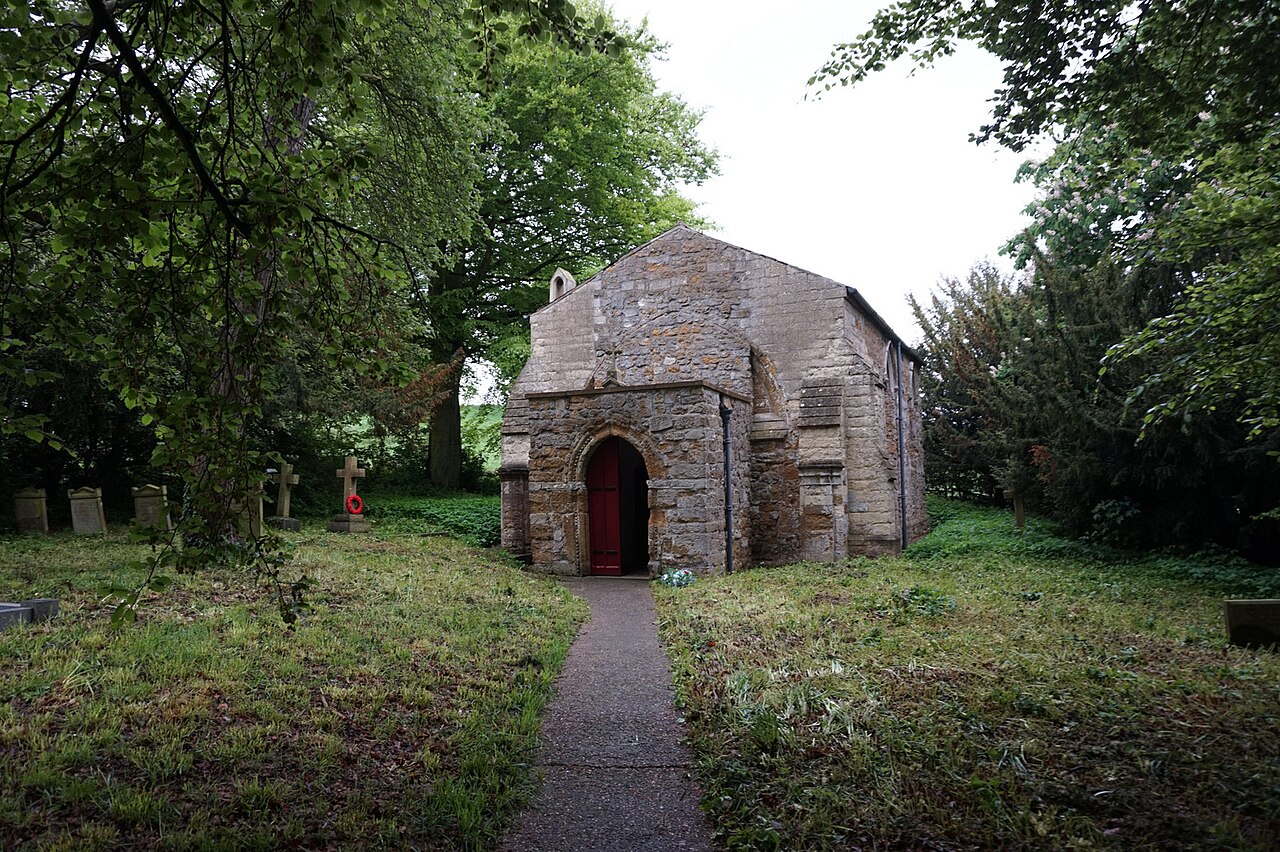
Clixby
Villages · 1.5 km
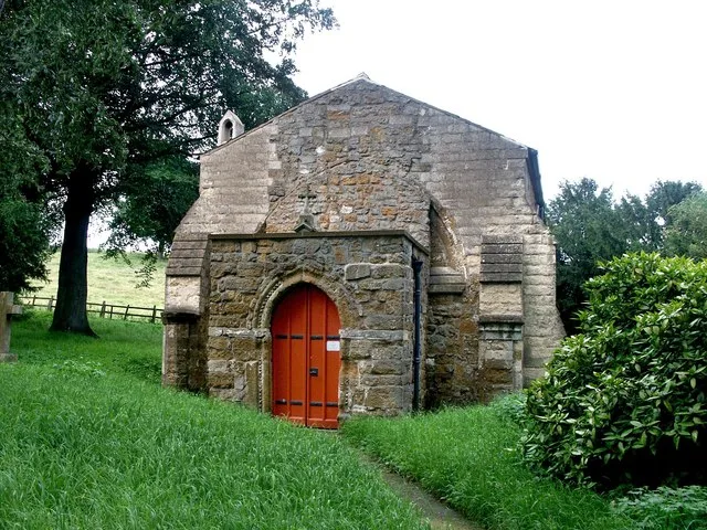
All Hallows Church, Clixby
Historic churches · 1.5 km

Searby
Villages · 1.8 km

Somerby
Villages · 3.2 km

Somerby Monument
Memorials & monuments · 3.3 km

Hundon Manor
Manor houses · 3.7 km

Nettleton Park
Caravan parks · 3.9 km

Mealand Hill Caravan Park
Caravan parks · 4.1 km
Mealand Hill Caravan Park
Caravan parks · 4.1 km

Pelham's Pillar
Memorials & monuments · 4.2 km

Fonaby Top
Mountains & hills · 4.2 km

Howsham
Villages · 4.3 km
Nearby
📷 5📷 3Historic churches · East Midlands
All Hallows Church, Clixby
All Hallows Church, Clixby — church in West Lindsey, UK.
📷 5📷 5📷 3Memorials & monuments · East Midlands
Somerby Monument
Somerby Monument — a memorial in england-yorkshire, United Kingdom.
📷 3Manor houses · East Midlands
Hundon Manor
Hundon Manor — a manor in england-yorkshire, United Kingdom.
Where to eat & stay near Grasby
Places to stay
Caravan parks · East Midlands
Nettleton Park
Nettleton Park — a caravan park in england east midlands.
📷 5Caravan parks · Yorkshire & the Humber
Mealand Hill Caravan Park
Mealand Hill Caravan Park — a caravan park in england yorkshire.
📷 5Caravan parks · Yorkshire & the Humber
Mealand Hill Caravan Park
Mealand Hill Caravan Park — a caravan park in england yorkshire.
 📷 5
📷 5Campsites · East Midlands
The Skipworth Arms Campsite
The Skipworth Arms Campsite — a campsite in england east midlands.
 📷 5
📷 5B&Bs · Yorkshire & the Humber
Holcombe Guest House
Holcombe Guest House — a bed-and-breakfast in england yorkshire.
 📷 7
📷 7Hotels · Yorkshire & the Humber
Hampton by Hilton Humberside Airport
Hampton by Hilton Humberside Airport — a hotel in england yorkshire. 3-star. Brand: Hampton.
Places to eat & drink
 📷 3
📷 3Historic pubs · Yorkshire & the Humber
Tivoli Tavern
Tivoli Tavern — Historic pub — listed building or notable heritage status.
 📷 5
📷 5Historic pubs · Yorkshire & the Humber
The Cross Keys
The Cross Keys in England Yorkshire, United Kingdom.
 📷 7
📷 7Historic pubs · Yorkshire & the Humber
The Berkeley
The Berkeley in England Yorkshire, United Kingdom.
 📷 5
📷 5Historic pubs · Yorkshire & the Humber
Criterion Public House
Criterion Public House in England Yorkshire, United Kingdom.
 📷 5
📷 5Historic pubs · East Midlands
The Signal Box Inn
The Signal Box Inn in England East Midlands, United Kingdom.
 📷 6
📷 6Historic pubs · Yorkshire & the Humber
Vauxhall Tavern Public House
Vauxhall Tavern Public House in England Yorkshire, United Kingdom.
More places in this region
 📷 5
📷 5Historic churches · East Midlands
All Saints' Church, Stamford
All Saints' Church, Stamford — church in Stamford, Lincolnshire, England, UK.
 📷 5
📷 5Historic churches · East Midlands
Church of All Saints
Church of All Saints — church in Little Casterton, Rutland, United Kingdom.
 📷 5
📷 5Historic churches · East Midlands
Church of All Saints
Church of All Saints — church in Fenland, UK.
 📷 5
📷 5Historic churches · East Midlands
Church of St Leonard
Church of St Leonard — church in Fenland, UK.
Frequently asked questions
- Where is Grasby?
- Grasby is in Lincolnshire, Yorkshire, United Kingdom (postcode DN38 6AH), in the parish of Grasby.
- What is Grasby?
- Grasby is a small village and civil parish in the West Lindsey district of Lincolnshire, England. The population of the civil parish (including Clixby) taken at the 2011 census was 480. It is situated
- How do I get to Grasby?
- The nearest railway station is Barnetby, about 6.0 km away. Drivers can use postcode DN38 6AH.
- Is Grasby a protected site?
- Yes — Grasby is part of the Humber Estuary - 2000480 SSSI Site of Special Scientific Interest and the Humber Estuary Ramsar wetland.
- Is Grasby free to visit?
- Yes, Grasby is free to enter.
- How do I get to Grasby?
- The nearest railway station is Barnetby, about 6.0 km away. Drivers can navigate to postcode DN38 6AH.