
Historic churches · East Midlands
Grainthorpe
In or near Tetney.
Grainthorpe is a small village and civil parish in the East Lindsey district of Lincolnshire, England. It is situated 7 miles (11 km) north-east from the town of Louth, and approximately 3 miles (5 km

John Firth — CC BY-SA 2.0 via Wikimedia Commons licence

Plan your visit
- Typical visit
- 30 min–1 h
- Nearest railway station
- Ludborough · 7.5 km
- Free entry
Getting there & planning your visit
Grainthorpe is located in East Lindsey, Lincolnshire, with the postcode LN11 7HU. The nearest railway station is Ludborough, which is 7.5 km away. Entry to the church is free.
About
Grainthorpe is a small village and civil parish in the East Lindsey district of Lincolnshire, England. It is situated 7 miles (11 km) north-east from the town of Louth, and approximately 3 miles (5 km) from the Lincolnshire coast. The civil parish includes the hamlets of Wragholme to the north-west, and Ludney to the south-east. The population of Conisholme is included in the 2011 census. Grainthorpe is listed in the 1086 Domesday Book as "Germundtorp", with 28 households. The deserted medieval village of Swinehope was believed to be cited here, abandoned when its harbour silted up. There was a medieval saltern at the hamlet of Wragholme. The parish church is a Grade I listed building dedicated to St Clement and dating from 1200, with later alterations, additions, and restorations. It has a 15th-century font. The churchyard contains war graves of a soldier and a Royal Flying Corps airman of the First World War. Grainthorpe Hall is an early 18th-century red-brick house, which is Grade II listed. Grainthorpe has its own primary school, village hall and post office, although the post office is currently open only two days a week in the Church Hall. The Coach house adjacent to the old Mill has been restored, and has re-opened as a village shop and tea room. There is also now a village shop Gilimans, selling supplies and pet food. Prior to this, the village's nearest shops were in the nearby villages of Marshchapel, North Somercotes, and Alvingham. Also sited in the village are pl
Photo gallery
Protected designations
- Site of Special Scientific Interest: Humber Estuary - 2000480 SSSI
- National Nature Reserve: LINCOLNSHIRE CORONATION COAST
- Area of Outstanding Natural Beauty: Lincolnshire Wolds
- Ramsar wetland: Humber Estuary
Designations sourced from Natural England open data under OGL v3.
From the Wikipedia article
Grainthorpe is a small village and civil parish in the East Lindsey district of Lincolnshire, England. It is situated 7 miles (11 km) north-east from the town of Louth, and approximately 3 miles (5 km) from the Lincolnshire coast. The civil parish includes the hamlets of Wragholme to the north-west, and Ludney to the south-east. The population of Conisholme is included in the 2011 census. Grainthorpe is listed in the 1086 Domesday Book as "Germundtorp", with 28 households. The deserted medieval village of Swinehope was believed to be cited here, abandoned when its harbour silted up. There was a medieval saltern at the hamlet of Wragholme. The parish church is a Grade I listed building dedicated to St Clement and dating from 1200, with later alterations, additions, and restorations. It has a 15th-century font. The churchyard contains war graves of a soldier and a Royal Flying Corps airman of the First World War. Grainthorpe Hall is an early 18th-century red-brick house, which is Grade II listed. Grainthorpe has its own primary school, village hall and post office, although the post office is currently open only two days a week in the Church Hall. The Coach house adjacent to the old Mill has been restored, and has re-opened as a village shop and tea room. There is also now a village shop Gilimans, selling supplies and pet food. Prior to this, the village's nearest shops were in the nearby villages of Marshchapel, North Somercotes, and Alvingham. Also sited in the village are playing fields which consist of a tennis court, football pitch and cricket pitch.
Excerpt from Wikipedia under CC BY-SA 4.0. See the source article linked in Sources below.
- Coordinates
- 53.4506, 0.0810
- County
- Lincolnshire
- District
- East Lindsey
- Parish
- Grainthorpe
- Postcode
- LN11 7HU
- Parliamentary constituency
- Louth and Horncastle
- Nearest railway station
- Ludborough — 7.5 km
- Official site
- www.neighbourhood.statistics.gov.uk
Sources
- wikipedia: Grainthorpe (CC BY-SA 4.0)
Other places nearby
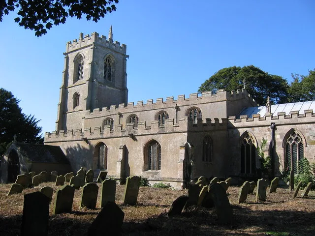
Church of St Clement
Historic churches · 0.6 km

Church of St Peter
Historic churches · 2.5 km

Conisholme
Historic churches · 2.6 km

Lowis Farm Camp Site
Campsites · 2.8 km

Louth Navigation
Canals · 3.0 km

Marsh Chapel
Villages · 3.3 km

North Somercotes
Historic churches · 3.5 km

Covenham Reservoir
Reservoirs & lochs · 3.8 km

North Somercotes
Villages · 4.0 km

South Somercotes War Memorial
Memorials & monuments · 4.5 km

South Somercotes
Villages · 4.5 km
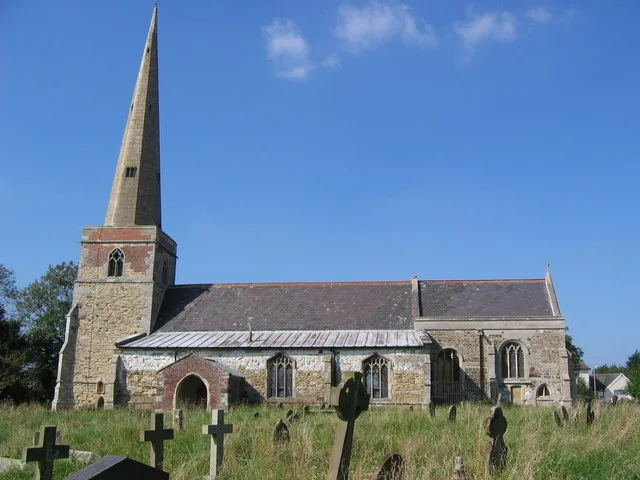
St Peter's Church, South Somercotes
Historic churches · 4.5 km
Nearby
📷 3Historic churches · East Midlands
Church of St Clement
Church of St Clement — Grade I listed church in Grainthorpe, Lincolnshire, England, UK.
📷 3Historic churches · East Midlands
Church of St Peter
Church of St Peter — Grade I listed church in Conisholme, Lincolnshire, England, UK.
📷 5Historic churches · East Midlands
Conisholme
Conisholme is a small settlement and civil parish in the East Lindsey district of Lincolnshire, England. It is on the Cleethorpes to Mablethorpe A1031 road, and 7 miles (11 km) north-east from Louth.
📷 5Campsites · East Midlands
Lowis Farm Camp Site
Lowis Farm Camp Site — a campsite in england east midlands.
📷 5📷 5Where to eat & stay near Grainthorpe
Places to stay
📷 5Campsites · East Midlands
Lowis Farm Camp Site
Lowis Farm Camp Site — a campsite in england east midlands.
 📷 5
📷 5Caravan parks · East Midlands
Brickyard Fisheries
Brickyard Fisheries — a caravan park in england east midlands.
 📷 5
📷 5Caravan parks · East Midlands
Windy Ridge Caravan Site & Fishing Lakes
Windy Ridge Caravan Site & Fishing Lakes — a caravan park in england east midlands.
 📷 5
📷 5Caravan parks · East Midlands
Sunnydale Holiday Park
Sunnydale Holiday Park — a caravan park in england east midlands. Brand: Parkdean Resorts.
 📷 5
📷 5Caravan parks · East Midlands
Tuxworth Caravan Sites
Tuxworth Caravan Sites — a caravan park in england east midlands.
 📷 5
📷 5Caravan parks · East Midlands
New Inn Caravan Park
New Inn Caravan Park — a caravan park in england east midlands.
Places to eat & drink
 📷 5
📷 5 📷 5
📷 5Historic pubs · East Midlands
The Signal Box Inn
The Signal Box Inn in England East Midlands, United Kingdom.
 📷 3
📷 3Historic pubs · Yorkshire & the Humber
Tivoli Tavern
Tivoli Tavern — Historic pub — listed building or notable heritage status.
 📷 5
📷 5Historic pubs · East Midlands
Massingberd Arms
Massingberd Arms in England East Midlands, United Kingdom.
 📷 5
📷 5More places in this region
 📷 5
📷 5Historic churches · East Midlands
All Saints' Church, Stamford
All Saints' Church, Stamford — church in Stamford, Lincolnshire, England, UK.
 📷 5
📷 5Historic churches · East Midlands
Church of All Saints
Church of All Saints — church in Little Casterton, Rutland, United Kingdom.
 📷 5
📷 5Historic churches · East Midlands
Church of All Saints
Church of All Saints — church in Fenland, UK.
 📷 5
📷 5Historic churches · East Midlands
Church of St Leonard
Church of St Leonard — church in Fenland, UK.
Frequently asked questions
- Where is Grainthorpe?
- Grainthorpe is in Lincolnshire, the East Midlands, United Kingdom (postcode LN11 7HU), in the parish of Grainthorpe.
- What is Grainthorpe?
- Grainthorpe is a small village and civil parish in the East Lindsey district of Lincolnshire, England. It is situated 7 miles (11 km) north-east from the town of Louth, and approximately 3 miles (5 km
- How do I get to Grainthorpe?
- The nearest railway station is Ludborough, about 7.5 km away. Drivers can use postcode LN11 7HU.
- Is Grainthorpe a protected site?
- Yes — Grainthorpe is part of the Humber Estuary - 2000480 SSSI Site of Special Scientific Interest and the LINCOLNSHIRE CORONATION COAST National Nature Reserve.
- Is Grainthorpe free to visit?
- Yes, Grainthorpe is free to enter.
- How do I get to Grainthorpe?
- The nearest railway station is Ludborough, about 7.5 km away. Drivers can navigate to postcode LN11 7HU.