
Historic churches · South West England
Godolphin Cross
In or near St Hilary.
Godolphin Cross (Cornish: Krows Hirlan) is a village in the civil parish of Breage, in west Cornwall, England. It is midway between the towns of Hayle and Helston. From 1974 until 2009 it was in Kerri

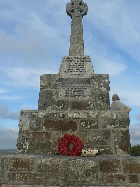
P Barnett — CC BY-SA 2.0 via Wikimedia Commons licence

Plan your visit
- Typical visit
- 30 min–1 h
- Nearest railway station
- Prospidnick Halt · 3.7 km
- Free entry
Getting there & planning your visit
To visit Godolphin Cross, the nearest railway station is Prospidnick Halt, located 3.7 km away. Entry to the church is free, and the postcode for sat-nav is TR13 9RH.
About
Godolphin Cross (Cornish: Krows Hirlan) is a village in the civil parish of Breage, in west Cornwall, England. It is midway between the towns of Hayle and Helston. From 1974 until 2009 it was in Kerrier district. Godolphin Cross is in an upland area, part of a geological formation known as the Tregonning-Godolphin Granite. The term refers to the plateau of high ground in this area, one of five granite batholiths in Cornwall (see Geology of Cornwall). One mile west of the village, Godolphin Hill rises to 162 metres (531 ft). The Godolphin Estate is near the village. It is now completely owned by the National Trust, and is undergoing extensive renovation. The whole estate and surrounding woodlands are once again open to the public, who were excluded from most of the estate by the former owners. Godolphin Primary School serves children from 4 to 11 years and had a roll of 82 children in November 2021. It received a good Ofsted report in June 2015. The Church of St John the Baptist is now redundant. It was designed by James Piers St Aubyn and built in 1849–50. In 2006, an application was received by Kerrier District Council to convert the church into a private dwelling. There is a Cornish cross in the churchyard. In 1886 it was moved to the churchyard, having been found in use as a gatepost on the Chytodden estate. In 2017 funds for the purchase of the village hall were provided by Sheikh Mohammed bin Rashid Al Maktoum, the ruler of Dubai. Villagers had appealed to him for help,
Photo gallery
Protected designations
- Area of Outstanding Natural Beauty: Cornwall
Designations sourced from Natural England open data under OGL v3.
From the Wikipedia article
Godolphin Cross (Cornish: Krows Hirlan) is a village in the civil parish of Breage, in west Cornwall, England. It is midway between the towns of Hayle and Helston. From 1974 until 2009 it was in Kerrier district. Godolphin Cross is in an upland area, part of a geological formation known as the Tregonning-Godolphin Granite. The term refers to the plateau of high ground in this area, one of five granite batholiths in Cornwall (see Geology of Cornwall). One mile west of the village, Godolphin Hill rises to 162 metres (531 ft). The Godolphin Estate is near the village. It is now completely owned by the National Trust, and is undergoing extensive renovation. The whole estate and surrounding woodlands are once again open to the public, who were excluded from most of the estate by the former owners. Godolphin Primary School serves children from 4 to 11 years and had a roll of 82 children in November 2021. It received a good Ofsted report in June 2015. The Church of St John the Baptist is now redundant. It was designed by James Piers St Aubyn and built in 1849–50. In 2006, an application was received by Kerrier District Council to convert the church into a private dwelling. There is a Cornish cross in the churchyard. In 1886 it was moved to the churchyard, having been found in use as a gatepost on the Chytodden estate. In 2017 funds for the purchase of the village hall were provided by Sheikh Mohammed bin Rashid Al Maktoum, the ruler of Dubai. Villagers had appealed to him for help, on the basis of the connection between the village and Godolphin Arabian, one of three stallions from which all thoroughbreds are descended. Al Maktoum is the owner of the Godolphin Racing stable. The building was formerly the Methodist Chapel and school room.
Excerpt from Wikipedia under CC BY-SA 4.0. See the source article linked in Sources below.
- Coordinates
- 50.1333, -5.3481
- District
- Cornwall
- Parish
- Breage
- Postcode
- TR13 9RH
- Parliamentary constituency
- St Ives
- Nearest railway station
- Prospidnick Halt — 3.7 km
Sources
- wikipedia: Godolphin Cross (CC BY-SA 4.0)
Other places nearby

Polrose Mines
Historic houses · 0.6 km

Forecourt Walls, Stiles And Mounting Block
Holy wells · 0.9 km

Godolphin Estate
Museums · 0.9 km
Godolphin House
Historic houses · 0.9 km

Leed's Shaft
Historic houses · 1.4 km
Tregonning Hill
Mountains & hills · 1.5 km

Castle Pencaire
Vineyards · 1.5 km

War Memorial near Castle Pencair Fort
Memorials & monuments · 1.5 km
Germoe War Memorial
Memorials & monuments · 1.5 km
Pencaire
Archaeological sites · 1.5 km

Carleen
Historic churches · 1.6 km

Godolphin Hill
Mountains & hills · 1.6 km
Nearby
📷 3Historic houses · South West England
Polrose Mines
Polrose Mines — a historic house in england-south-west, United Kingdom.
📷 5Holy wells · South West England
Forecourt Walls, Stiles And Mounting Block
Forecourt Walls, Stiles And Mounting Block — Grade I listed wall in Breage, United Kingdom.
📷 5Museums · South West England
Godolphin Estate
The Godolphin Estate is a National Trust property situated in Godolphin Cross, 7 km (4.3 mi) north-west of Helston in Cornwall, England. The house is a Grade I listed building.
📷 3Historic houses · South West England
Godolphin House
Godolphin House — a Grade I-listed historic house in england-south-west, United Kingdom.
📷 3Historic houses · South West England
Leed's Shaft
Leed's Shaft — a historic house in england-south-west, United Kingdom.
📷 3Where to eat & stay near Godolphin Cross
Places to stay
 📷 5
📷 5Campsites · South West England
Wheal Vreagh Farm Campsite
Wheal Vreagh Farm Campsite — a campsite in england south west.
 📷 5
📷 5 📷 3
📷 3Campsites · South West England
Dropped Anchor Camping Site
Dropped Anchor Camping Site — a campsite in england south west.
 📷 5
📷 5Caravan parks · South West England
Praa Sands Holiday Park
Praa Sands Holiday Park — a caravan park in england south west.
 📷 5
📷 5Campsites · South West England
Calloose Caravan Park
Calloose Caravan Park — a campsite in england south west.
 📷 5
📷 5Places to eat & drink
 📷 7
📷 7Historic pubs · South West England
The Pendarves Arms
The Pendarves Arms in England South West, United Kingdom.
 📷 5
📷 5Historic pubs · South West England
Fitzsimmons Arms Public House
Fitzsimmons Arms Public House in England South West, United Kingdom.
 📷 5
📷 5 📷 5
📷 5Historic pubs · South West England
The Bucket of Blood
The Bucket of Blood in England South West, United Kingdom.
 📷 5
📷 5 📷 7
📷 7Restaurants · South West England
The Old Lifeboat House Bistro
The Old Lifeboat House Bistro — a restaurant in england south west. Cuisine: seafood.
More places in this region
 📷 5
📷 5Historic churches · South West England
Abbey Church of St Gregory the Great, Downside Abbey
Abbey Church of St Gregory the Great, Downside Abbey — church in Stratton-on-the-Fosse, Somerset, England, UK.
 📷 5
📷 5Historic churches · South West England
All Saints Church
All Saints Church — Grade I listed church in Woolley, Somerset, England, UK.
 📷 5
📷 5Historic churches · South West England
All Saints Church, Hampreston
All Saints Church, Hampreston — church in Hampreston, Dorset, England, UK.
 📷 5
📷 5Historic churches · South West England
All Saints Church, Nether Cerne
All Saints Church, Nether Cerne — church in Nether Cerne, Dorset, England, UK.
Frequently asked questions
- Where is Godolphin Cross?
- Godolphin Cross is in South-West England, United Kingdom (postcode TR13 9RH), in the parish of Breage.
- What is Godolphin Cross?
- Godolphin Cross (Cornish: Krows Hirlan) is a village in the civil parish of Breage, in west Cornwall, England. It is midway between the towns of Hayle and Helston. From 1974 until 2009 it was in Kerri
- How do I get to Godolphin Cross?
- The nearest railway station is Prospidnick Halt, about 3.7 km away. Drivers can use postcode TR13 9RH.
- Is Godolphin Cross a protected site?
- Yes — Godolphin Cross is part of the Cornwall National Landscape (AONB).
- Is Godolphin Cross free to visit?
- Yes, Godolphin Cross is free to enter.
- How do I get to Godolphin Cross?
- The nearest railway station is Prospidnick Halt, about 3.7 km away. Drivers can navigate to postcode TR13 9RH.