
Cemeteries · East Midlands
Glossop Cemetery
Also known as: Glossop
In or near Old Glossop.
Glossop Cemetery is a cemetery in the United Kingdom.

Roger May — CC BY-SA 2.0 via Wikimedia Commons licence

Plan your visit
- Typical visit
- 30 min–1 h
- Nearest railway station
- Hadfield · 1.2 km
- Free entry
- Dog-friendly
Getting there & planning your visit
Glossop Cemetery is located in the East Midlands, with the nearest railway station being Hadfield, approximately 1.2 km away. Admission is free, and the postcode for sat-nav is SK13 7QG.
About
Glossop Cemetery is a cemetery in Derbyshire, the East Midlands of architectural and local-history note. The site is a designated Site of Special Scientific Interest. It sits within the High Peak parliamentary constituency. The nearest railway station is Hadfield, about 1.2 km away. Postcode area SK13.
Photo gallery
Protected designations
- Site of Special Scientific Interest: Dark Peak SSSI
Designations sourced from Natural England open data under OGL v3.
From the Wikipedia article
Glossop is a market town in the borough of High Peak, Derbyshire, England, 15 miles (24 km) east of Manchester, 24 miles (39 km) north-west of Sheffield and 32 miles (51 km) north of Matlock. Near Derbyshire's borders with Cheshire, Greater Manchester, South Yorkshire and West Yorkshire, between 150 and 300 metres (492 and 984 ft) above sea level, it is bounded by the Peak District National Park to the south, east and north. In 2021, it had a population of 17,825. Historically, the name Glossop refers to the small hamlet that gave its name to an ancient parish recorded in the Domesday Book of 1086 and then the manor given by William I of England to William Peverel. A municipal borough was created in 1866, which encompassed less than half of the manor's territory. The area now known as Glossop approximates to the villages that used to be called Glossopdale, on the lands of the Duke of Norfolk. Originally a centre of wool processing, Glossop rapidly expanded in the late 18th century when it specialised in the production and printing of calico, a coarse cotton. It became a mill town with many chapels and churches; its fortunes were tied to the cotton industry. Architecturally, the area is dominated by buildings constructed with the local sandstone; a number of these, including Glossop Gasworks, are grade II listed. Two significant former cotton mills and the Dinting railway viaduct remain.
Excerpt from Wikipedia under CC BY-SA 4.0. See the source article linked in Sources below.
Background
History
Historically, the ancient parish of Glossop consisted of the ten townships of the manor: Glossop, Hadfield, Padfield, Dinting, Simmondley, Whitfield, Chunal, Charlesworth, Chisworth, Ludworth and nine more: Mellor, Thornsett, Rowarth, Whittle (Whitle), Beard, Ollersett, Hayfield, Little Hayfield, Phoside, Kinder, Bugsworth, Brownside and Chinley. Within the parish were the chapelries of Hayfield and Mellor. The ancient parish was in the Hundred of High Peak; it was about 16 mi long and 5 mi wide, with an area of 31876 acre. Beard, Ollerset, Thornsett, Rowarth and Whitle later formed the town of New Mills, while Hayfield, Little Hayfield, Phoside and Kinder joined the parish of Hayfield. The…
Visiting
Two public open spaces in Glossop have been given the Green Flag Award: Manor Park, close to the town centre, which has views of the surrounding countryside, and Howard Park, which was described by the Award organisation as "a good example of visionary layout from the Victorian era retaining many original features". Glossop's parkrun takes place in Manor Park every Saturday at 9am. Harehills Park, with its riverside footpath and mature trees, has been identified by Glossop Vision as a strategic open space, and was donated by the 2nd Lord Howard of Glossop as a First World War memorial.
Sourced from Wikipedia under CC BY-SA 4.0.
- Coordinates
- 53.4585, -1.9479
- County
- Derbyshire
- District
- High Peak
- Parish
- High Peak, unparished area
- Postcode
- SK13 7QG
- Parliamentary constituency
- High Peak
- Nearest railway station
- Hadfield — 1.2 km
Sources
Other places nearby

Windy Harbour Hotel Caravan and Camping Site
Caravan parks · 0.5 km

Swineshaw Reservoir
Reservoirs & lochs · 0.7 km

Mouselow Castle
Literary houses · 0.8 km

Glossop Castle
Castles · 0.8 km
Mouselow Castle
Vineyards · 0.8 km
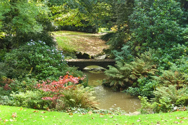
Howard Park
Country parks · 0.9 km

Bulls Head Public House
Historic pubs · 1.0 km

Manor Park Miniature Railway
Miniature railways · 1.3 km

Longdendale
Gorges · 1.3 km
Manor Park, Glossop
Parks · 1.3 km
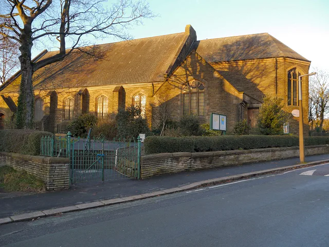
St. Luke's Church, Glossop
Historic churches · 1.4 km
Peak Naze
Mountains & hills · 1.4 km
Nearby
📷 5Caravan parks · East Midlands
Windy Harbour Hotel Caravan and Camping Site
Windy Harbour Hotel Caravan and Camping Site — a caravan park in england east midlands.
📷 3Reservoirs & lochs · East Midlands
Swineshaw Reservoir
Swineshaw Reservoir — reservoir in Derbyshire, England, UK.
📷 5Literary houses · East Midlands
Mouselow Castle
Mouselow Castle — a literary house museum in england east midlands.
📷 5Castles · East Midlands
Glossop Castle
Glossop Castle (also known as Mouselow Castle) is a Norman earthwork north of Glossop, off Hilltop Road, 14 miles (23 km) east of Manchester, on the A57. The site is visible from the main road, standi
📷 5Vineyards · East Midlands
Mouselow Castle
Mouselow Castle — a UK vineyard in england east midlands, producing English or Welsh wine from cool-climate grape varieties.
📷 3Country parks · East Midlands
Howard Park
Howard Park — public park in Glossop, Derbyshire, England, UK.
Where to eat & stay near Glossop Cemetery
Places to stay
📷 5Caravan parks · East Midlands
Windy Harbour Hotel Caravan and Camping Site
Windy Harbour Hotel Caravan and Camping Site — a caravan park in england east midlands.
 📷 5
📷 5Campsites · East Midlands
Crossgate Farm Campsite
Crossgate Farm Campsite — a campsite in england east midlands.
 📷 5
📷 5 📷 5
📷 5Campsites · East Midlands
Crowden Campsite
Crowden Campsite — a campsite in england east midlands.
 📷 5
📷 5Hostels · East Midlands
Crowden Outdoor Education Centre
Crowden Outdoor Education Centre — a hostel in england east midlands.
 📷 5
📷 5Campsites · Yorkshire & the Humber
Boarfold Scout Camp
Boarfold Scout Camp — a campsite in england west midlands.
Places to eat & drink
📷 5Historic pubs · East Midlands
Bulls Head Public House
Bulls Head Public House in England Yorkshire, United Kingdom.
 📷 7
📷 7Historic pubs · East Midlands
The Spinners Arms Public House
The Spinners Arms Public House in England Yorkshire, United Kingdom.
 📷 5
📷 5Historic pubs · East Midlands
Norfolk Arms Public House
Norfolk Arms Public House in England Yorkshire, United Kingdom.
 📷 5
📷 5Historic pubs · East Midlands
The Oakwood and Oakwood Restaurant
The Oakwood and Oakwood Restaurant in England Yorkshire, United Kingdom.
 📷 5
📷 5Historic pubs · East Midlands
Former Dollars Public House
Former Dollars Public House in England Yorkshire, United Kingdom.
 📷 5
📷 5Historic pubs · East Midlands
The Crown Inn, Glossop
The Crown Inn, Glossop in England Yorkshire, United Kingdom.
More cemeteries in this region
 📷 5
📷 5Cemeteries · East Midlands
Elm Cemetery
Elm Cemetery is a cemetery in the United Kingdom.
 📷 5
📷 5Cemeteries · East Midlands
General Cemetery Pocket Park
General Cemetery Pocket Park is a cemetery in the United Kingdom.
 📷 5
📷 5Cemeteries · East Midlands
Wisbech Borough Cemetery
Wisbech Borough Cemetery is a cemetery in the United Kingdom.
 📷 3
📷 3Cemeteries · East Midlands
Abbey Lane Cemetery
Abbey Lane Cemetery is a cemetery in the United Kingdom.
Frequently asked questions
- Where is Glossop Cemetery?
- Glossop Cemetery is in Derbyshire, the East Midlands, United Kingdom (postcode SK13 7QG), in the parish of High Peak, unparished area.
- What is Glossop Cemetery?
- Glossop Cemetery is a cemetery in the United Kingdom.
- How do I get to Glossop Cemetery?
- The nearest railway station is Hadfield, about 1.2 km away. The nearest town is Old Glossop. Drivers can use postcode SK13 7QG.
- Is Glossop Cemetery a protected site?
- Yes — Glossop Cemetery is part of the Dark Peak SSSI Site of Special Scientific Interest.
- Is Glossop Cemetery free to visit?
- Yes, Glossop Cemetery is free to enter.
- How do I get to Glossop Cemetery?
- The nearest railway station is Hadfield, about 1.2 km away. Drivers can navigate to postcode SK13 7QG.