
Historic churches · North West England
Glasserton Parish Church And Churchyard
Glasserton Parish Church And Churchyard — category A listed building-listed church in scotland-lowlands, United Kingdom.

Billy McCrorie — CC BY-SA 2.0 via Wikimedia Commons licence

Plan your visit
- Typical visit
- 30 min–1 h
- Free entry
About
Glasserton Parish Church And Churchyard is a category A listed building-listed church in scotland-lowlands, United Kingdom, registered on the Historic Environment Scotland register (entry LB10137). Listed status protects buildings and structures of special architectural or historic interest. See the linked Wikipedia article for further details.
Photo gallery
Heritage listing
Category A Date Added 20/07/1972 Local Authority Dumfries And Galloway Planning Authority Dumfries And Galloway Parish Glasserton NGR NX 42121 38087 Coordinates 242121, 538087 — 17th century origin, largely rebuilt 1732 as rectangular box, N aisle and tower added 1836 by John Buonarotti Papworth. 17th century bellcote removed form Kirkmaiden Church (Glasserton Parish) to Glasserton in early 19th century. 1732 rectangular church on E-W axis with iasle and tower to N, 1836 giving T-plan. Original part shows signs of much rebuilding and alteration. Rubble walling, polished sandstone margins, later work has uniform red sandstone margins with bold tails. S ELEVATION: symmetrical 4-window front with round-arched windows. Smaller windows to outer bays with 2 large (almost full-height) windows to inner bays, some sash and case all with small-pane glazing. Jambs mainly polished cream sandstone with segmental stones forming arch-heads, possibly later 18th century enlargements. To centre, large blocked round-arched opening original access to pulpit. At upper level flanking outer windows are blocked square headed openings, presumably earlier windows lighting galleries. A worn partly inscribed red sandstone block is re-used as prt of margin to westernmost window. E and W gables have 2 large round arched openings, that to E ground is glazed door. Single bay N aisle with round-arched openings, narrow rubble voussoirs. Sash and case windows with small-pane glazing. Bolection moulded eaves cornice, end skews with skewputts, good graded slate roofs. To W gable small 17th century stone bellcote, weathered date of 1680, originally from Kirkmaiden Church (see separate item). Square section with 4 colonettes at angles and cushion capitals supporting moulded cornice, ogival canopy and ball fi
From Historic Environment Scotland under OGL v3.
Place summary
Glasserton Parish Church and Churchyard is located in the Scottish Lowlands. This site is a category A listed building, noted for its architectural and historical significance.
AI-generated from the structured facts on this page (operator, designation, listing, era). Not a substitute for visiting.
- Coordinates
- 54.7129, -4.4523
- District
- Dumfries and Galloway
- Postcode
- DG8 8LY
- Parliamentary constituency
- Dumfries and Galloway
Sources
- wikidata: Q17570958 (CC0)
Other places nearby

Glasserton Hill
Vineyards · 1.3 km

Port Castle Bay
Natural landmarks · 1.4 km
Glasserton
Villages · 1.4 km
Hill of Glasserton
Mountains & hills · 1.5 km

Fell of Carleton
Mountains & hills · 1.9 km
Fell of Carleton
Mountains & hills · 1.9 km

Rispain Camp
Vineyards · 2.0 km

Rispain Camp
Archaeological sites · 2.0 km

St. Ninian's Cave
Caves · 2.1 km
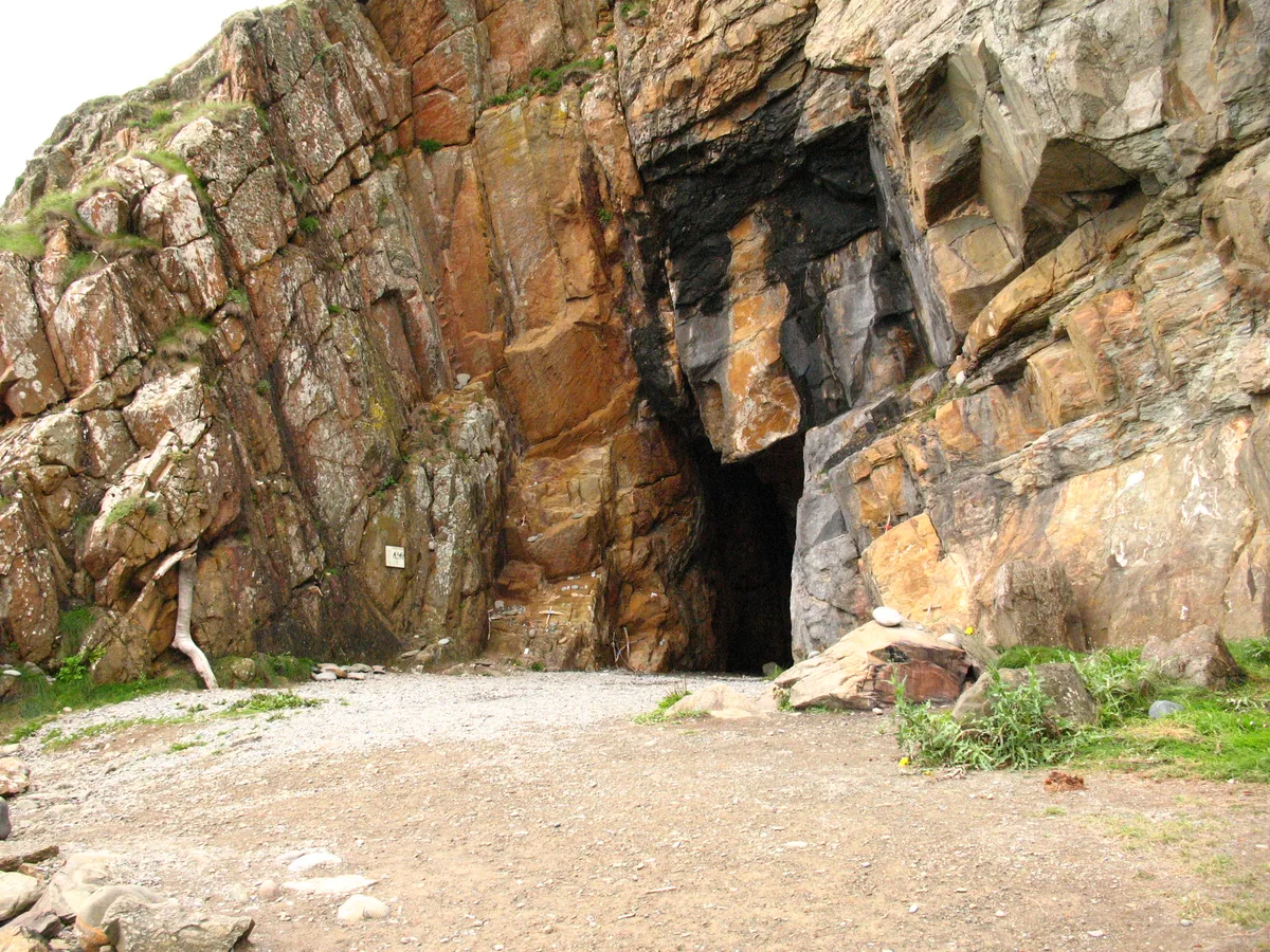
St Ninian's Cave
Mountains & hills · 2.1 km

Laggan Camp
Vineyards · 2.5 km

St Martin and St Ninian Catholic Church
Historic churches · 3.2 km
Nearby
📷 5Vineyards · North West England
Glasserton Hill
Glasserton Hill — a UK vineyard in scotland lowlands, producing English or Welsh wine from cool-climate grape varieties.
📷 5Natural landmarks · North West England
Port Castle Bay
Port Castle Bay — a natural feature in scotland lowlands.
📷 5📷 5Mountains & hills · North West England
Hill of Glasserton
Hill of Glasserton — mountain in scotland lowlands. Elevation: 123 m.
📷 5Mountains & hills · North West England
Fell of Carleton
Fell of Carleton — a hill or mountain in scotland lowlands.
📷 5Mountains & hills · North West England
Fell of Carleton
Fell of Carleton — mountain in scotland lowlands. Elevation: 146 m.
Where to eat & stay near Glasserton Parish Church And Churchyard
Places to stay
 📷 5
📷 5Caravan parks · North West England
Burrowhead Holiday Village
Burrowhead Holiday Village — a caravan park in scotland lowlands.
 📷 5
📷 5Campsites · North West England
Kings Green Caravan Park
Kings Green Caravan Park — a campsite in scotland lowlands.
 📷 5
📷 5Campsites · North West England
Garlieston Lodge Caravan Site
Garlieston Lodge Caravan Site — a campsite in scotland lowlands.
 📷 5
📷 5Campsites · North West England
Garlieston Caravan Club Site
Garlieston Caravan Club Site — a campsite in scotland lowlands.
 📷 5
📷 5Campsites · North West England
DRUMROAMIN FARM CAMPING & CARAVAN SITE
DRUMROAMIN FARM CAMPING & CARAVAN SITE — a campsite in scotland lowlands.
 📷 5
📷 5Caravan parks · North West England
Auchenlarie Holiday Park
Auchenlarie Holiday Park — a caravan park in scotland lowlands.
Places to eat & drink
 📷 7
📷 7Historic pubs · North West England
The Harbour Inn, 18, 19 South Crescent, Garlieston
The Harbour Inn, 18, 19 South Crescent, Garlieston in Scotland Lowlands, United Kingdom.
 📷 7
📷 7Historic pubs · North West England
17 North Main Street, Wigtown
17 North Main Street, Wigtown in Scotland Lowlands, United Kingdom.
 📷 7
📷 7Historic pubs · North West England
The Craighlaw Arms, 23 Main Street, Kirkcowan
The Craighlaw Arms, 23 Main Street, Kirkcowan in Scotland Lowlands, United Kingdom.
More places in this region
 📷 3
📷 3Historic churches · North West England
All Saints Chapel, Somerford
All Saints Chapel, Somerford — church in Cheshire East, Cheshire, England, UK.
 📷 3
📷 3Historic churches · North West England
All Saints Church, Church Lawton
All Saints Church, Church Lawton — Grade II* listed church in Church Lawton, Cheshire East, Cheshire, England, UK.
 📷 3
📷 3Historic churches · North West England
All Saints Church, Scholar Green
All Saints Church, Scholar Green — church in Cheshire East, Cheshire, England, UK.
 📷 3
📷 3Historic churches · North West England
All Saints Church, Siddington
All Saints Church, Siddington — church in Cheshire East, Cheshire, England, UK.
Frequently asked questions
- Where is Glasserton Parish Church And Churchyard?
- Glasserton Parish Church And Churchyard is in the Scottish Lowlands, United Kingdom (postcode DG8 8LY).
- What is Glasserton Parish Church And Churchyard?
- Glasserton Parish Church And Churchyard — category A listed building-listed church in scotland-lowlands, United Kingdom.
- How do I get to Glasserton Parish Church And Churchyard?
- Drivers can use postcode DG8 8LY.
- Is Glasserton Parish Church And Churchyard a listed building?
- Glasserton Parish Church And Churchyard is officially recognised as category A listed building listed.
- Is Glasserton Parish Church And Churchyard free to visit?
- Yes, Glasserton Parish Church And Churchyard is free to enter.
- How do I get to Glasserton Parish Church And Churchyard?
- Drivers can navigate to postcode DG8 8LY. It sits within the Dumfries and Galloway parliamentary constituency.