Mountains & hills · Central Scotland
Gillies Hill
In or near Stirling.
Gillies Hill — Named summit at 170 m.

Wikimedia Commons contributors — see linked file page for photographer and licence licence
Plan your visit
- Typical visit
- 3 h–8 h
- Best time of year
- Late spring – early autumn (May–Oct)
- Nearest railway station
- Stirling · 3.6 km
- Free entry
- Dog-friendly
Getting there & planning your visit
To visit Gillies Hill, you can take a train to Stirling station, which is 3.6 km away. The postcode for navigation is FK7 9QA, and entry is free.
About
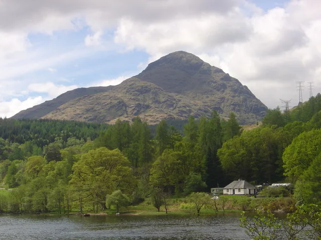
Gillies Hill is a named summit in the United Kingdom. Wikidata describes it as: "Named summit at 170 m.". Coordinates: 56.0992°, -3.9784°.
Photo gallery
From the Wikipedia article
Gillies Hill is located west of Stirling and the M9, south of Cambusbarron, and north of the Bannock Burn in Central Scotland. Gillies Hill covers a 140 hectares (350 acres) crag and tail which rises from a height of 79 metres (259 ft) at the Bannock Burn Bridge near Sauchie Craig to an elevation of 162 m (531 ft) at a point which overlooks the former quarrying operation to the west and Stirling Castle to the east. The hill lies north of the Bannock Burn, northeast of Sauchie Craig (an area designated SSSI, Site of Special Scientific Interest), east of the Touch Hills and Murrayswood, south of Cambusbarron, and west of Stirling and the M9. Gillies Hill is the hill from which Robert the Bruce’s camp followers, or Gillies, descended onto the field of the Battle of Bannockburn in 1314 turning the tide of the battle which granted Scotland nearly 400 years of independence. The majority of Gillies Hill has been classified as a Semi-natural Ancient Woodland by The Woodland Trust using aerial surveys and by a follow-up Phase 1 habitat survey conducted in 2010. To date 21 Scotland & 38 United Kingdom ancient woodland indicator species have been documented on the hill demonstrating that the woodland's understory and sections of its tree cover have been cloaked in woodland for centuries; the earliest mapped confirmation of trees on the site dates back to the 1580s Pont map.
Excerpt from Wikipedia under CC BY-SA 4.0. See the source article linked in Sources below.
- Coordinates
- 56.0992, -3.9784
- District
- Stirling
- Postcode
- FK7 9QA
- Parliamentary constituency
- Stirling and Strathallan
- Nearest railway station
- Stirling — 3.6 km
Sources
- osm: n2624052847 (ODbL)
- wikipedia: Gillies Hill (CC BY-SA 4.0)
- commons: Gillies Hill from below Stirling Castle.jpg (CC BY-SA 4.0)
Other places nearby

Gillies Hill
Vineyards · 0.4 km

Wallstale, dun site
Archaeological sites · 0.6 km

Castlehill, dun site
Archaeological sites · 0.7 km

Wester Craigend, dun site
Archaeological sites · 0.8 km

Polmaise Castle
Castles · 0.8 km

Cambusbarron
Forests & woodlands · 1.3 km

Birkhill House, Stirling
Historic houses · 1.7 km

Middlethird, dun site
Archaeological sites · 1.7 km

homestead 600m SSW of Woodside
Vineyards · 1.7 km

Torbrex
Historic houses · 1.8 km

Middlethird Hill
Mountains & hills · 1.9 km

Castlehill Wood, dun site
Archaeological sites · 2.0 km
Nearby
📷 5Vineyards · Central Scotland
Gillies Hill
Gillies Hill — a UK vineyard in scotland central, producing English or Welsh wine from cool-climate grape varieties.
📷 3Archaeological sites · Central Scotland
Wallstale, dun site
Wallstale, dun site — a archaeological in scotland-central, United Kingdom.
📷 3Archaeological sites · Central Scotland
Castlehill, dun site
Castlehill, dun site — a archaeological in scotland-central, United Kingdom.
📷 3Archaeological sites · Central Scotland
Wester Craigend, dun site
Wester Craigend, dun site — a archaeological in scotland-central, United Kingdom.
📷 3Castles · Central Scotland
Polmaise Castle
Polmaise Castle — a castle in scotland-central, United Kingdom.
📷 4Forests & woodlands · Central Scotland
Cambusbarron
Cambusbarron in Scotland Islands, United Kingdom.
Where to eat & stay near Gillies Hill
Places to stay
 📷 5
📷 5Hostels · Central Scotland
Stirling Youth Hostel
Stirling Youth Hostel — a hostel in scotland central.
 📷 5
📷 5Hostels · Central Scotland
William Wallace Hotel
William Wallace Hotel — a hostel in scotland central.
 📷 5
📷 5Hotels · Central Scotland
Stirling Court Hotel
Stirling Court Hotel — a hotel in scotland central.
 📷 5
📷 5Campsites · Central Scotland
Witches Craig Caravan and Camping Park
Witches Craig Caravan and Camping Park — a campsite in scotland central.
 📷 5
📷 5Campsites · Central Scotland
Blair Drummond Caravan Park
Blair Drummond Caravan Park — a campsite in scotland central.
 📷 6
📷 6Hotels · Central Scotland
DoubleTree by Hilton Hotel Dunblane Hydro
DoubleTree by Hilton Hotel Dunblane Hydro — a hotel in scotland central. 4-star. Brand: DoubleTree.
Places to eat & drink
 📷 6
📷 6Historic pubs · Central Scotland
Westerton Arms, 34 Henderson Street, Bridge of Allan
Westerton Arms, 34 Henderson Street, Bridge of Allan in Scotland Central, United Kingdom.
 📷 6
📷 6Historic pubs · Central Scotland
The Gothenburg
The Gothenburg in Scotland Islands, United Kingdom.
 📷 5
📷 5Historic pubs · Central Scotland
Dennyloanhead
Dennyloanhead in Scotland Islands, United Kingdom.
 📷 7
📷 7Historic pubs · Central Scotland
Johnstone Arms Hotel, 48 Stirling Street, Alva
Johnstone Arms Hotel, 48 Stirling Street, Alva in Scotland Central, United Kingdom.
 📷 5
📷 5Historic pubs · Central Scotland
The Masonic Arms, 62 Main Street, Cumbernauld Village
The Masonic Arms, 62 Main Street, Cumbernauld Village in Scotland Central, United Kingdom.
 📷 7
📷 7Historic pubs · Central Scotland
Ye Olde House Inn, 25-26 Forth Street, Kincardine On Forth
Ye Olde House Inn, 25-26 Forth Street, Kincardine On Forth in Scotland Central, United Kingdom.
More mountains in this region
 📷 3
📷 3 📷 3
📷 3 📷 3
📷 3Mountains & hills · Central Scotland
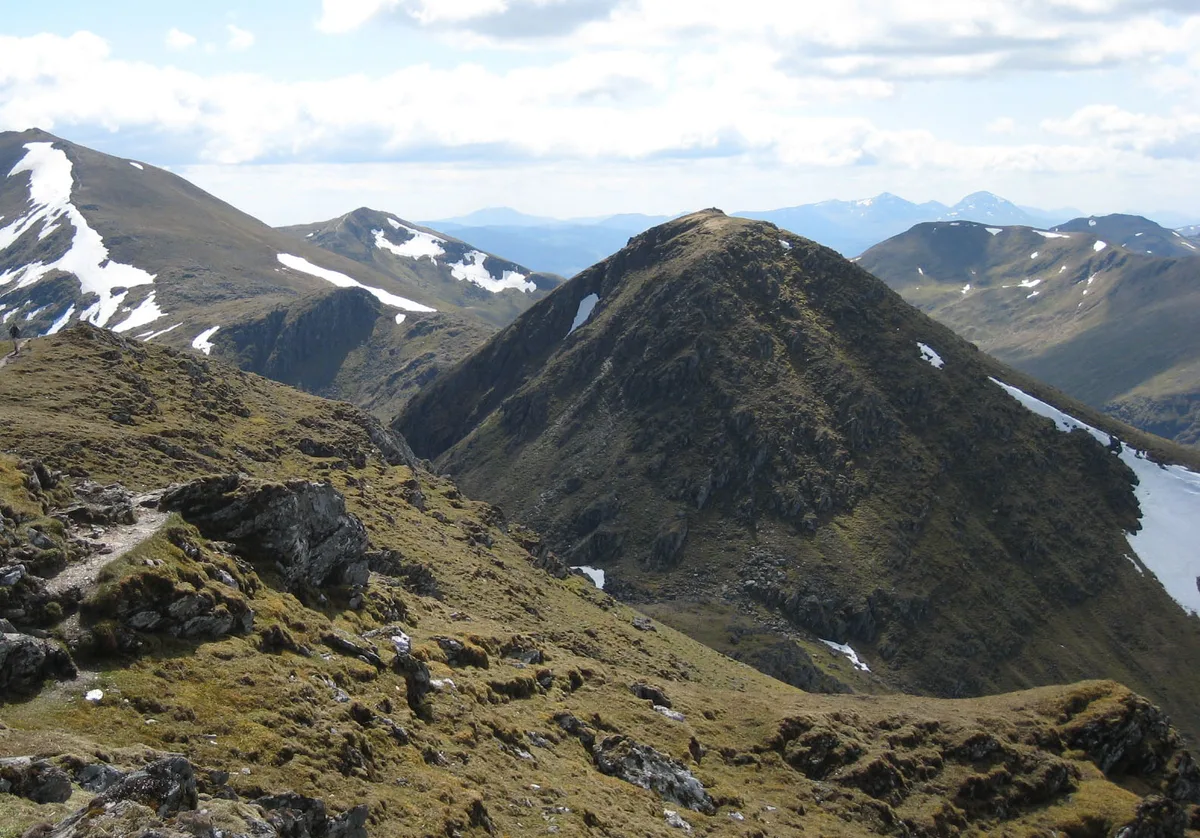
An Caisteal
An Caisteal — Named summit at 995 m.
 📷 5
📷 5Frequently asked questions
- Where is Gillies Hill?
- Gillies Hill is in central Scotland, United Kingdom (postcode FK7 9QA).
- What is Gillies Hill?
- Gillies Hill — Named summit at 170 m.
- How do I get to Gillies Hill?
- The nearest railway station is Stirling, about 3.6 km away. Drivers can use postcode FK7 9QA.
- Is Gillies Hill free to visit?
- Yes, Gillies Hill is free to enter.
- How do I get to Gillies Hill?
- The nearest railway station is Stirling, about 3.6 km away. Drivers can navigate to postcode FK7 9QA.