
Archaeological sites · North West England
Giants Grave
In or near Haverigg.
Giants Grave — archaeological in england north west.

Richard Law — CC BY-SA 2.0 via Wikimedia Commons licence

Plan your visit
- Typical visit
- 45 min–1.5 h
- Nearest railway station
- Silecroft · 1.0 km
About
Giants Grave is a archaeological located in england north west. British historic ruins recorded in OpenStreetMap. Many such sites are scheduled monuments or listed structures.
Photo gallery
Protected designations
- Site of Special Scientific Interest: Duddon Estuary SSSI
- Ramsar wetland: Duddon Estuary
Designations sourced from Natural England open data under OGL v3.
Place summary
Giants Grave is an archaeological site located in North-West England. It features ancient burial mounds that are significant for understanding prehistoric funerary practices. The site provides insights into the region's early inhabitants and their cultural customs. Visitors can explore the area, which is marked by its historical importance and distinctive landscape.
AI-generated from the structured facts on this page (operator, designation, listing, era). Not a substitute for visiting.
- Coordinates
- 54.2183, -3.3262
- District
- Cumberland
- Parish
- Whicham
- Postcode
- LA18 5LN
- Parliamentary constituency
- Barrow and Furness
- Nearest railway station
- Silecroft — 1 km
Sources
- osm: n1388930044 (ODbL)
- wikidata: Q15221652 (CC0)
Other places nearby

Giant's Grave, Cumbria
Stone circles · 0.0 km
Giant's Grave standing stones, Kirksanton
Windmills · 0.0 km

Kirksanton
Villages · 0.5 km

Silecroft
Villages · 1.0 km

Whicham and Silecroft War Memorial
Memorials & monuments · 1.1 km

Silecroft Holiday Park
Caravan parks · 1.2 km
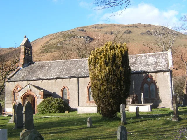
St Mary's Church, Whicham
Historic churches · 1.6 km

Lowscales Hill
Mountains & hills · 1.9 km

RAF Millom
Museums · 2.0 km

Seaness
Viewpoints · 2.1 km

Lakeland Outdoor Club
Campsites · 2.5 km

Millom Park elevated viewing platform
Viewpoints · 3.1 km
Nearby
📷 4Stone circles · North West England
Giant's Grave, Cumbria
Giant's Grave (grid reference SD135810) are two standing stones at the foot of Black Combe in Cumbria, England. The smaller stone has three cup and ring marks whilst the taller has only one. The grave
📷 5Windmills · North West England
Giant's Grave standing stones, Kirksanton
Giant's Grave standing stones, Kirksanton — a post mill in england-north-west, United Kingdom.
📷 5📷 5📷 3Memorials & monuments · North West England
Whicham and Silecroft War Memorial
Whicham and Silecroft War Memorial — Grade II listed building-listed memorial in england-north-west, United Kingdom.
📷 5Caravan parks · North West England
Silecroft Holiday Park
Silecroft Holiday Park — a caravan park in england north west.
Where to eat & stay near Giants Grave
Places to stay
📷 5Caravan parks · North West England
Silecroft Holiday Park
Silecroft Holiday Park — a caravan park in england north west.
📷 5Campsites · North West England
Lakeland Outdoor Club
Lakeland Outdoor Club — a campsite in england north west.
 📷 5
📷 5Caravan parks · North West England
Butterflowers Holiday Park
Butterflowers Holiday Park — a caravan park in england north west.
 📷 5
📷 5Campsites · North West England
Harbour Lights Campsite
Harbour Lights Campsite — a campsite in england north west.
 📷 5
📷 5Caravan parks · North West England
Port Haverigg Holiday Village
Port Haverigg Holiday Village — a caravan park in england north west.
 📷 4
📷 4Campsites · North West England
Baystone Bank Farm Camping Site
Baystone Bank Farm Camping Site — a campsite in england north west.
Places to eat & drink
 📷 5
📷 5Historic pubs · North West England
Chappells Tavern
Chappells Tavern in England North West, United Kingdom.
 📷 5
📷 5Historic pubs · North West England
Furness Abbey Hotel
Furness Abbey Hotel in England North West, United Kingdom.
 📷 5
📷 5Historic pubs · North West England
Blacksmiths Arms
Blacksmiths Arms in England North West, United Kingdom.
 📷 5
📷 5Historic pubs · North West England
The Lord Ramsden Public House
The Lord Ramsden Public House in England North West, United Kingdom.
 📷 7
📷 7 📷 5
📷 5Historic pubs · North West England
Crofters Public House
Crofters Public House in England North West, United Kingdom.
More archaeological sites in this region
 📷 3
📷 3Archaeological sites · North West England
Early medieval sculptural fragments in St Mary's churchyard
Early medieval sculptural fragments in St Mary's churchyard — archaeological site in Sandbach, Cheshire East, England, UK.
 📷 3
📷 3Archaeological sites · North West England
Gaddum's Wood
Gaddum's Wood is a archaeological site in the United Kingdom.
 📷 3
📷 3Archaeological sites · North West England
Marton moated monastic grange, three fishponds, connecting channels and base of stone cross
Marton moated monastic grange, three fishponds, connecting channels and base of stone cross — archaeological site in Whitegate and Marton, Cheshire West and Chester, England, UK.
 📷 3
📷 3Archaeological sites · North West England
St Oswalds Well
St Oswalds Well — a archaeological in england-west-midlands, United Kingdom.
Frequently asked questions
- Where is Giants Grave?
- Giants Grave is in North-West England, United Kingdom (postcode LA18 5LN), in the parish of Whicham.
- What is Giants Grave?
- Giants Grave — archaeological in england north west.
- How do I get to Giants Grave?
- The nearest railway station is Silecroft, about 1.0 km away. Drivers can use postcode LA18 5LN.
- Is Giants Grave a protected site?
- Yes — Giants Grave is part of the Duddon Estuary SSSI Site of Special Scientific Interest and the Duddon Estuary Ramsar wetland.
- How do I get to Giants Grave?
- The nearest railway station is Silecroft, about 1.0 km away. Drivers can navigate to postcode LA18 5LN.