
Holy wells · East Midlands
Gateway And Flanking Walls At Minster Churchyard
In or near Halloughton.
Gateway And Flanking Walls At Minster Churchyard — Grade II* listed gateway and walls in Southwell, Nottinghamshire, England, UK.
.jpg?width=1200)
Wikimedia Commons contributors — see linked file page for photographer and licence licence
.jpg)
Plan your visit
- Typical visit
- 15 min–30 min
- Nearest railway station
- Fiskerton · 3.5 km
- Free entry
- Dog-friendly
About
Gateway And Flanking Walls At Minster Churchyard is a holy well in the United Kingdom. Heritage designation: Grade II* listed building. Part of Southwell Minster. Wikidata describes it as: "Grade II* listed gateway and walls in Southwell, Nottinghamshire, England, UK". Coordinates: 53.0772°, -0.9559°.
Photo gallery
Place summary
The Gateway and Flanking Walls at Minster Churchyard are located in Southwell, Nottinghamshire, in the East Midlands. This structure is designated as a Grade II* listed building, highlighting its architectural significance and historical importance within the churchyard.
AI-generated from the structured facts on this page (operator, designation, listing, era). Not a substitute for visiting.
- Coordinates
- 53.0772, -0.9559
- County
- Nottinghamshire
- District
- Newark and Sherwood
- Parish
- Southwell
- Postcode
- NG25 0JJ
- Parliamentary constituency
- Newark
- Nearest railway station
- Fiskerton — 3.5 km
Sources
- wikidata: Q17547726 (CC0)
- commons: West gateway to the Minster churchyard, Southwell (geograph 7045551).jpg (CC BY-SA 4.0)
Other places nearby

Saracen's Head
Hotels · 0.1 km
Southwell
Villages · 0.1 km

Southwell, Nottinghamshire
Museums · 0.1 km

Southwell Minster
Cathedrals · 0.1 km

Burgage Hill
Vineyards · 0.4 km

Potwell Dyke Bridge
Historic bridges · 0.4 km

Southwell War Memorial
Memorials & monuments · 0.5 km

Holy Trinity Church, Southwell
Historic churches · 0.5 km

The Workhouse, Southwell
Museums · 1.2 km

Maythorne caravan site & fishing lakes
Campsites · 1.7 km
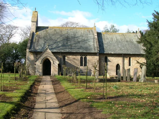
St James' Church, Halloughton
Historic churches · 2.3 km
.jpg?width=1200)
Newark and Sherwood
Museums · 2.6 km
Nearby
📷 5Hotels · East Midlands
Saracen's Head
Saracen's Head — a hotel in england east midlands.
📷 5📷 5Museums · East Midlands
Southwell, Nottinghamshire
Southwell, Nottinghamshire — a museum in england-east-midlands, United Kingdom.
📷 4Cathedrals · East Midlands
Southwell Minster
Southwell Minster — a Grade I-listed cathedral in england-east-midlands, United Kingdom.
📷 5Vineyards · East Midlands
Burgage Hill
Burgage Hill — a UK vineyard in england east midlands, producing English or Welsh wine from cool-climate grape varieties.
📷 3Historic bridges · East Midlands
Potwell Dyke Bridge
Potwell Dyke Bridge — Grade II listed building-listed bridge in england-east-midlands, United Kingdom.
Where to eat & stay near Gateway And Flanking Walls At Minster Churchyard
Places to stay
📷 5Hotels · East Midlands
Saracen's Head
Saracen's Head — a hotel in england east midlands.
📷 5Campsites · East Midlands
Maythorne caravan site & fishing lakes
Maythorne caravan site & fishing lakes — a campsite in england east midlands.
 📷 5
📷 5 📷 3
📷 3Campsites · East Midlands
Robin Hood's Retreat
Robin Hood's Retreat — a campsite in england east midlands.
 📷 5
📷 5 📷 5
📷 5Campsites · East Midlands
Lurcher Farm Cottage Camping & Caravanning Site
Lurcher Farm Cottage Camping & Caravanning Site — a campsite in england east midlands.
Places to eat & drink
 📷 5
📷 5 📷 7
📷 7Historic pubs · East Midlands
The Spring House Public House
The Spring House Public House in England East Midlands, United Kingdom.
 📷 5
📷 5Historic pubs · East Midlands
The Watermill Public House
The Watermill Public House in England East Midlands, United Kingdom.
 📷 5
📷 5Restaurants · East Midlands
Victoria Fish Bar
Victoria Fish Bar — a restaurant in england east midlands. Cuisine: fish and chips.
 📷 5
📷 5Historic pubs · East Midlands
The Woolpack Public House
The Woolpack Public House in England East Midlands, United Kingdom.
 📷 5
📷 5Restaurants · East Midlands
The Ram
The Ram — a restaurant in england east midlands.
More places in this region
_(geograph_7136563).jpg?width=1200) 📷 5
📷 5Holy wells · East Midlands
Wall And Gatepiers To Barn Hill House
Wall And Gatepiers To Barn Hill House — wall in Stamford, South Kesteven, England, UK.
_(geograph_7158446).jpg?width=1200) 📷 5
📷 5Holy wells · East Midlands
Wall And Gates To No 2
Wall And Gates To No 2 — wall in Stamford, South Kesteven, England, UK.
 📷 3
📷 3Holy wells · East Midlands
Boundary Wall Extending Along Eastern Boundary Of Footpath Between Number 65 And The Churchyard Of St Bartholomew's Church
Boundary Wall Extending Along Eastern Boundary Of Footpath Between Number 65 And The Churchyard Of St Bartholomew's Church — wall in Chesterfield, Derbyshire, England, UK.
 📷 3
📷 3Holy wells · East Midlands
Close Wall between Number 16a Minster Yard and the Deanery
Close Wall between Number 16a Minster Yard and the Deanery — Grade I listed wall in Lincoln, United Kingdom.
Frequently asked questions
- Where is Gateway And Flanking Walls At Minster Churchyard?
- Gateway And Flanking Walls At Minster Churchyard is in Nottinghamshire, the East Midlands, United Kingdom (postcode NG25 0JJ), in the parish of Southwell.
- What is Gateway And Flanking Walls At Minster Churchyard?
- Gateway And Flanking Walls At Minster Churchyard — Grade II* listed gateway and walls in Southwell, Nottinghamshire, England, UK.
- How do I get to Gateway And Flanking Walls At Minster Churchyard?
- The nearest railway station is Fiskerton, about 3.5 km away. The nearest town is Halloughton. Drivers can use postcode NG25 0JJ.
- Is Gateway And Flanking Walls At Minster Churchyard a listed building?
- Gateway And Flanking Walls At Minster Churchyard is officially recognised as Grade II* listed building listed.
- Is Gateway And Flanking Walls At Minster Churchyard free to visit?
- Yes, Gateway And Flanking Walls At Minster Churchyard is free to enter.
- How do I get to Gateway And Flanking Walls At Minster Churchyard?
- The nearest railway station is Fiskerton, about 3.5 km away. Drivers can navigate to postcode NG25 0JJ.