
Holy wells · Scottish Islands
Funzie Girt
In or near Uyeasound.
Funzie Girt — ancient dividing wall running from north to south across Fetlar, Shetland Islands, Scotland, UK.

Wikimedia Commons contributors — see linked file page for photographer and licence licence

Plan your visit
- Typical visit
- 15 min–30 min
- Free entry
- Dog-friendly
About
Funzie Girt is a holy well in the United Kingdom. Heritage designation: scheduled monument. Wikidata describes it as: "ancient dividing wall running from north to south across Fetlar, Shetland Islands, Scotland, UK". Coordinates: 60.6244°, -0.8705°.
Photo gallery
From the Wikipedia article
Funzie Girt (; Scots: Funyie Girt "Finns' dyke") is an ancient dividing wall that was erected from north to south across the island of Fetlar in Shetland, Scotland. Some sources describe it as having been built in the Neolithic, but the date of construction is not certainly known. The line of the wall, which ran for over 4 kilometres (2.5 mi), once divided the island in two almost equal sections. Also known as the Finnigirt Dyke, it has vanished in places at the southern end, although the ruins are clearly visible along much of the uninhabited north of the island, where it is a conspicuous feature of the landscape. The dyke's original purpose is not known, nor is its relationship to other archaeological sites of a similar age nearby. There are various folk tales about its construction, and it is the subject of various pieces of Shetland folk music.
Excerpt from Wikipedia under CC BY-SA 4.0. See the source article linked in Sources below.
Background
History
A strip of land 1 km wide that ran along the dyke's eastern side was once known as "Houbie", now the name of Fetlar's principal settlement. The northern, and most complete section of Funzie Girt has been protected as a scheduled monument since December 1957. The notification to Sir Harold Stanley Nicolson of Brough Lodge, Fetlar states that the protected area is "2000 yards or thereby" (i.e. about 1,828 metres) in extent. The text provides a detailed description and the associated map indicates the line of the wall. No land on either side is included. The scheduled area is however contiguous with that of the "irregular polygon" surrounding Whilsa Pund that received similar protection in…
Architecture
]] The date of construction is unknown. Haswell-Smith (2004) speculatively implies a Mesolithic provenance and a Bronze Age date has also been mentioned although the Neolithic is quoted by some authoritative sources. However the distinction between the Neolithic and Bronze Ages is not especially marked in Shetland and a date prior to the 1st millennium BC is likely. There are numerous old boundary dykes in Shetland and Funzie Girt is considered to be the best surviving example. It both divides the island west to east and also marks an upland/lower land boundary, with the higher slopes of Vord Hill to the east of the dyke. It is constructed from local stones with the largest slabs and…
Sourced from Wikipedia under CC BY-SA 4.0.
- Coordinates
- 60.6244, -0.8705
- Address
- Shetland, Scotland, UK
- Established
- 1500
Sources
- wikidata: Q5509428 (CC0)
- wikipedia: Funzie Girt (CC BY-SA 4.0)
- commons: Coastline east of Hamars Ness, Fetlar - geograph.org.uk - 1028202.jpg (CC BY-SA 4.0)
Other places nearby

Vord Hill
Mountains & hills · 0.5 km
Vord Hill
Mountains & hills · 0.6 km

Whilsa Pund
Historic houses · 1.0 km

Busta Hill
Mountains & hills · 1.6 km

Hjaltadans
Archaeological sites · 1.6 km
Haltadans
Stone circles · 1.6 km

Daaey
Islands · 1.9 km

Busta Pund, promontory fort
Archaeological sites · 2.0 km

Hamara Field
Mountains & hills · 2.1 km

Hill of Mongirsdale
Mountains & hills · 2.5 km

Urie Lingey
Islands · 2.7 km
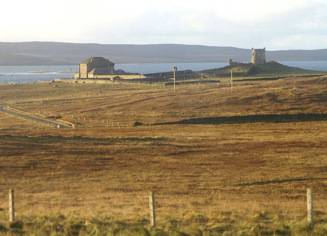
Fetlar
Islands · 2.7 km
Nearby
📷 5📷 5Mountains & hills · Scottish Islands
Vord Hill
Vord Hill — mountain in scotland islands. Elevation: 159 m.
📷 3Historic houses · Scottish Islands
Whilsa Pund
Whilsa Pund — a historic house in Scottish Islands, United Kingdom.
📷 5Mountains & hills · Scottish Islands
Busta Hill
Busta Hill — mountain in scotland islands. Elevation: 124 m.
📷 3Archaeological sites · Scottish Islands
Hjaltadans
Hjaltadans — an archaeological site in Scottish Islands, United Kingdom.
📷 4Where to eat & stay near Funzie Girt
Places to stay
 📷 5
📷 5Hostels · Scottish Islands
Aithbank Camping Böd
Aithbank Camping Böd — a hostel in scotland islands.
 📷 5
📷 5Caravan parks · Scottish Islands
Gardiesfauld Caravan Park
Gardiesfauld Caravan Park — a caravan park in scotland islands.
 📷 5
📷 5Campsites · Scottish Islands
Gardiesfauld Campsite
Gardiesfauld Campsite — a campsite in scotland islands.
 📷 5
📷 5 📷 5
📷 5 📷 5
📷 5Campsites · Scottish Islands
Burravoe Pier Trust Campsite
Burravoe Pier Trust Campsite — a campsite in scotland islands.
Frequently asked questions
- Where is Funzie Girt?
- Funzie Girt is in the Scottish Islands, United Kingdom.
- What is Funzie Girt?
- Funzie Girt — ancient dividing wall running from north to south across Fetlar, Shetland Islands, Scotland, UK.
- How do I get to Funzie Girt?
- The nearest town is Uyeasound. Its coordinates are 60.6244°, -0.8705°.
- When was Funzie Girt built?
- Built or established in 1500.
- Is Funzie Girt a listed building?
- Funzie Girt is officially recognised as scheduled monument listed.
- Is Funzie Girt free to visit?
- Yes, Funzie Girt is free to enter.