Towns & cities · South East England
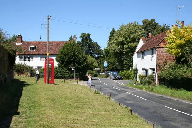
Froyle
Froyle — village in Hampshire, England.

Wikimedia Commons contributors — see linked file page for photographer and licence licence
Plan your visit
- Typical visit
- 3 h–6 h
- Nearest railway station
- Bentley · 3.3 km
- Free entry
- Family-friendly
- Dog-friendly
Getting there & planning your visit
To visit Froyle, the nearest railway station is Bentley, located 3.3 km away. The postcode for navigation is GU34 4NH. Entry to the town is free.
About
Froyle is a town, city, village or settlement in the United Kingdom. Recent population estimates put it at around 644 people. Wikidata describes it as: "village in Hampshire, England". Coordinates: 51.1858°, -0.9151°.
Photo gallery
See it from the streetimagery from 2021
Imagery © Mapillary contributors, CC BY-SA 4.0
From the Wikipedia article
Froyle is a village and civil parish in the East Hampshire district of Hampshire, England. It is 3.6 miles (5.8 km) northeast of Alton. The nearest railway station is 2 miles (3.3 km) east of the village, at Bentley. According to the 2011 census, the parish had a population of 644 people. The village is divided into Upper Froyle, centred around the Church and Manor House, and Lower Froyle which grew up around the farms.
Excerpt from Wikipedia under CC BY-SA 4.0. See the source article linked in Sources below.
Background
History
Froyle is situated on the edge of The Downs above the Pilgrims' Way that leads from Winchester to Canterbury. It is most likely that, in the winter months, the actual route taken by Pilgrims passed through the village to avoid the wet conditions in the valley of the River Wey. There was a Church at "Froli" (mentioned in the Domesday Book) in 1086. The entry for Froyle also states "Froyle, it was ever there...." and there are traces of habitation on the surrounding downs going back to the Iron Age. It is also known by some who live there as the 'village of the saints' because of the 19 statues of saints in niches on the front walls of houses and other buildings in Upper Froyle. They were…
Sourced from Wikipedia under CC BY-SA 4.0.
- Coordinates
- 51.1858, -0.9151
- County
- Hampshire
- District
- East Hampshire
- Parish
- Froyle
- Postcode
- GU34 4NH
- Parliamentary constituency
- East Hampshire
- Population
- 644
- Nearest railway station
- Bentley — 3.3 km
Sources
- wikidata: Q2108131 (CC0)
- wikipedia: Froyle (CC BY-SA 4.0)
- commons: Exterior of St Mary's Church, Upper Froyle.jpg (CC BY-SA 4.0)
Other places nearby

Lower Froyle
Villages · 0.4 km

Saintbury Hill
Mountains & hills · 0.5 km

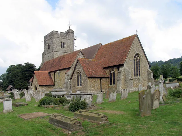
Church of St Mary of the Assumption
Historic churches · 0.7 km
.jpg?width=1200)
Coldrey
Historic houses · 1.2 km

Hen And Chicken Public House
Historic pubs · 1.3 km

Crest Hill
Mountains & hills · 2.0 km

Froyle
Villages · 2.2 km

The Battery
Literary houses · 2.7 km

Bentley
Towns & cities · 2.8 km

Binsted War Memorial
Memorials & monuments · 2.9 km

Penley Copse
Castles · 2.9 km

River Hill
Mountains & hills · 3.3 km
Froyle is a village located in Hampshire, South East England, with a population of 644. Our guide lists N nearby attractions within reach.
At a glance
- Population
- 644
- Administrative county
- Hampshire
- Constituency
- East Hampshire
- Top categories near here
Things to see in Froyle
12 attractions within 12 km. Full guide: things to do in Froyle →
📷 5Historic churches · South East England
Church of St Mary of the Assumption
Church of St Mary of the Assumption — church in Froyle, Hampshire, UK.
📷 5Historic houses · South East England
Coldrey
Coldrey — house in Bentley, East Hampshire, England, UK.

Manor houses · South East England
Swaines Hill Manor
Swaines Hill Manor — a manor in england-south-east, United Kingdom.
📷 5Memorials & monuments · South East England
Binsted War Memorial
Binsted War Memorial — Grade II listed building-listed memorial in england-south-east, United Kingdom.
 📷 5
📷 5Natural landmarks · South East England
Lord Wandsworth College
Lord Wandsworth College — a school heritage in england-south-east, United Kingdom.
📷 5Literary houses · South East England
The Battery
The Battery — a literary house museum in england south east.
📷 5📷 5 📷 5
📷 5Mountains & hills · South East England
Holybourne Down
Holybourne Down — a hill or mountain in england south east.
📷 5Mountains & hills · South East England
Crest Hill
Crest Hill — mountain in england south east. Elevation: 188 m.
📷 5Mountains & hills · South East England
Saintbury Hill
Saintbury Hill — mountain in england south east. Elevation: 219 m.
📷 5Historic pubs · South East England
Hen And Chicken Public House
Hen And Chicken Public House in England South East, United Kingdom.
Nearby
📷 5📷 5Mountains & hills · South East England
Saintbury Hill
Saintbury Hill — mountain in england south east. Elevation: 219 m.
📷 5Historic churches · South East England
Church of St Mary of the Assumption
Church of St Mary of the Assumption — church in Froyle, Hampshire, UK.
📷 5Historic houses · South East England
Coldrey
Coldrey — house in Bentley, East Hampshire, England, UK.
📷 5Historic pubs · South East England
Hen And Chicken Public House
Hen And Chicken Public House in England South East, United Kingdom.
📷 5Mountains & hills · South East England
Crest Hill
Crest Hill — mountain in england south east. Elevation: 188 m.
Where to eat & stay near Froyle
Places to stay
 📷 7
📷 7Hotels · South East England
Alton House Hotel
Alton House Hotel — a hotel in england south east.
 📷 7
📷 7 📷 5
📷 5 📷 5
📷 5 📷 5
📷 5Campsites · South East England
Fox & Goose Campsite
Fox & Goose Campsite — a campsite in england south east.
 📷 5
📷 5Places to eat & drink
📷 5Historic pubs · South East England
Hen And Chicken Public House
Hen And Chicken Public House in England South East, United Kingdom.
 📷 6
📷 6 📷 5
📷 5Historic pubs · South East England
The 'Eight Bells' Public House
The 'Eight Bells' Public House in England South East, United Kingdom.
 📷 5
📷 5 📷 7
📷 7Restaurants · South East England
The Bengal Lounge
The Bengal Lounge — a restaurant in england south east.
 📷 5
📷 5Historic pubs · South East England
The Waterwitch
The Waterwitch in England South East, United Kingdom.
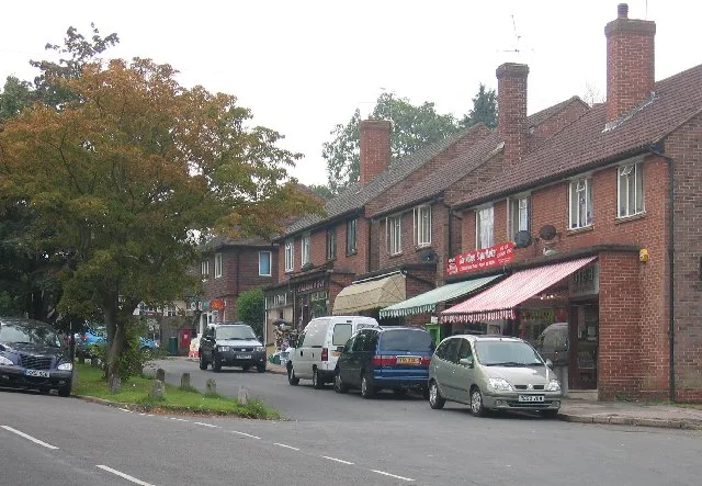
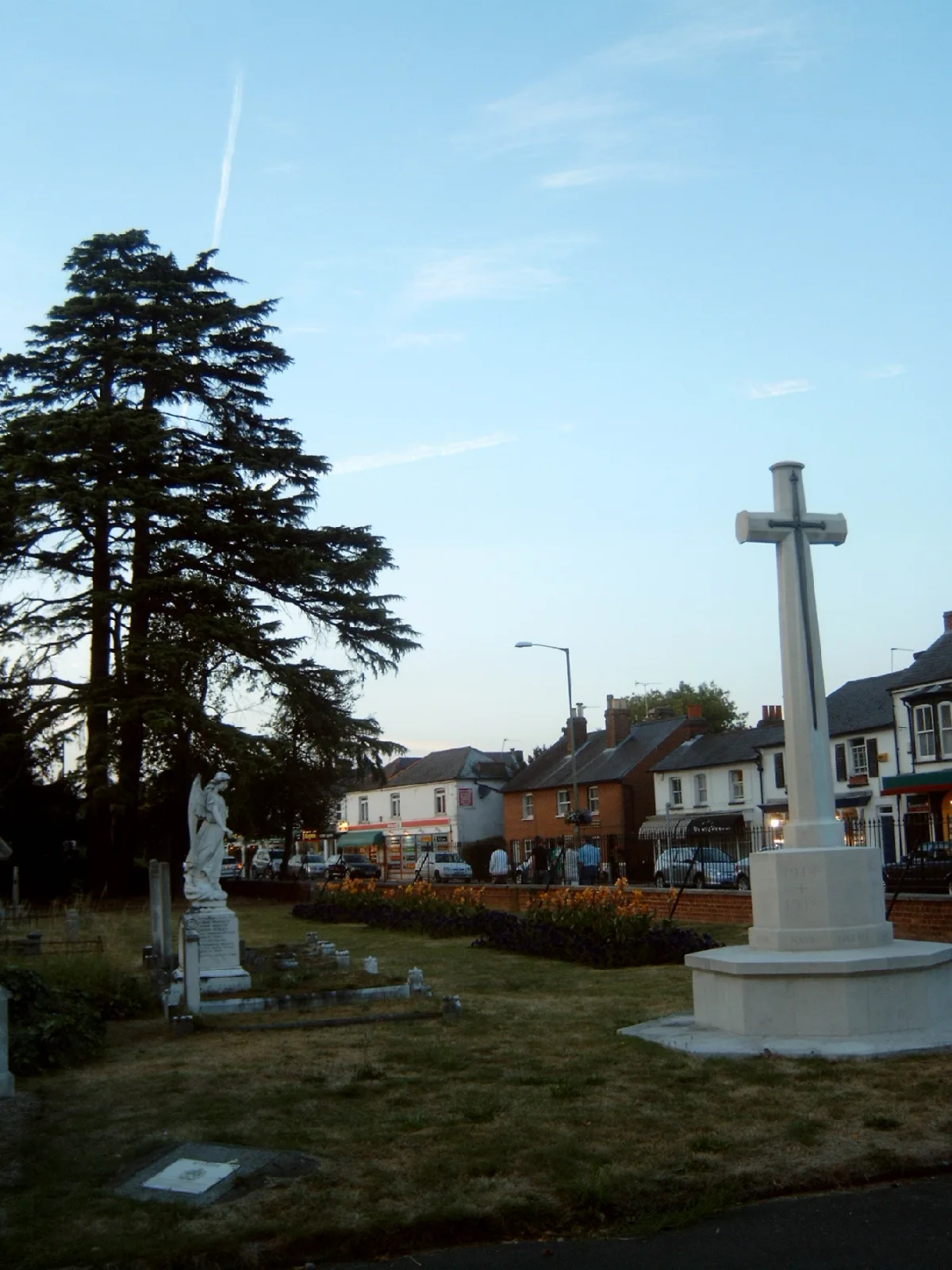
More towns in this region
 Flagship📷 10
Towns & cities · South East England
Betchworth
Betchworth — village and civil parish in the Mole Valley district of Surrey, England.
 Flagship📷 10
Towns & cities · South East England
Boxley
Boxley — village and civil parish in Maidstone District, Kent, England, UK.
 Flagship📷 10
Towns & cities · South East England
Effingham
Effingham — village and civil parish in Guildford borough, Surrey, England, UK.
 Flagship📷 10
Towns & cities · South East England
Englefield Green
Englefield Green — village in the borough of Runnymede, Surrey, UK.
Frequently asked questions
- Where is Froyle?
- Froyle is in Hampshire, South-East England, United Kingdom (postcode GU34 4NH), in the parish of Froyle.
- What is Froyle?
- Froyle — village in Hampshire, England.
- How do I get to Froyle?
- The nearest railway station is Bentley, about 3.3 km away. Drivers can use postcode GU34 4NH.
- Is Froyle free to visit?
- Yes, Froyle is free to enter.
- How do I get to Froyle?
- The nearest railway station is Bentley, about 3.3 km away. Drivers can navigate to postcode GU34 4NH.