
Castles · North West England
Frodsham
In or near Daresbury.
Frodsham is a market town, civil parish, and electoral ward in the unitary authority of Cheshire West and Chester and the ceremonial county of Cheshire, England. Its population in 2021 was 9,300. It

Eirian Evans — CC BY-SA 2.0 via Wikimedia Commons licence

Plan your visit
- Typical visit
- 1.5 h–3 h
- Nearest railway station
- Frodsham · 0.4 km
- Family-friendly
- Limited wheelchair access
Getting there & planning your visit
To visit Frodsham Castle, the nearest railway station is Frodsham, located 0.4 km away. The postcode for navigation is WA6 7DF. Please note that wheelchair accessibility is limited.
About
Frodsham is a market town, civil parish, and electoral ward in the unitary authority of Cheshire West and Chester and the ceremonial county of Cheshire, England. Its population in 2021 was 9,300. It is 14 miles (23 km) south east of Liverpool and 28 miles (45 km) southwest of Manchester. The River Weaver runs to its northeast and on the west it overlooks the estuary of the River Mersey. The A56 road and the Chester–Manchester railway line pass through the town, and the M56 motorway passes to the northwest. In the medieval era, Frodsham was an important borough and port belonging to the Earls of Chester. Its parish church, St. Laurence's, still exhibits evidence of a building present in the 12th century in its nave and is referenced in the Domesday Book. A market is held each Thursday, and Frodsham's viability as a trading centre was emphasised by the presence of the "big five" clearing banks and several building societies, though the branches of HSBC and NatWest have recently closed. Development in the town's shops and premises with alcohol licences is evident through the opening or modernisation of contemporary-style bar, restaurants, take-aways, and public houses since 2002, and in the continued presence of small, specialised, businesses operating from town-centre shops.
Photo gallery
From the Wikipedia article
Frodsham is a market town, civil parish, and electoral ward in the unitary authority of Cheshire West and Chester and the ceremonial county of Cheshire, England. Its population in 2021 was 9,300. It is 14 miles (23 km) south east of Liverpool and 28 miles (45 km) southwest of Manchester. The River Weaver runs to its northeast and on the west it overlooks the estuary of the River Mersey. The A56 road and the Chester–Manchester railway line pass through the town, and the M56 motorway passes to the northwest. In the medieval era, Frodsham was an important borough and port belonging to the Earls of Chester. Its parish church, St. Laurence's, still exhibits evidence of a building present in the 12th century in its nave and is referenced in the Domesday Book. A market is held each Thursday, and Frodsham's viability as a trading centre was emphasised by the presence of the "big five" clearing banks and several building societies, though the branches of HSBC and NatWest have recently closed. Development in the town's shops and premises with alcohol licences is evident through the opening or modernisation of contemporary-style bar, restaurants, take-aways, and public houses since 2002, and in the continued presence of small, specialised, businesses operating from town-centre shops.
Excerpt from Wikipedia under CC BY-SA 4.0. See the source article linked in Sources below.
Background
History
Frodsham Hill is the location of an Iron Age promontory fort, the outline of which can still be seen. The town is of Saxon origin; its 11th-century church is mentioned in the Domesday Book. Frodsham was an important manor of the medieval Earls of Chester and was created a borough in the early 13th century, probably by Earl Ranulf III. The mouth of the River Weaver, where it joins the Mersey, made Frodsham into a significant port for the coasting trade, particularly for the export of Cheshire salt, brought down the river from Northwich and Nantwich. The site of the manor house was in Castle Park; the building was of stone and was fortified. In an account of 1315 it is called 'castellum'…
Sourced from Wikipedia under CC BY-SA 4.0.
- Coordinates
- 53.2947, -2.7289
- District
- Cheshire West and Chester
- Parish
- Frodsham
- Postcode
- WA6 7DF
- Parliamentary constituency
- Runcorn and Helsby
- Nearest railway station
- Frodsham — 0.4 km
Sources
- wikipedia: Frodsham (CC BY-SA 4.0)
Other places nearby

Brook Stone
Natural landmarks · 0.1 km

Frodsham School
Natural landmarks · 0.2 km

Bear's Paw Hotel, Frodsham
Historic pubs · 0.2 km
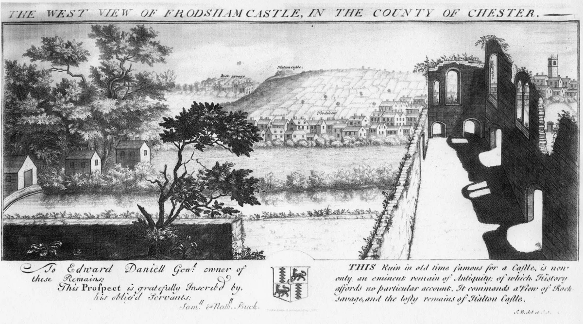
Frodsham Castle
Castles · 0.3 km

Castle Park House
Parks · 0.3 km

Frodsham railway station
Heritage railway stations · 0.4 km

Graceland Park
Caravan parks · 0.5 km

Frodsham War Memorial
Viewpoints · 0.8 km

Frodsham War Memorial
Memorials & monuments · 0.8 km

Mersey View
Viewpoints · 0.8 km

War memorial cross in the churchyard of St Laurence's Church
Memorials & monuments · 0.8 km
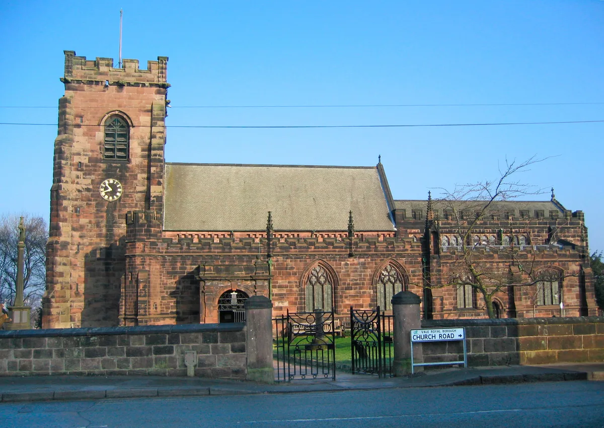
St Laurence's Church, Frodsham
Historic churches · 0.8 km
Nearby
📷 3Natural landmarks · North West England
Brook Stone
Brook Stone — a other in wales-north, United Kingdom.
📷 5Natural landmarks · North West England
Frodsham School
Frodsham School — a school heritage in wales-north, United Kingdom.
📷 5Historic pubs · North West England
Bear's Paw Hotel, Frodsham
Bear's Paw Hotel, Frodsham in Wales North, United Kingdom.
📷 3📷 5Parks · North West England
Castle Park House
Castle Park House is a former country house surrounded by extensive grounds in the market town of Frodsham in Cheshire, England. It is reputedly built on the site of Frodsham Castle, and originates fr
📷 5Heritage railway stations · North West England
Frodsham railway station
Frodsham railway station — a Grade II*-listed railway station in wales-north, United Kingdom.
Where to eat & stay near Frodsham
Places to stay
📷 5 📷 5
📷 5Caravan parks · North West England
The Old Pumping Station
The Old Pumping Station — a caravan park in wales north.
 📷 5
📷 5Caravan parks · North West England
The Ridgeway Country Holiday Park
The Ridgeway Country Holiday Park — a caravan park in wales north.
 📷 5
📷 5Caravan parks · North West England
Small Acre Caravan Park
Small Acre Caravan Park — a caravan park in wales north.
 📷 5
📷 5Caravan parks · North West England
Rangeway Bank Farm
Rangeway Bank Farm — a caravan park in wales north.
 📷 5
📷 5Places to eat & drink
📷 5Historic pubs · North West England
Bear's Paw Hotel, Frodsham
Bear's Paw Hotel, Frodsham in Wales North, United Kingdom.
 📷 3
📷 3Historic pubs · North West England
Tricorn
Tricorn — Historic pub — listed building or notable heritage status.
 📷 5
📷 5Historic pubs · North West England
Castle Hotel, Halton
Castle Hotel, Halton in Wales North, United Kingdom.
 📷 5
📷 5Historic pubs · North West England
The Norton Arms Public House
The Norton Arms Public House in Wales North, United Kingdom.
 📷 5
📷 5Historic pubs · North West England
Rake Hall
Rake Hall in Wales North, United Kingdom.
 📷 5
📷 5Historic pubs · North West England
Allerton Hall
Allerton Hall in Wales North, United Kingdom.
More castles in this region
 📷 3
📷 3Castles · North West England
Manchester Castle
Manchester Castle — medieval fortified manor house in England.
 📷 5
📷 5Castles · North West England
Mow Cop Castle
Mow Cop Castle — folly on the Cheshire and Staffordshire border, England, UK.
 📷 3
📷 3 📷 3
📷 3Castles · North West England
Ullerwood Castle
Ullerwood Castle — castle in Greater Manchester, England.
Frequently asked questions
- Where is Frodsham?
- Frodsham is in North Wales, United Kingdom (postcode WA6 7DF), in the parish of Frodsham.
- What is Frodsham?
- Frodsham is a market town, civil parish, and electoral ward in the unitary authority of Cheshire West and Chester and the ceremonial county of Cheshire, England. Its population in 2021 was 9,300. It
- How do I get to Frodsham?
- The nearest railway station is Frodsham, about 0.4 km away. Drivers can use postcode WA6 7DF.
- Does Frodsham charge admission?
- Frodsham typically charges admission. Check the official site for current ticket prices and opening hours.
- How do I get to Frodsham?
- The nearest railway station is Frodsham, about 0.4 km away. Drivers can navigate to postcode WA6 7DF.