
Natural landmarks · South East England
Frank Montgomery School
In or near Sturry.
Frank Montgomery School — a school heritage in england-south-east, United Kingdom.

David Anstiss — CC BY-SA 2.0 via Wikimedia Commons licence

Plan your visit
- Typical visit
- 1 h–2 h
- Nearest railway station
- Sturry · 2.2 km
- Free entry
- Dog-friendly
About
Frank Montgomery School is a school heritage located in england-south-east, United Kingdom. Catalogued from Wikidata's UK heritage register; see the Wikipedia article for further historical and visitor details.
Photo gallery
Protected designations
- Site of Special Scientific Interest: Stodmarsh SSSI
- National Nature Reserve: BLEAN WOODS
- Area of Outstanding Natural Beauty: Kent Downs
- Ramsar wetland: Stodmarsh
Designations sourced from Natural England open data under OGL v3.
Place summary
Frank Montgomery School is located in South-East England. It serves as an educational institution, distinguished by its commitment to academic excellence and community engagement. Further details about its history or architectural significance are not provided.
AI-generated from the structured facts on this page (operator, designation, listing, era). Not a substitute for visiting.
Background
History
Frank Montgomery School was founded in 1935. The school mainly took in children from the senior classes of existing schools in the nearby farming villages of Sturry and Westbere, and the coal mining village of Hersden. It was originally named Sturry Central School. Mr G.E. Draper-Hunt was the first headmaster, remaining in post until his retirement in 1958. Until its replacement by Spires Academy school in 2007, the school's uniform of bottle green, and shield showing the white horse of the county of Kent, a coal mine tower and wheat sheaves, with the motto Strive for the Right, remained the same. When it opened in 1935 the school was hailed as a model for future school building design…
Sourced from Wikipedia under CC BY-SA 4.0.
- Coordinates
- 51.3117, 1.1483
- County
- Kent
- District
- Canterbury
- Parish
- Hersden
- Postcode
- CT2 0FF
- Parliamentary constituency
- Herne Bay and Sandwich
- Nearest railway station
- Sturry — 2.2 km
Sources
- wikidata: Q17015240 (CC0)
- wikipedia: Frank Montgomery School (CC BY-SA 4.0)
Other places nearby
.jpg?width=1200)
Westbere House
Historic houses · 0.7 km

Rushbourne Manor
Manor houses · 2.1 km

Sturry
Towns & cities · 2.1 km

Chapters
Cafés · 2.2 km
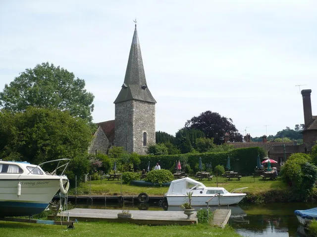
Church of St Mary the Virgin, Fordwich
Historic churches · 2.3 km

Aspendos
Restaurants · 2.3 km

Watergate Cottage Watergate House
Historic houses · 2.4 km

Alfred Palmer
Memorials & monuments · 2.4 km
.jpg?width=1200)
The Manor House
Historic houses · 2.4 km

Bridge Over The Great Stour
Historic bridges · 2.4 km

Fordwich
Historic churches · 2.4 km
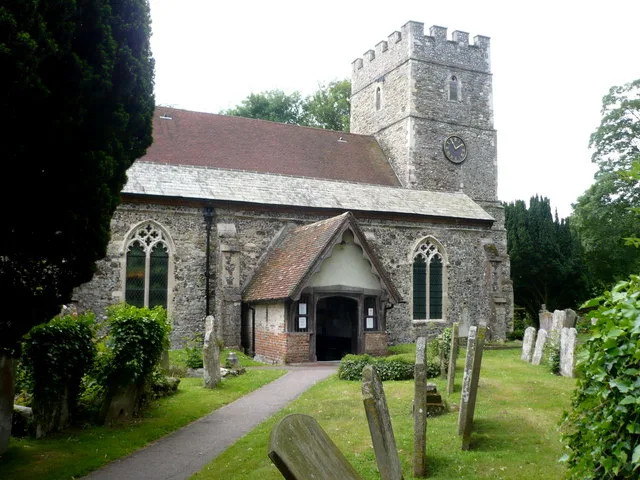
St Nicholas' Church, Sturry
Historic churches · 2.4 km
Nearby
📷 5Historic houses · South East England
Westbere House
Westbere House — house in Westbere, Canterbury, England, UK.
📷 5Manor houses · South East England
Rushbourne Manor
Rushbourne Manor — Grade II listed building-listed manor in england-south-east, United Kingdom.
Flagship📷 10Towns & cities · South East England
Sturry
Sturry — village and civil parish in Kent, England, UK.
📷 7Cafés · South East England
Chapters
Chapters — a café in england south east.
📷 5Historic churches · South East England
Church of St Mary the Virgin, Fordwich
Church of St Mary the Virgin, Fordwich — Grade I listed church in Fordwich, Canterbury, Kent, England, UK.
📷 6Where to eat & stay near Frank Montgomery School
Places to stay
 📷 5
📷 5Caravan parks · South East England
South View Caravan Park
South View Caravan Park — a caravan park in england south east.
 📷 5
📷 5Campsites · South East England
Ross Wood Scout Campsite
Ross Wood Scout Campsite — a campsite in england south east.
 📷 5
📷 5Campsites · South East England
Nethergong Camping
Nethergong Camping — a campsite in england south east.
📷 5 📷 5
📷 5Campsites · South East England
Braggs Lane Farm Camping and Caravan Site
Braggs Lane Farm Camping and Caravan Site — a campsite in england south east.
 📷 5
📷 5Campsites · South East England
Canterbury Camping and Caravanning Club Site
Canterbury Camping and Caravanning Club Site — a campsite in england south east.
Places to eat & drink
📷 7Cafés · South East England
Chapters
Chapters — a café in england south east.
📷 6 📷 7
📷 7Historic pubs · South East England
Ye Olde Beverlie
Ye Olde Beverlie — Historic pub — listed building or notable heritage status.
 📷 7
📷 7Historic pubs · South East England
The Royal Dragoon Public House
The Royal Dragoon Public House in England South East, United Kingdom.
 📷 5
📷 5Restaurants · South East England
Cinnamon
Cinnamon — a restaurant in england south east.
 📷 5
📷 5Historic pubs · South East England
The Miller's Arms Public House
The Miller's Arms Public House in England South East, United Kingdom.
More natural landmarks in this region
 📷 5
📷 5Natural landmarks · South East England
Queen Victoria Statue
Queen Victoria Statue — Public artwork (statue) by Victor Ferdinand Franz Eugen Gustaf Adolf Constantin Friedrich of Hohenlohe-Langenburg.
 📷 5
📷 5Natural landmarks · South East England
Silent Pool
Silent Pool — lake in the United Kingdom.
 📷 5
📷 5Natural landmarks · South East England
Thomas & Jane Holloway Statue
Thomas & Jane Holloway Statue — Public artwork (statue) by Victor Ferdinand Franz Eugen Gustaf Adolf Constantin Friedrich of Hohenlohe-Langenburg.
 📷 5
📷 5Natural landmarks · South East England
Polesden Lacey
Polesden Lacey — a other in england-london, United Kingdom.
Frequently asked questions
- Where is Frank Montgomery School?
- Frank Montgomery School is in Kent, South-East England, United Kingdom (postcode CT2 0FF), in the parish of Hersden.
- What is Frank Montgomery School?
- Frank Montgomery School — a school heritage in england-south-east, United Kingdom.
- How do I get to Frank Montgomery School?
- The nearest railway station is Sturry, about 2.2 km away. Drivers can use postcode CT2 0FF.
- Is Frank Montgomery School a protected site?
- Yes — Frank Montgomery School is part of the Stodmarsh SSSI Site of Special Scientific Interest and the BLEAN WOODS National Nature Reserve.
- Is Frank Montgomery School free to visit?
- Yes, Frank Montgomery School is free to enter.
- How do I get to Frank Montgomery School?
- The nearest railway station is Sturry, about 2.2 km away. Drivers can navigate to postcode CT2 0FF.