
Mountains & hills · North West England
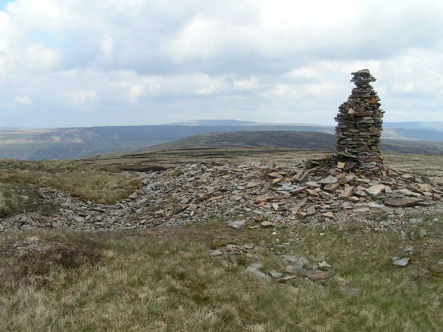
Fountains Fell South Top
In or near Stainforth.
Fountains Fell South Top — Named summit at 662 m.

Wikimedia Commons contributors — see linked file page for photographer and licence licence

Plan your visit
- Typical visit
- 3 h–8 h
- Best time of year
- Late spring – early autumn (May–Oct)
- Nearest railway station
- Horton-in-Ribblesdale · 6.7 km
- Free entry
- Dog-friendly
Getting there & planning your visit
To visit Fountains Fell South Top, the nearest railway station is Horton-in-Ribblesdale, which is 6.7 km away. Entry is free.
About
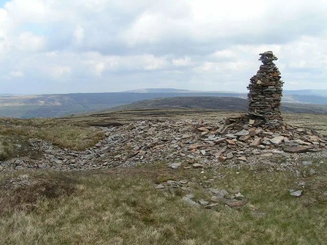
Fountains Fell South Top is a named summit in the United Kingdom. Wikidata describes it as: "Named summit at 662 m.". Coordinates: 54.1330°, -2.2024°.
Photo gallery
Protected designations
- Site of Special Scientific Interest: Pen-Y-Ghent SSSI
Designations sourced from Natural England open data under OGL v3.
From the Wikipedia article
Fountains Fell is a mountain in the Yorkshire Dales, England. The main summit (SD864716) has a height of 668 metres (2,192 ft) and a relative height or topographic prominence of 243 metres (797 ft) and thus qualifies as a Marilyn. Its subsidiary, Fountains Fell South Top (SD868708) reaches 662 metres (2,172 ft) and qualifies as a Nuttall. A third summit, further south at SD868697, reaches 610 metres (2,001 ft) and is the most southerly 2,000 ft summit in the Pennines. The eastern slopes of the fell form part of the National Trust's Malham Tarn and Moor estate.
Excerpt from Wikipedia under CC BY-SA 4.0. See the source article linked in Sources below.
Background
History
The name Fountains derives from ownership of the land in the 13th century by the Cistercian monks of Fountains Abbey (25 mi to the east, near Ripon), who used it for sheep grazing.
Sourced from Wikipedia under CC BY-SA 4.0.
- Coordinates
- 54.1330, -2.2024
- Address
- Yorkshire Dales
- Nearest railway station
- Horton-in-Ribblesdale — 6.7 km
Sources
- osm: n410124058 (ODbL)
- wikipedia: Fountains Fell (CC BY-SA 4.0)
- commons: Fountains Fell cairn.jpg (CC BY-SA 4.0)
Other places nearby
Fountains Fell
Natural landmarks · 0.9 km
Fountains Fell
Mountains & hills · 0.9 km

Coate's Cavern
Caves · 1.2 km

Cherry Tree Hole
Caves · 1.4 km

Coronation Pot
Caves · 1.4 km

Gingling Hole
Caves · 1.6 km

Darnbrook Pot
Caves · 1.6 km

New Year Pot
Caves · 1.8 km
Rocky Pot
Caves · 1.8 km
Curtain Pot
Caves · 1.8 km

Echo Pot
Caves · 1.9 km
Strangle Pot
Caves · 1.9 km
Nearby
📷 3Natural landmarks · North West England
Fountains Fell
Fountains Fell — mountain in United Kingdom.
📷 3📷 5📷 3Caves · Yorkshire & the Humber
Cherry Tree Hole
Cherry Tree Hole is a cave in the United Kingdom.
📷 2📷 3Where to eat & stay near Fountains Fell South Top
Places to stay
 📷 5
📷 5Hostels · Yorkshire & the Humber
Halton Gill Bunk Barn
Halton Gill Bunk Barn — a hostel in england north west.
 📷 5
📷 5Campsites · North West England
Ribblesdale Pods
Ribblesdale Pods — a campsite in england north west.
 📷 5
📷 5Campsites · North West England
Broad Croft House Camping Pods
Broad Croft House Camping Pods — a campsite in england north west.
 📷 5
📷 5Hostels · North West England
Yorkshire Subterranean Society (YSS)
Yorkshire Subterranean Society (YSS) — a hostel in england north west.
 📷 5
📷 5 📷 5
📷 5Places to eat & drink
 📷 6
📷 6Historic pubs · North West England
Falcon Manor Hotel
Falcon Manor Hotel in England North West, United Kingdom.
 📷 5
📷 5Restaurants · North West England
The Game Cock Inn
The Game Cock Inn — a restaurant in england north west. Cuisine: french;english.
 📷 5
📷 5Cafés · North West England
Lakehouse Food & Drink
Lakehouse Food & Drink — a café in england north west.
 📷 7
📷 7 📷 5
📷 5Historic pubs · Yorkshire & the Humber
Grassington House Hotel
Grassington House Hotel in England Yorkshire, United Kingdom.
 📷 5
📷 5Restaurants · Yorkshire & the Humber
The Angel Inn
The Angel Inn — a restaurant in england north west.
More mountains in this region
 📷 5
📷 5Mountains & hills · North West England
Appleton Park
Appleton Park — a hill or mountain in england west midlands.
 📷 5
📷 5Mountains & hills · North West England
High Warren
High Warren — mountain in england west midlands. Elevation: 105 m.
 📷 5
📷 5Mountains & hills · North West England
Alderley Edge
Alderley Edge — mountain in england west midlands. Elevation: 194 m.
 📷 3
📷 3Frequently asked questions
- Where is Fountains Fell South Top?
- Fountains Fell South Top is in North-West England, United Kingdom.
- What is Fountains Fell South Top?
- Fountains Fell South Top — Named summit at 662 m.
- How do I get to Fountains Fell South Top?
- The nearest railway station is Horton-in-Ribblesdale, about 6.7 km away. Its coordinates are 54.1330°, -2.2024°.
- Is Fountains Fell South Top a protected site?
- Yes — Fountains Fell South Top is part of the Pen-Y-Ghent SSSI Site of Special Scientific Interest.
- Is Fountains Fell South Top free to visit?
- Yes, Fountains Fell South Top is free to enter.
- How do I get to Fountains Fell South Top?
- The nearest railway station is Horton-in-Ribblesdale, about 6.7 km away.