
Towns & cities · East Midlands
Fotherby
Fotherby — village in Lincolnshire, England, UK.

Wikimedia Commons contributors — see linked file page for photographer and licence licence

Plan your visit
- Typical visit
- 3 h–6 h
- Nearest railway station
- Ludborough · 4.3 km
- Free entry
- Family-friendly
- Dog-friendly
Getting there & planning your visit
Fotherby is located in the East Midlands, with the nearest railway station being Ludborough, which is 4.3 km away. The postcode for Fotherby is LN11 0TF. Entry to the town is free.
About
Fotherby is a town, city, village or settlement in the United Kingdom. Recent population estimates put it at around 439 people. Wikidata describes it as: "village in Lincolnshire, England, UK". Coordinates: 53.4065°, -0.0345°.
Photo gallery
Protected designations
- Area of Outstanding Natural Beauty: Lincolnshire Wolds
- Ramsar wetland: Humber Estuary
Designations sourced from Natural England open data under OGL v3.
From the Wikipedia article
Fotherby is a village and civil parish in the East Lindsey district of Lincolnshire, England. It is situated just east from the A16 road, 13 miles (21 km) east from Market Rasen, and 10 miles (16 km) south from Cleethorpes. In the Domesday account Fotherby is written as "Fodrebi". Before the Conquest lordship was held by Thorgot Lag, and after, Berengar of Tosny, with Robert of Tosny as Tenant-in-chief. In 1885 Kelly's noted six almshouses, built in 1866 for the benefit of six poor people by James Fowler, on the site of an older glebe house. Parish area was 1,400 acres (5.7 km2) with chief agricultural production of wheat, barley, oats, turnips, seeds and beans, and an 1881 population of 1881. Fotherby Grade II listed Anglican church is dedicated to St Mary. It was entirely rebuilt by James Fowler in 1863, in Early English style with chancel, nave, south porch, and western tower with a broach spire containing three bells originally cast in 1608. Further listed buildings are Mawers Farm on Peppin Lane, and a Sunday School building on Church Lane.
Excerpt from Wikipedia under CC BY-SA 4.0. See the source article linked in Sources below.
- Coordinates
- 53.4065, -0.0345
- County
- Lincolnshire
- District
- East Lindsey
- Parish
- Fotherby
- Postcode
- LN11 0TF
- Parliamentary constituency
- Louth and Horncastle
- Population
- 439
- Nearest railway station
- Ludborough — 4.3 km
Sources
- wikidata: Q2172495 (CC0)
- wikipedia: Fotherby (CC BY-SA 4.0)
- commons: St Mary's church Fotherby - geograph.org.uk - 96899.jpg (CC BY-SA 4.0)
Other places nearby

Fotherby
Villages · 0.8 km

Cross in St Andrew's churchyard
Historic churches · 1.5 km

Utterby
Towns & cities · 1.6 km

Little Grimsby
Villages · 1.9 km

Little Grimsby Hall
Historic houses · 1.9 km

Brackenborough with Little Grimsby
Historic churches · 2.4 km

North Ormsby Priory
Historic churches · 2.4 km

North Ormsby
Towns & cities · 2.5 km

North Elkington
Villages · 2.7 km

Louth Distillery
Distilleries · 3.1 km
Play Factory Louth
Theme parks · 3.1 km

Brackenborough
National landscapes (AONB) · 3.2 km
Fotherby is a town in Lincolnshire, situated within the East Midlands region. Visitors can explore local heritage at Louth Museum and enjoy the natural scenery of Wolds College. The area also offers historic sites such as Keddington and Alvingham churches for those seeking quiet exploration.
At a glance
- Population
- 439
- Administrative county
- Lincolnshire
- Constituency
- Louth and Horncastle
- Top categories near here
Things to see in Fotherby
18 attractions within 12 km. Full guide: things to do in Fotherby →
 📷 3
📷 3Historic houses · East Midlands
84, Westgate
84, Westgate — Grade II listed house in Louth, East Lindsey, Lincolnshire, England, UK.
📷 3Distilleries · East Midlands
Louth Distillery
Louth Distillery — Whisky/spirit distillery.
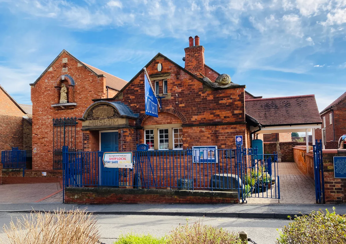 📷 3
📷 3Museums · East Midlands
Louth Museum
Louth Museum — museum in Louth, England, United Kingdom.
📷 3Theme parks · East Midlands
Play Factory Louth
Play Factory Louth — a theme park in East Midlands, United Kingdom.
 📷 3
📷 3Galleries · East Midlands
Spout Yard Park Gallery
Spout Yard Park Gallery — a gallery in East Midlands, United Kingdom.
📷 4National landscapes (AONB) · East Midlands
Brackenborough
Brackenborough is a hamlet in the civil parish of Brackenborough with Little Grimsby, in the East Lindsey district of Lincolnshire, England. It is situated approximately 2 miles (3 km) north from the
📷 3Historic houses · East Midlands
Little Grimsby Hall
Little Grimsby Hall — a Grade I-listed historic house in england-east-midlands, United Kingdom.
 📷 4
📷 4Heritage railway stations · East Midlands
Louth railway station
Louth railway station — a Grade II-listed railway station in england-east-midlands, United Kingdom.
 📷 5
📷 5Natural landmarks · East Midlands
Wolds College
Wolds College — a school heritage in england-east-midlands, United Kingdom.
 📷 5
📷 5Historic churches · East Midlands
Alvingham
Alvingham is a village and civil parish in the East Lindsey district of Lincolnshire, England. It is situated 3 miles (5 km) north-east from the market town of Louth.
📷 5Historic churches · East Midlands
Brackenborough with Little Grimsby
Brackenborough with Little Grimsby — a church in england-east-midlands, United Kingdom.
 📷 5
📷 5Historic churches · East Midlands
Keddington
Keddington is a village and civil parish in the East Lindsey district of Lincolnshire, England. It is 2 miles (3 km) north-east from Louth. Keddington Grade II* listed Anglican parish church is ded
 📷 5
📷 5Campsites · East Midlands
Old Hall Caravan Club
Old Hall Caravan Club — a campsite in england east midlands.
 📷 5📷 5📷 5📷 5
 📷 5
📷 5Nearby
📷 5📷 3Historic churches · East Midlands
Cross in St Andrew's churchyard
Cross in St Andrew's churchyard — a Grade II-listed church in england-east-midlands, United Kingdom.
📷 3Towns & cities · East Midlands
Utterby
Utterby — village and civil parish in East Lindsey, United Kingdom.
📷 5📷 3Historic houses · East Midlands
Little Grimsby Hall
Little Grimsby Hall — a Grade I-listed historic house in england-east-midlands, United Kingdom.
📷 5Historic churches · East Midlands
Brackenborough with Little Grimsby
Brackenborough with Little Grimsby — a church in england-east-midlands, United Kingdom.
Where to eat & stay near Fotherby
Places to stay
📷 5Campsites · East Midlands
Old Hall Caravan Club
Old Hall Caravan Club — a campsite in england east midlands.
 📷 5
📷 5 📷 5
📷 5Campsites · East Midlands
Happyford CL
Happyford CL — a campsite in england east midlands.
 📷 5
📷 5Caravan parks · East Midlands
Furze Farm Estate
Furze Farm Estate — a caravan park in england east midlands.
 📷 5
📷 5Caravan parks · East Midlands
Windy Ridge Caravan Site & Fishing Lakes
Windy Ridge Caravan Site & Fishing Lakes — a caravan park in england east midlands.
 📷 5
📷 5Caravan parks · East Midlands
Little End Corner Caravan Park
Little End Corner Caravan Park — a caravan park in england east midlands.
Places to eat & drink
📷 5 📷 5
📷 5Historic pubs · East Midlands
The Signal Box Inn
The Signal Box Inn in England East Midlands, United Kingdom.
 📷 5
📷 5Historic pubs · East Midlands
Massingberd Arms
Massingberd Arms in England East Midlands, United Kingdom.
 📷 3
📷 3Historic pubs · Yorkshire & the Humber
Tivoli Tavern
Tivoli Tavern — Historic pub — listed building or notable heritage status.
 📷 5
📷 5 📷 5
📷 5More towns in this region
 📷 5
📷 5 📷 5
📷 5Towns & cities · East Midlands
Marholm
Marholm — village and civil parish in Cambridgeshire, UK.
 📷 5
📷 5Towns & cities · East Midlands
Thornhaugh
Thornhaugh — village and civil parish in Cambridgeshire, UK.
 Flagship📷 4
Towns & cities · East Midlands
Austerfield
Austerfield — village and civil parish in South Yorkshire, England, UK.
Frequently asked questions
- Where is Fotherby?
- Fotherby is in Lincolnshire, the East Midlands, United Kingdom (postcode LN11 0TF), in the parish of Fotherby.
- What is Fotherby?
- Fotherby — village in Lincolnshire, England, UK.
- How do I get to Fotherby?
- The nearest railway station is Ludborough, about 4.3 km away. Drivers can use postcode LN11 0TF.
- Is Fotherby a protected site?
- Yes — Fotherby is part of the Lincolnshire Wolds National Landscape (AONB) and the Humber Estuary Ramsar wetland.
- Is Fotherby free to visit?
- Yes, Fotherby is free to enter.
- How do I get to Fotherby?
- The nearest railway station is Ludborough, about 4.3 km away. Drivers can navigate to postcode LN11 0TF.