
Memorials & monuments · South West England
Fort Stamford
In or near Brixton.
Fort Stamford is a memorial in the United Kingdom.

Wikimedia Commons contributors — see linked file page for photographer and licence licence

Plan your visit
- Typical visit
- 15 min–45 min
- Nearest railway station
- Plymouth · 3.1 km
- Free entry
- Dog-friendly
Getting there & planning your visit
To visit Fort Stamford, the nearest railway station is Plymouth, which is 3.1 km away. The postcode for sat-nav is PL9 9WJ, and entry to the site is free.
About
Fort Stamford is a public memorial or monument in the United Kingdom. Records date its origin to 1861. Coordinates: 50.3546°, -4.1194°.
Photo gallery
Protected designations
- Site of Special Scientific Interest: Plymouth Sound Shores and Cliffs SSSI
- Area of Outstanding Natural Beauty: South Devon
Designations sourced from Natural England open data under OGL v3.
From the Wikipedia article
Stamford Fort is a 19th-century fort, built as a result of the Royal Commission on National Defence of 1859. Part of an extensive scheme known as Palmerston Forts, after the prime minister who championed the scheme, it was built to defend the landward approaches to the east of Plymouth, as an element of the plan for the defence of the Royal Naval Dockyard at Devonport. It is 165 feet above sea level, between Jennycliffe Bay and Hooe Lake. Designed by Captain (later Maj General) Edmund Frederick Du Cane, it was built by George Roach and Company, who also built Staddon Fort. It was built as a five sided polygonal fort, surrounded by a dry ditch. Three sides face landward, one seaward, whilst the rear faces the Cattewater. The ditch was defended with three caponiers and a counter-scarp gallery. The fort was connected by a military road to the nearby Staddon Fort. To house the fort's garrison a barrack block for 200 men was built within the rear section of the fort, arranged in 13 casemates, on two floors. These have now been converted into flats. It was designed to be armed with 20 guns and 6 mortars. By 1893 it mounted five 64 Pounder Rifled Muzzle Loading Guns, one 7-inch Rifled Breech Loading (RBL) gun and two 10-inch Rifled Muzzle Loading (RML) guns. By the early 1900s the fort had become obsolete as a defensive position and was disarmed in 1904. It was sold off by the War Office in 1963. It is now used as a caravan park, fitness centre and private flats. It was Scheduled in 1963.
Excerpt from Wikipedia under CC BY-SA 4.0. See the source article linked in Sources below.
- Coordinates
- 50.3546, -4.1194
- District
- Plymouth
- Parish
- Plymouth, unparished area
- Postcode
- PL9 9WJ
- Parliamentary constituency
- South West Devon
- Established
- 1861
- Nearest railway station
- Plymouth — 3.1 km
Sources
- osm: n4945217522 (ODbL)
- wikipedia: Stamford Fort (CC BY-SA 4.0)
- commons: Entrance Archway, Fort Stamford, Plymouth.jpg (CC BY-SA 4.0)
Other places nearby

Turnchapel
Villages · 0.5 km

The Bridge
Restaurants · 0.5 km

Rum Bay
Natural landmarks · 0.5 km

Hooe, Plymouth
Castles · 0.5 km

Batten Bay
Natural landmarks · 0.6 km
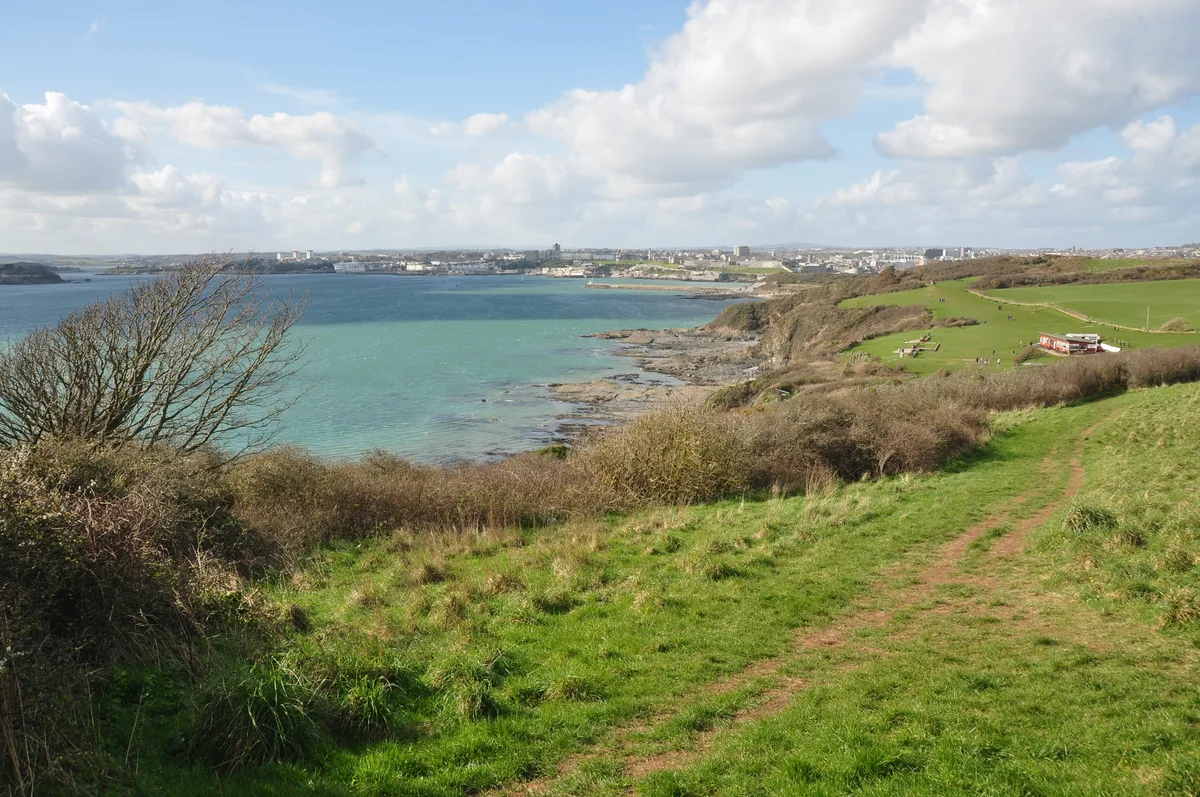
Jennycliff Bay
Mountains & hills · 0.8 km

Mount Batten
Archaeological sites · 0.8 km

Mount Batten Centre
Hostels · 0.8 km

Mount Batten Watersports & Activities
Natural landmarks · 0.8 km

Mount Batten Tower
Memorials & monuments · 0.9 km

Worth's Cattedown Bone Cave 150m north of Cattedown Wharves
Caves · 0.9 km

Roger
Museums · 0.9 km
Nearby
📷 5📷 7📷 5📷 5Castles · South West England
Hooe, Plymouth
Hooe is a suburb of Plymstock, Plymouth in the English county of Devon.
📷 5Natural landmarks · South West England
Batten Bay
Batten Bay — a natural feature in england south west.
📷 5Mountains & hills · South West England
Jennycliff Bay
Jennycliff Bay — bay in the United Kingdom.
Where to eat & stay near Fort Stamford
Places to stay
📷 5Hostels · South West England
Mount Batten Centre
Mount Batten Centre — a hostel in england south west.
 📷 7
📷 7 📷 5
📷 5 📷 5
📷 5Hotels · South West England
Moxy Hotel
Moxy Hotel — a hotel in england south west.
 📷 5
📷 5 📷 5
📷 5Hostels · South West England
Plymouth Backpackers
Plymouth Backpackers — a hostel in england south west.
Places to eat & drink
📷 7 📷 5
📷 5Cafés · South West England
Duttons Cafe Bar Restaurant
Duttons Cafe Bar Restaurant — a café in england south west.
 📷 7
📷 7Restaurants · South West England
Phoenix Wharf at Piermaster's House
Phoenix Wharf at Piermaster's House — a restaurant in england south west.
 📷 7
📷 7 📷 7
📷 7 📷 5
📷 5Restaurants · South West England
Miller & Carter
Miller & Carter — a restaurant in england south west. Cuisine: steak. Brand: Miller & Carter.
Other memorials from this era
 📷 5
📷 5Memorials & monuments · London
Admiral Sir John Franklin
Admiral Sir John Franklin is a memorial in the United Kingdom.
 📷 5
📷 5Memorials & monuments · London
Baron de Stern Clock Tower
Baron de Stern Clock Tower is a memorial in the United Kingdom.
.jpg?width=1200) 📷 5
📷 5Memorials & monuments · London
Bringer of Peace
Bringer of Peace is a memorial in the United Kingdom.
 📷 5
📷 5Memorials & monuments · London
Charles George Gordon
Charles George Gordon — Public artwork (statue).
More memorials in this region
 📷 5
📷 5Memorials & monuments · South West England
Bath Cenotaph
Bath Cenotaph is a memorial in the United Kingdom.
 📷 5
📷 5Memorials & monuments · South West England
Cross of Sacrifice
Cross of Sacrifice is a memorial in the United Kingdom.
 📷 5
📷 5Memorials & monuments · South West England
Grange Arch
Grange Arch is a memorial in the United Kingdom.
.jpg?width=1200) 📷 5
📷 5Memorials & monuments · South West England
King Alfred Memorial
King Alfred Memorial is a memorial in the United Kingdom.
Frequently asked questions
- Where is Fort Stamford?
- Fort Stamford is in South-West England, United Kingdom (postcode PL9 9WJ), in the parish of Plymouth, unparished area.
- What is Fort Stamford?
- Fort Stamford is a memorial in the United Kingdom.
- How do I get to Fort Stamford?
- The nearest railway station is Plymouth, about 3.1 km away. Drivers can use postcode PL9 9WJ.
- When was Fort Stamford built?
- Built or established in 1861.
- Is Fort Stamford a protected site?
- Yes — Fort Stamford is part of the Plymouth Sound Shores and Cliffs SSSI Site of Special Scientific Interest and the South Devon National Landscape (AONB).
- Is Fort Stamford free to visit?
- Yes, Fort Stamford is free to enter.
- How do I get to Fort Stamford?
- The nearest railway station is Plymouth, about 3.1 km away. Drivers can navigate to postcode PL9 9WJ.