
Gardens · Yorkshire & the Humber
Former Sandes Soldiers' Home
In or near East Hauxwell.
Former Sandes Soldiers' Home — a garden in england-yorkshire, United Kingdom.

JThomas — CC BY-SA 2.0 via Wikimedia Commons licence

Plan your visit
- Typical visit
- 1 h–2.5 h
- Best time of year
- Spring & summer (Apr–Sep)
- Nearest railway station
- Finghall Lane · 7.6 km
- Dog-friendly
About
Former Sandes Soldiers' Home is a garden of interest in england-yorkshire, United Kingdom — drawn from open-data sources for visitor reference. See the linked Wikipedia article for the full description.
Photo gallery
From the Wikipedia article
The Former Sandes Soldiers' Home, is a grade II* listed building within Catterick Garrison, North Yorkshire, England. Historic England stated that the building had been grade II* listed due to its "architectural quality and its historical association with Elise Sandes". The awarding of the grade II* status places it in the top 8% of buildings listed by Historic England.
Excerpt from Wikipedia under CC BY-SA 4.0. See the source article linked in Sources below.
Background
History
Catterick Garrison (known as Catterick Camp until 1973) was opened during the First World War as a training facility, but in 1923 it was decided to retain the site as a permanent army base, a decision which prompted General Sir Charles Harington ask for the home to be built. The building was opened on 23 November 1928 and provided a place where soldiers could go without the pressure of the military environment. The building was designed by a firm of architects based in Belfast, and, at the insistence of Elise Sandes who ran the Sandes homes, it was constructed using a workforce recruited from largely from Ulster. When the home was opened, it included a canteen, cinema, billiards room,…
Sourced from Wikipedia under CC BY-SA 4.0.
- Coordinates
- 54.3741, -1.7184
- District
- North Yorkshire
- Parish
- Scotton
- Postcode
- DL9 4SY
- Parliamentary constituency
- Richmond and Northallerton
- Established
- 1928
- Nearest railway station
- Finghall Lane — 7.6 km
Sources
- wikidata: Q130407268 (CC0)
- wikipedia: Former Sandes Soldiers' Home (CC BY-SA 4.0)
Other places nearby

Catterick Garrison
Museums · 0.4 km

Savoy Catterick Garrison
Cinemas · 0.5 km

Empire Catterick Garrison
Theatres · 0.5 km

Hipswell
Castles · 0.7 km

19th Platoon 4th Section
Natural landmarks · 0.8 km

Hipswell Hall
Historic houses · 0.9 km
.jpg?width=1200)
Colburn Hall
Historic houses · 2.0 km

Colburn, North Yorkshire
Museums · 2.1 km

Foxglove Covert Local Nature Reserve
Forests & woodlands · 2.3 km

Easby Abbey Premonstratensian monastery: monastic precinct, cultivation terraces, water-management features and ancillary buildi
Abbeys & priories · 2.6 km
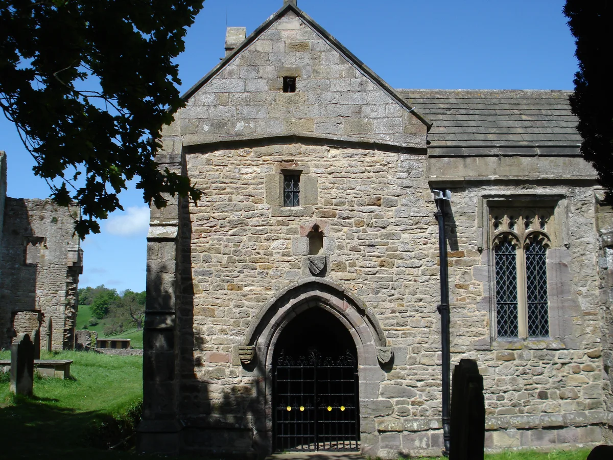
St Agatha's Church, Easby
Abbeys & priories · 2.6 km
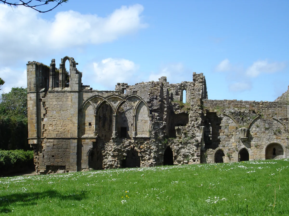
Easby Abbey
Abbeys & priories · 2.6 km
Nearby
📷 5Museums · Yorkshire & the Humber
Catterick Garrison
Catterick Garrison is a major garrison and military town 3 miles (5 km) south of Richmond, North Yorkshire, England. It is the largest British Army garrison in the world, with a population of around 1
📷 5Cinemas · Yorkshire & the Humber
Savoy Catterick Garrison
Savoy Catterick Garrison — a cinema in england yorkshire.
📷 5Theatres · Yorkshire & the Humber
Empire Catterick Garrison
Empire Catterick Garrison — a cinema heritage in england-yorkshire, United Kingdom.
📷 5Castles · Yorkshire & the Humber
Hipswell
Hipswell — a castle in england-yorkshire, United Kingdom.
📷 3Natural landmarks · Yorkshire & the Humber
19th Platoon 4th Section
19th Platoon 4th Section — a other in england-yorkshire, United Kingdom.
📷 3Historic houses · Yorkshire & the Humber
Hipswell Hall
Hipswell Hall — Grade I listed building in Richmondshire, United Kingdom.
Where to eat & stay near Former Sandes Soldiers' Home
Places to stay
 📷 5
📷 5Campsites · Yorkshire & the Humber
Brompton On Swale Camping and Caravan Park
Brompton On Swale Camping and Caravan Park — a campsite in england yorkshire.
 📷 5
📷 5 📷 5
📷 5Hotels · Yorkshire & the Humber
Black Lion Hotel
Black Lion Hotel — a hotel in england yorkshire.
 📷 5
📷 5Hotels · Yorkshire & the Humber
The Turf Hotel
The Turf Hotel — a hotel in england yorkshire.
 📷 7
📷 7 📷 5
📷 5Places to eat & drink
 📷 4
📷 4Historic pubs · North East England
The Bar
The Bar in England North East, United Kingdom.
 📷 5
📷 5Restaurants · Yorkshire & the Humber
The Sandpiper Inn
The Sandpiper Inn — a restaurant in england yorkshire.
 📷 7
📷 7Cafés · Yorkshire & the Humber
Kim's Cafe & Bistro
Kim's Cafe & Bistro — a café in england yorkshire.
 📷 5
📷 5 📷 7
📷 7Cafés · Yorkshire & the Humber
The Castle Keep Tea Room
The Castle Keep Tea Room — a café in england yorkshire.
 📷 6
📷 6Historic pubs · Yorkshire & the Humber
The Blue Lion
The Blue Lion in England Yorkshire, United Kingdom.
More gardens in this region
 📷 3
📷 3Gardens · Yorkshire & the Humber
Clayton Vale
Clayton Vale — valley in Clayton, Manchester, England, UK.
 📷 4
📷 4Gardens · Yorkshire & the Humber
Houldsworth Working Men's Club
Houldsworth Working Men's Club — a garden in england-west-midlands, United Kingdom.
 📷 4
📷 4Gardens · Yorkshire & the Humber
Millennium House
Millennium House — a garden in england-west-midlands, United Kingdom.
 📷 4
📷 4Gardens · Yorkshire & the Humber
Millington Hall
Millington Hall — a garden in england-west-midlands, United Kingdom.
Frequently asked questions
- Where is Former Sandes Soldiers' Home?
- Former Sandes Soldiers' Home is in Yorkshire, United Kingdom (postcode DL9 4SY), in the parish of Scotton.
- What is Former Sandes Soldiers' Home?
- Former Sandes Soldiers' Home — a garden in england-yorkshire, United Kingdom.
- How do I get to Former Sandes Soldiers' Home?
- The nearest railway station is Finghall Lane, about 7.6 km away. The nearest town is East Hauxwell. Drivers can use postcode DL9 4SY.
- When was Former Sandes Soldiers' Home built?
- Built or established in 1928.
- Who owns Former Sandes Soldiers' Home?
- Former Sandes Soldiers' Home is owned by | landlord =.
- How do I get to Former Sandes Soldiers' Home?
- The nearest railway station is Finghall Lane, about 7.6 km away. Drivers can navigate to postcode DL9 4SY.