
Museums · North West England
Formby
In or near Haskayne.
Formby is a town and civil parish in the Metropolitan Borough of Sefton, Merseyside, England. Historically in Merseyside, three manors are recorded in the Domesday Book of 1086 under "Fornebei", Halsa

David Hawgood — CC BY-SA 2.0 via Wikimedia Commons licence

Plan your visit
- Typical visit
- 1.5 h–3 h
- Best time of year
- Year-round
- Nearest railway station
- Formby · 0.6 km
- Family-friendly
- Limited wheelchair access
Getting there & planning your visit
To visit Formby, the nearest railway station is Formby, located 0.6 km away. The postcode for sat-nav is L37 3HD. Entry is free, but please note that wheelchair accessibility is limited.
About
Formby is a town and civil parish in the Metropolitan Borough of Sefton, Merseyside, England. Historically in Merseyside, three manors are recorded in the Domesday Book of 1086 under "Fornebei", Halsall, Walton and Poynton. Cockle raking and shrimp fishing lasted into the 19th century. By 1872, the township and sub-district was made up of two chapelries (St Peter's and St Luke's), Birkdale township, the hamlets of Ainsdale and Raven-Meols and Altcar parish. Formby was built on the plain adjoining the Irish Sea coast a few miles north of the Crosby channel. A commuter town for Liverpool, Formby is also a tourist destination with day trippers attracted to its beaches, sand dunes and wildlife, particularly the endangered red squirrel and natterjack toad. The area is conserved by the National Trust, and designated a Site of Special Scientific Interest.
Photo gallery
Protected designations
- Site of Special Scientific Interest: Sefton Coast SSSI
- Ramsar wetland: Ribble & Alt Estuaries
Designations sourced from Natural England open data under OGL v3.
From the Wikipedia article
Formby is a town and civil parish in the Metropolitan Borough of Sefton, Merseyside, England. Historically in Merseyside, three manors are recorded in the Domesday Book of 1086 under "Fornebei", Halsall, Walton and Poynton. Cockle raking and shrimp fishing lasted into the 19th century. By 1872, the township and sub-district was made up of two chapelries (St Peter's and St Luke's), Birkdale township, the hamlets of Ainsdale and Raven-Meols and Altcar parish. Formby was built on the plain adjoining the Irish Sea coast a few miles north of the Crosby channel. A commuter town for Liverpool, Formby is also a tourist destination with day trippers attracted to its beaches, sand dunes and wildlife, particularly the endangered red squirrel and natterjack toad. The area is conserved by the National Trust, and designated a Site of Special Scientific Interest.
Excerpt from Wikipedia under CC BY-SA 4.0. See the source article linked in Sources below.
Background
History
Erosion of sand on the beach at Formby is revealing layers of mud and sediment, laid down in the late Mesolithic to the late Neolithic, approximately 8,000 – 5,000 years ago, and covered in the early Bronze Age. These sediments often contain the footprints of humans and animals (red deer, roe deer, wild boar, wolf, aurochs) and birds (oystercatcher, crane and other waders) from that period. In June 2016, over 50 human footprints from 7,000 years ago were uncovered on the beach. The common place-name suffix -by is from the Scandinavian byr meaning "homestead", "settlement" or "village". The village of Formby was originally spelt Fornebei and means "the old settlement" or "village belonging…
Visiting
Formby has a significant tourist industry, most notably between the warmer months of May and September. In particular, it is popular with day trippers from across the North West. There are two main spots along the Formby Coast which are particularly popular with the public. The Lifeboat Road site is about 1½ miles from the town centre; there are three linked unpaved car parks with several routes cascading out into the sand dunes and woods. The car parks are about 900 yards from the beach and there is a charge to park there. Victoria Road is north of Lifeboat Road and is busier due to the red squirrel reserve being located here, as well as it being the starting point for the asparagus trail.…
Sourced from Wikipedia under CC BY-SA 4.0.
- Coordinates
- 53.5586, -3.0666
- District
- Sefton
- Parish
- Formby
- Postcode
- L37 3HD
- Parliamentary constituency
- Sefton Central
- Nearest railway station
- Formby — 0.6 km
Sources
- wikipedia: Formby (CC BY-SA 4.0)
Other places nearby
Formby Little Theatre
Theatres · 0.2 km

St Peter's Church, Formby
Historic churches · 1.0 km

Formby Golf Club
Golf courses · 1.3 km

Formby Red Squirrel Reserve
Wildlife reserves · 1.7 km

Freshfield Caravan Park
Caravan parks · 2.1 km

Formby Point Caravan Park
Caravan parks · 2.1 km
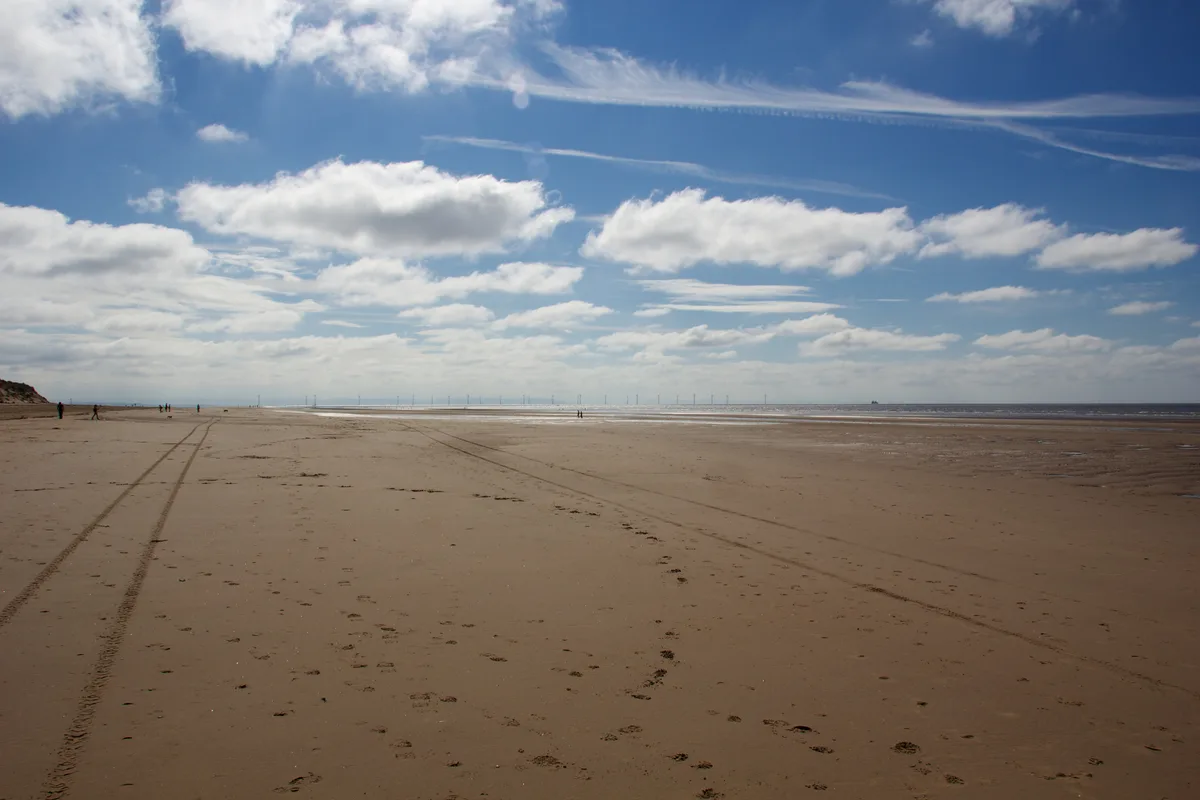
Formby Beach
Beaches · 2.1 km
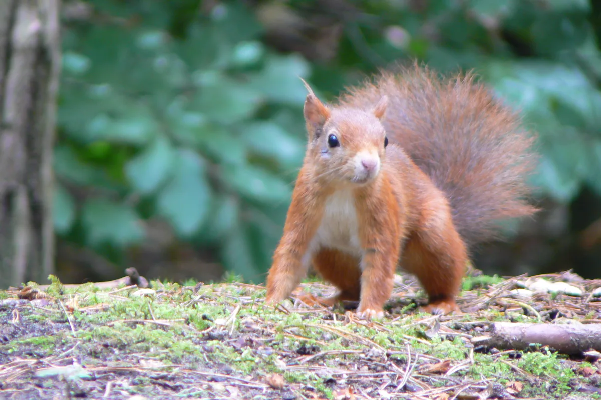
Formby Red Squirrel Reserve
Wildlife reserves · 2.2 km

Formby Lighthouse
Lighthouses · 2.2 km

Cabin Hill National Nature Reserve
Wildlife reserves · 2.6 km

Formby Lifeboat Station
Historic houses · 2.7 km
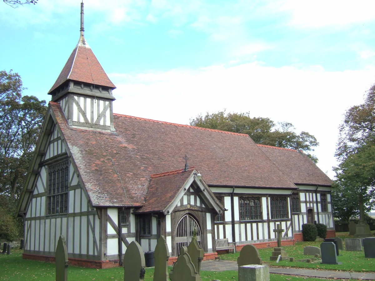
St Michael and All Angels Church, Altcar
Historic churches · 2.7 km
Nearby
📷 3Theatres · North West England
Formby Little Theatre
Formby Little Theatre is a theatre in the United Kingdom.
📷 4Historic churches · North West England
St Peter's Church, Formby
St Peter's Church, Formby — a Grade II*-listed church in england-north-west, United Kingdom.
📷 3Golf courses · North West England
Formby Golf Club
Formby Golf Club — Golf club in Merseyside, England.
📷 3Wildlife reserves · North West England
Formby Red Squirrel Reserve
Formby Red Squirrel Reserve in England North West, United Kingdom.
📷 5Caravan parks · North West England
Freshfield Caravan Park
Freshfield Caravan Park — a caravan park in england north west.
📷 5Caravan parks · North West England
Formby Point Caravan Park
Formby Point Caravan Park — a caravan park in england north west.
Where to eat & stay near Formby
Places to stay
📷 5Caravan parks · North West England
Freshfield Caravan Park
Freshfield Caravan Park — a caravan park in england north west.
📷 5Caravan parks · North West England
Formby Point Caravan Park
Formby Point Caravan Park — a caravan park in england north west.
 📷 5
📷 5Caravan parks · North West England
Willowbank Caravan Park
Willowbank Caravan Park — a caravan park in england north west.
 📷 5
📷 5Caravan parks · North West England
Plex Moss Caravan Park
Plex Moss Caravan Park — a caravan park in england north west.
 📷 5
📷 5Caravan parks · North West England
Tristram's Farmhouse
Tristram's Farmhouse — a caravan park in england north west.
 📷 5
📷 5Campsites · North West England
Century House Camp Site
Century House Camp Site — a campsite in england north west.
Places to eat & drink
 📷 7
📷 7Historic pubs · North West England
Buck I' Th' Vine Inn
Buck I' Th' Vine Inn in England North West, United Kingdom.
 📷 7
📷 7Historic pubs · North West England
The Windmill Public House
The Windmill Public House in England North West, United Kingdom.
 📷 7
📷 7Cafés · North West England
Claude's of Churchtown
Claude's of Churchtown — a café in england north west.
 📷 5
📷 5Historic pubs · North West England
Former bank and residence
Former bank and residence in Wales North, United Kingdom.
 📷 5
📷 5Historic pubs · North West England
That Part Of The Brighton Public House Contained Within Buchanan Road The Brighton Public House
That Part Of The Brighton Public House Contained Within Buchanan Road The Brighton Public House in Wales North, United Kingdom.
 📷 5
📷 5Historic pubs · North West England
Throstles Nest Hotel, Scotland Road
Throstles Nest Hotel, Scotland Road in Wales North, United Kingdom.
More museums in this region
 📷 3
📷 3Museums · North West England
Cube Gallery
Cube Gallery — former architecture museum in Manchester, England.
 📷 3
📷 3Museums · North West England
Cuckooland Museum
Cuckooland Museum — horological museum in England, UK.
 📷 4
📷 4Museums · North West England
Elizabeth Gaskell's House
Elizabeth Gaskell's House — museum in Manchester.
 📷 3
📷 3Museums · North West England
Englesea Brook Chapel and Museum of Primitive Methodism
Englesea Brook Chapel and Museum of Primitive Methodism — Primitive Methodist chapel and museum, United Kingdom.
Frequently asked questions
- Where is Formby?
- Formby is in North-West England, United Kingdom (postcode L37 3HD), in the parish of Formby.
- What is Formby?
- Formby is a town and civil parish in the Metropolitan Borough of Sefton, Merseyside, England. Historically in Merseyside, three manors are recorded in the Domesday Book of 1086 under "Fornebei", Halsa
- How do I get to Formby?
- The nearest railway station is Formby, about 0.6 km away. Drivers can use postcode L37 3HD.
- Is Formby a protected site?
- Yes — Formby is part of the Sefton Coast SSSI Site of Special Scientific Interest and the Ribble & Alt Estuaries Ramsar wetland.
- How do I get to Formby?
- The nearest railway station is Formby, about 0.6 km away. Drivers can navigate to postcode L37 3HD.