Natural landmarks · North Wales
Foel Cwm Sian Llŵyd
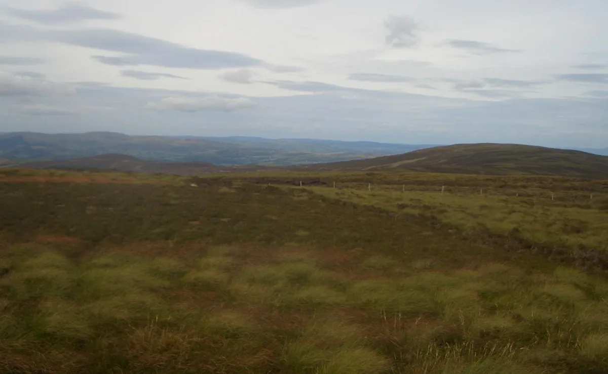
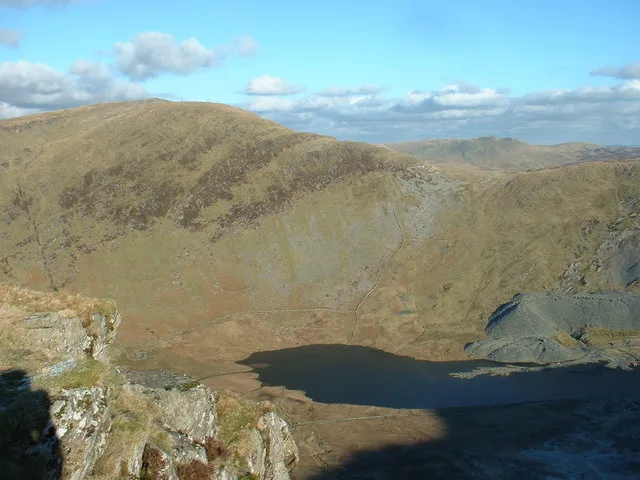
Foel Cwm Sian Llŵyd — mountain (648m) in Gwynedd.

Wikimedia Commons contributors — see linked file page for photographer and licence licence
Plan your visit
- Typical visit
- 1 h–2 h
- Nearest railway station
- Bala (Penybont) · 7.4 km
- Free entry
- Dog-friendly
About
Foel Cwm Sian Llŵyd is a named natural landmark in the United Kingdom. Part of Berwyn range. Wikidata describes it as: "mountain (648m) in Gwynedd". Coordinates: 52.8705°, -3.4950°.
Photo gallery
From the Wikipedia article
Foel Cwm Sian Llŵyd is a subsidiary summit of Cyrniau Nod in north east Wales. It forms a part of the Berwyn range known as the Hirnantau. Its summit has the Snowdonia National Park boundary running through it, and is the most easterly 2000 ft summit in the park. The views from the summit are extensive, if unremarkable due to the featureless, flat moorland surroundings. The summit is marked by a trig point. At the northern end of the summit area lies a ruined stone tower.
Excerpt from Wikipedia under CC BY-SA 4.0. See the source article linked in Sources below.
- Coordinates
- 52.8705, -3.4950
- Address
- Gwynedd, Wales
- Nearest railway station
- Bala (Penybont) — 7.4 km
Sources
- wikidata: Q5463996 (CC0)
- wikipedia: Foel Cwm Sian Llŵyd (CC BY-SA 4.0)
- commons: Cwmsainllwyd.JPG (CC BY-SA 4.0)
Other places nearby
Loading nearby places…
Nearby
 📷 5
📷 5Mountains & hills · North Wales
Foel Cwm Sian Llwyd
Foel Cwm Sian Llwyd — a hill or mountain in wales north.
 📷 3
📷 3Mountains & hills · North Wales
Foel Cwm-Sian Llwyd
Foel Cwm-Sian Llwyd — Named summit at 648 m.
 📷 5
📷 5Mountains & hills · North Wales
Carnedd Wen
Carnedd Wen — mountain in wales north. Elevation: 619 m.
 📷 5
📷 5Mountains & hills · North Wales
Trum y Sarn
Trum y Sarn — mountain in wales north. Elevation: 614 m.
 📷 5
📷 5Mountains & hills · North Wales
Bryniau Gleision
Bryniau Gleision — mountain in wales north. Elevation: 479 m.
 📷 5
📷 5Mountains & hills · North Wales
Pen y Bryniau
Pen y Bryniau — mountain in wales north. Elevation: 518 m.
Where to eat & stay near Foel Cwm Sian Llŵyd
Places to stay
 📷 5
📷 5Hotels · North Wales
Palé Hall Hotel
Palé Hall Hotel — a hotel in wales north.
 📷 5
📷 5Campsites · North Wales
Tŷ Isaf
Tŷ Isaf — a campsite in wales north.
 📷 5
📷 5Caravan parks · North Wales
Pen Y Garth Lodge Park
Pen Y Garth Lodge Park — a caravan park in wales north.
 📷 2
📷 2Campsites · North Wales
Tytandderwen Camping & Caravan Park
Tytandderwen Camping & Caravan Park — a campsite in wales north.
 📷 5
📷 5Campsites · North Wales
Pen y Bont
Pen y Bont — a campsite in wales north.
 📷 5
📷 5Caravan parks · North Wales
Glendower Holiday Park
Glendower Holiday Park — a caravan park in wales north.
Places to eat & drink
📷 5Restaurants · North Wales
Palé Hall Hotel Restaurant
Palé Hall Hotel Restaurant — a restaurant in wales north. Cuisine: welsh;british;fine dining. 5-star.
 📷 5
📷 5Historic pubs · North Wales
Tŷ Mawr
Tŷ Mawr in Wales North, United Kingdom.
 📷 5
📷 5Cafés · North Wales
Meirion Mill
Meirion Mill — a café in wales north.
 📷 5
📷 5Historic pubs · North Wales
Leyland Arms
Leyland Arms in Wales North, United Kingdom.
 📷 5
📷 5Cafés · North Wales
Finley's Cafe
Finley's Cafe — a café in wales north.
More natural landmarks in this region
 Flagship📷 5
Natural landmarks · North Wales
Llyn Llydaw
Llyn Llydaw is a natural landmark in the United Kingdom.
 📷 5
📷 5Natural landmarks · North Wales
Llyn Tegid
Llyn Tegid is a natural landmark in the United Kingdom.
 📷 3
📷 3Natural landmarks · North Wales
Allt-fawr
Allt-fawr — mountain (698m) in Gwynedd, Wales.
 📷 3
📷 3Natural landmarks · North Wales
Aran Benllyn
Aran Benllyn — mountain (885m) in Gwynedd.
Frequently asked questions
- Where is Foel Cwm Sian Llŵyd?
- Foel Cwm Sian Llŵyd is in North Wales, United Kingdom.
- What is Foel Cwm Sian Llŵyd?
- Foel Cwm Sian Llŵyd — mountain (648m) in Gwynedd.
- How do I get to Foel Cwm Sian Llŵyd?
- The nearest railway station is Bala (Penybont), about 7.4 km away. Its coordinates are 52.8705°, -3.4950°.
- Is Foel Cwm Sian Llŵyd free to visit?
- Yes, Foel Cwm Sian Llŵyd is free to enter.
- How do I get to Foel Cwm Sian Llŵyd?
- The nearest railway station is Bala (Penybont), about 7.4 km away.