
Natural landmarks · East of England
Filby Broad
In or near Filby.
Filby Broad — lake in Norfolk, England, UK.

Wikimedia Commons licence
Plan your visit
- Typical visit
- 1 h–2 h
- Nearest railway station
- Acle · 6.7 km
- Free entry
- Dog-friendly
Getting there & planning your visit
Filby Broad is located in Great Yarmouth, Norfolk, with the postcode NR29 3AE. The nearest railway station is Acle, which is 6.7 km away. Entry to Filby Broad is free.
About
Filby Broad is a named natural landmark in the United Kingdom. Part of Trinity Broads. Wikidata describes it as: "lake in Norfolk, England, UK". Coordinates: 52.6620°, 1.6330°.
Photo gallery
Protected designations
- Site of Special Scientific Interest: Trinity Broads SSSI
Designations sourced from Natural England open data under OGL v3.
From the Wikipedia article
Filby Broad is one of five broads (lakes) in the Trinity Broads in Norfolk, England. It lies within the Broads National Park, adjacent to the village of Filby. The broad has an abundant selection of birds and wildlife. The lake is connected to Ormesby Broad and Rollesby Broad via a narrow inlet under a road bridge and via the River Bure and the main broads network by a now unnavigable cutting with a lock gate. This cuts the broad off from the main Broadland area and that means there is no water traffic for a majority of the time. As with the other Norfolk broads, Filby is a peat working and is now only about six to eight feet at its deepest. It is approximately half-a-mile long and surrounded on all sides by reed banks and trees, and one end of the Bridges Carrs area of the broad has been given Site of Special Scientific Interest status. Currently the main use as a body of water is as a reservoir serving the Yarmouth and Broadland areas, owned and operated by the Essex and Suffolk Water Company. There is no public access to the Broad. It has a public boardwalk constructed at the north west side. As a leisure facility the main occupant of the broad is the Norfolk Schools Sailing Association, which has occupied the site since the early 1970s and has built over time a sailing base, slip ways and dinghy park at the north end of the broad. The Association is a voluntary group that provides sailing training to children and adults within the county of Norfolk. This has created a body of water that has a very restricted level of human access leaving it an ideal spot within the broadland area for nesting birds away from the tourist bustle of the main rivers.
Excerpt from Wikipedia under CC BY-SA 4.0. See the source article linked in Sources below.
- Coordinates
- 52.6620, 1.6330
- County
- Norfolk
- District
- Great Yarmouth
- Parish
- Fleggburgh
- Postcode
- NR29 3AE
- Parliamentary constituency
- Great Yarmouth
- Nearest railway station
- Acle — 6.7 km
Sources
- wikidata: Q5448304 (CC0)
- wikipedia: Filby Broad (CC BY-SA 4.0)
Other places nearby

Broad Farm
Campsites · 0.7 km

Filby Dissenters' Chapel
Historic houses · 0.8 km
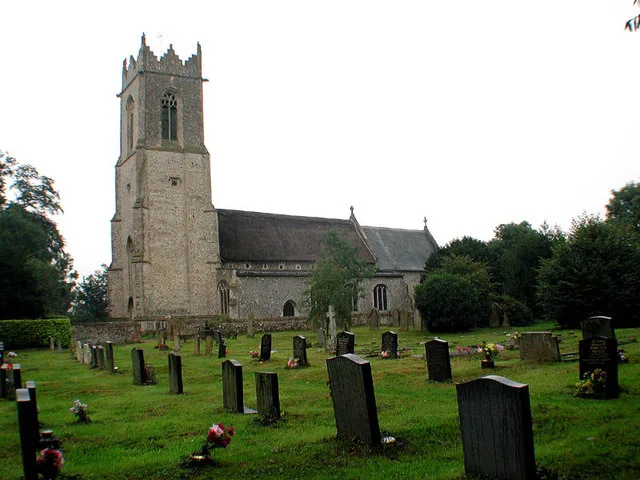
Filby
Towns & cities · 0.8 km
Filby Bittern Village Sign
Public art & sculpture · 1.0 km

Thrigby War Memorial
Memorials & monuments · 1.0 km

Thrigby Hall Wildlife Gardens
Zoos & aquariums · 1.1 km

Filby War Memorial
Memorials & monuments · 1.1 km
Burgh Hall Park
Caravan parks · 1.2 km

Burgh St Margaret Village Sign
Public art & sculpture · 1.3 km
Burgh St Margaret War Memorial
Memorials & monuments · 1.4 km
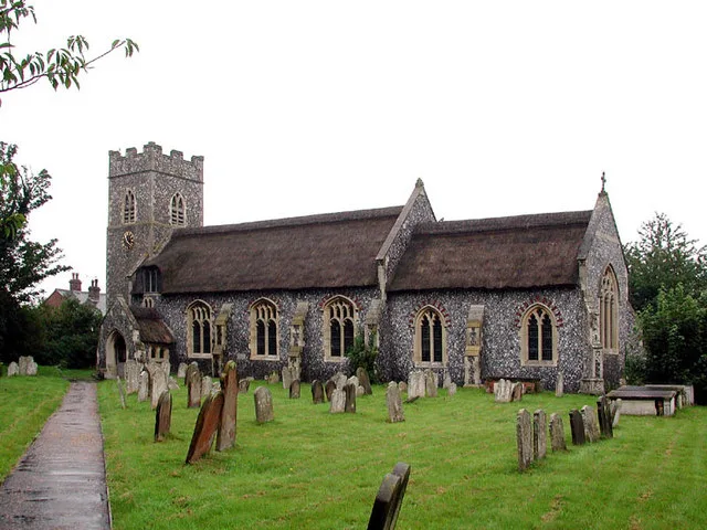
Fleggburgh
Towns & cities · 1.4 km

Filby Village Sign
Public art & sculpture · 1.5 km
Nearby
📷 5📷 3Historic houses · East of England
Filby Dissenters' Chapel
Filby Dissenters' Chapel — a historic house in england-east, United Kingdom.
Flagship📷 3📷 3Public art & sculpture · East of England
Filby Bittern Village Sign
Filby Bittern Village Sign — a public art in england-east, United Kingdom.
📷 3Memorials & monuments · East of England
Thrigby War Memorial
Thrigby War Memorial — Grade II listed building-listed memorial in england-east, United Kingdom.
📷 3Zoos & aquariums · East of England
Thrigby Hall Wildlife Gardens
Thrigby Hall Wildlife Gardens in England East, United Kingdom.
Where to eat & stay near Filby Broad
Places to stay
📷 5📷 5 📷 5
📷 5 📷 5
📷 5 📷 5
📷 5Campsites · East of England
Scratby Hall Caravan Park
Scratby Hall Caravan Park — a campsite in england east.
 📷 5
📷 5Places to eat & drink
 📷 5
📷 5 📷 5
📷 5Historic pubs · East of England
St Johns Head Public House
St Johns Head Public House in England East, United Kingdom.
 📷 5
📷 5Historic pubs · East of England
Two Necked Swan Public House
Two Necked Swan Public House in England East, United Kingdom.
 📷 5
📷 5Historic pubs · East of England
Dukes Head Public House
Dukes Head Public House in England East, United Kingdom.
 📷 5
📷 5 📷 5
📷 5Historic pubs · East of England
Peggottys Public House
Peggottys Public House in England East, United Kingdom.
More natural landmarks in this region
 📷 5
📷 5Natural landmarks · East of England
Orton Mere
Orton Mere — lake in Peterborough, Cambridgeshire, England, UK.
 📷 5
📷 5Natural landmarks · East of England
Magog Down
Magog Down — a other in england-london, United Kingdom.
 📷 5
📷 5Natural landmarks · East of England
Abington Pottery
Abington Pottery — a other in england-london, United Kingdom.
 📷 5
📷 5Natural landmarks · East of England
Car Dyke
Car Dyke — a other in england-london, United Kingdom.
Frequently asked questions
- Where is Filby Broad?
- Filby Broad is in Norfolk, East of England, United Kingdom (postcode NR29 3AE), in the parish of Fleggburgh.
- What is Filby Broad?
- Filby Broad — lake in Norfolk, England, UK.
- How do I get to Filby Broad?
- The nearest railway station is Acle, about 6.7 km away. Drivers can use postcode NR29 3AE.
- Is Filby Broad a protected site?
- Yes — Filby Broad is part of the Trinity Broads SSSI Site of Special Scientific Interest.
- Is Filby Broad free to visit?
- Yes, Filby Broad is free to enter.
- How do I get to Filby Broad?
- The nearest railway station is Acle, about 6.7 km away. Drivers can navigate to postcode NR29 3AE.