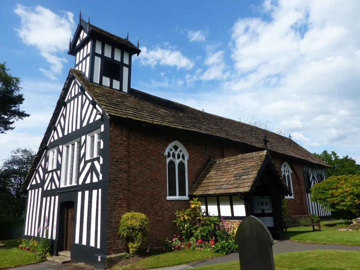
Historic churches · North West England
Fallowfield
In or near Manchester.
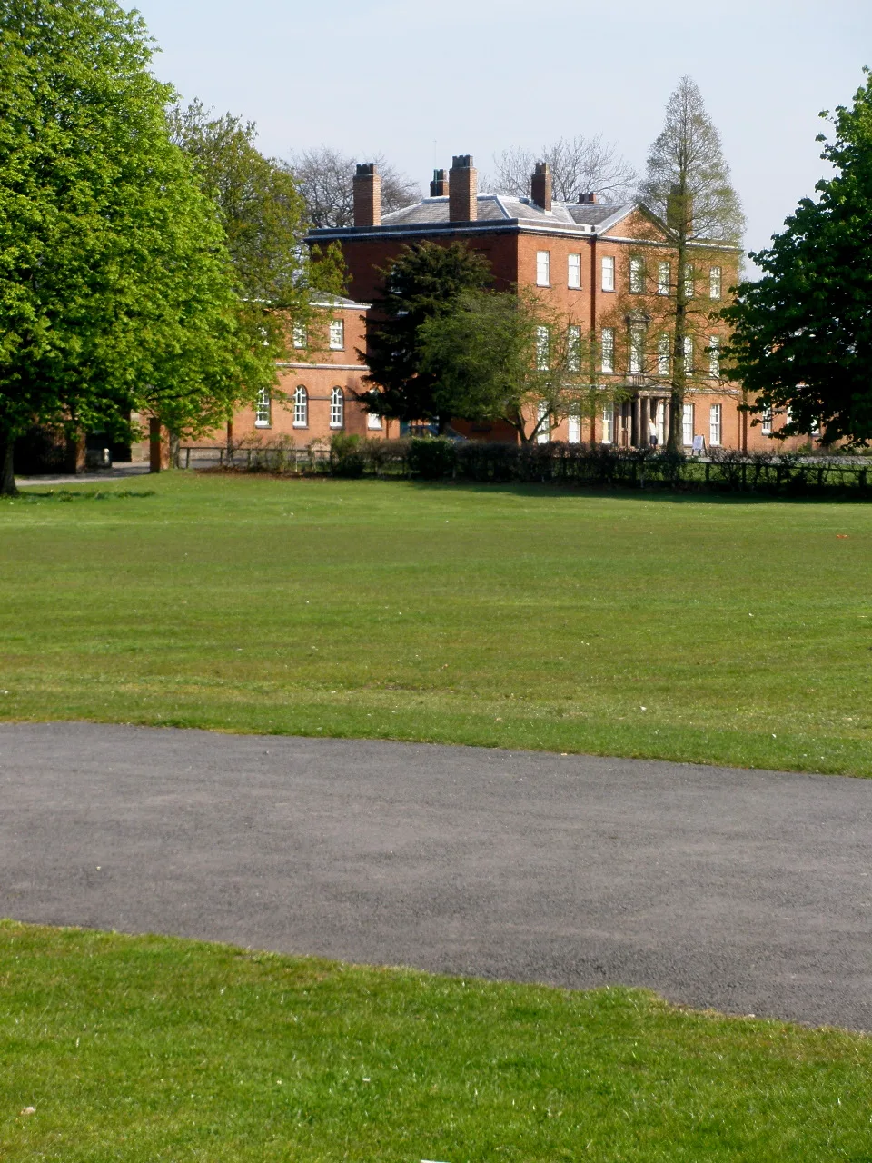
Fallowfield is an area of Manchester which had a population of 14,869 at the 2021 census. Historically in Lancashire, it lies 3 miles (5 km) south of Manchester city centre and is bisected east–west b

Alex McGregor — CC BY-SA 2.0 via Wikimedia Commons licence
Plan your visit
- Typical visit
- 30 min–1 h
- Nearest railway station
- Mauldeth Road · 1.2 km
- Free entry
Getting there & planning your visit
To visit Fallowfield church in Manchester, the nearest railway station is Mauldeth Road, located 1.2 km away. Entry to the church is free.
About
Fallowfield is an area of Manchester which had a population of 14,869 at the 2021 census. Historically in Lancashire, it lies 3 miles (5 km) south of Manchester city centre and is bisected east–west by Wilbraham Road and north–south by Wilmslow Road. The former Fallowfield Loop railway line, now a shared use path, follows a route nearly parallel with the east–west main road (Moseley Road/Wilbraham Road). The area has a large student population. The University of Manchester's main accommodation complex – the Fallowfield Campus – occupies a large area in the north; this is adjacent to the university's Owens Park halls of residence and the Firs Botanical Grounds. In the northwest of the suburb is Platt Fields Park, which is formed from part of the land that once belonged to the Platts of Platt Hall.
Photo gallery
See it from the streetimagery from 2026
Imagery © Mapillary contributors, CC BY-SA 4.0
From the Wikipedia article
Fallowfield is an area of Manchester which had a population of 14,869 at the 2021 census. Historically in Lancashire, it lies 3 miles (5 km) south of Manchester city centre and is bisected east–west by Wilbraham Road and north–south by Wilmslow Road. The former Fallowfield Loop railway line, now a shared use path, follows a route nearly parallel with the east–west main road (Moseley Road/Wilbraham Road). The area has a large student population. The University of Manchester's main accommodation complex – the Fallowfield Campus – occupies a large area in the north; this is adjacent to the university's Owens Park halls of residence and the Firs Botanical Grounds. In the northwest of the suburb is Platt Fields Park, which is formed from part of the land that once belonged to the Platts of Platt Hall.
Excerpt from Wikipedia under CC BY-SA 4.0. See the source article linked in Sources below.
Background
History
The early medieval linear earthwork Nico Ditch passes through Platt Fields Park in Fallowfield and dates from the 8th or 9th century. Early Fallowfield was an ill-defined area north of Withington until the mid-19th century. The first mention of Fallowfield is in a deed of 1317 (as "Fallafeld"). During the 14th century at least part of the land in Fallowfield was held by Jordan de Fallafeld. In 1530 it was mentioned as "Falowfelde". Withington formed a sub-manor within the large Manor of Manchester. The Platt Estate in the north was first owned by the Platts and later by the Worsleys. The building of Wilbraham Road to connect Fallowfield with Edge Lane in Chorlton-cum-Hardy in 1869 enabled…
Sourced from Wikipedia under CC BY-SA 4.0.
- Coordinates
- 53.4425, -2.2186
- District
- Manchester
- Parish
- Manchester, unparished area
- Postcode
- M14 6ND
- Parliamentary constituency
- Manchester Rusholme
- Nearest railway station
- Mauldeth Road — 1.2 km
Sources
- wikipedia: Fallowfield (CC BY-SA 4.0)
Other places nearby

Queen of Hearts
Historic pubs · 0.1 km

Joshua Jarvis Ghost Bike
Memorials & monuments · 0.1 km

South Manchester Synagogue
Historic churches · 0.2 km

Fallowfield Stadium
Stadiums · 0.2 km

Manchester Commonwealth Games Sculpture
Public art & sculpture · 0.3 km

Uttley House
Historic houses · 0.3 km

Firs Botanical Grounds
Botanic gardens · 0.4 km

Ashburne Hall
Historic houses · 0.5 km

Toast Rack
Gardens · 0.5 km

Withington Girls' School
Natural landmarks · 0.6 km
Platt Fields Park
Parks · 0.8 km
A Small Vital Flame (Margaret Ashton)
Public art & sculpture · 0.9 km
Nearby
📷 7Historic pubs · North West England
Queen of Hearts
Queen of Hearts in England North West, United Kingdom.
📷 3Memorials & monuments · North West England
Joshua Jarvis Ghost Bike
Joshua Jarvis Ghost Bike — a memorial in england-west-midlands, United Kingdom.
📷 5Historic churches · North West England
South Manchester Synagogue
South Manchester Synagogue — a synagogue in england-west-midlands, United Kingdom.
📷 3Stadiums · North West England
Fallowfield Stadium
Fallowfield Stadium is a stadium in the United Kingdom.
📷 3Public art & sculpture · North West England
Manchester Commonwealth Games Sculpture
Manchester Commonwealth Games Sculpture — a public art in england-west-midlands, United Kingdom.
📷 4Historic houses · North West England
Uttley House
Uttley House — a Grade II*-listed historic house in england-west-midlands, United Kingdom.
Where to eat & stay near Fallowfield
Places to stay
 📷 5
📷 5Hotels · North West England
Hyatt House Manchester
Hyatt House Manchester — a hotel in england west midlands. 4-star. Brand: Hyatt House.
📷 5Hotels · North West England
Hyatt Regency Manchester
Hyatt Regency Manchester — a hotel in england west midlands. 4-star. Brand: Hyatt Regency.
 📷 7
📷 7Hotels · North West England
Maldron Hotel Manchester City Centre
Maldron Hotel Manchester City Centre — a hotel in england west midlands. 4-star. Brand: Maldron Hotels.
 📷 5
📷 5Hotels · North West England
Whitworth Locke, Civic Quarter
Whitworth Locke, Civic Quarter — a hotel in england west midlands. Brand: Locke.
 📷 5
📷 5Hotels · North West England
DoubleTree by Hilton Hotel Manchester - Piccadilly
DoubleTree by Hilton Hotel Manchester - Piccadilly — a hotel in england west midlands. 4-star. Brand: DoubleTree.
 📷 5
📷 5Hotels · North West England
Hilton Manchester Deansgate
Hilton Manchester Deansgate — a hotel in england west midlands.
Places to eat & drink
📷 7Historic pubs · North West England
Queen of Hearts
Queen of Hearts in England North West, United Kingdom.
 📷 7
📷 7 📷 7
📷 7Historic pubs · North West England
The Rampant Lion
The Rampant Lion in England North West, United Kingdom.
 📷 7
📷 7Cafés · Yorkshire & the Humber
Station South
Station South — a café in england west midlands.
 📷 5
📷 5Historic pubs · North West England
Plymouth Grove Hotel
Plymouth Grove Hotel in England North West, United Kingdom.
 📷 5
📷 5Historic pubs · North West England
323-7, Oxford Road
323-7, Oxford Road in England North West, United Kingdom.
More places in this region
 📷 3
📷 3Historic churches · North West England
All Saints Chapel, Somerford
All Saints Chapel, Somerford — church in Cheshire East, Cheshire, England, UK.
 📷 3
📷 3Historic churches · North West England
All Saints Church, Church Lawton
All Saints Church, Church Lawton — Grade II* listed church in Church Lawton, Cheshire East, Cheshire, England, UK.
 📷 3
📷 3Historic churches · North West England
All Saints Church, Scholar Green
All Saints Church, Scholar Green — church in Cheshire East, Cheshire, England, UK.
 📷 3
📷 3Historic churches · North West England
All Saints Church, Siddington
All Saints Church, Siddington — church in Cheshire East, Cheshire, England, UK.
Frequently asked questions
- Where is Fallowfield?
- Fallowfield is in the West Midlands, United Kingdom (postcode M14 6ND), in the parish of Manchester, unparished area.
- What is Fallowfield?
- Fallowfield is an area of Manchester which had a population of 14,869 at the 2021 census. Historically in Lancashire, it lies 3 miles (5 km) south of Manchester city centre and is bisected east–west b
- How do I get to Fallowfield?
- The nearest railway station is Mauldeth Road, about 1.2 km away. Drivers can use postcode M14 6ND.
- Is Fallowfield free to visit?
- Yes, Fallowfield is free to enter.
- How do I get to Fallowfield?
- The nearest railway station is Mauldeth Road, about 1.2 km away. Drivers can navigate to postcode M14 6ND.