
National parks · South West England
Exmoor
In or near Winsford.
Exmoor is a National park in South West England.

Photo by Sean_the_Spook ( talk ) ( Uploads ) (Wikimedia Commons, CC BY-SA 3.0) licence
Plan your visit
- Typical visit
- 4 h–8 h
- Best time of year
- Spring – autumn (Apr–Oct)
- Free entry
- Family-friendly
- Dog-friendly
Getting there & planning your visit
Exmoor National Park is located in Somerset, with the postcode TA24 7AB. Entry to the park is free. There is no nearest railway station mentioned, so please plan your visit accordingly.
About
Exmoor is a national park in the United Kingdom. Designated in 1954. According to Wikipedia: "Exmoor is loosely defined as an area of hilly open moorland in west Somerset and north Devon in South West England.". It is one of fifteen designated national parks across England, Scotland, and Wales, protected for its landscape and recreation value.
Photo gallery
Summary from the official site
Exmoor is a national park known for its diverse landscapes, rich history, and commitment to nature conservation. Visitors can explore its scenic beauty, engage in outdoor activities, and learn about the area's heritage and environmental initiatives.
Read more on the official property page.
Protected designations
- Site of Special Scientific Interest: Barle Valley SSSI
- Site of Special Scientific Interest: North Exmoor SSSI
- Site of Special Scientific Interest: River Barle SSSI
- Site of Special Scientific Interest: South Exmoor SSSI
Designations sourced from Natural England open data under OGL v3.
From the Wikipedia article
Exmoor () is loosely defined as an area of hilly open moorland in west Somerset and north Devon in South West England. It is named after the River Exe, the source of which is situated in the centre of the area, two miles north-west of Simonsbath. Exmoor is more precisely defined as the area of the former ancient royal hunting forest, also called Exmoor, which was officially surveyed 1815–1818 as 18,810 acres (7,610 ha or 76.1 km2) in extent. The moor has given its name to a National Park, which includes the Brendon Hills, the East Lyn Valley, the Vale of Porlock and 55 km (34 mi) of the Bristol Channel coast. The total area of the Exmoor National Park is 692.8 km2 (267.5 mi2), of which 71% is in Somerset and 29% in Devon. The upland area is underlain by sedimentary rocks dating from the Devonian and early Carboniferous periods with Triassic and Jurassic age rocks on lower slopes. Where these reach the coast, cliffs are formed which are cut with ravines and waterfalls. It was recognised as a heritage coast in 1991. The highest point on Exmoor is Dunkery Beacon; at 519 metres (1,703 ft) it is also the highest point in Somerset. The terrain supports lowland heath communities, ancient woodland and blanket mire which provide habitats for scarce flora and fauna. There have also been reports of the Beast of Exmoor, a cryptozoological cat roaming Exmoor. Several areas have been designated as Nature Conservation Review and Geological Conservation Review sites. There is evidence of human occupation from the Mesolithic. This developed for agriculture and extraction of mineral ores into the Bronze and Iron Ages. The remains of standing stones, cairns and bridges can still be identified. The royal forest was granted a charter in the 13th century, however foresters who managed the area were identified in the Domesday Book. In the Middle Ages sheep farming was common with a system of agistment licensing the grazing of livestock as the Inclosure Acts divided up the land. The area…
Excerpt from Wikipedia under CC BY-SA 4.0. See the source article linked in Sources below.
Background
History
.]] There is evidence of occupation of the area by people from Mesolithic times onward. In the Neolithic period, people started to manage animals and grow crops on farms cleared from the woodland, rather than act purely as hunters and as gatherers. It is also likely that extraction and smelting of mineral ores to make metal tools, weapons, containers and ornaments started in the late Neolithic, and continued into the Bronze and Iron Ages. view of Old Burrow Roman fortlet east of Lynmouth]] Tarr Steps are a prehistoric ( 1000 BC) clapper bridge across the River Barle, about 4 km south-east of Withypool and 6 km north-west of Dulverton. The stone slabs weigh up to 5 tonnes apiece, and the…
Sourced from Wikipedia under CC BY-SA 4.0.
- Coordinates
- 51.1000, -3.6000
- District
- Somerset
- Parish
- Winsford
- Postcode
- TA24 7AB
- Parliamentary constituency
- Tiverton and Minehead
- Established
- 1954
- Official site
- www.exmoor-nationalpark.gov.uk
Sources
- wikidata: Q593627 (CC0)
- wikipedia: Exmoor (CC BY-SA 4.0)
- commons: PorlockVale.jpg (CC BY-SA 3.0)

Featured in these 2 guides
Other places nearby

Winsford Hill
Mountains & hills · 0.5 km
Winsford Hill
Mountains & hills · 0.5 km

Caratacus Stone
Memorials & monuments · 1.4 km

Halse Farm
Campsites · 1.5 km

Draydon Knap
Mountains & hills · 2.2 km

Garratts Wood
Archaeological sites · 2.3 km
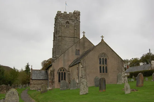
Church of St Mary Magdalene, Winsford
Historic churches · 2.4 km

Winsford
Towns & cities · 2.4 km

Room Hill
Mountains & hills · 2.5 km

Bridge Over Winn Brook
Historic bridges · 2.6 km

Vicarage Bridge At Ngr Ss 9061 3516
Historic bridges · 2.6 km

Lyncombe Hill
Mountains & hills · 2.6 km
Nearby
📷 5Mountains & hills · South West England
Winsford Hill
Winsford Hill — mountain in england south west. Elevation: 428 m.
📷 5Mountains & hills · South West England
Winsford Hill
Winsford Hill — a hill or mountain in england south west.
📷 4Memorials & monuments · South West England
Caratacus Stone
Caratacus Stone — a memorial in england-south-west, United Kingdom.
📷 5📷 5Mountains & hills · South West England
Draydon Knap
Draydon Knap — mountain in england south west. Elevation: 384 m.
📷 5Archaeological sites · South West England
Garratts Wood
Garratts Wood is a archaeological site in the United Kingdom.
Where to eat & stay near Exmoor
Places to stay
📷 5 📷 5
📷 5Hotels · South West England
Tarr Farm Inn
Tarr Farm Inn — a hotel in england south west.
 📷 5
📷 5Campsites · South West England
Exe Valley Caravan Site
Exe Valley Caravan Site — a campsite in england south west.
 📷 5
📷 5Hostels · South West England
Exford Youth Hostel
Exford Youth Hostel — a hostel in england south west.
📷 5Campsites · South West England
Exmoor Youth Hostel Campsite
Exmoor Youth Hostel Campsite — a campsite in england south west.
 📷 7
📷 7B&Bs · South West England
Stagshead Farm Exmoor B&B
Stagshead Farm Exmoor B&B — a bed-and-breakfast in england south west.
Places to eat & drink
 📷 5
📷 5Historic pubs · South West England
The London Inn
The London Inn in England South West, United Kingdom.
 📷 5
📷 5Historic pubs · South West England
The Red Lion Public House
The Red Lion Public House in England South West, United Kingdom.
 📷 7
📷 7 📷 7
📷 7Cafés · South West England
Castle Coffee House
Castle Coffee House — a café in england south west.
 📷 7
📷 7 📷 5
📷 5Historic pubs · South West England
Luttrell Arms
Luttrell Arms in England South West, United Kingdom.
More national parks in this region
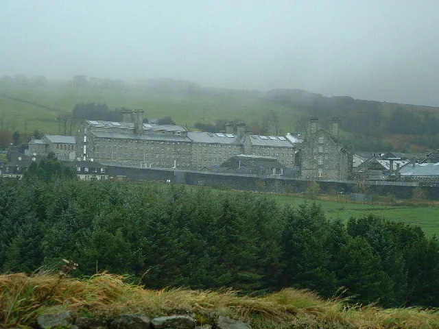 Flagship📷 10
National parks · South West England
Dartmoor
Dartmoor is a National park in South West England.
 📷 4
📷 4National parks · South West England
River Lyd, Devon
The Lyd is a river rising at Lyd Head (Corn Ridge in NW Dartmoor) in the Dartmoor national park in Devon in South West England and flowing into the River Tamar beyond Lifton. It runs through Lydford G
 📷 5
📷 5National parks · South West England
Holnicote Estate
Holnicote (pronounced "Hunnicutt") in the parish of Selworthy, West Somerset, England, is a historic estate consisting of 12,420 acres (5,026 hectares) of land, much situated within the Exmoor Nationa
 📷 3
📷 3National parks · South West England
Exmoor National Park
Exmoor National Park — a other in england-south-west, United Kingdom.
Frequently asked questions
- Where is Exmoor?
- Exmoor is in South-West England, United Kingdom (postcode TA24 7AB), in the parish of Winsford.
- What is Exmoor?
- Exmoor is a National park in South West England.
- How do I get to Exmoor?
- Drivers can use postcode TA24 7AB.
- When was Exmoor built?
- Built or established in 1954.
- Is Exmoor a protected site?
- Yes — Exmoor is part of the Barle Valley SSSI Site of Special Scientific Interest and the North Exmoor SSSI Site of Special Scientific Interest.
- Is Exmoor free to visit?
- Yes, Exmoor is free to enter.
- How do I get to Exmoor?
- Drivers can navigate to postcode TA24 7AB. It sits within the Tiverton and Minehead parliamentary constituency.