Museums · North West England
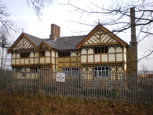
Euxton
In or near Farington.
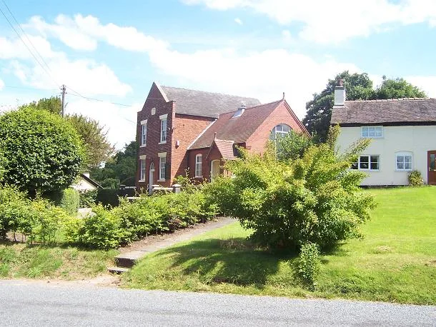
Euxton ( EKS-tən) is a village and civil parish in the Borough of Chorley, Lancashire, England. The population at the 2011 census was 9,993, but is now estimated to be around 14,000 due to housing dev

David Dixon — CC BY-SA 2.0 via Wikimedia Commons licence
_-_geograph.org.uk_-_4248605.jpg)
Plan your visit
- Typical visit
- 1.5 h–3 h
- Best time of year
- Year-round
- Nearest railway station
- Euxton Balshaw Lane · 0.3 km
- Family-friendly
- Limited wheelchair access
Getting there & planning your visit
To visit Euxton museum, the nearest railway station is Euxton Balshaw Lane, located 0.3 km away. The postcode for navigation is PR7 6JG. Please note that wheelchair accessibility is limited.
About
Euxton ( EKS-tən) is a village and civil parish in the Borough of Chorley, Lancashire, England. The population at the 2011 census was 9,993, but is now estimated to be around 14,000 due to housing developments in the village, including at Buckshaw. The village is just to the west of Chorley, and south of Clayton-le-Woods. Euxton covers an area around 2.5 miles (4.0 km) from east to west and 2 miles (3.2 km) north to south. The village is made up of several areas including Runshaw Moor, Balshaw, Shaw Green, Daisy Hill, Buckshaw, Pincock, Primrose Hill, Glead Hill, Dawbers, Spout Hillock, Culbeck and Pear Tree. The boundaries of Euxton have remained largely unchanged, as they follow a series of natural waterways. The northern boundary is formed by Worden Brook, which runs through the centre of Buckshaw Village and becomes Shaw Brook, marking the border between Euxton and Leyland. To the east, the boundary was historically defined by German Brook and German Lane (now Washington Lane), whereas the boundary is now broadly aligned with West Way. The southern boundary is formed by the River Yarrow, while to the west, the parish boundary follows historic field lines from Runshaw Moor southwards to the point where the A581 changes from Dawbers Lane to Southport Road near the Elephant Restaurant and on to the Yarrow. Euxton is served by five primary schools: Balshaw Lane Primary, Primrose Hill Primary, Euxton C of E Primary, Euxton RC Primary and Trinity C of E/Methodist Primary School
Photo gallery
From the Wikipedia article
Euxton ( EKS-tən) is a village and civil parish in the Borough of Chorley, Lancashire, England. The population at the 2011 census was 9,993, but is now estimated to be around 14,000 due to housing developments in the village, including at Buckshaw. The village is just to the west of Chorley, and south of Clayton-le-Woods. Euxton covers an area around 2.5 miles (4.0 km) from east to west and 2 miles (3.2 km) north to south. The village is made up of several areas including Runshaw Moor, Balshaw, Shaw Green, Daisy Hill, Buckshaw, Pincock, Primrose Hill, Glead Hill, Dawbers, Spout Hillock, Culbeck and Pear Tree. The boundaries of Euxton have remained largely unchanged, as they follow a series of natural waterways. The northern boundary is formed by Worden Brook, which runs through the centre of Buckshaw Village and becomes Shaw Brook, marking the border between Euxton and Leyland. To the east, the boundary was historically defined by German Brook and German Lane (now Washington Lane), whereas the boundary is now broadly aligned with West Way. The southern boundary is formed by the River Yarrow, while to the west, the parish boundary follows historic field lines from Runshaw Moor southwards to the point where the A581 changes from Dawbers Lane to Southport Road near the Elephant Restaurant and on to the Yarrow. Euxton is served by five primary schools: Balshaw Lane Primary, Primrose Hill Primary, Euxton C of E Primary, Euxton RC Primary and Trinity C of E/Methodist Primary School.
Excerpt from Wikipedia under CC BY-SA 4.0. See the source article linked in Sources below.
Background
History
Euxton's original village settlement in Pincock was based near the ford over the River Yarrow, along the route of the old Roman road Watling Street – now the A49 road – that runs through the length of the village, from Pincock to Packsaddle. Demonstrating its significance, Euxton had a market charter granted in 1301 by Edward I and whilst the area was called Euxton, the township was called Euxtonburgh. The name suggests an Anglo-Saxon origin. It has been suggested that it is derived from "Efe's Tun", with "tun" referring to a farmstead and Efe being a personal name and the later addition of burgh suggesting the settlement had grown and been fortified. The manorial seat was Euxton Hall owned…
Sourced from Wikipedia under CC BY-SA 4.0.
- Coordinates
- 53.6620, -2.6740
- County
- Lancashire
- District
- Chorley
- Parish
- Euxton
- Postcode
- PR7 6JG
- Parliamentary constituency
- South Ribble
- Nearest railway station
- Euxton Balshaw Lane — 0.3 km
Sources
- wikipedia: Euxton (CC BY-SA 4.0)
Other places nearby

Euxton Hall Chapel
Historic churches · 0.2 km

Euxton Parish Church Gate
Memorials & monuments · 0.4 km
Euxton War Memorial
Memorials & monuments · 0.5 km

Euxton Parish Church
Historic churches · 0.7 km

Pincock Brow
Historic bridges · 0.8 km
Pincock Bridge
Historic bridges · 0.8 km

Euxton
Villages · 0.9 km
Buckshaw Hall
Stately homes · 1.7 km

Drinking Fountain
Public art & sculpture · 1.8 km

Stable Block to Astley Hall
Historic houses · 1.8 km

Astley Hall, Chorley
Historic houses · 1.9 km

Astley Park
Parks · 2.0 km
Nearby
📷 3Historic churches · North West England
Euxton Hall Chapel
Euxton Hall Chapel — church in Lancashire, England, UK.
📷 3Memorials & monuments · North West England
Euxton Parish Church Gate
Euxton Parish Church Gate — a memorial in england-north-west, United Kingdom.
📷 3Memorials & monuments · North West England
Euxton War Memorial
Euxton War Memorial is a memorial in the United Kingdom.
📷 4Historic churches · North West England
Euxton Parish Church
Euxton Parish Church — church in Euxton, Chorley, Lancashire, England, UK.
📷 3Historic bridges · North West England
Pincock Brow
Pincock Brow is a historic bridge in the United Kingdom.
📷 3Historic bridges · North West England
Pincock Bridge
Pincock Bridge — Grade II listed building-listed bridge in england-north-west, United Kingdom.
Where to eat & stay near Euxton
Places to stay
 📷 7
📷 7Hotels · North West England
Hartwood Hall Hotel
Hartwood Hall Hotel — a hotel in england north west. 3-star. Brand: Greene King.
 📷 5
📷 5Campsites · North West England
Primrose Cottage Camping
Primrose Cottage Camping — a campsite in england north west.
 📷 5
📷 5Caravan parks · North West England
Greenbank Farm
Greenbank Farm — a caravan park in england north west.
 📷 5
📷 5 📷 5
📷 5Campsites · North West England
Bibbys Farm Scout Camp
Bibbys Farm Scout Camp — a campsite in england north west.
 📷 5
📷 5Campsites · North West England
Charity Farm Caravan & Camping Park
Charity Farm Caravan & Camping Park — a campsite in england north west.
Places to eat & drink
 📷 7
📷 7Historic pubs · North West England
Eagle And Child Inn
Eagle And Child Inn in England North West, United Kingdom.
 📷 5
📷 5 📷 5
📷 5Historic pubs · North West England
Ye Olde Hob Inn
Ye Olde Hob Inn in England North West, United Kingdom.
 📷 5
📷 5Historic pubs · North West England
Bradley Hall Public House
Bradley Hall Public House in England North West, United Kingdom.
 📷 7
📷 7 📷 6
📷 6Historic pubs · North West England
Former Red Lion Hotel And Ellesmere Chambers
Former Red Lion Hotel And Ellesmere Chambers in England North West, United Kingdom.
More museums in this region
 📷 3
📷 3Museums · North West England
Cube Gallery
Cube Gallery — former architecture museum in Manchester, England.
 📷 3
📷 3Museums · North West England
Cuckooland Museum
Cuckooland Museum — horological museum in England, UK.
 📷 4
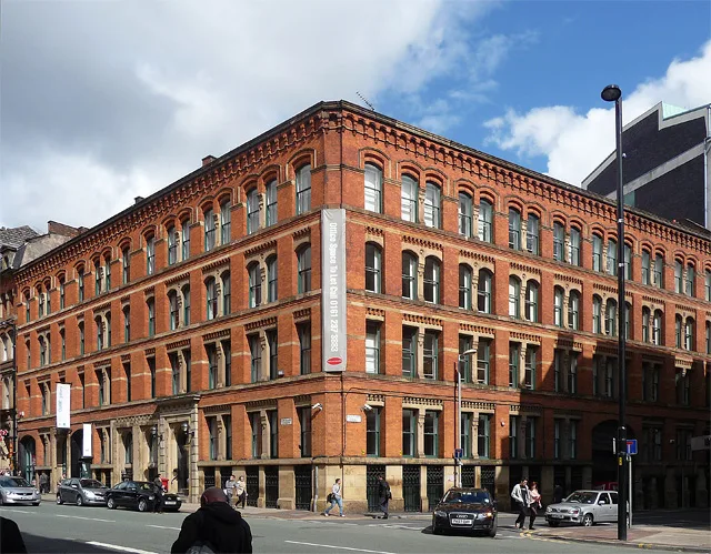
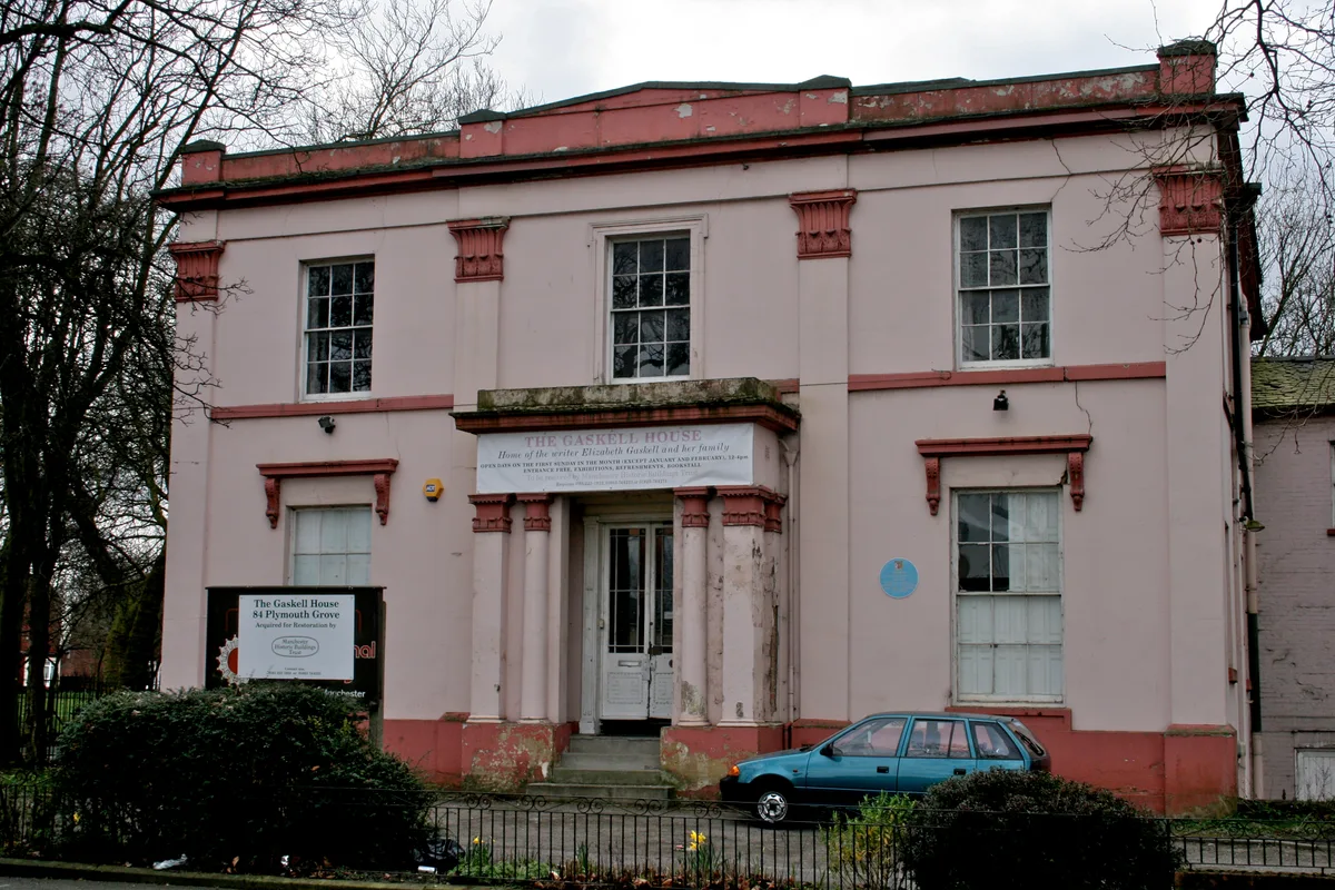
📷 4Museums · North West England
Elizabeth Gaskell's House
Elizabeth Gaskell's House — museum in Manchester.
 📷 3
📷 3Museums · North West England
Englesea Brook Chapel and Museum of Primitive Methodism
Englesea Brook Chapel and Museum of Primitive Methodism — Primitive Methodist chapel and museum, United Kingdom.
Frequently asked questions
- Where is Euxton?
- Euxton is in Lancashire, North-West England, United Kingdom (postcode PR7 6JG), in the parish of Euxton.
- What is Euxton?
- Euxton ( EKS-tən) is a village and civil parish in the Borough of Chorley, Lancashire, England. The population at the 2011 census was 9,993, but is now estimated to be around 14,000 due to housing dev
- How do I get to Euxton?
- The nearest railway station is Euxton Balshaw Lane, about 0.3 km away. Drivers can use postcode PR7 6JG.
- How do I get to Euxton?
- The nearest railway station is Euxton Balshaw Lane, about 0.3 km away. Drivers can navigate to postcode PR7 6JG.