
Chapels · South East England
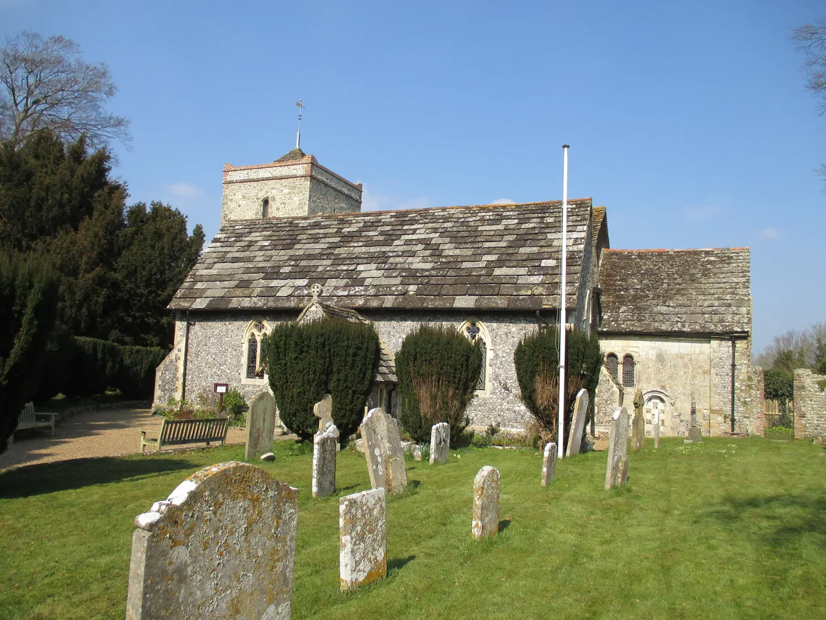
Erringham chapel
In or near Botolphs.
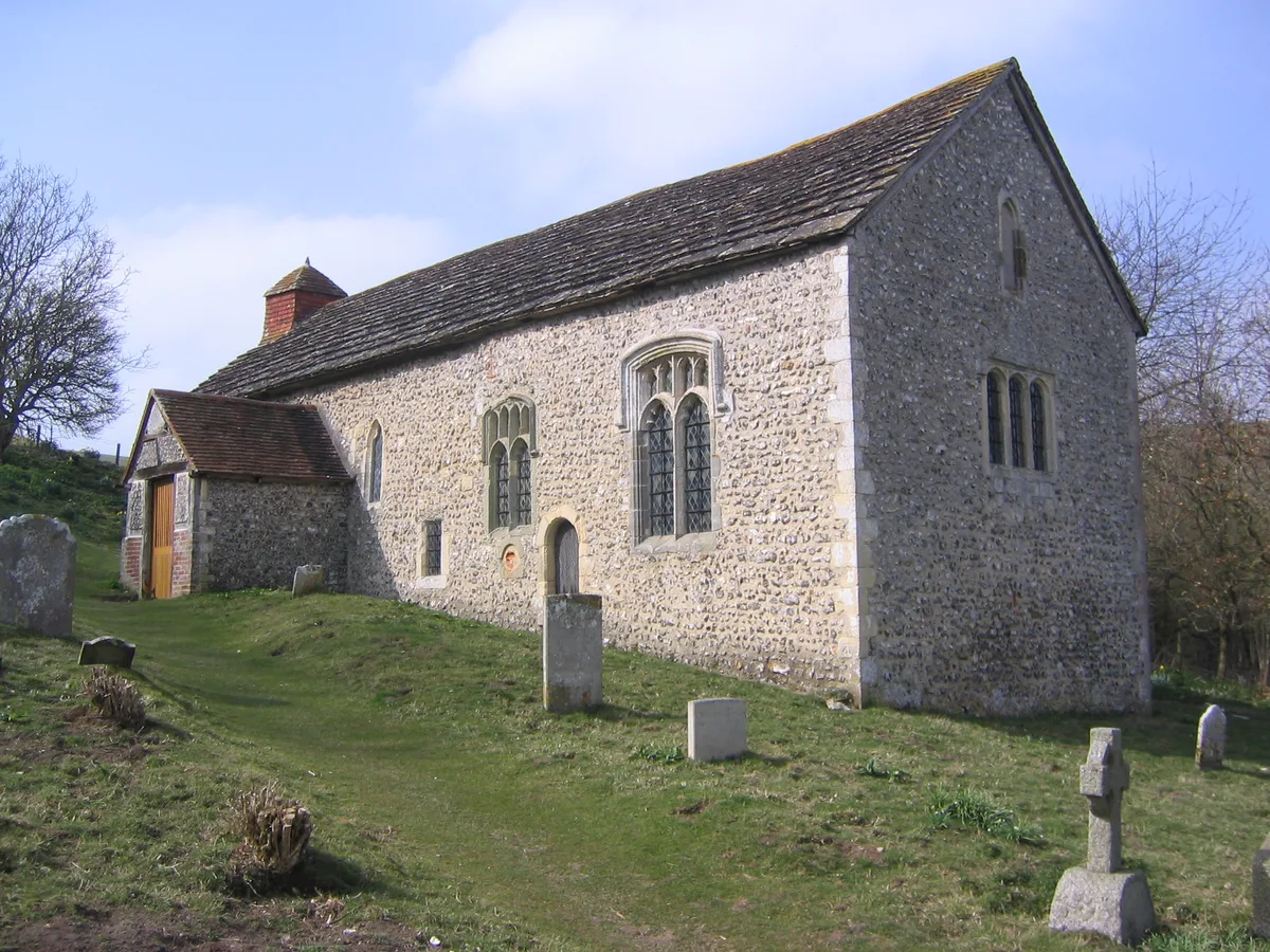
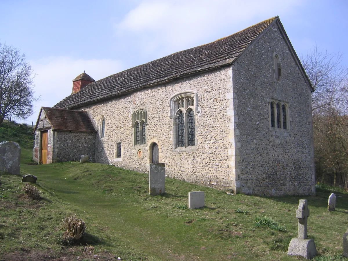
Erringham chapel — former place of worship in Shoreham-by-Sea, West Sussex, England.
.jpg?width=1200)
Wikimedia Commons contributors — see linked file page for photographer and licence licence
.jpg)
Plan your visit
- Typical visit
- 20 min–45 min
- Nearest railway station
- Shoreham-by-Sea · 3.7 km
- Free entry
Getting there & planning your visit
Erringham Chapel is located in Horsham, West Sussex, with the postcode BN44 3TX. The nearest railway station is Shoreham-by-Sea, which is 3.7 km away. Entry to the chapel is free.
About
Erringham chapel is a chapel in the United Kingdom. Wikidata describes it as: "former place of worship in Shoreham-by-Sea, West Sussex, England". Coordinates: 50.8659°, -0.2882°.
Photo gallery
Protected designations
- Area of Outstanding Natural Beauty: High Weald
Designations sourced from Natural England open data under OGL v3.
From the Wikipedia article
Erringham chapel is a former place of worship in the deserted medieval village of Old Erringham, north of Shoreham-by-Sea in the district of Adur, one of seven local government districts in the English county of West Sussex. Founded in the 11th century as a chapel of ease to St Nicolas' Church in the Saxon riverside village of Old Shoreham, it was in use for several centuries until depopulation caused Old Erringham to become unviable as a settlement. The chapel fell into ruin, and its remains have been incorporated into a barn on the farm which now occupies the site of the village. English Heritage has listed the remaining structure at Grade II for its architectural and historical importance.
Excerpt from Wikipedia under CC BY-SA 4.0. See the source article linked in Sources below.
Background
History
The east bank of the River Adur—the area covered by the present-day town of Shoreham-by-Sea and its rural hinterland—was first settled during the Iron Age, and also saw Roman activity. During the Saxon era it became a prosperous agricultural area. Two villages developed next to the river: Old Shoreham, about 1 mi north of the English Channel and the river estuary, and Old Erringham, another mile to the north. Old Shoreham became important enough to support a large church—St Nicolas' Church—by about 900, and its population at the time of the Domesday survey in 1086 was 76. and a nave. and 13th William de Braose, 1st Lord of Bramber held the chapel and its mother church at the time of the…
Sourced from Wikipedia under CC BY-SA 4.0.
- Coordinates
- 50.8659, -0.2882
- County
- West Sussex
- District
- Horsham
- Parish
- Upper Beeding
- Postcode
- BN44 3TX
- Parliamentary constituency
- Arundel and South Downs
- Nearest railway station
- Shoreham-by-Sea — 3.7 km
Sources
- wikidata: Q5395529 (CC0)
- wikipedia: Erringham chapel (CC BY-SA 4.0)
- commons: Old Erringham, West Sussex (Geograph Image 1072813 5200c69b).jpg (CC BY-SA 4.0)
Other places nearby

Old Erringham Ringwork
Literary houses · 1.1 km
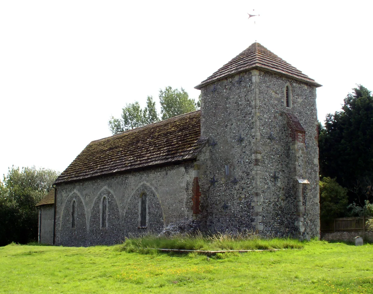
St Botolph's Church, Botolphs
Historic churches · 1.3 km

Botolphs
Towns & cities · 1.4 km
Coombes
Towns & cities · 1.4 km
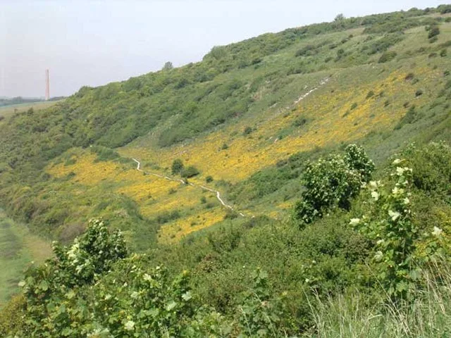
Mill Hill, Shoreham
Wildlife reserves · 1.5 km

Valerie Manor
Manor houses · 1.6 km
Coombes Church
Historic churches · 1.6 km

Southdown Caravan Park
Caravan parks · 2.0 km
Upper Beeding
Towns & cities · 2.2 km

YHA Truleigh Hill
Hostels · 2.3 km

YHA Truleigh Hill
Campsites · 2.3 km

Lancing College Chapel
Chapels · 2.4 km
Nearby
📷 5Literary houses · South East England
Old Erringham Ringwork
Old Erringham Ringwork — a literary house museum in england south east.
📷 5Historic churches · South East England
St Botolph's Church, Botolphs
St Botolph's Church, Botolphs — church in Botolphs, West Sussex, England, UK.
📷 5Flagship📷 10Towns & cities · South East England
Coombes
Coombes — village in West Sussex, England, UK.
📷 5Wildlife reserves · South East England
Mill Hill, Shoreham
Mill Hill, Shoreham — nature reserve in West Sussex, England.
📷 5Manor houses · South East England
Valerie Manor
Valerie Manor — Grade II listed building-listed manor in england-south-east, United Kingdom.
Where to eat & stay near Erringham chapel
Places to stay
📷 5Caravan parks · South East England
Southdown Caravan Park
Southdown Caravan Park — a caravan park in england south east.
📷 5📷 5Campsites · South East England
YHA Truleigh Hill
YHA Truleigh Hill — a campsite in england south east.
 📷 5
📷 5Caravan parks · South East England
Withy Patch Caravan Park
Withy Patch Caravan Park — a caravan park in england south east.
 📷 5
📷 5Campsites · South East England
Hillside Scout Camp
Hillside Scout Camp — a campsite in england south east.
 📷 5
📷 5Caravan parks · South East England
Broadway Park
Broadway Park — a caravan park in england south east.
Places to eat & drink
 📷 7
📷 7 📷 5
📷 5Historic pubs · South East England
The Royal Sovereign Public House
The Royal Sovereign Public House in England South East, United Kingdom.
 📷 5
📷 5Historic pubs · South East England
The Star Public House
The Star Public House in England South East, United Kingdom.
 📷 5
📷 5Historic pubs · South East England
The Stags Head Public House
The Stags Head Public House in England South East, United Kingdom.
.jpg?width=1200) 📷 5
📷 5Historic pubs · South East England
Hangleton Manor
Hangleton Manor — Historic pub — listed building or notable heritage status.
 📷 6
📷 6Historic pubs · South East England
Sussex Arms Public House
Sussex Arms Public House in England South East, United Kingdom.
More places in this region
.jpg?width=1200) 📷 5
📷 5Chapels · South East England
Anglican Chapel At Dorking Cemetery
Anglican Chapel At Dorking Cemetery — chapel in Mole Valley, Surrey, England, UK.
 📷 5
📷 5Chapels · South East England
Bethel Chapel Guildford
Bethel Chapel Guildford — church in Surrey, United Kingdom.
 📷 5
📷 5Chapels · South East England
Bridge Chapel
Bridge Chapel — chapel in Rochester, Kent, England, UK.
 📷 5
📷 5Chapels · South East England
Chapel 100 Yards North West Of Hoe Place
Chapel 100 Yards North West Of Hoe Place — chapel in Woking, Surrey, England, UK.
Frequently asked questions
- Where is Erringham chapel?
- Erringham chapel is in West Sussex, South-East England, United Kingdom (postcode BN44 3TX), in the parish of Upper Beeding.
- What is Erringham chapel?
- Erringham chapel — former place of worship in Shoreham-by-Sea, West Sussex, England.
- How do I get to Erringham chapel?
- The nearest railway station is Shoreham-by-Sea, about 3.7 km away. The nearest town is Botolphs. Drivers can use postcode BN44 3TX.
- Is Erringham chapel a protected site?
- Yes — Erringham chapel is part of the High Weald National Landscape (AONB).
- Is Erringham chapel free to visit?
- Yes, Erringham chapel is free to enter.
- How do I get to Erringham chapel?
- The nearest railway station is Shoreham-by-Sea, about 3.7 km away. Drivers can navigate to postcode BN44 3TX.